

York County Heritage Trust Sanctioned Guide Scott Mingus is standing near Bair’s Mill on Kreutz Creek. This view was taken facing northeast at approximately 2:45 PM on Sunday, September 13, 2009.
In today’s post, York Heritage Trust Civil War Sanctioned Guide Scott Mingus shows us the location of Bair’s Mill and the location of the Union skirmish line.
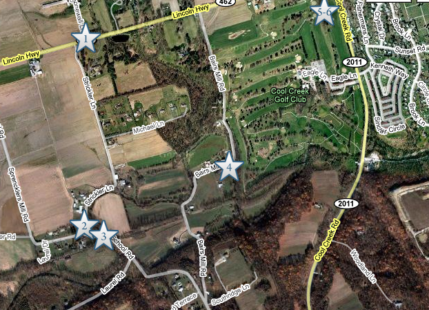
This map shows the location of where our Wrightsville videos were produced. Videos #1-#3 were shown in our first Wrightsville post. Video #1 was taken at the junction of PA 462 and Strickler Lane. Video #2 was taken at the junction of Strickler Lane and Strickler’s School Road. Video #3 was taken on Strickler Schoolhouse Road, at the bridge over Kreutz Creek. Video #5 was taken at Bair’s Mill. Videos #5 and #6 were taken at the intersection of the Lincoln Highway and Cool Creek Road. This map was created facing north at approximately 7:00 PM on Wednesday, September 16, 2009.
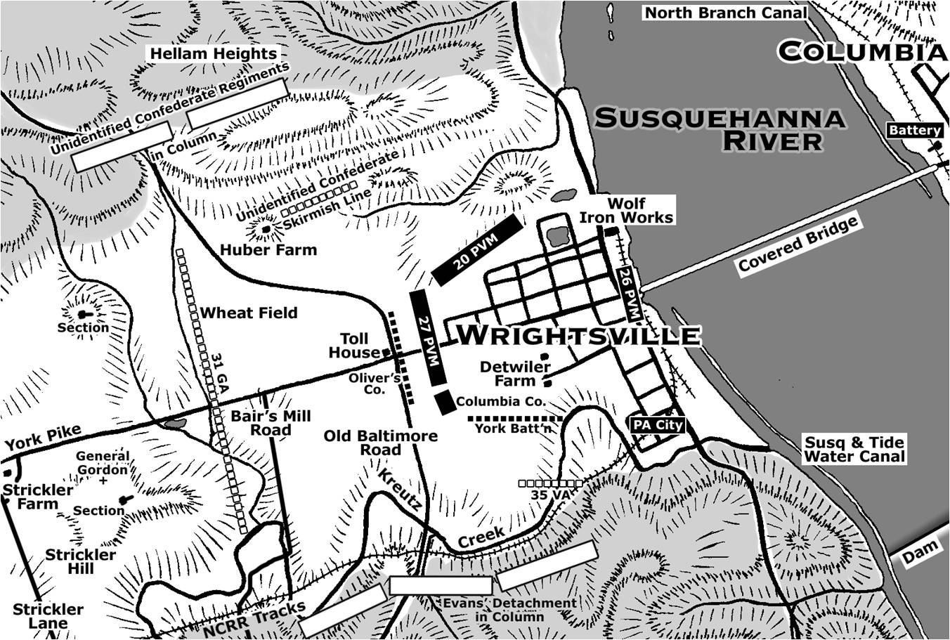
This map shows the units defending Wrightsville and the position of the Confederate units as they advanced on the defenses. Copyright Scott L. Mingus, Sr.; drawn for Flames Beyond Gettysburg by Tom Poston. All rights reserved.
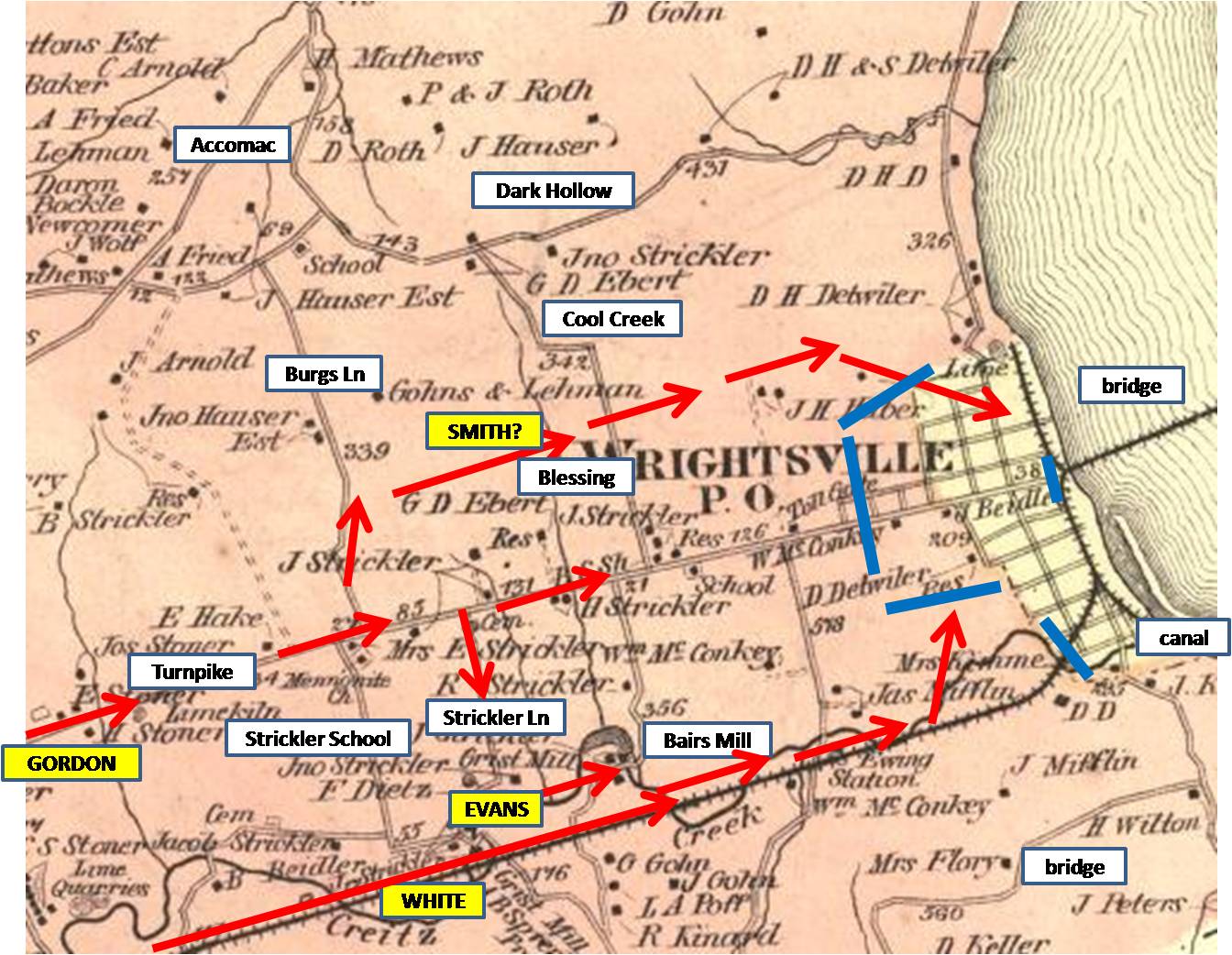
This 1876 map of Wrightsville shows landmarks, Confederate troop movements in red, and the Union defenses in blue. This map was created in 1876.

This Bair’s Mill sits on the site of the Civil War era Bair’s Mill. This view was taken facing northeast at approximately 2:45 PM on Sunday, September 13, 2009.
In Video #4 York County Heritage Trust Sanctioned Guide Scott Mingus is standing near Kreutz Creek at Bair’s Mill. He describes the makeup of the Wrightsville Union defenders, and describes how the farmers in this area suffered from the Confederate’s visit. This view was taken facing southwest to northeast at approximately 2:45 PM on Sunday, September 13, 2009.
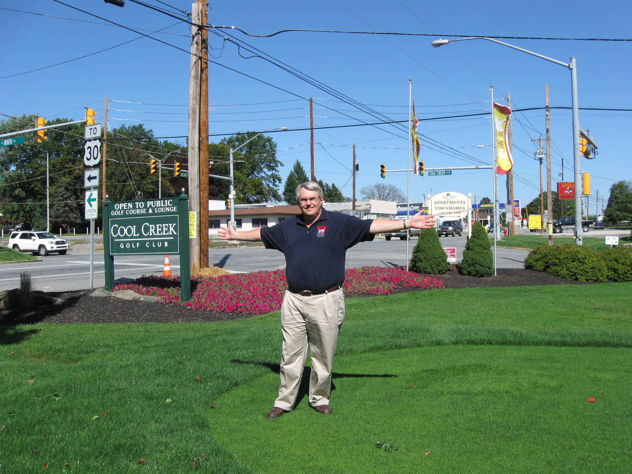
Civil War Sanctioned Guide Scott Mingus is standing at the intersection of Cool Creek Road and PA 462. He is showing us how the Union skirmish line stretched along Cool Creek Road. This view was taken facing northeast at approximately 2:45 PM on Sunday, September 13, 2009.
In Video #5 Sanctioned Guide Scott Mingus is standing near the intersection of PA 462 and Cool Creek Road. He shows the primary skirmish line of the 27th Pennsylvania Emergency Militia. This view was taken facing northeast to south to northeast at approximately 2:45 PM on Sunday, September 13, 2009.

Although Scott is standing in the area of the Union skirmish line, the Union earthworks were in the background by the tree to the right of the yellow truck. This view was taken facing northeast at approximately 2:45 PM on Sunday, September 13, 2009.
In Video #6 Scott Mingus is standing near the intersection of PA 462 and Cool Creek Road. He continues his description of the Union defense line and how the Confederates will approach this position. This view was taken facing northeast to southeast to west to northeast at approximately 2:45 PM on Sunday, September 13, 2009.