Wrightsville Part 1 With York County Civil War Guide Scott Mingus
September 21, 2009
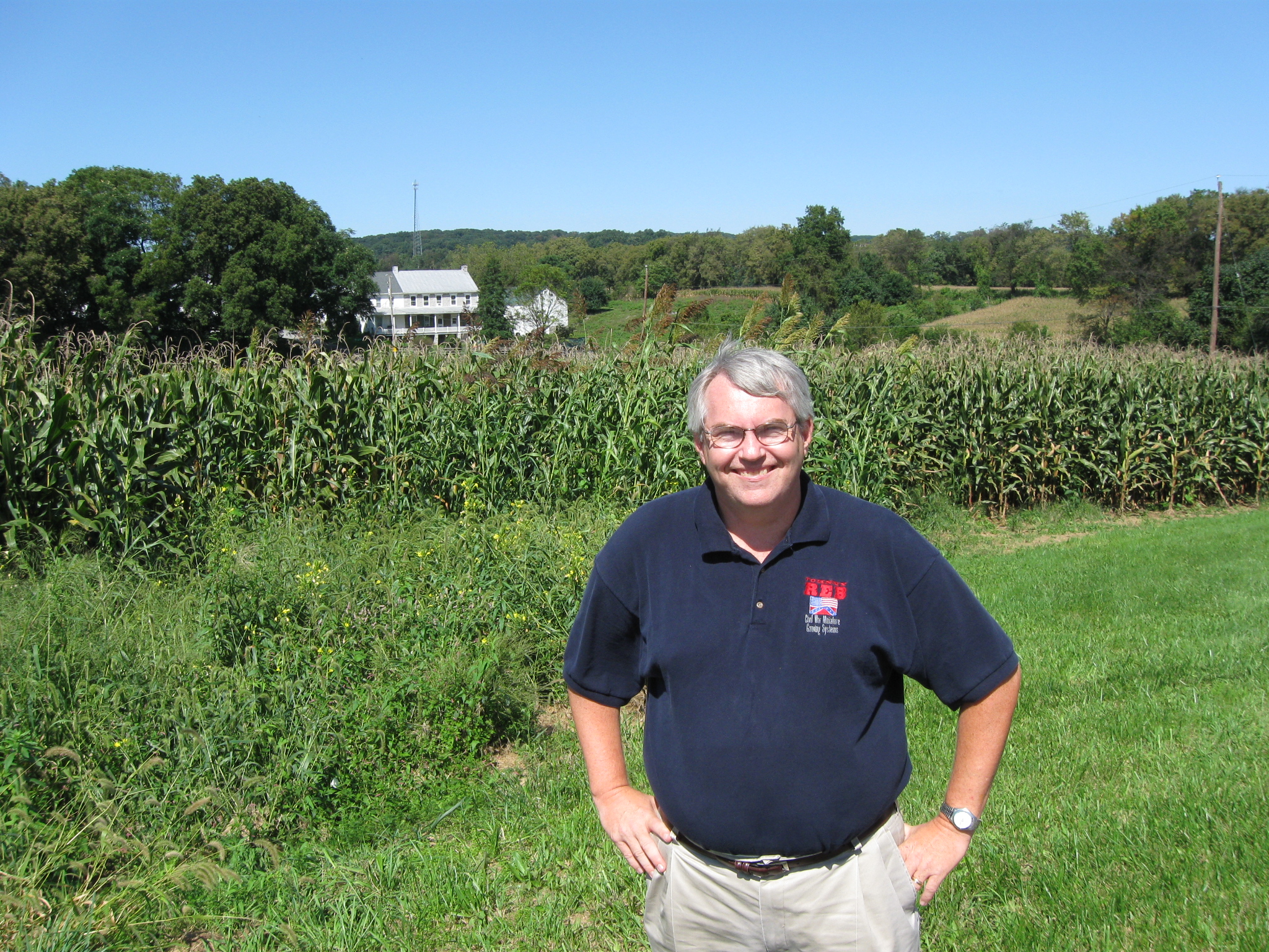
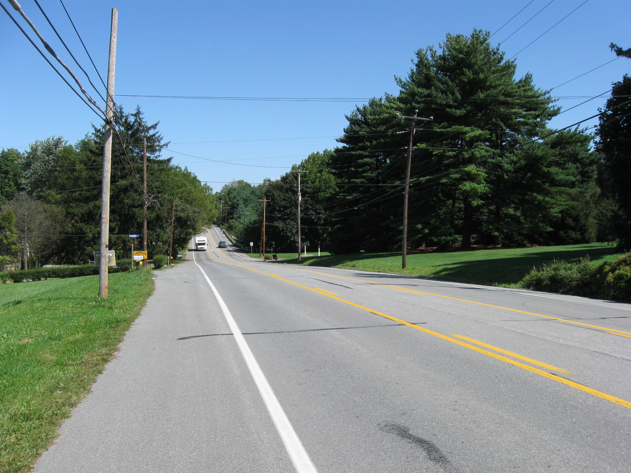
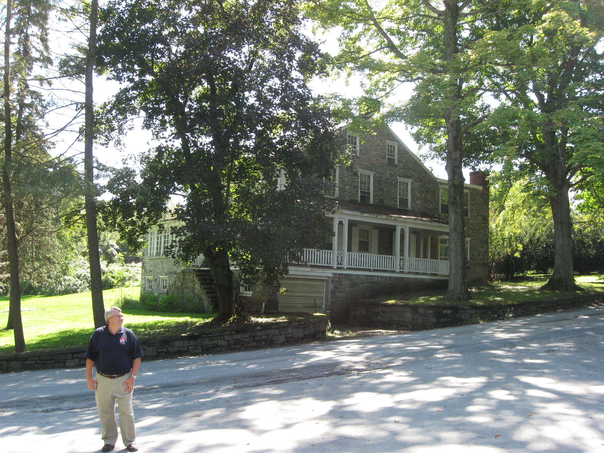
York County Heritage Trust Sanctioned Guide Scott Mingus is on PA Route 462. In the background is the J. Strickler Farm. This view was taken facing north at approximately 2:15 PM on Sunday, September 13, 2009.
Scott L. Mingus, Sr. is a scientist and executive in the paper and printing industry, and holds patents in self-adhesive postage stamp products and in bar code labels. He has written six books on the Civil War, including Human Interest Stories of the Gettysburg Campaign (Volumes 1 and 2), Human Interest Stories from Antietam, and Flames Beyond Gettysburg: The Gordon Expedition, June 1863. His latest book, A Spirit of Daring: Hays’ Louisiana Tigers in the Gettysburg Campaign, was published in October by LSU Press. In the works is Gettysburg Glimpses 2: More True Stories from the Battlefield. Mingus also has written several articles, including in The Gettysburg Magazine. He maintains a blog on York County, Pennsylvania, in the Civil War for the York Daily Record (www.yorkblog.com/cannonball/), and he is a sanctioned Civil War Guide for the York County Heritage Trust.
Mingus has written several booklets on wargaming the Civil War, including the two-volume Enduring Valor: Gettysburg in Miniature, the popularly acclaimed Undying Courage: The Antietam Campaign in Miniature, Touched With Fire, and Crossed Sabers: Gettysburg in Miniature. His latest work, Brothers Divided, features a dozen new scenarios from the Gettysburg campaign. He and his wife Debi publish Charge!, the leading international fanzine for ACW miniature wargaming.
A native of southeastern Ohio, he graduated from Miami University after majoring in Paper Science and Engineering. Mingus spent 23 years working for office products giant Avery Dennison in the Cleveland area before joining Glatfelter, a global manufacturer of specialty papers, in 2001. He and his family live near York, Pennsylvania.
In today’s post, Scott Mingus brings the forces to Wrightsville, and shows us how the Confederates advanced on the Union defenses.
This map shows the location of where our Wrightsville videos were produced. Video #1 was taken at the junction of PA 462 and Strickler Lane. Video #2 was taken at the junction of Strickler Lane and Strickler’s School Road. Video #3 was taken on Strickler Schoolhouse Road, at the bridge over Kreutz Creek. This map was created facing north at approximately 8:00 PM on Monday, September 14, 2009.
In Video #1 York County Heritage Trust Sanctioned Guide Scott Mingus is standing on PA 462, the Lincoln Highway, at its junction with Strickler Lane. He gives a general background to the movement of the Confederates moving towards Wrightsville. He shows how Brigadier-General John B. Gordon’s Georgians deployed in this area as they advanced towards the Union defenses at Wrightsville. This view was taken facing southwest to northeast at approximately 2:15 PM on Sunday, September 13, 2009.
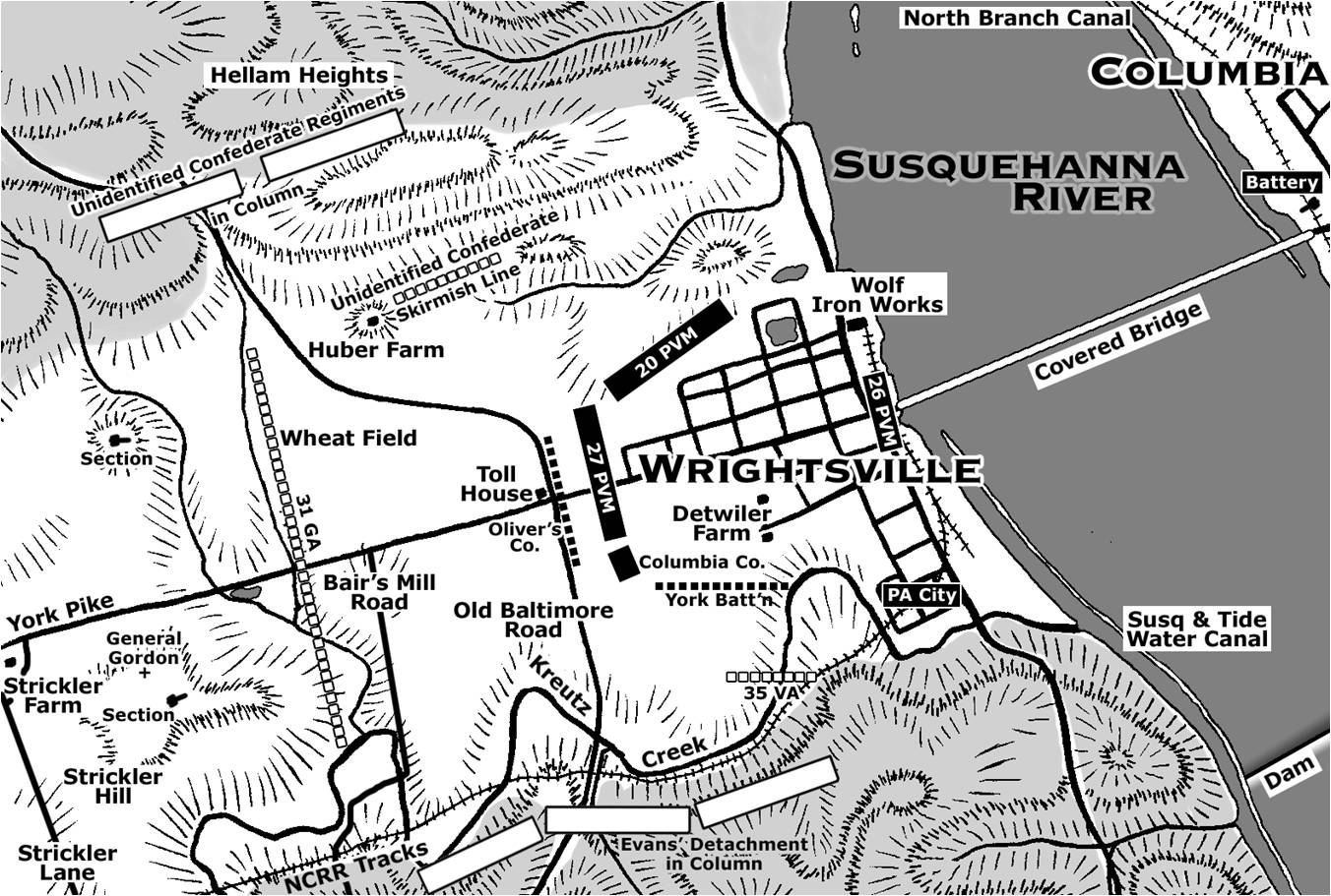
This map shows the units defending Wrightsville and the position of the Confederate units as they advanced on the defenses. Copyright Scott L. Mingus, Sr.; drawn for Flames Beyond Gettysburg by Tom Poston. All rights reserved.
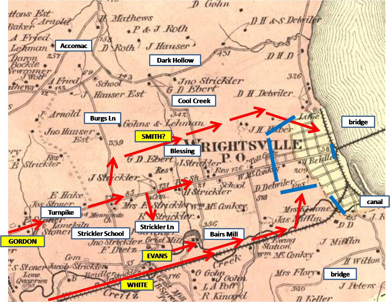
This 1876 map of Wrightsville shows landmarks, Confederate troop movements in red, and the Union defenses in blue. This map was created in 1876.
PA 462 was the Gettysburg-York-Wrightsville Road. Confederates under Jubal Early and John Brown Gordon moved towards the camera as they approached Wrightsville. This view was taken facing southwest at approximately 2:15 PM on Sunday, September 13, 2009.
At this location (Strickler Ridge) we are approximately one mile from Wrightsville and the Susquehanna River. This view was taken facing northeast at approximately 2:15 PM on Sunday, September 13, 2009.
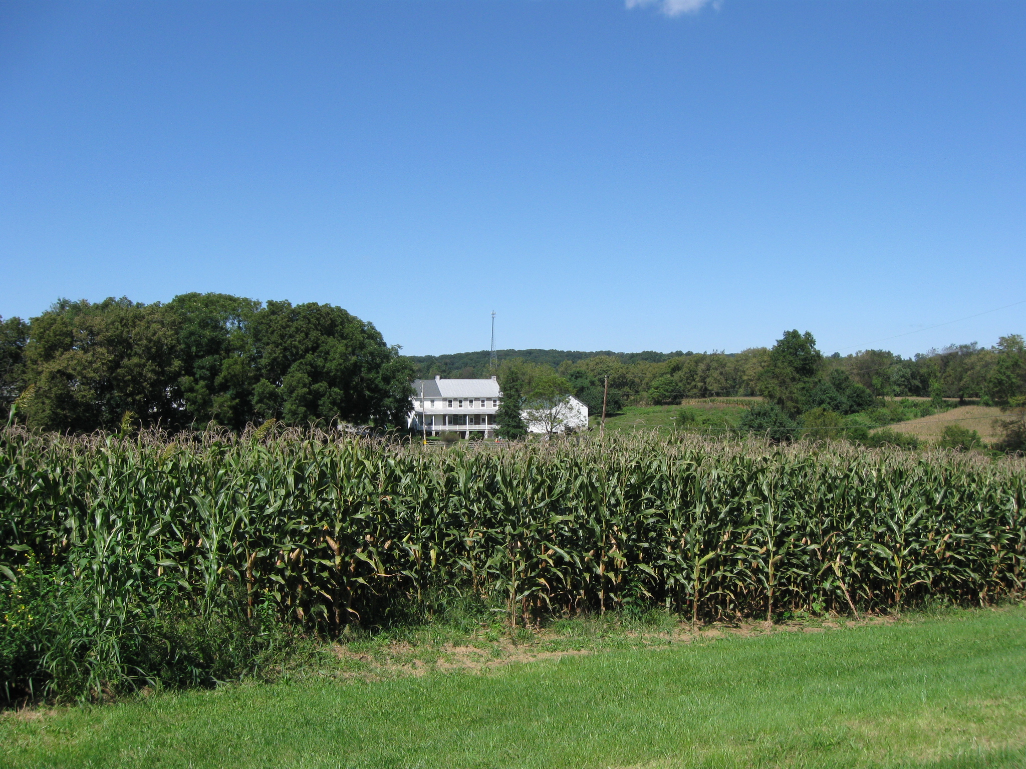
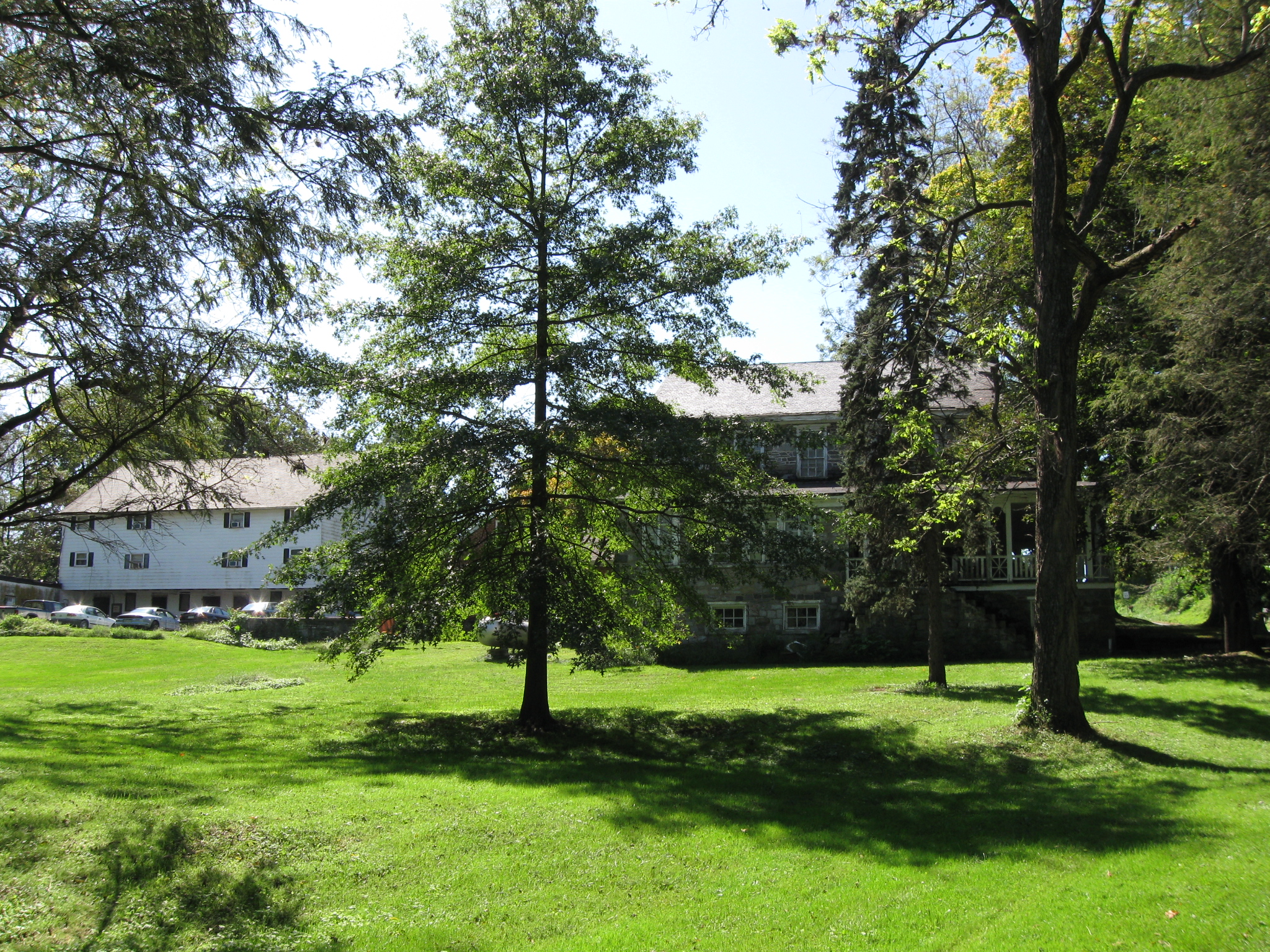
When Brigadier General John Brown Gordon deployed his Georgians to advance to Wrightsville, his left was near this farm… This view was taken facing northeast at approximately 2:15 PM on Sunday, September 13, 2009.
… the J. Strickler Farm. This view was taken facing northeast at approximately 2:15 PM on Sunday, September 13, 2009.
The 31st Georgia Infantry Regiment advanced down the Gettysburg-York-Wrightsville Road with its right near the E. Strickler Farm. This view was taken facing south at approximately 2:15 PM on Sunday, September 13, 2009.
Three Georgia regiments were sent to the right of the E. Strickler Farm, on Strickler Lane to outflank the defenses from the south. This view was taken facing south at approximately 2:15 PM on Sunday, September 13, 2009.
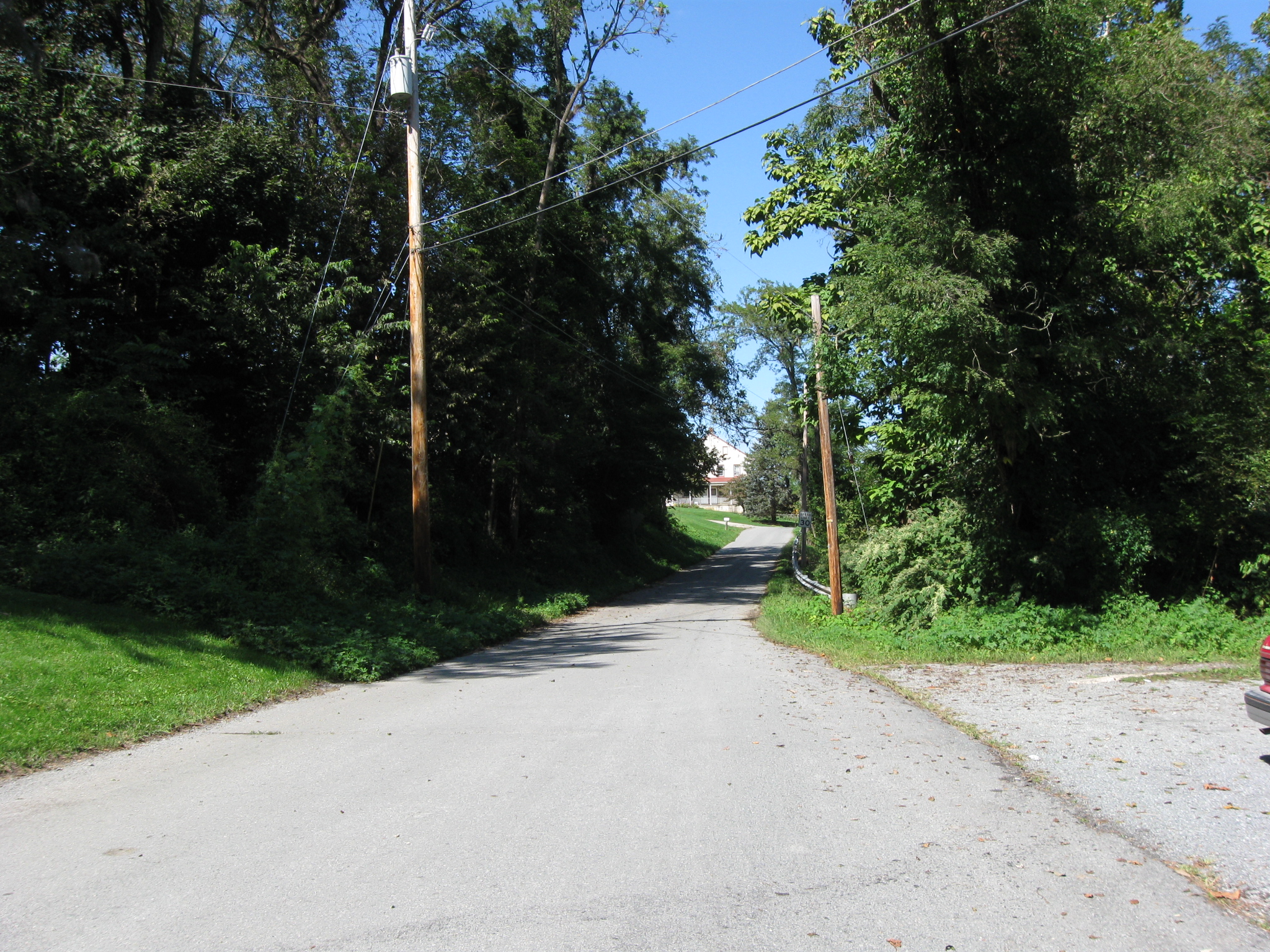
Sanctioned Guide Scott Mingus is standing at the junction of the Strickler Schoolhouse Road (in the background by another J. Strickler House) and Strickler Lane. This view was taken facing south at approximately 2:15 PM on Sunday, September 13, 2009.
In Video #2 Sanctioned Guide Scott Mingus is standing on Strickler Lane at its junction with Strickler’s School Road. He shows how John Brown Gordon’s Infantry met the 35th Battalion Virginia Cavalry under Lt. Colonel Elijah White as they advanced towards Wrightsville. This view was taken facing north to south to southeast at approximately 2:15 PM on Sunday, September 13, 2009.
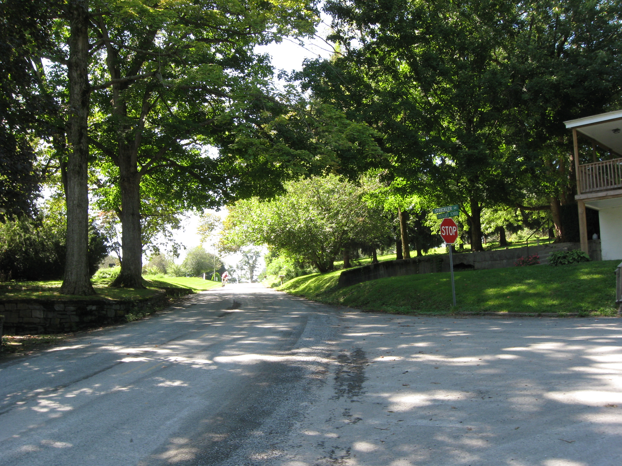
Three Georgia infantry regiments left PA 462 and headed down Strickler’s Lane, towards the camera… This view was taken facing north at approximately 2:15 PM on Sunday, September 13, 2009.
… moving right to left to the junction of Strickler’s School Road. This view was taken facing west at approximately 2:15 PM on Sunday, September 13, 2009.
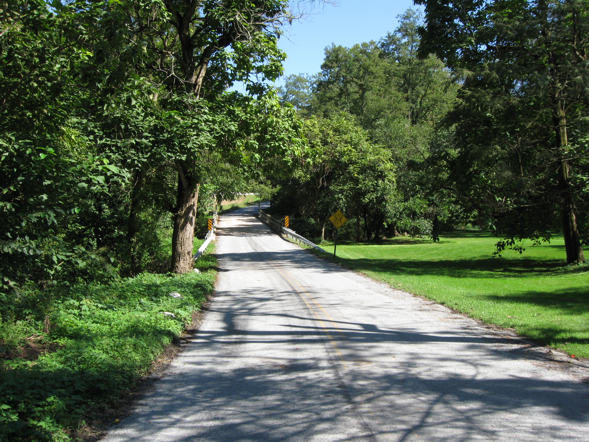
Stickler’s School Road continues down to the bridge. This view was taken facing southeast at approximately 2:15 PM on Sunday, September 13, 2009.
Scott Mingus is waiting on the bridge which crosses Kreutz Creek. This view was taken facing east at approximately 2:15 PM on Sunday, September 13, 2009.
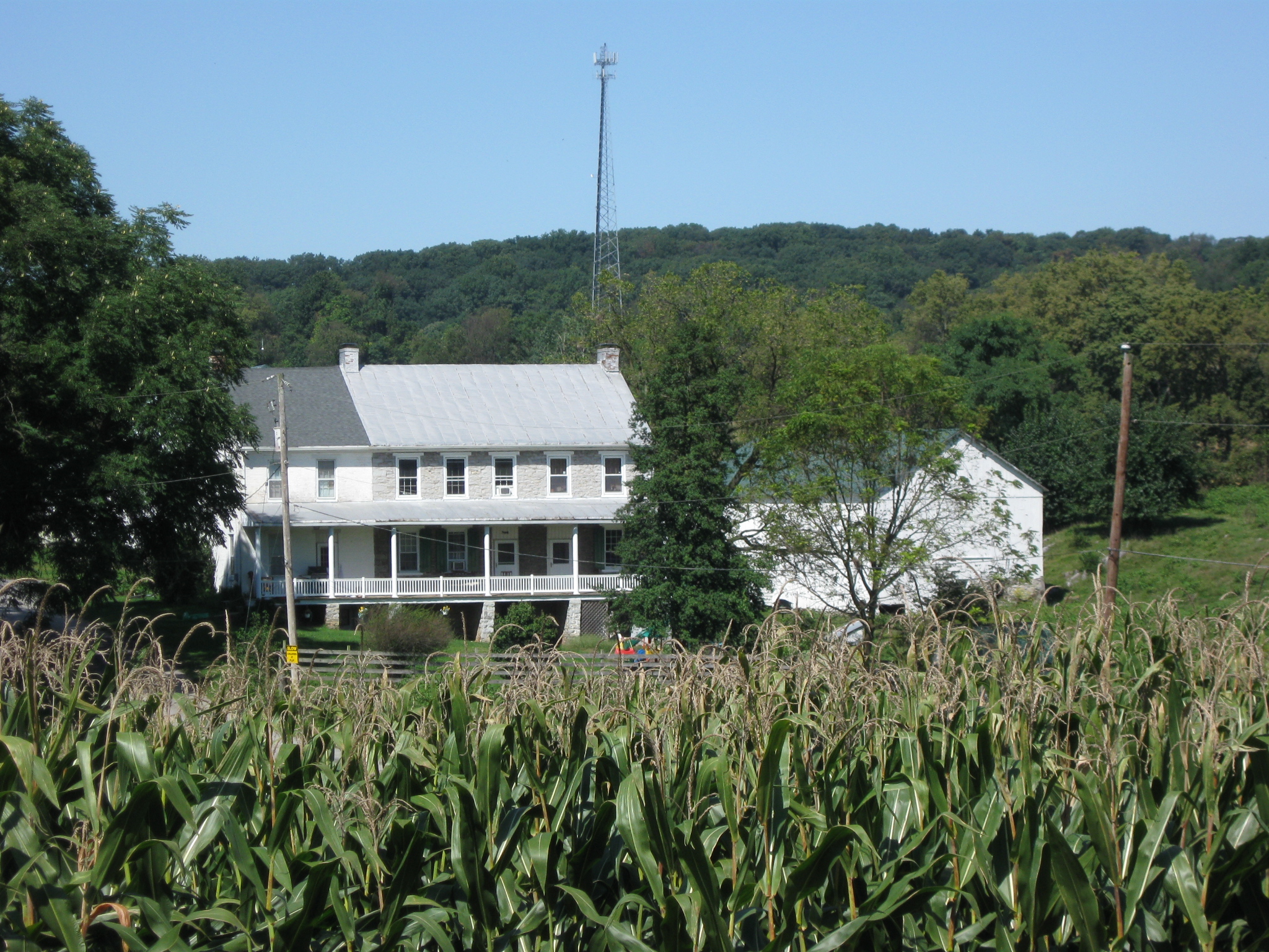
This view of the J. Strickler Farm is from the bridge over Kreutz Creek. This view was taken facing west at approximately 2:15 PM on Sunday, September 13, 2009.
Scott Mingus standing on the Strickler’s School Bridge over Kreutz Creek. This view was taken facing southeast at approximately 2:15 PM on Sunday, September 13, 2009.
In Video #3 Scott Mingus is standing on the Strickler’s School Road Bridge over Kreutz’s Creek. He shows us Kreutz Creek, and how close the Northern Central Railway Bridge is to Strickler’s School Road. This view was taken facing south to west to east at approximately 2:15 PM on Sunday, September 13, 2009.
Kreutz Creek. The bridge in the background would have been a wooden bridge in 1863 for the Northern Central Railroad. This view was taken facing southeast at approximately 2:15 PM on Sunday, September 13, 2009.