Battle for Hanover Part 6 With Licensed Battlefield Guide John Krepps
September 8, 2009
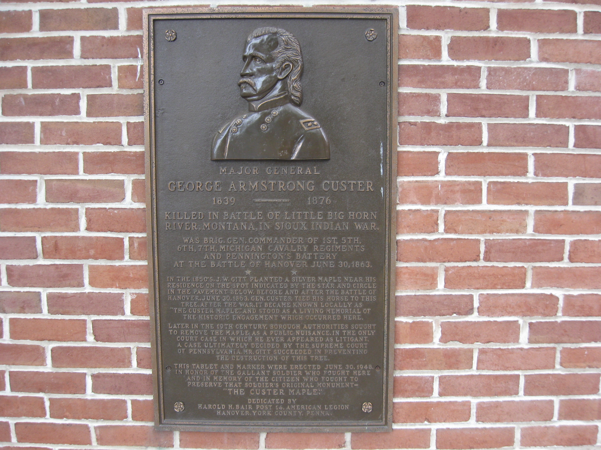
Gettysburg Licensed Battlefield Guide John Krepps is the author of the book, A Strong and Sudden Onslaught, The Cavalry Action at Hanover, Pennsylvania. He is standing on the southwest quadrant of Hanover’s Town Square. On the wall to the left of John is a plaque for Brigadier-General George Armstrong Custer. On the right is one of two 10-pounder cannon in the square. John is standing on the site of a maple tree to which General Custer tied his horse. This view was taken facing south at approximately 3:00 PM on Wednesday, July 29, 2009.
The Battle for Hanover is a not very well known, but very important action in the Gettysburg Campaign. Licensed Battlefield Guide John Krepps has written a book on this event: A Strong and Sudden Onslaught, The Cavalry Action at Hanover, Pennsylvania. John is the host for our series on the events leading up to the battle, and the battle itself. John is a McSherrystown, Pennsylvania native, a Hanover, Pennsylvania resident, and has been a Licensed Battlefield Guide since 1995. He had four ancestors who fought in the Civil War, all with Pennsylvania units. One relative fought on Gettysburg’s East Cemetery Hill the night of July 2, 1863.
In our first post we concentrated on an introduction to Stuart’s Cavalry raid, and showed some images from Union Mills, Maryland.
In our second post we continued our visit to Union Mills and looked at the route of the Old Hanover Road.
In our third post we finished our approach to Hanover and stopped along Line Road and the Gitt Farm.
In our fourth post John described the initial clash at Hanover at the junction of Westminster Avenue and Frederick Street on the morning of June 30, 1863.
In our fifth post, Gettysburg Licensed Battlefield Guide John Krepps showed us that as the battle moved toward Hanover’s town square, Confederate cavalry found an alley to outflank Union forces moving on Frederick Street.
In today’s post, Licensed Battlefield Guide John Krepps shows us some items on the southwest and southeast quadrants of Hanover’s Town Square.
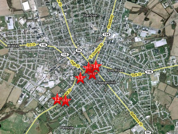
This map shows the location of where our videos were produced on the Old Hanover Road. Videos #1-#9 were shown in our previous Hanover posts. Videos #10 and #11 were taken at the “Confederates Invade Pennsylvania” wayside marker northeast of the junction of the Westminster Road/Westminster Avenue and Frederick Street. Video #12 was taken at the junction of Westminster Road/Westminster Avenue and Frederick Street. Video #13 was taken near the Henry Winebrenner House on Frederick Street. Videos #14 and #15 were taken in Exchange Alley, a block south of Frederick Street. Videos #16-#17 were taken in the southwest quadrant of Hanover’s Town Square. Video #18 was taken in the southeast quadrant of Hanover’s Town Square. This map was created facing north at approximately 7:00 PM on Monday, August 3, 2009.
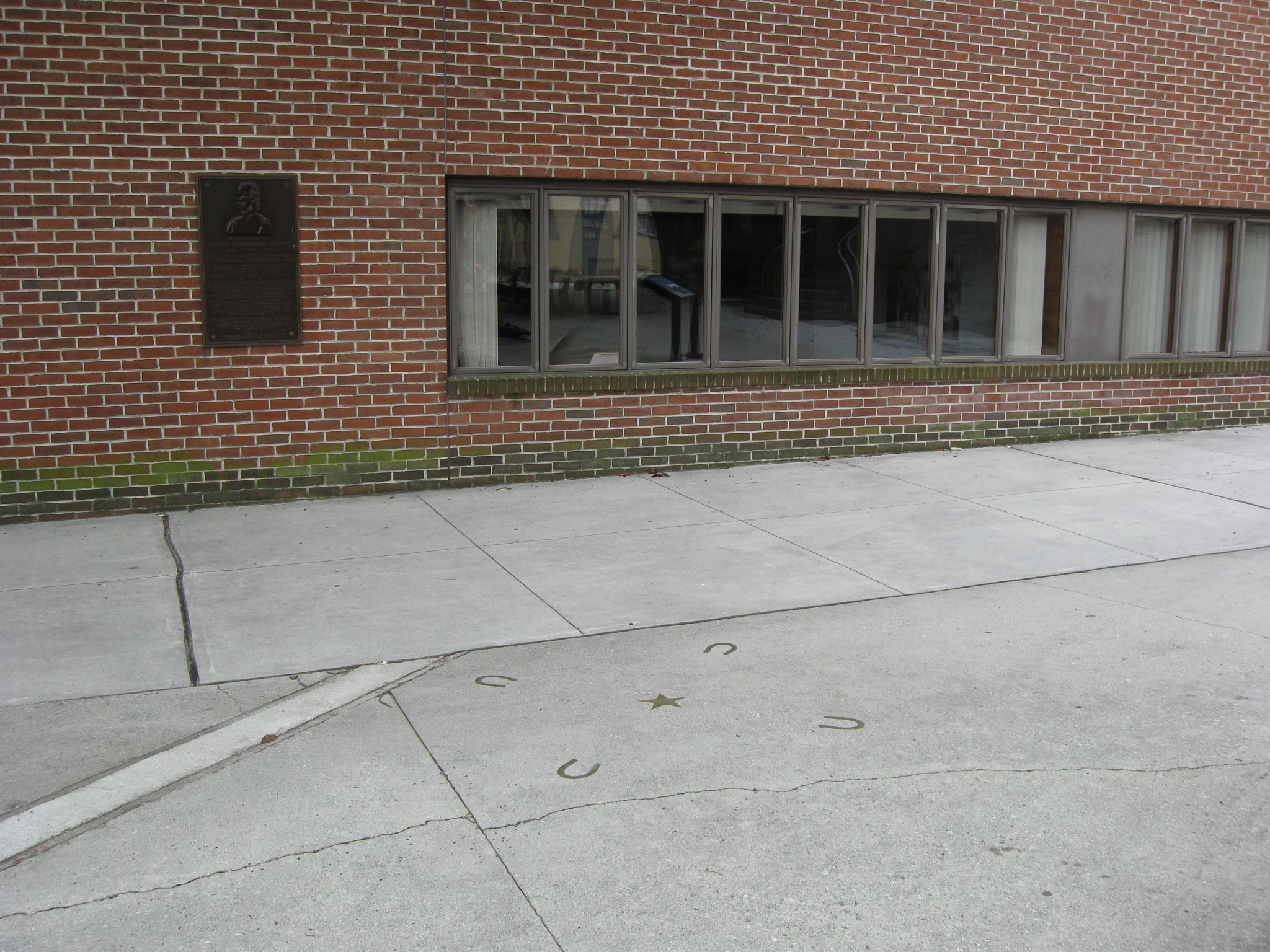
In Video #16 (Videos #1-#15 were shown in our previous Hanover posts) Gettysburg Licensed Battlefield Guide John Krepps is standing in the southwest corner of Hanover’s Town Square. He shows us the location of the store and home of Josiah Gitt, and the location of the tree to which Brigadier-General George Armstrong Custer tied his horse. This view was taken facing southwest to south to southwest at approximately 3:00 PM on Wednesday, July 29, 2009.
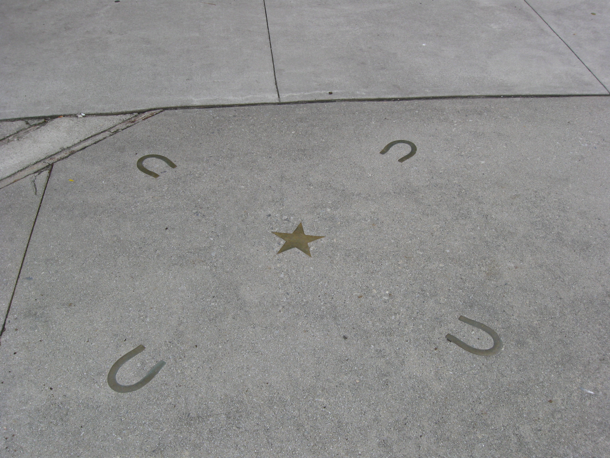
The plaque on the site of the former Josiah Gitt General Store is on the left. On the sidewalk are items that mark the location of a silver maple tree in 1863. This view was taken facing south at approximately 3:00 PM on Wednesday, July 29, 2009.
A closeup of the Custer plaque. This view was taken facing south at approximately 3:00 PM on Wednesday, July 29, 2009.
The horseshoes surround the star where the silver maple tree was located to which Brigadier-General George Armstrong Custer tied his horse. This view was taken facing south at approximately 3:00 PM on Wednesday, July 29, 2009.
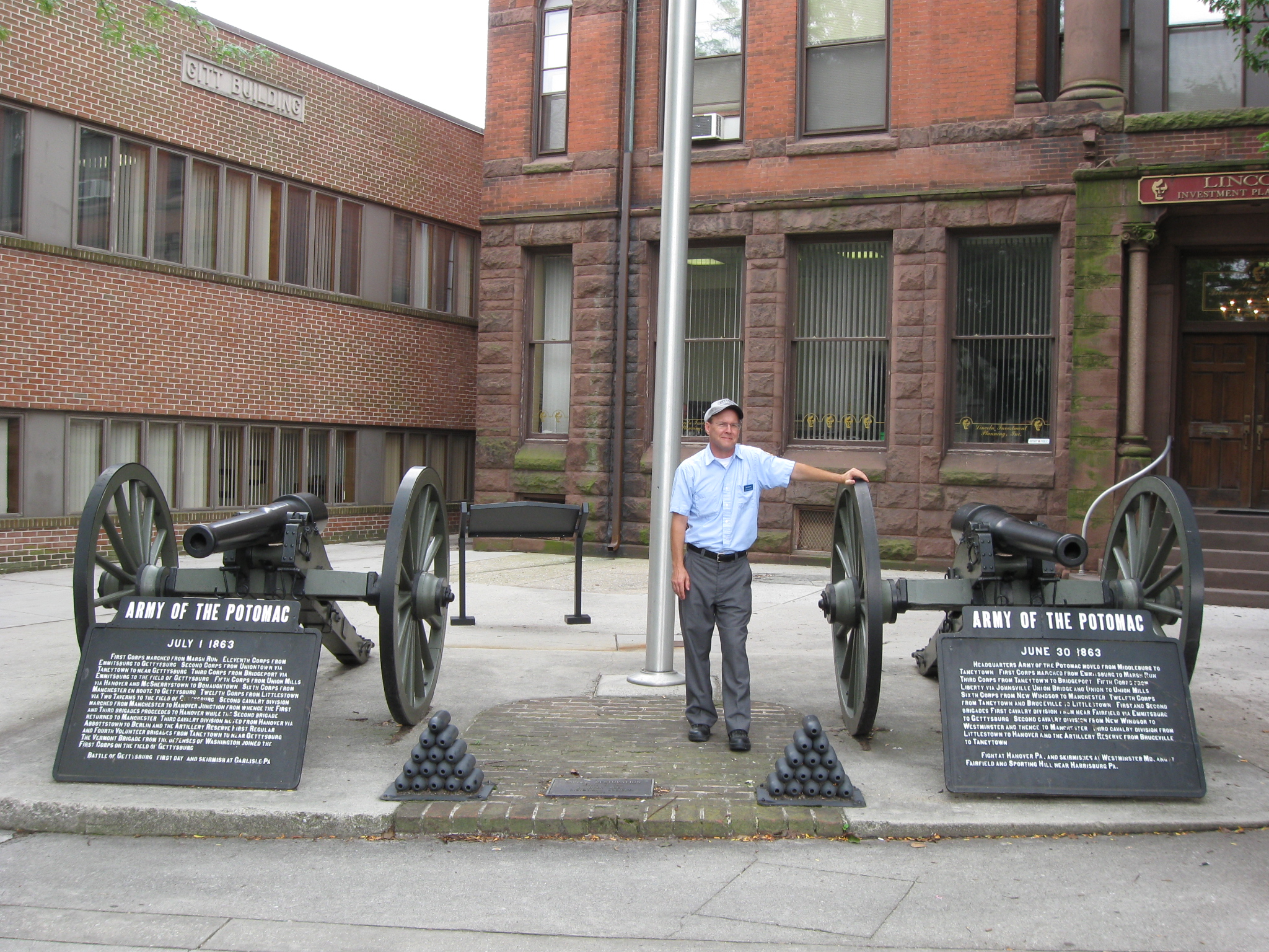
Licensed Battlefield Guide John Krepps is standing by two 10-pounder cannon in the southwest quadrant of Hanover’s Town Square. This view was taken facing southwest at approximately 3:00 PM on Wednesday, July 29, 2009.
In Video #17 Licensed Battlefield Guide John Krepps is standing in the southwest corner of Hanover’s Town Square. He shows us the two 10-pounder Parrott rifles now located in the square. This view was taken facing northwest to southwest to northeast at approximately 3:00 PM on Wednesday, July 29, 2009.
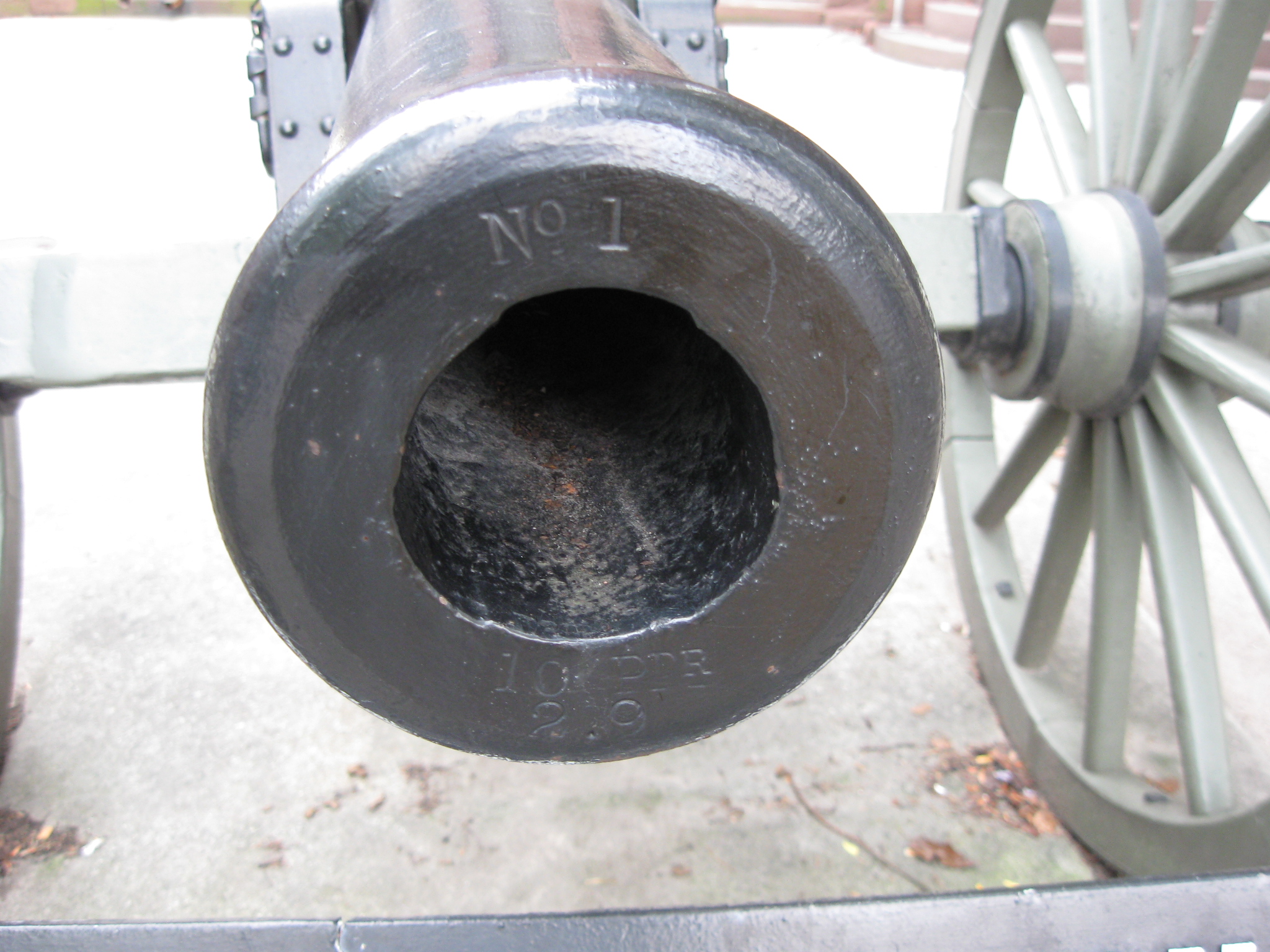
The cannon on the left (south) is #1. It appears that the artillery tubes are reproductions as their weight, date of manufacture, and initials of the inspector when the tubes were made are not on the muzzle. The muzzle opening is also not very “round.” This view was taken facing southwest at approximately 3:00 PM on Wednesday, July 29, 2009.
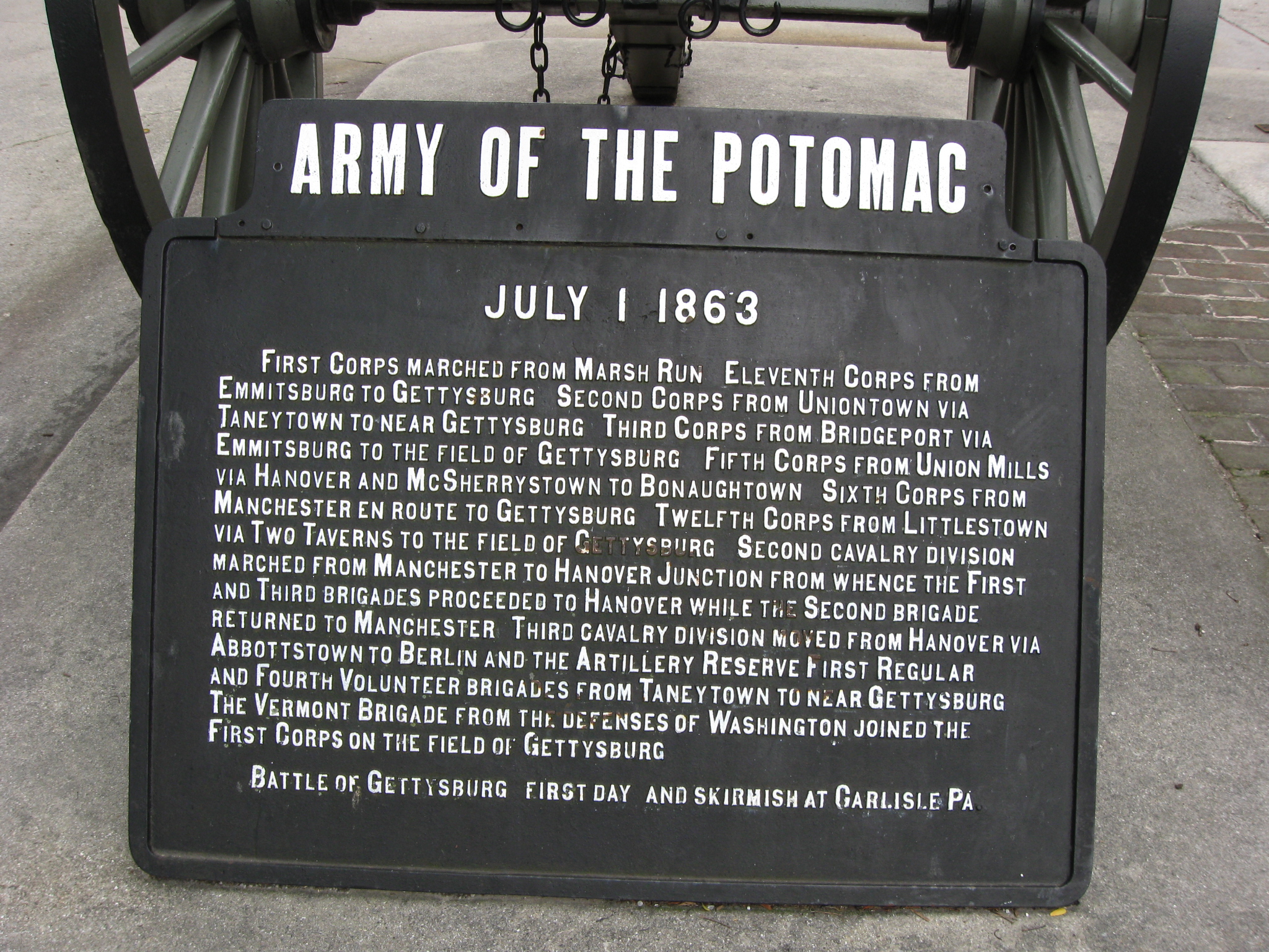
Below artillery tube #1 is this War Department plaque. This view was taken facing southwest at approximately 3:00 PM on Wednesday, July 29, 2009.
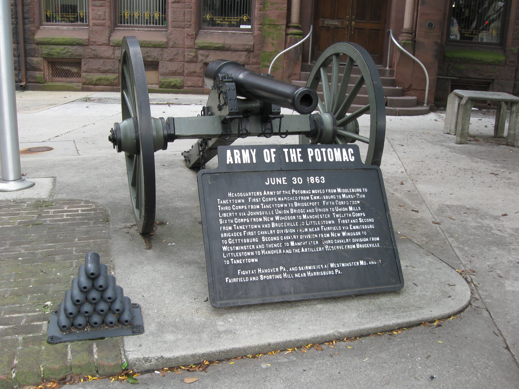
Here is the right (north) cannon and its reproduction artillery projectiles. This view was taken facing southwest at approximately 3:00 PM on Wednesday, July 29, 2009.
This tube is #6, and again it appears to be a reproduction. This view was taken facing southwest at approximately 3:00 PM on Wednesday, July 29, 2009.
The War Department plaque underneath artillery tube #6. This view was taken facing southwest at approximately 3:00 PM on Wednesday, July 29, 2009.
The letters “CP” on top of tube #1 and tube #6 possibly stand for either Commonwealth of Pennsylvania or City of Philadelphia. This view was taken facing northeast at approximately 3:00 PM on Wednesday, July 29, 2009.
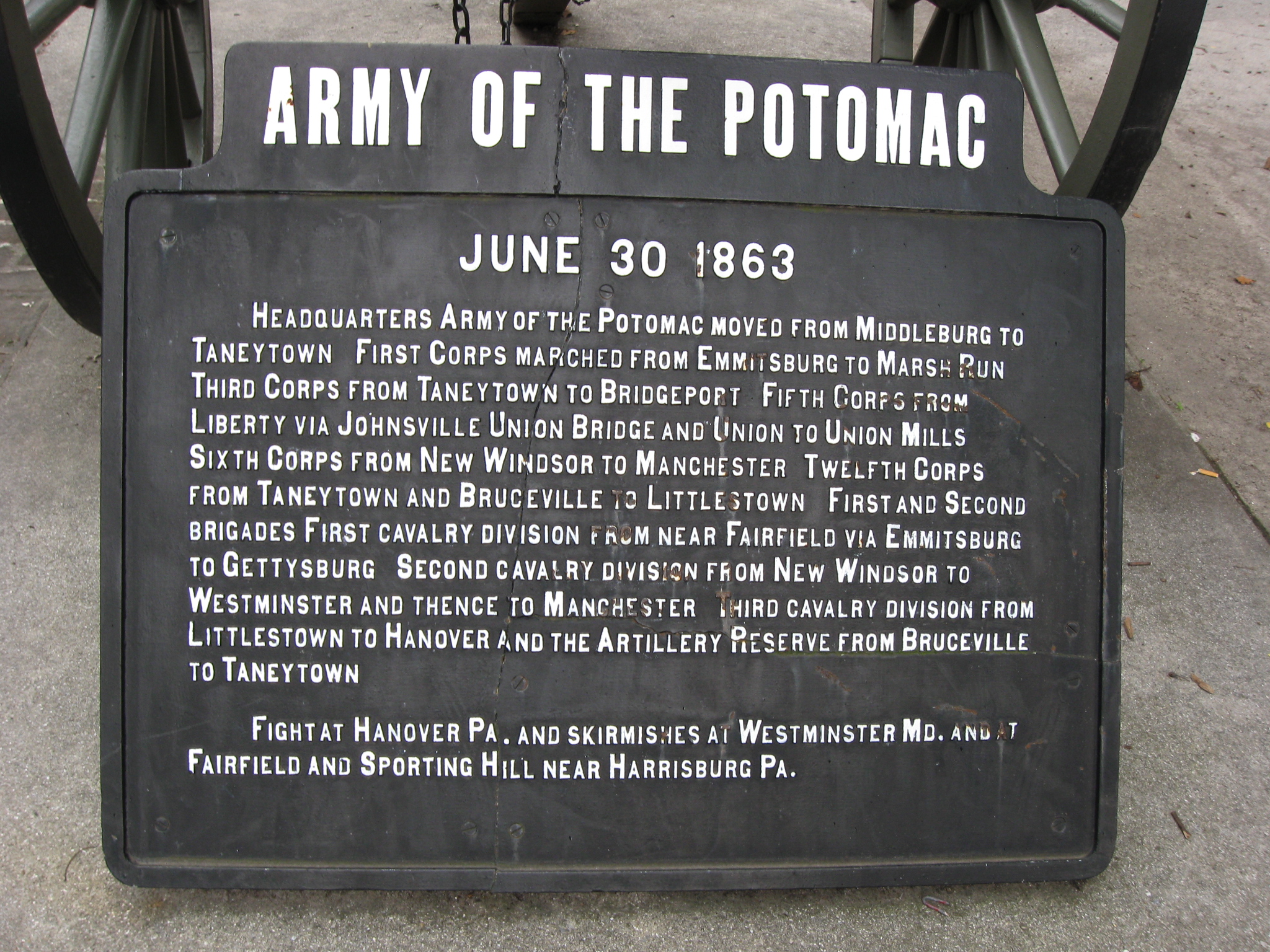
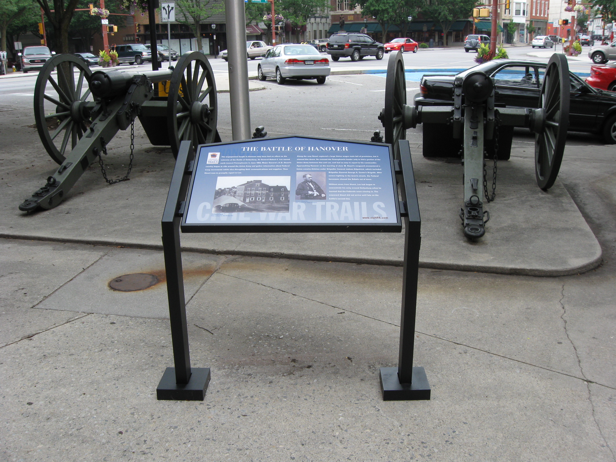
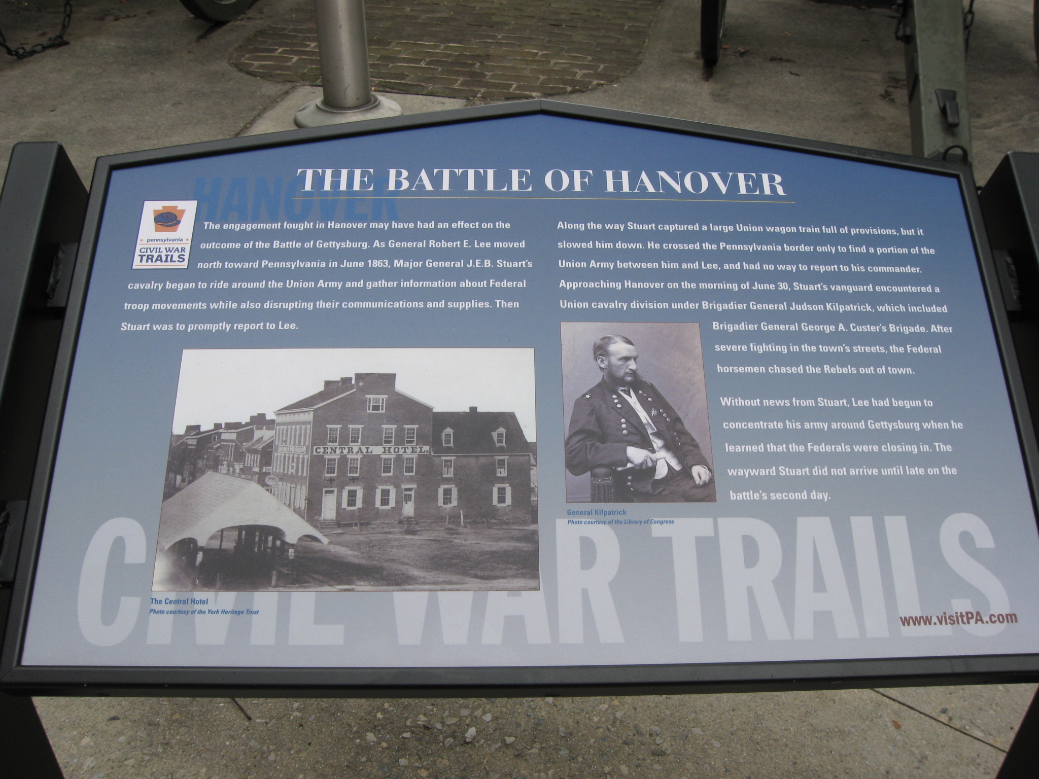
Behind the artillery tubes in the southwest quadrant of the town square is a new wayside. This view was taken facing northeast at approximately 3:00 PM on Wednesday, July 29, 2009.
A closer view of the new wayside behind the artillery pieces. This view was taken facing northeast at approximately 3:00 PM on Wednesday, July 29, 2009.
John Krepps is now standing in the southeast quadrant of Hanover’s Town Square. The light colored building in the background was the Central Hotel in 1863. This view was taken facing northwest at approximately 3:00 PM on Wednesday, July 29, 2009.
In Video #18 John Krepps is standing in the southeast corner of Hanover’s Town Square. He shows the location of the streets entering and exiting the square, describes how the Confederates pushed the Union troops through the square, and shows us the location of the Central Hotel. This view was taken facing northwest to north to northwest at approximately 3:00 PM on Wednesday, July 29, 2009.
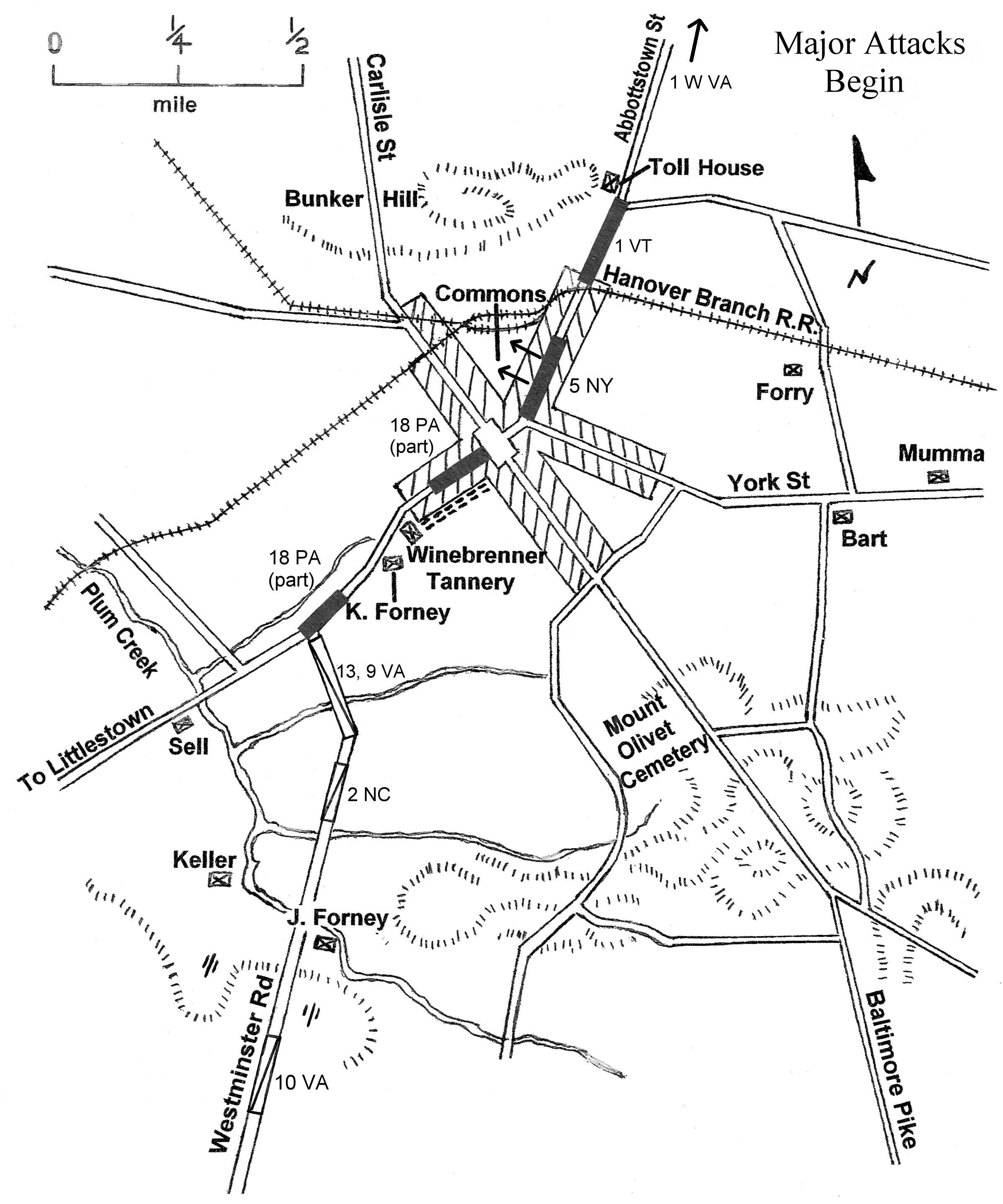
This map is from John Krepps’ book, A Strong and Sudden Onslaught, The Cavalry Action at Hanover, Pennsylvania. This map shows the action intensifying in the Battle of Hanover as the fighting reached the town square on June 30, 1863. Union units are shaded a dark color. Confederate units have lines running through them. Gettysburg Licensed Battlefield Guide Dave Weaver drew the basic map, and John Krepps drew the troop movements.
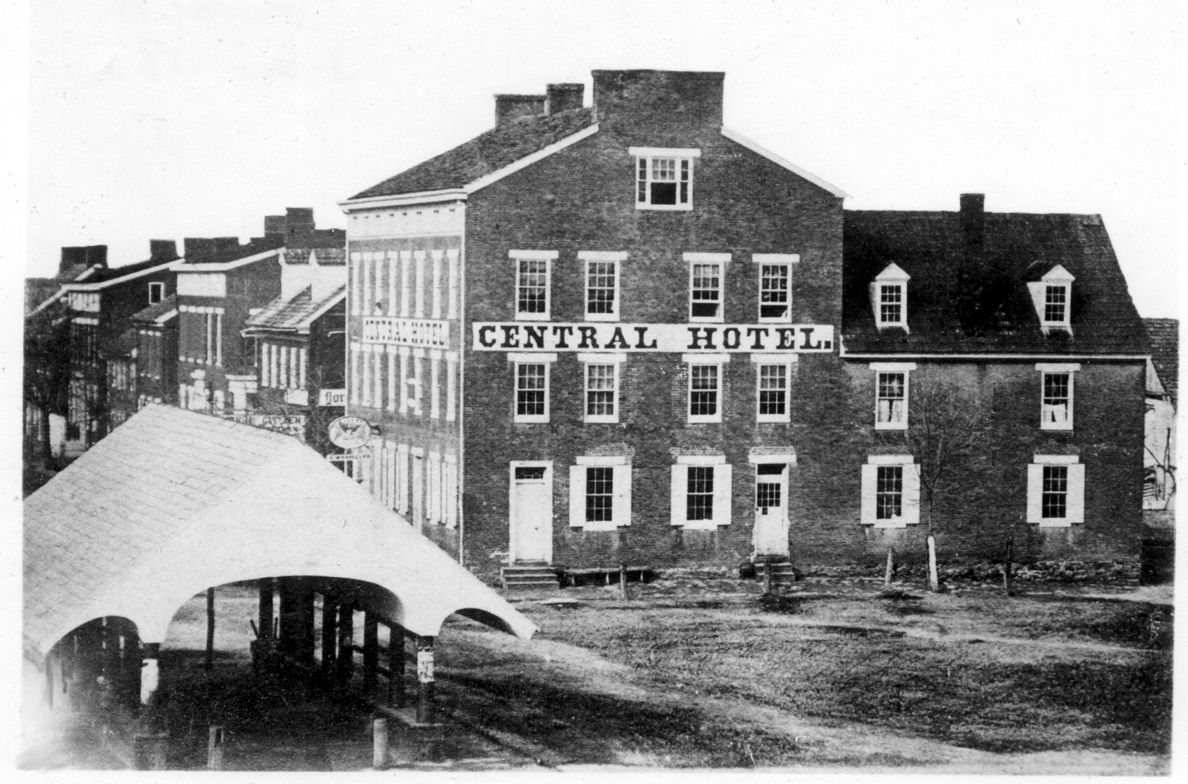
This post-battle photograph shows the Hanover Market House on the left and the Central Hotel in the background. Thomas McCausland was the proprietor of the hotel during the Civil War. The federal census of 1860 cites eighteen individuals who resided in the hotel at that time. This photograph was taken circa the 1860s and is courtesy of the Pennsylvania Room, of the Guthrie (Hanover) Public Library.