Licensed Battlefield Guide Rich Kohr: Gettysburg’s Electric Trolley Part 8
May 7, 2009
In today’s trolley post, we explore the Gettysburg Electric Trolley’s location in Plum Run Valley (Valley of Death) and how it climbed the north slope of Little Round Top. This view was taken facing east between 1893 and 1902.
We are continuing our series on the Gettysburg Electric Trolley, which existed from 1893 to 1916. In our first trolley post, Gettysburg Licensed Battlefield Guide Rich Kohr took us from the Electric Power Station in the town of Gettysburg, over Cemetery Hill to Evergreen Cemetery. In our second post, Rich took the trolley out of Evergreen Cemetery, around the area of the “old” National Park Service Visitor Center, and showed how it was not allowed to continue along its proposed route on Cemetery Ridge. Our third post showed that because the trolley couldn’t travel on Cemetery Ridge, the “outbound” route needed to go to the Emmitsburg Road, where there were some other options, including double tracks at the Klingel Farm. The fourth trolley post took the trolley south along the Emmitsburg Road to where it turns on the Wheatfield Road at the Peach Orchard. The fifth trolley post took the trolley into the Wheatfield area. Our sixth trolley post covered “the big fill” near Plum Run, and the worst trolley accident. Our seventh post covered the Devil’s Den area and an automobile-trolley accident. In today’s post the trolley comes across Plum Run Valley (Valley of Death) and climbs the north slope of Little Round Top.
This map shows the route of the trolley. The red line is the trolley route. The green line is the route of the Gettysburg/Harrisburg/Reading Railroad. For some time, the trolley used the Gettysburg/Harrisburg/Reading Railroad line from the Emmitsburg Road to Little Round Top to help establish a circular route on the battlefield. The blue sections are where the trolley had double or passing tracks. The white stars are the locations where we filmed videos, which we have numbered. Today’s post features videos #s 28-30. #s 31-32 will be in our final trolley post. This map was created at approximately 8:00 PM on Wednesday, May 6, 2009.
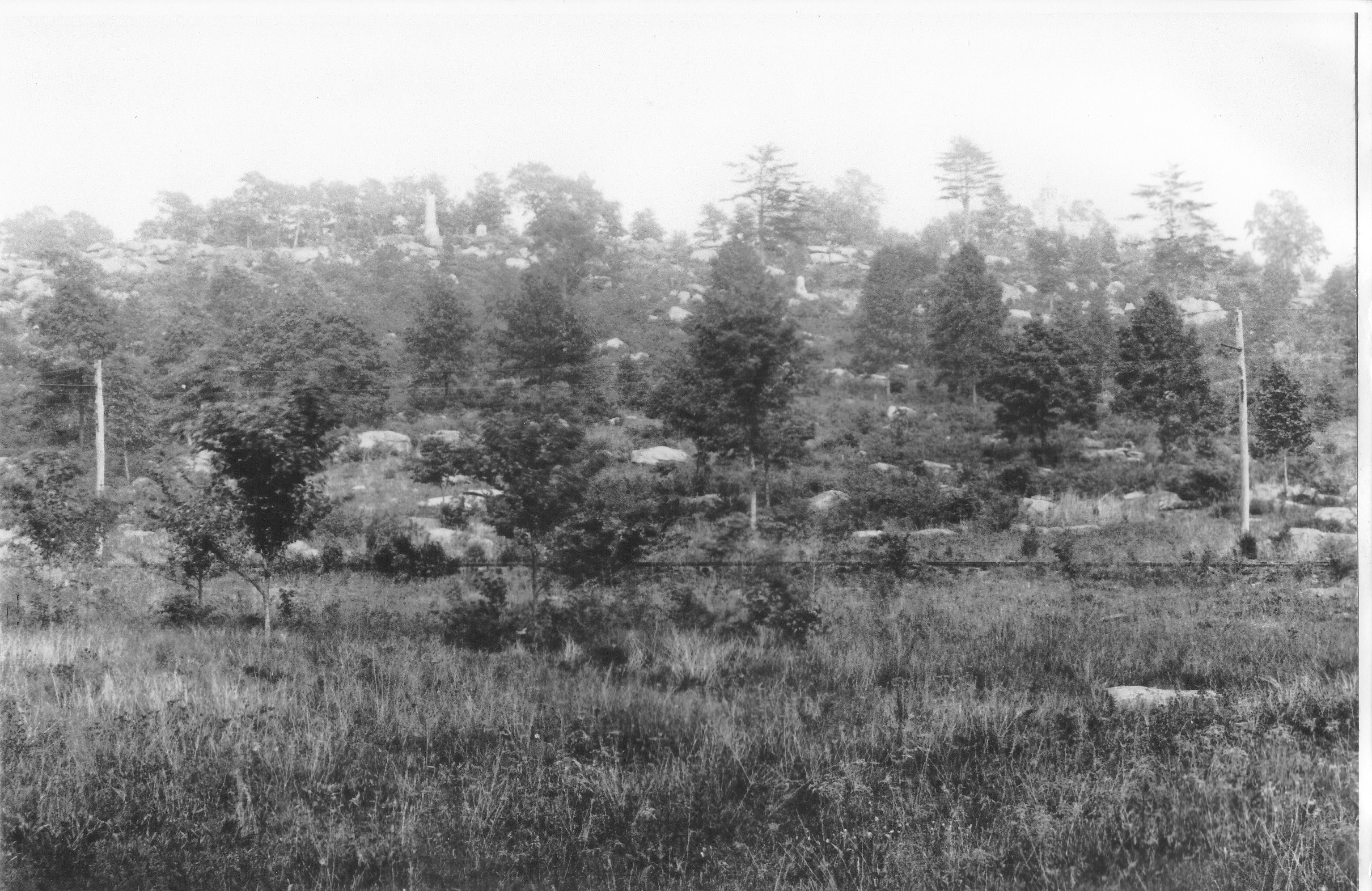
Another view of the trolley crossing Plum Run Valley. The trolley poles are prominent in this picture. Little Round Top is in the background. This view was taken facing east between 1893 and 1902.
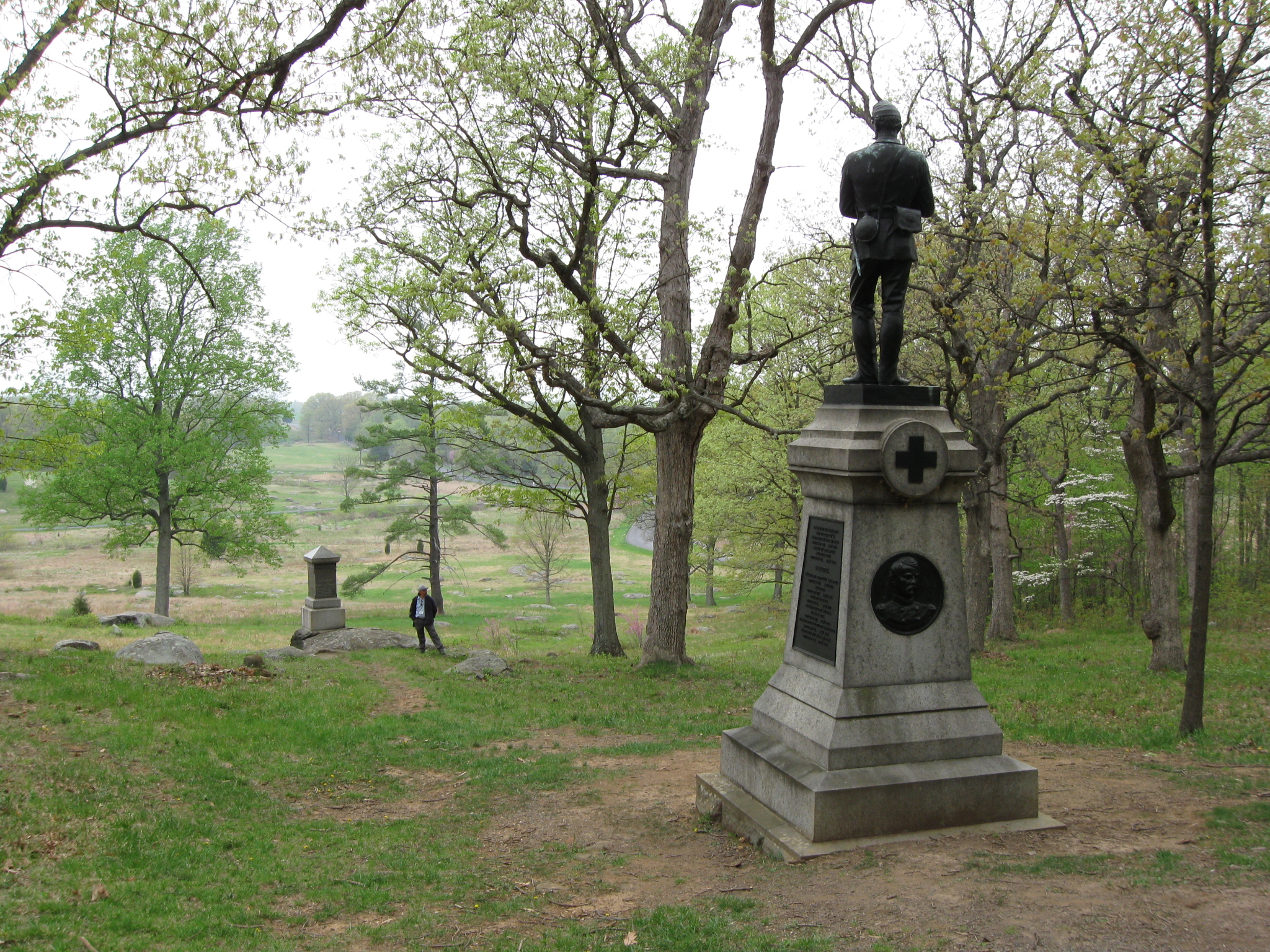
To reach the area of the trolley bed on the north slope of Little Round Top, we first need to park near the monument to the 121st New York Infantry Regiment, shown on the left. We then walked down the slope where Rich Kohr is standing by the 98th Pennsylvania monument. This view was taken facing northwest at approximately 5:00 PM on Thursday, April 30, 2009.
Here is our host for the Gettysburg Electric Trolley series, Gettysburg Licensed Battlefield Guide Rich Kohr standing next to the monument of the 98th Pennsylvania. But we still have to go down the slope to the trolley bed. This view was taken facing west at approximately 5:00 PM on Thursday, April 30, 2009.
Rich is now standing on the trolley bed. The monument to the 98th Pennsylvania is in the background. This view was taken facing east at approximately 5:00 PM on Thursday, April 30, 2009.
Rich is standing at the same spot as in the previous photograph, but the photographer has moved. The monument to Gibb’s Ohio Battery us above and to the left of Rich. The monument to the 155th Pennsylvania Infantry is in the background above and slightly to the right of Rich. This view was taken facing southeast at approximately 5:00 PM on Thursday, April 30, 2009.
Now the photographer and Rich are standing on the trolley bed. Houck’s Ridge is behind Rich. Devil’s Den is in the left background. This view was taken facing southwest at approximately 5:00 PM on Thursday, April 30, 2009.
In Video #28 (Videos #s 1-27 were in our previous trolley posts), Licensed Battlefield Guide Rich Kohr explains where the trolley climbed the north slope of Little Round Top. This view was taken facing southwest to northeast at approximately 5:00 PM on Thursday, April 30, 2009.
Rich is now showing how much the trolley bed was built up on this part of Little Round Top. His outstretched hand is level with the top of the trolley bed. This view was taken facing southwest at approximately 5:00 PM on Thursday, April 30, 2009.
Rich is standing on the trolley bed at the point where it enters the woods. This view was taken facing northeast at approximately 5:00 PM on Thursday, April 30, 2009.
Here Rich is pointing out how much the construction of the trolley bed cut into the slope of Little Round Top. This view was taken facing northeast at approximately 5:00 PM on Thursday, April 30, 2009.
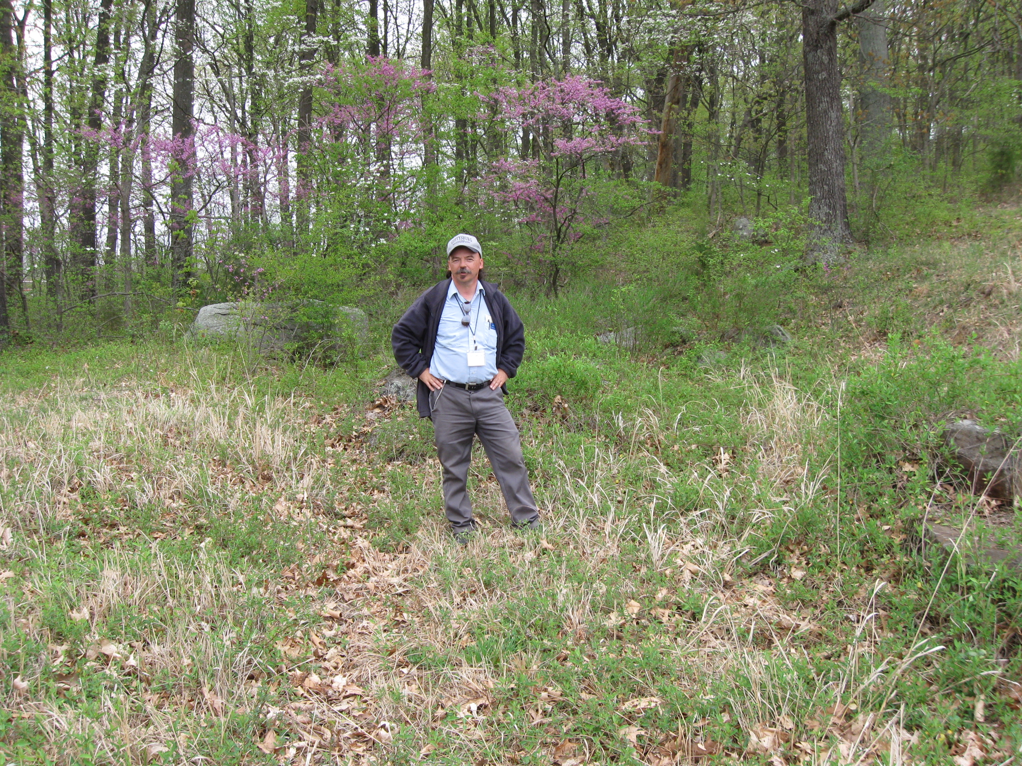
Rich is preparing to enter the woods, but because of the vegetation, this is not a good time of year to go through this area. This view was taken facing northeast at approximately 5:00 PM on Thursday, April 30, 2009.
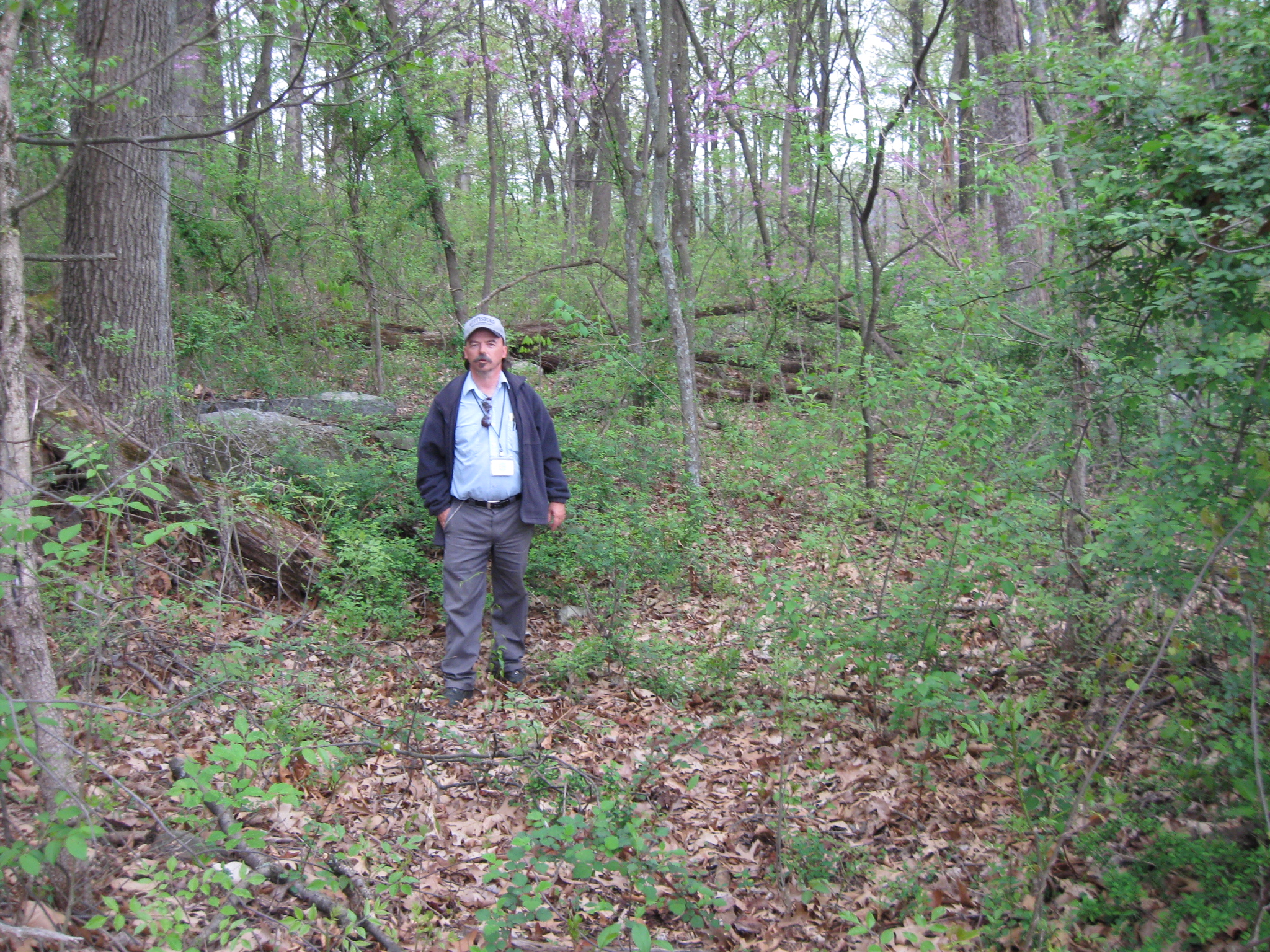
We are in the woods, and Rich is standing in the trolley bed. He is approximately ten feet below the photographer, and is standing by some of the “fill” used by either the War Department or National Park Service to make sure future visitors could not access the trolley bed. This view was taken facing northwest at approximately 5:00 PM on Thursday, April 30, 2009.
In Video #29, Rich explains how the trolley bed entered the woods, and how this area was filled in with large rocks and concrete objects to prevent the bed from being used by vehicular traffic. This view was taken facing southwest to northeast at approximately 5:00 PM on Thursday, April 30, 2009.
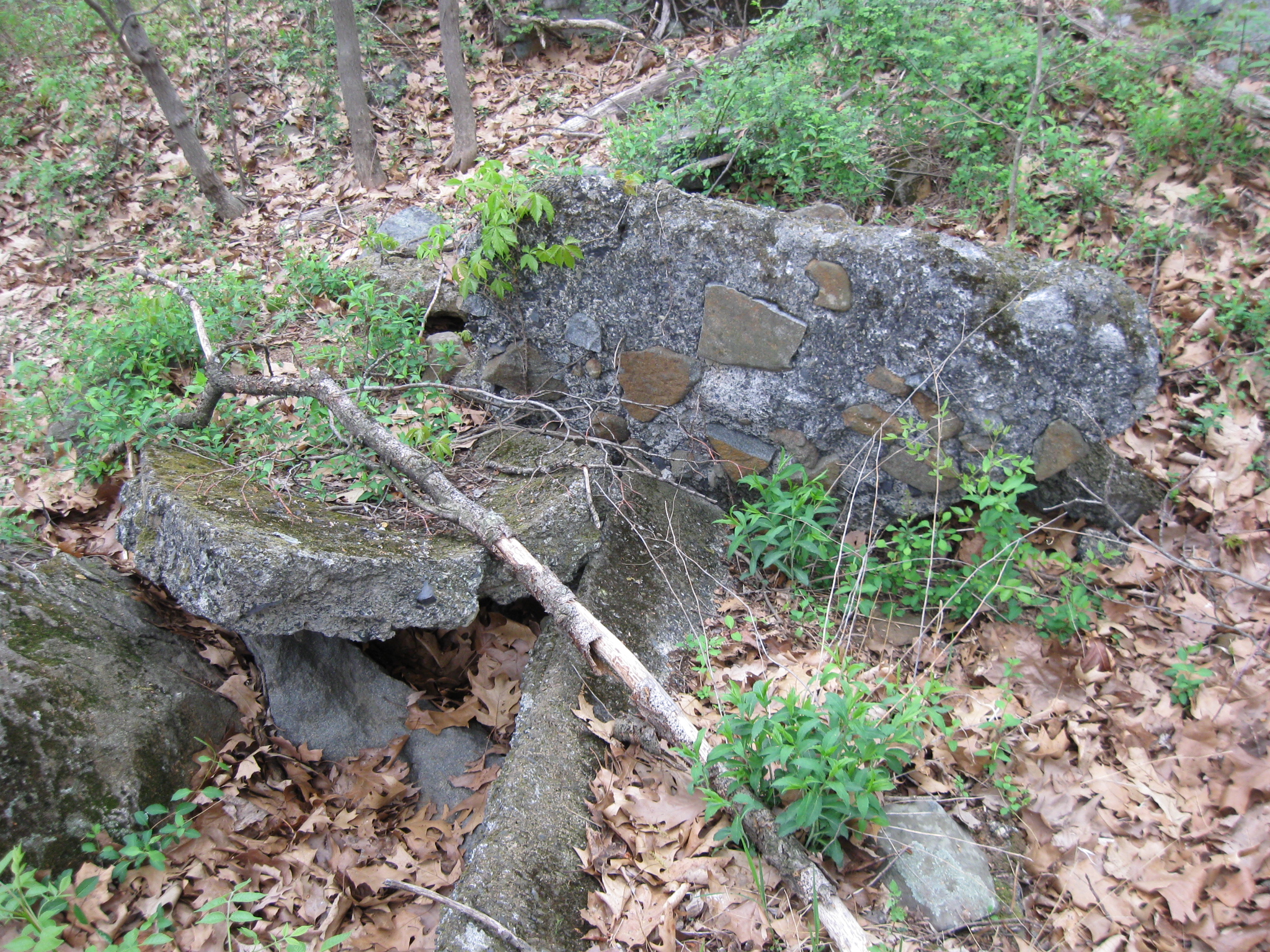
Some of the concrete fill in the trolley bed by which Rich was standing in Video #29. This view was taken facing northwest at approximately 5:00 PM on Thursday, April 30, 2009.
A large section of the rocks laid along the trolley bed. We are approaching the Wheatfield Road, which would be running from right to left (east to west) out of sight in this view. In the left background is the west slope of Munshower Hill. This view was taken facing north at approximately 5:00 PM on Thursday, April 30, 2009.
Rich is standing in the trolley bed. The area filled in with large rocks is now behind him. The photographer is standing on a raised berm near the Wheatfield Road (behind the photographer). This view was taken facing southwest at approximately 5:00 PM on Thursday, April 30, 2009.
In Video #30, Rich explains how the trolley bed exited the woods near the Wheatfield Road. This view was taken facing southwest to northeast at approximately 5:00 PM on Thursday, April 30, 2009.
To see other posts by Gettysburg Licensed Battlefield Guides,click here.