Daniel Sickles at Gettysburg Part 1 With Licensed Battlefield Guide Jim Hessler
April 24, 2009
Gettysburg Licensed Battlefield Guide Jim Hessler is standing near Maryland Highway 140 in the area where Sickles Third Army Corps camped the night of June 30, 1863. This view was taken facing southeast at approximately 4:00 PM on Sunday, April 19, 2009.
One of the most interesting individuals at the Battle of Gettysburg was United States Major-General Daniel Sickles. His movement to a position forward of the Army of the Potomac’s battle line on July 2, 1863, depending on your point of view, either saved the Union Army, or almost led to its destruction. Gettysburg Licensed Battlefield Guide Jim Hessler has been guiding at Gettysburg since 2003. He is employed full-time with Bill Me Later/ PayPal and has been a Licensed Battlefield Guide since 2003. His book, Sickles at Gettysburg: The Controversial Civil War General Who Committed Murder, Abandoned Little Round Top, and Declared Himself the Hero of Gettysburg, will be published in June. He is a long-time Gettysburg and Little Bighorn enthusiast and also a speaker at Civil War Round Tables. He lives in Gettysburg with his wife and two children.
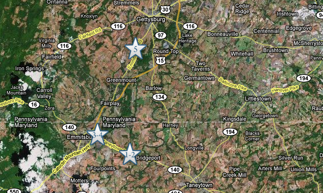
This map shows the location of where our Sickles videos were produced. Videos #1 and #2 were in Bridgeport, Maryland. Videos #3 and #4 were in Emmitsburg, Maryland, on the campus of St. Joseph’s Academy. Video #5 was taken at the driveway of the Rose Farm, just south of the famous Peach Orchard of Joseph Sherfy. This map was created facing north at approximately 9:00 PM on Wednesday, April 22, 2009.
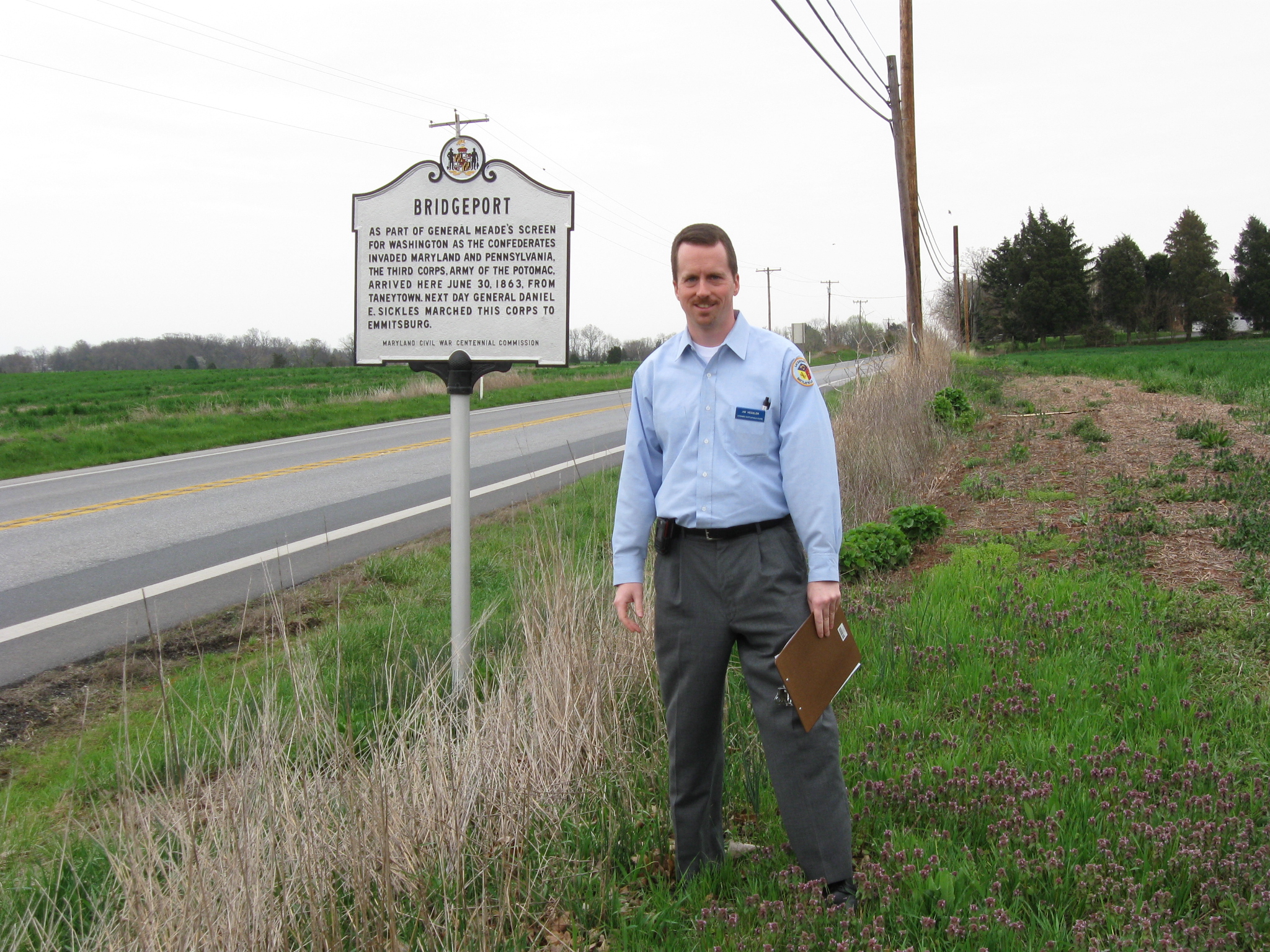
In Video #1, Gettysburg Licensed Battlefield Guide Jim Hessler is standing near the Maryland State Historical Marker along Maryland Highway 140 at Bridgeport. He introduces himself and gives us an idea of what will be included in this series. This view was taken facing southeast at approximately 4:00 PM on Sunday, April 19, 2009.
In Video #2, Jim Hessler explains how Sickles Third Corps moved from Taneytown to Emmitsburg. He also shows us some of the fields where his corps camped, and the building that was possibly Sickles’ Headquarters at Bridgeport. This view was taken facing southeast to northwest at approximately 4:00 PM on Sunday, April 19, 2009.
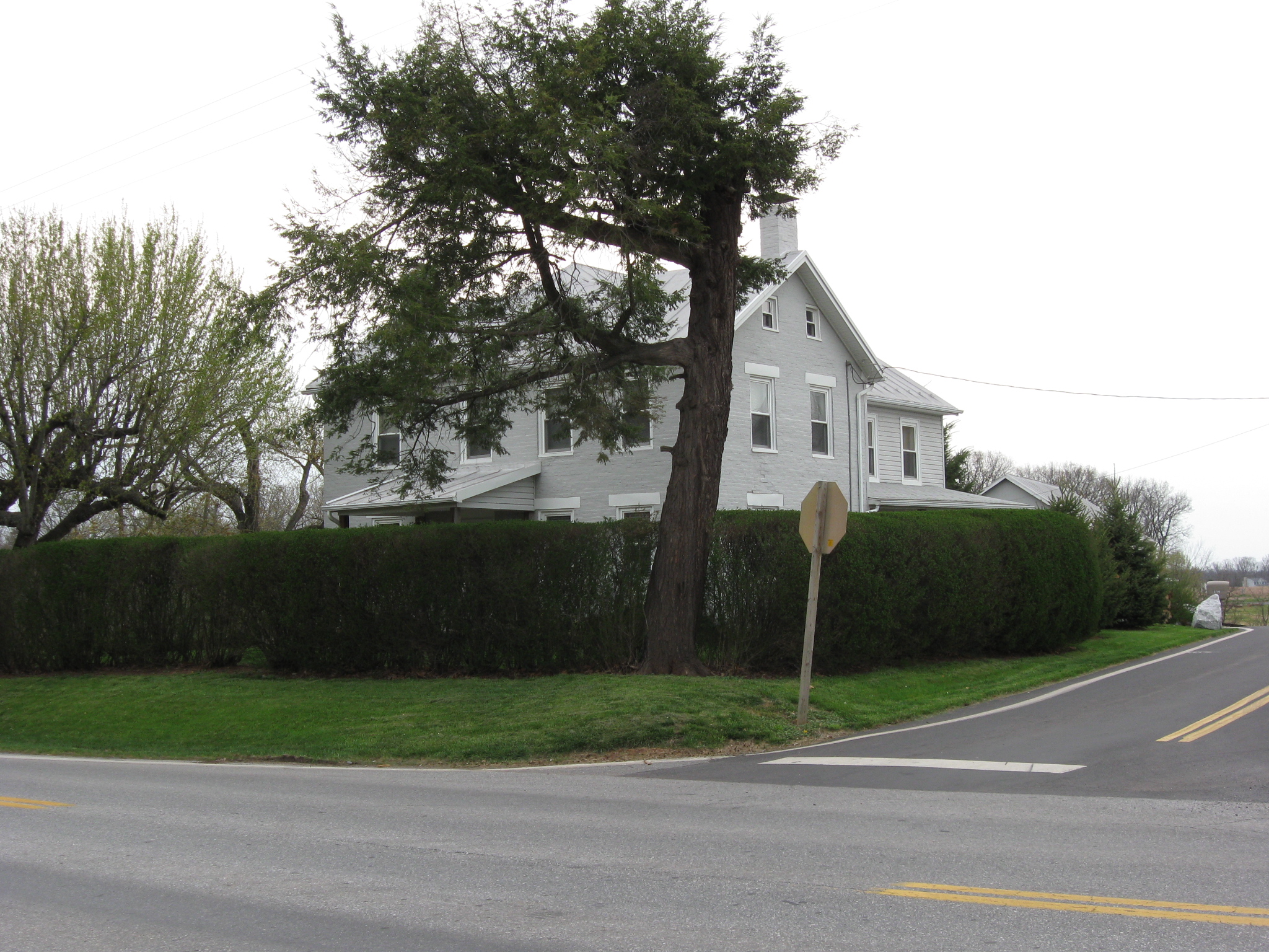
Maryland 140 runs from right to left in this view. Bullfrog Road approaches the camera on the right. The house is probably where Sickles had his headquarters the night of June 30, 1863. This view was taken facing north at approximately 4:00 PM on Sunday, April 19, 2009.
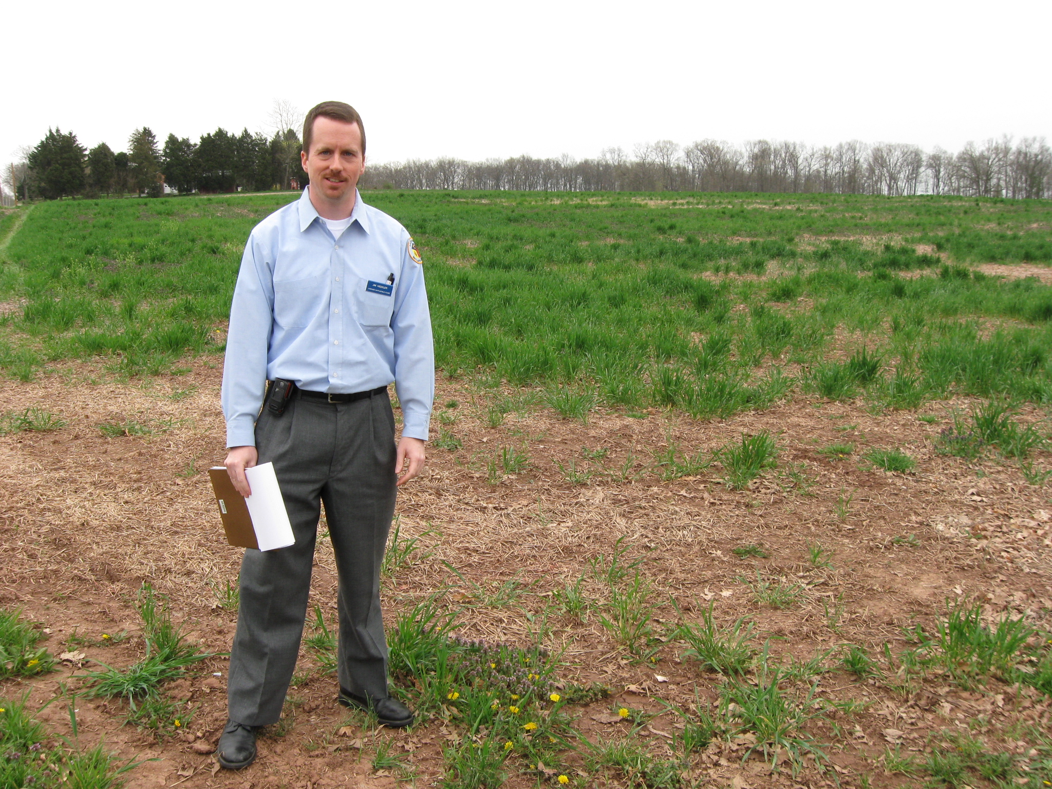
Jim Hessler is standing in the field on the right (south) side of Maryland 140 where part of Sickles Third Corps probably camped the night of June 30, 1863. Maryland 140 is out of sight to the left. This view was taken facing southeast at approximately 4:00 PM on Sunday, April 19, 2009.
The White House and St. Joseph’s Academy in Emmitsburg, Maryland. Sickles’ Third Corps camped here on June 30, 1863 and July 1, 1863. This view is courtesy of John Miller and the Emmitsburg Historical Society. This view was taken facing southeast circa the 1860s.
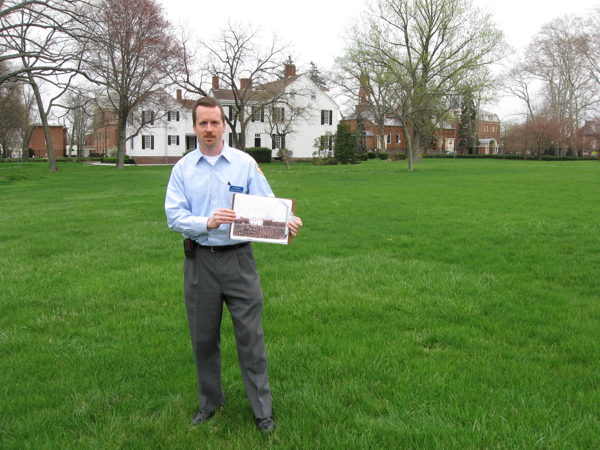
Jim is standing near the campus of St. Joseph’s Academy later St. Joseph’s College. This school of the Roman Catholic Church was founded at Emmitsburg in 1809. It closed in 1973. It is now the home of the National Emergency Training Center, or “The Fire Academy.” This view was taken facing southeast at approximately 4:15 PM on Sunday, April 19, 2009.
In Video #3, Licensed Battlefield Guide Jim Hessler is on the campus of what used to be St. Joseph’s Academy in Emmitsburg, Maryland. He explains the reason that Emmitsburg was a strategically important position during the Gettysburg Campaign. This view was taken facing southeast to west at approximately 4:15 PM on Sunday, April 19, 2009.
Jim Hessler is pointing to St. Marys Mount or Mount St. Marys near Emmitsburg. Major-General Meade was concerned about Confederates emerging from the mountains to the west, and placed Sickles Third Corps here to alert him to possible Confederate movements. This view was taken facing southwest at approximately 4:15 PM on Sunday, April 19, 2009.
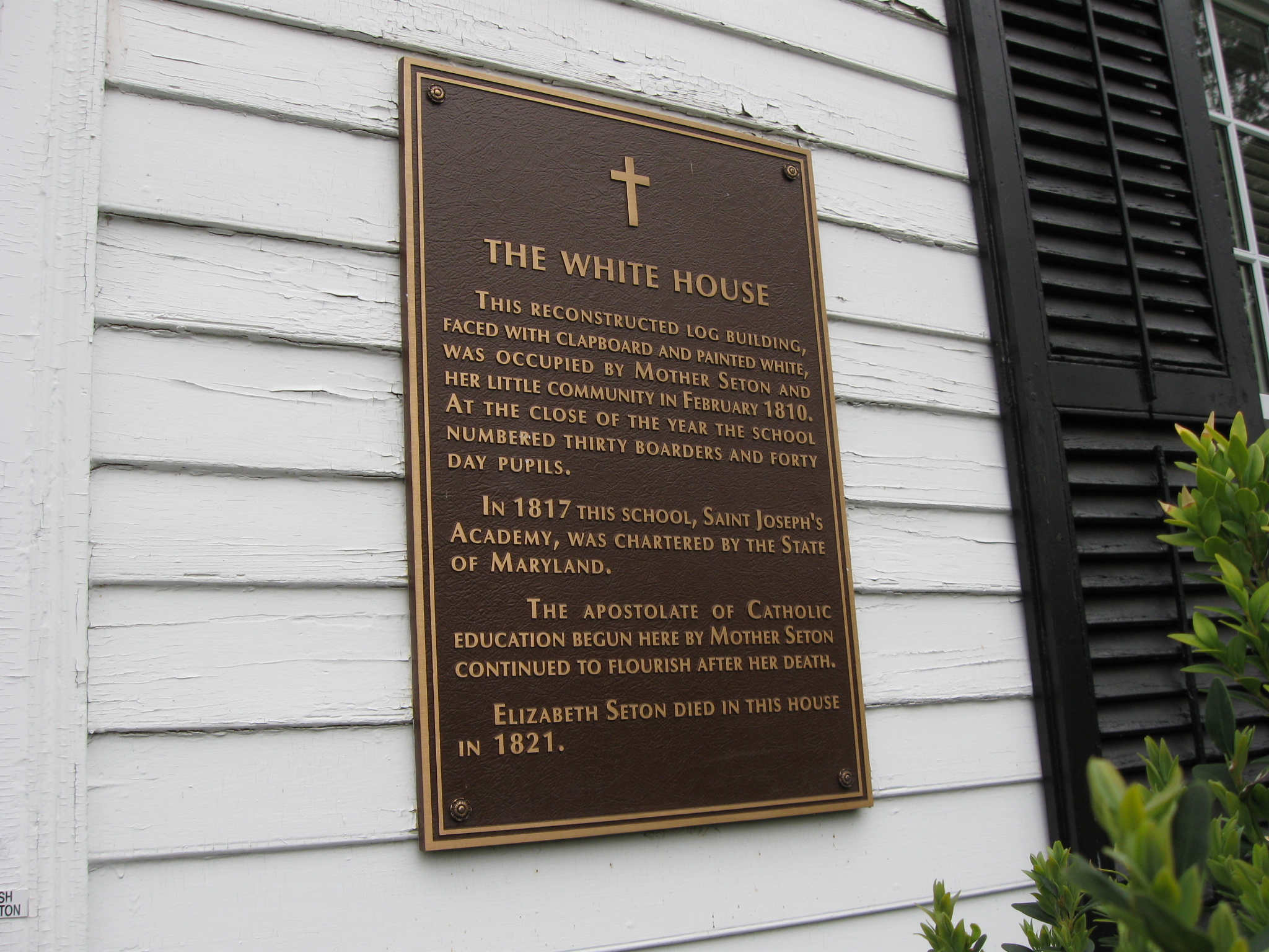
A log structure now known as the “White House” was first occupied on Feb. 20, 1810. Mother Elizabeth Seton and eight other students first occupied the structure when it was erected on another part of the campus. This view was taken facing northeast at approximately 4:15 PM on Sunday, April 19, 2009.
The original purpose of the Catholic School at Emmitsburg was provide a “day school” for poor children. However, financial difficulties made it necessary to accept boarding students, and in May, 1810, the first five boarders came from Frederick County. By the end of that year the number of boarders had increased to 30. At the close of the academic year in 1811 there were about 50 boarding students at the Academy. This view was taken facing north at approximately 4:15 PM on Sunday, April 19, 2009.
Enrollment in the day school had almost doubled by 1820, so a two-story brick building was constructed for the day students. While inspecting the building of this school during summer of that year, Mother Seton contracted a cold which brought on the long illness resulting in her death on January 4, 1821. She died in the “White House.” This plaque is on the front (south side) of the “White House.” This view was taken facing northeast at approximately 4:15 PM on Sunday, April 19, 2009.
Between 1826 and 1861 an intensive program of building and expansion of St. Joseph’s Academy was undertaken. By 1826 enrollment had reached 126. There were 80 boarders and six orphans in the “Academy,” and 40 day students in the “day school.” Jim is standing as close as we can get to some of the Academy buildings. The black fence separates us from what is now the “Fire Academy.” This view was taken facing southeast at approximately 4:15 PM on Sunday, April 19, 2009.
In Video #4, Jim explains what we know and don’t know about the location of Sickles’ headquarters in Emmitsburg. He also covers the conflicting orders for Sickles on July 1, 1863 to remain at Emmitsburg, or to move to Gettysburg. This view was taken facing southeast at approximately 4:15 PM on Sunday, April 19, 2009.
In Video #5, We have moved up the Emmitsburg Road toward Gettysburg. We have stopped at the driveway of the Rose Farm along the Emmitsburg Road. Jim shows us Sickles first impression of Gettysburg, including the high ground on the Emmitsburg Road occupied by Joseph Sherfy’s Peach Orchard. This view was taken facing southwest to north to northeast to east at approximately 5:00 PM on Sunday, April 19, 2009.
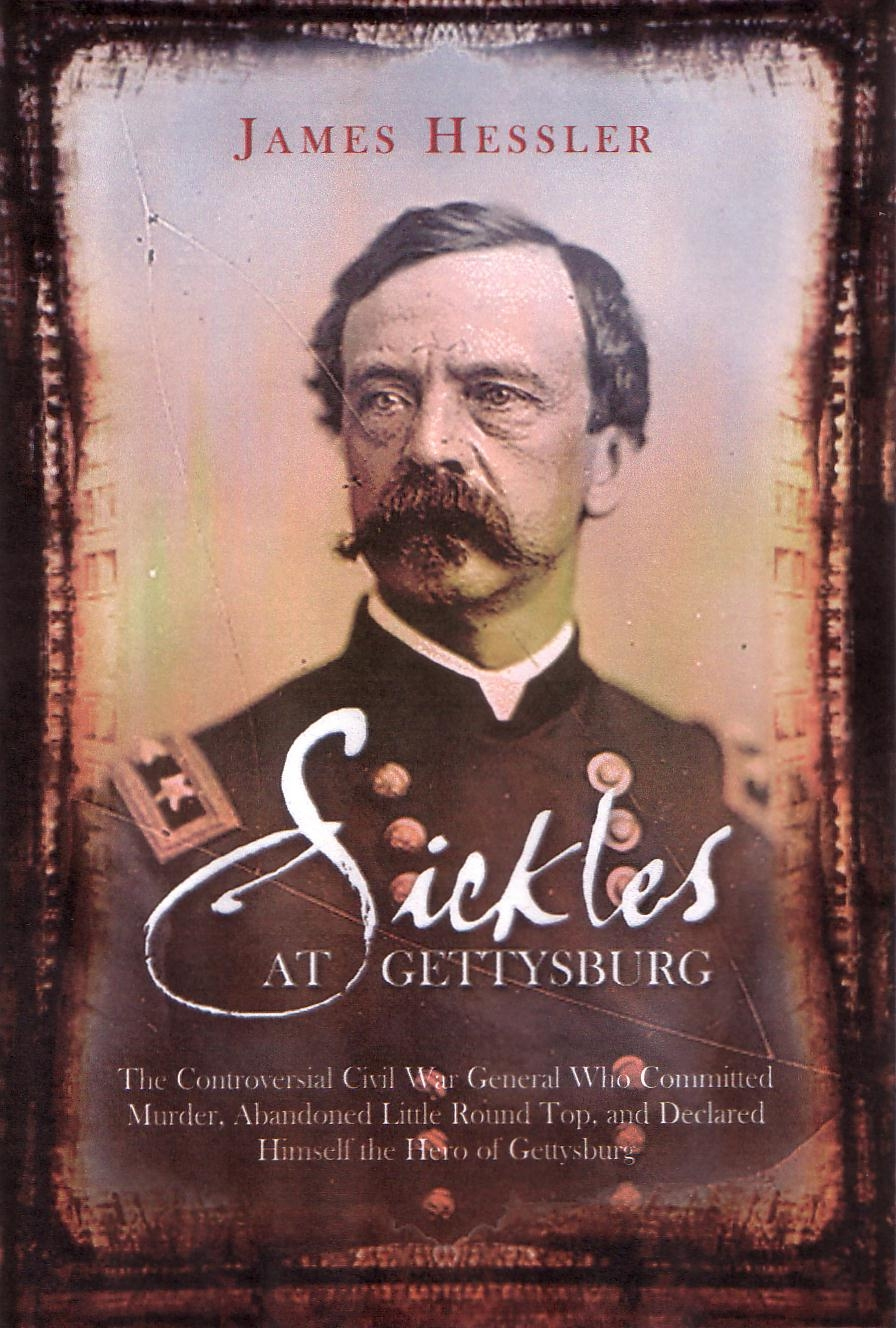
Here is the cover of Jim’s new book on Daniel Sickles. It is published by Savas Beattie LLC, and will be available in June, 2009. Click here for a link to an interview with Jim on their site. This cover was uploaded at approximately 5:00 PM on Tuesday, April 21, 2009.
To see other posts by Gettysburg Licensed Battlefield Guides,click here.