The National Park Service at Gettysburg National Military Park is finally attempting to get rid of some of the undergrowth/foliage that for years has quickly overtaken many parts of the battlefield. They have been spraying the foliage in an attempt to kill it. The big rocks of Devil’s Den are on the right. The slope of Little Round Top is in the left background. The Devil’s Den “Witness Tree” sits prominently above the foliage hidden (obviously not been sprayed yet) sharpshooter position. This view was taken facing northeast at approximately 4:45 PM on Monday, August 30, 2010.
The National Park Service is finally attempting to get rid of some of the non historic foliage at Gettysburg National Military Park. One of the prominent areas where they have started spraying is the south end of the battlefield near the Valley of Death. As we previously pointed out in a piece on the out of control undergrowth two years ago, the landscape and woods were mostly free of undergrowth at the time of the battle.
Farming practices in the 1860s were much different than today. The wooden fences that the Park Service is faithfully reconstructing on the battlefield were used to fence animals out of farmers crops. Animals were allowed to roam through the woods during the day, and they would have ate the undergrowth. This was not “jungle warfare” at Gettysburg, the soldiers were able to see much farther through the woods than we are today. Well, until they started firing their weapons and it became too smoky.
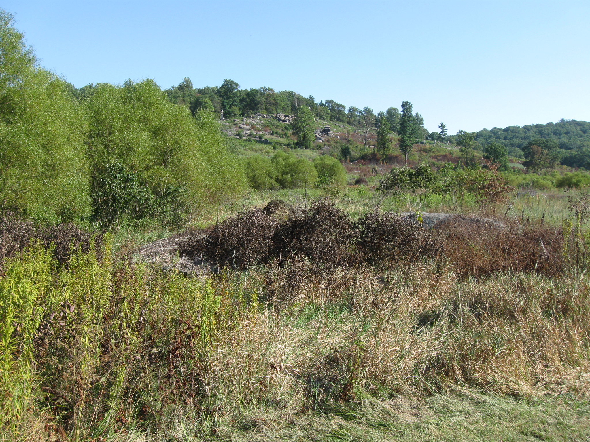
We will start our tour of Plum Run Valley/Valley of Death at the north end and work our way south. The dark colored plants, some in the foreground, but most on the slope of Little Round Top, have been sprayed with a herbicide. This view was taken facing southeast at approximately 4:45 PM on Monday, August 30, 2010.
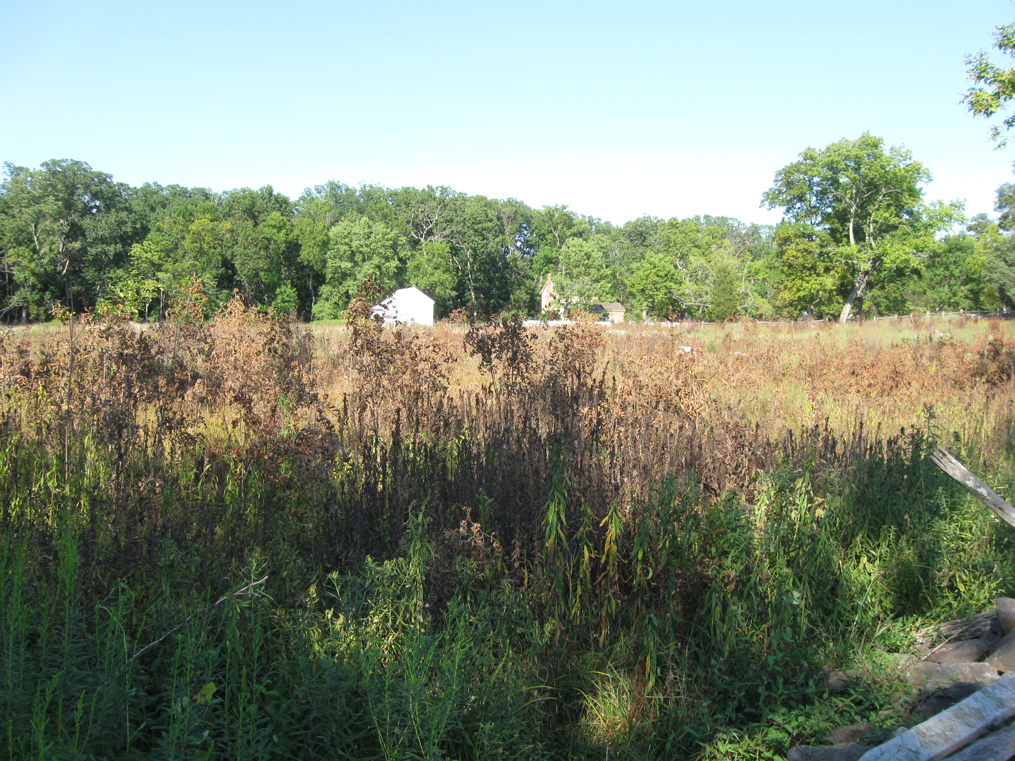
National Park Service spokesperson Katie Lawhon responded to our inquiries about the spraying with the following answer: “Gettysburg National Military Park staff have used two EPA-approved herbicides recently …Garlon 4 and Milestone VM…” The plants in the foreground have been sprayed on the John Weikert Farm, whose buildings are in the background. This view was taken facing northeast at approximately 4:45 PM on Monday, August 30, 2010.
Dow Chemical Company’s fact sheet states: “Garlon 4 Ultra is labeled to effectively control more than 55 woody plants and more than 25 tough-to-control annual and perennial broadleaf weeds in noncrop areas that include roadsides, railroads, pipelines, industrial sites, forests and rights-ofway such as power lines. It also is labeled for the establishment and maintenance of wildlife openings and can be used on sites that include grazed areas. This view was taken facing southeast at approximately 7:45 AM on Tuesday, July 8, 2008.
“The advanced Garlon 4 Ultra specialty herbicide formulation uses no petroleum distillates — important for compliance in states that have or are considering mandated reductions of Volatile Organic Compound (VOC) emissions into the atmosphere. The plant-derived solvent formulation results in a milder scent to help reduce the possible public objections associated with the strong odor of a petroleum-based solvent. The MSO solvent is less phytotoxic to foliage than petroleum-based formulations, and, therefore, the superior control can be attributed to improved uptake of active ingredient into plants. Because Garlon 4 Ultra uses triclopyr as the active ingredient, the same used in Garlon 4, the two herbicides share an extensive toxicology database and similar toxicology attributes. Garlon 4 Ultra is labeled with a ‘Caution’ signal word.” Yes we can believe that. Little Round Top is in the background. The marker for the “rear” section of Smith’s New York Battery is west of Crawford Avenue. This view was taken facing southeast at approximately 4:45 PM on Monday, August 30, 2010.
The Dow fact sheet on Milestone VM states: “Combining the power of two active ingredients, Milestone VM Plus offers broader-spectrum control of labeled noxious and invasive species, and provides fast knockdown on target species at multiple stages of growth. It is labeled to control more than 65 tough-to-control broadleaf weeds and more than 20 woody plants. Milestone VM Plus also is selective to most cool and warm-season perennial grasses, which allows native plants and grasses to flourish, and helps restore biodiversity.” The big rock of Devil’s Den are out of sight on the right. Sickles Avenue curves away from the “Elephant Rock” which is prominent in the center of this view. This view was taken facing southwest at approximately 4:45 PM on Monday, August 30, 2010.
The Dow fact sheet on Milestone VM continues, “When applied to emerged weeds, Milestone VM Plus moves systemically into the foliage and throughout the entire plant, disrupting the natural growth process by going deep into the root system. The active ingredients are absorbed and translocated, resulting in uneven growth; thickened, twisted stems; crinkled leaves; enlarged roots; and complete control in about two months. In addition, Milestone VM Plus provides soil-residual activity to control later-emerging seedlings of sensitive broadleaf weeds all season long.” The Slyder Farm buildings are in the right background. The plaque for Benning’s Brigade on Benning’s Knoll is in the center of this view. The “Elephant Rock” is in the left background. This view was facing south at approximately 4:45 PM on Monday, August 30, 2010.
National Park Service spokesperson Katie Lawhon continued with her answer to our inquiry: “The employees that applied the herbicide did so as licensed technicians under a Pennsylvania Pesticide Applicators’ License.” The Slaughter Pen area, which has been seriously overrun by foleage has not been sprayed… This view was taken facing northeast at approximately 4:45 PM on Monday, August 30, 2010.
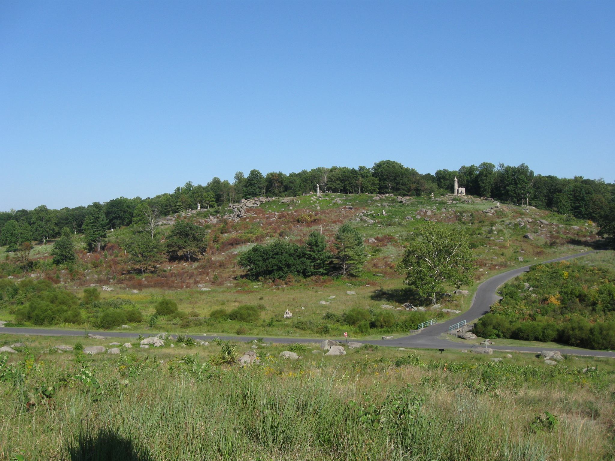
…while the spraying on the east slope of Little Round Top is very obvious. This view was taken facing east at approximately 4:45 PM on Monday, August 30, 2010.
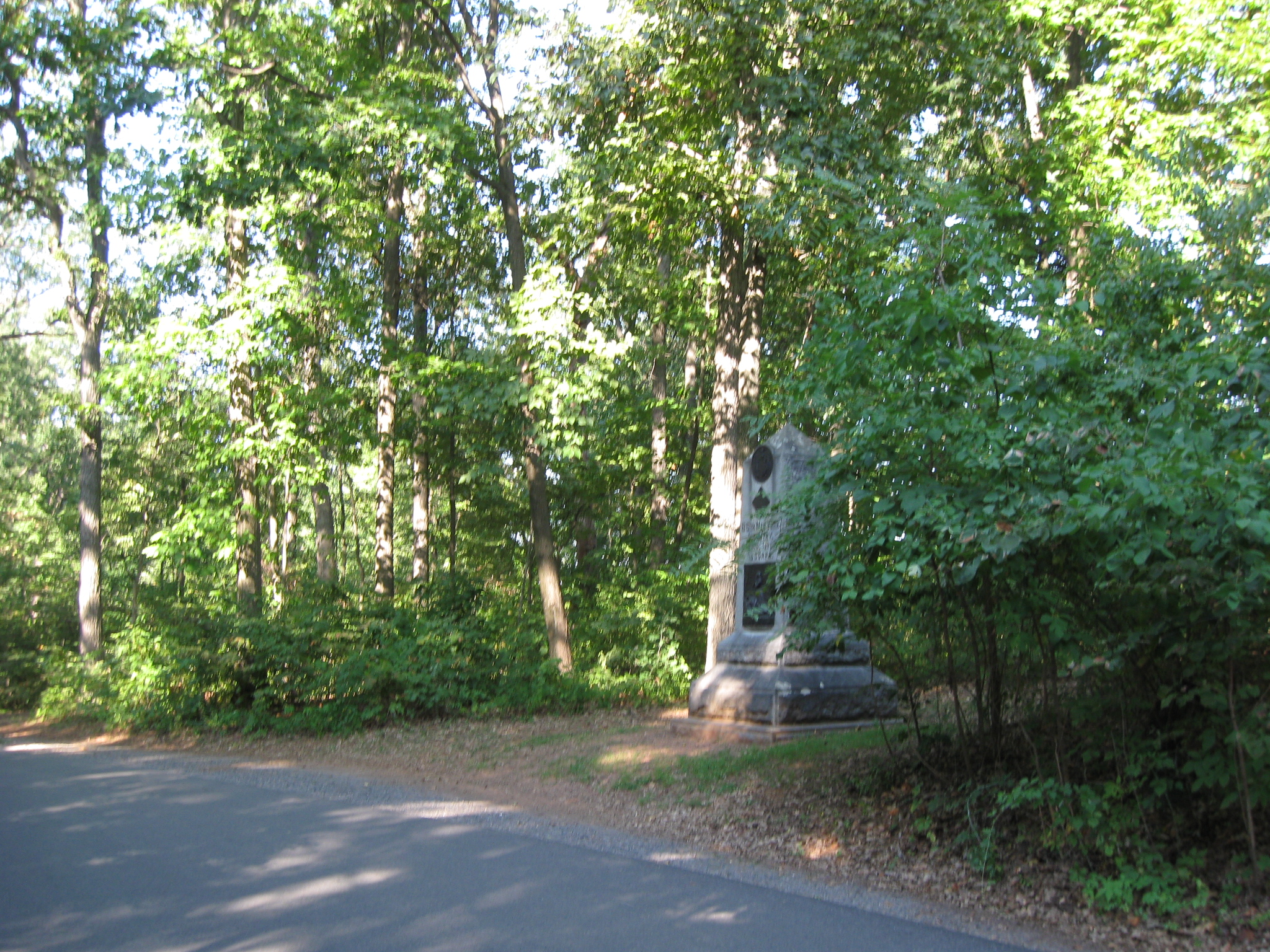
We asked Katie Lawhon if there was a schedule to figure out what areas will be sprayed next. We are glad the open ground is slowly being sprayed, but we really want the undergrowth removed from the woods, like the area where the monument to the 86th New York is located. Katie replied, “We spray areas to keep non-historic vegetation and exotic/invasive vegetation under control. We use the herbicides in combination with mowing as a management tool in areas that we want to maintain as open ground. Just as with the mowing, we work in areas all over the park on a frequent basis, so I do not have set schedules to share with you.” This view was taken facing northeast at approximately 4:45 PM on Monday, August 30, 2010.
We know they won’t mow through the woods, but we believe the undergrowth in the woods should be put on a schedule also. To understand how the 86th New York suffered 66 casualties on July 2nd, it would be nice to be able to see down the slope and understand the terrain where they were being attacked by the 3rd Arkansas, 1st Texas, and 15th Georgia. After all the tree removal projects were supposed to put the battlefield viewsheds closer to what the soldiers might have seen. This view was taken facing northwest at approximately 4:45 PM on Monday, August 30, 2010.