Old Visitor Center Restoration Update and Some Demolition “Action” Shots
April 27, 2009
The front or Taneytown Road entrance of the old Gettysburg National Military Park Electric Map Visitor Center. The photographer was standing on the other (east) side of the Taneytown Road near the wall of the Soldiers National Cemetery. This photograph is courtesy of Barbara Adams. This view was taken facing southwest on Thursday, April 2, 2009.
In today’s post, we are showing the progress on the restoration of the area of the old National Park Service Visitor Center (Electric Map Visitor Center) on the Taneytown Road. However, National Park Service Volunteer Extraordinaire Barb Adams has also graciously allowed us to use some of her pictures of the demolition. Because we work out of the area during the day, we couldn’t be on site to see the actual demolition, and our photographs were just of the aftermath of each day’s work. Barb’s pictures show the demolition as it occurred.
The rear of the 1921 building taken from the Cyclorama Parking Lot side of the structure. This photograph is courtesy of Barbara Adams. This view was taken facing northeast on Thursday, April 2, 2009.
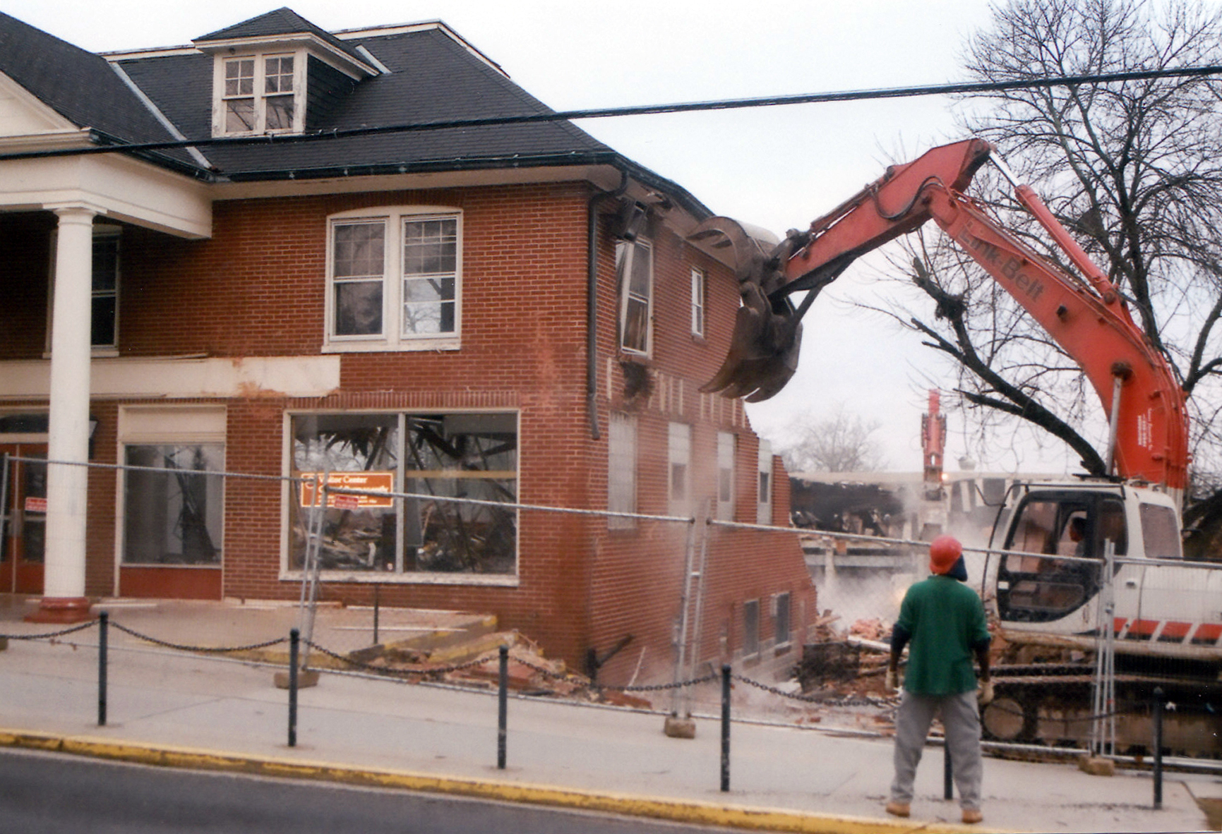
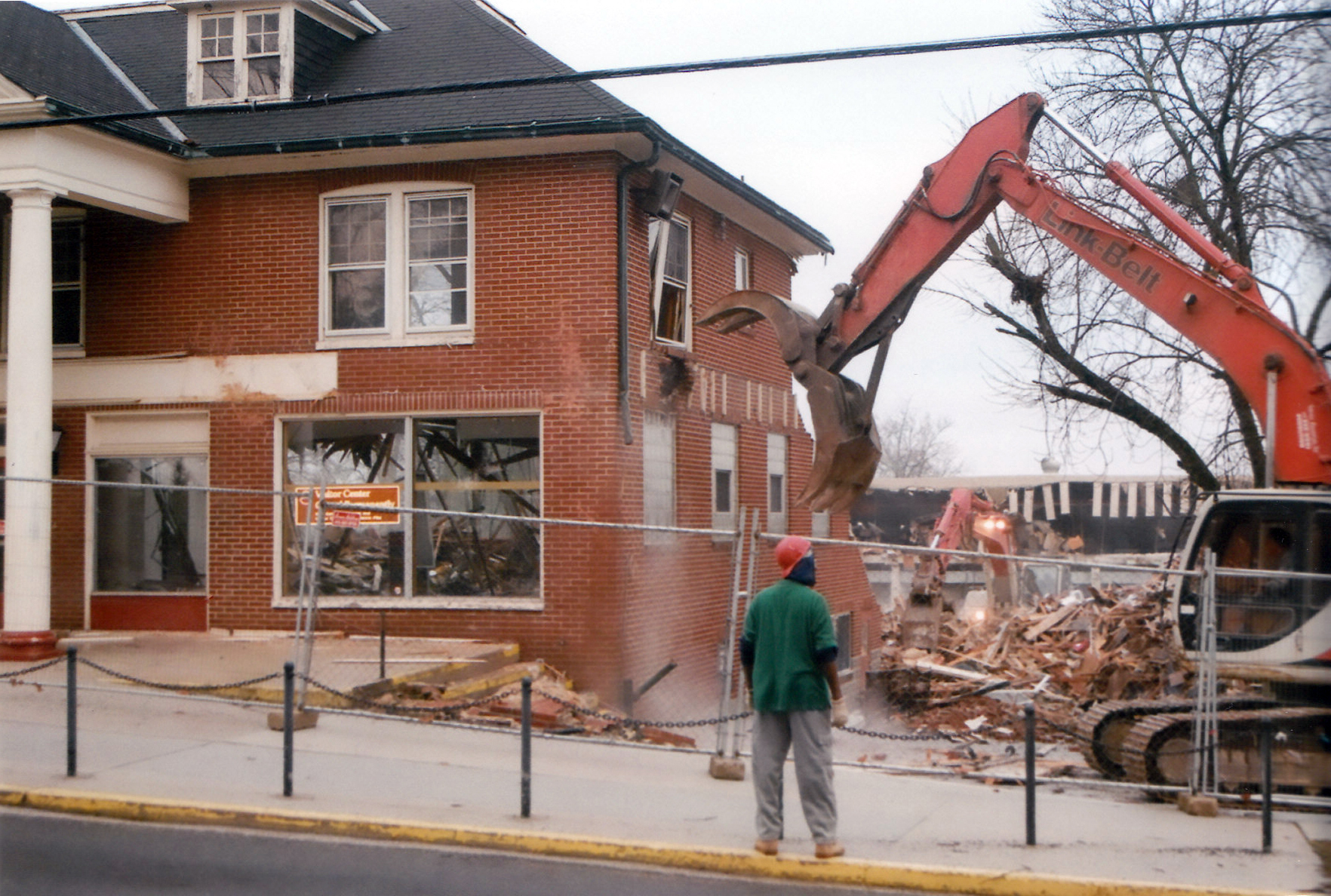
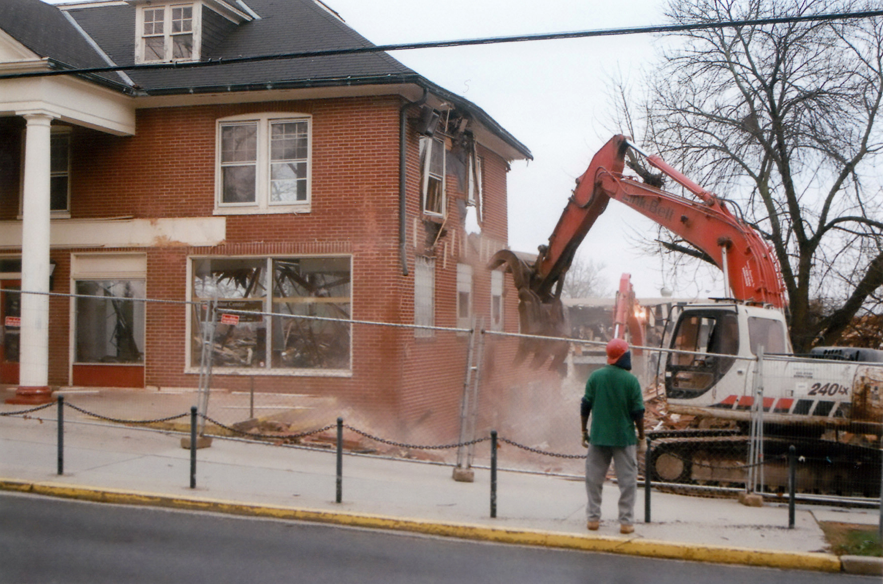
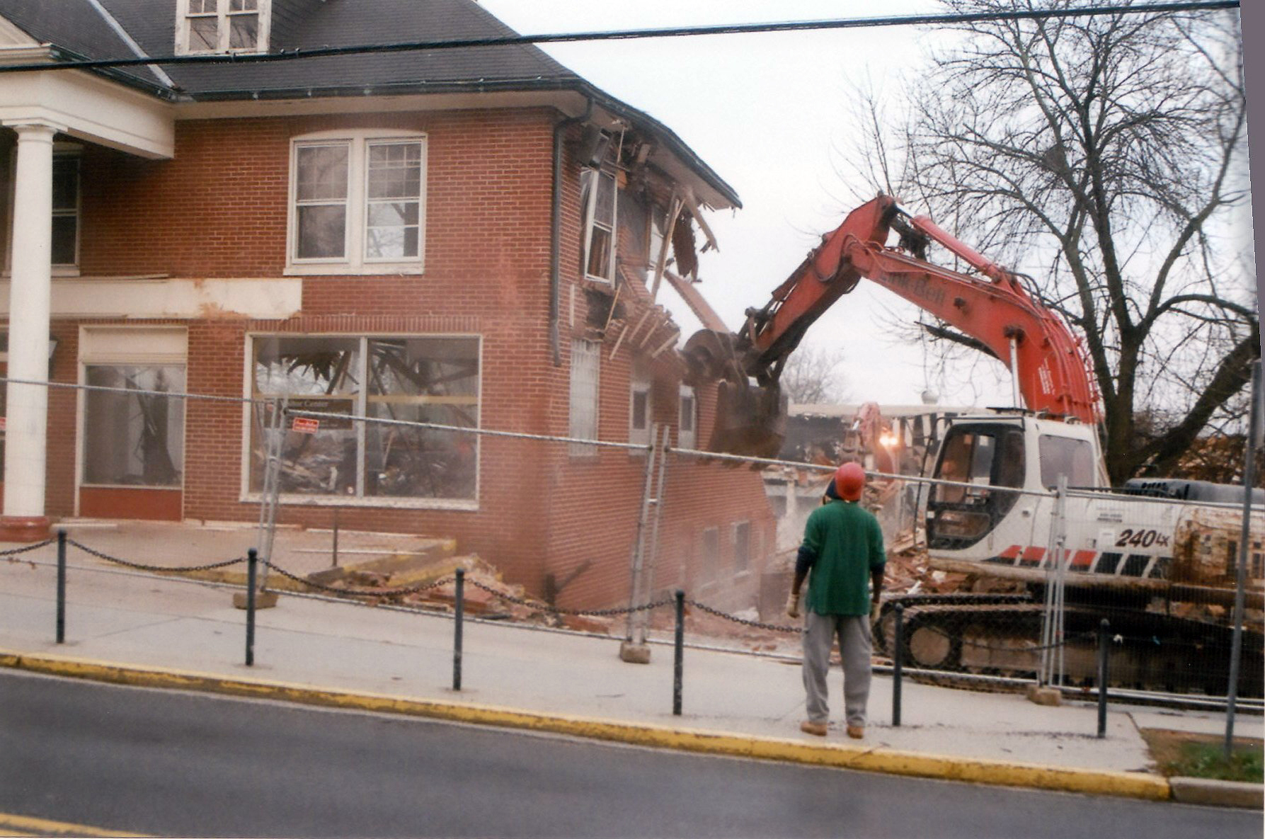
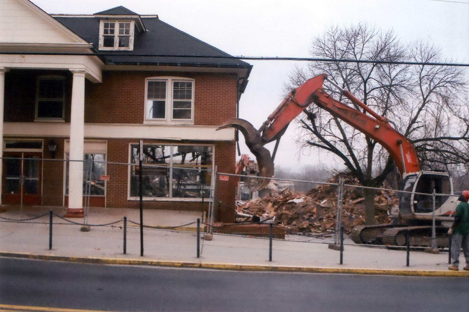
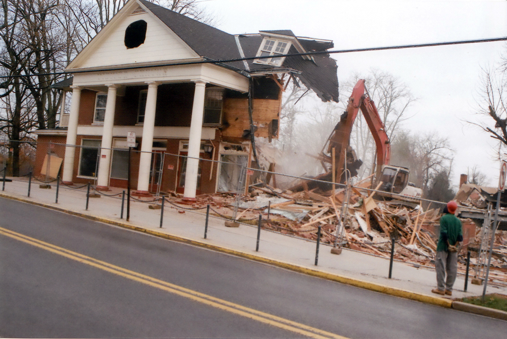
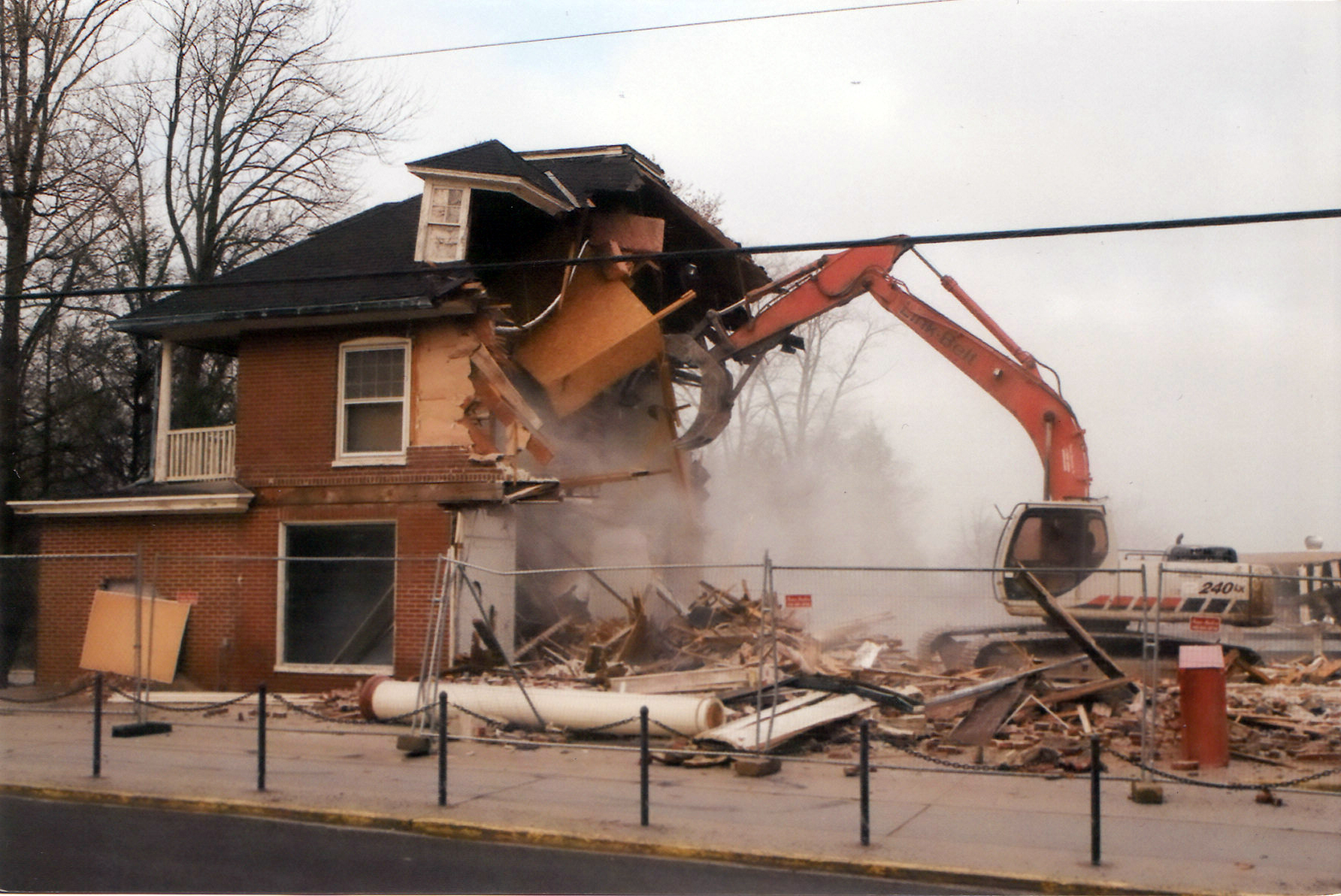
This photograph is courtesy of Barbara Adams. This view was taken facing northeast on Thursday, April 2, 2009.
This photograph is courtesy of Barbara Adams. This view was taken facing northeast on Thursday, April 2, 2009.
This photograph is courtesy of Barbara Adams. This view was taken facing northeast on Thursday, April 2, 2009.
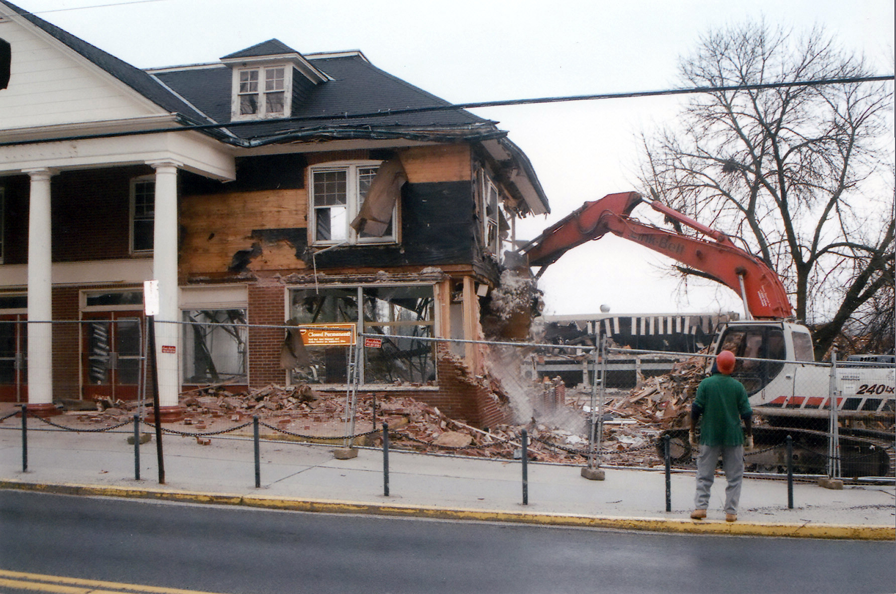
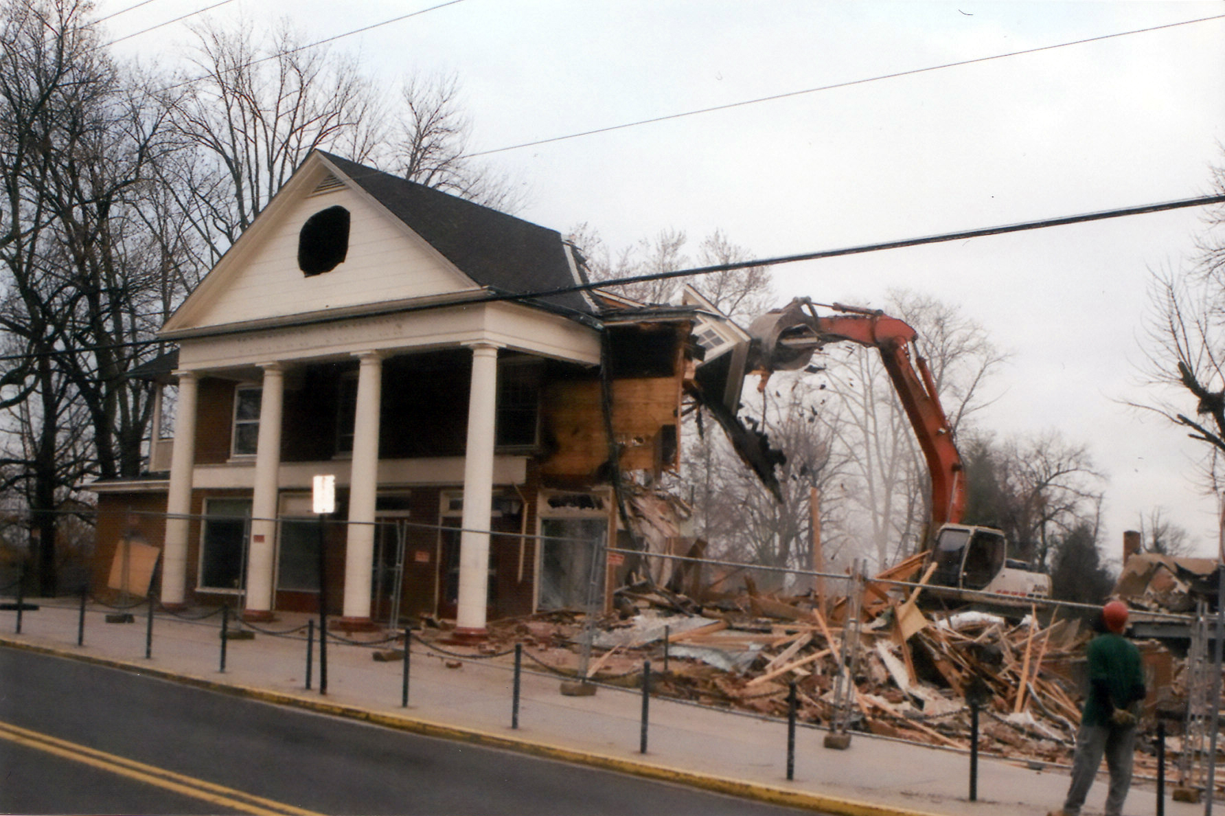
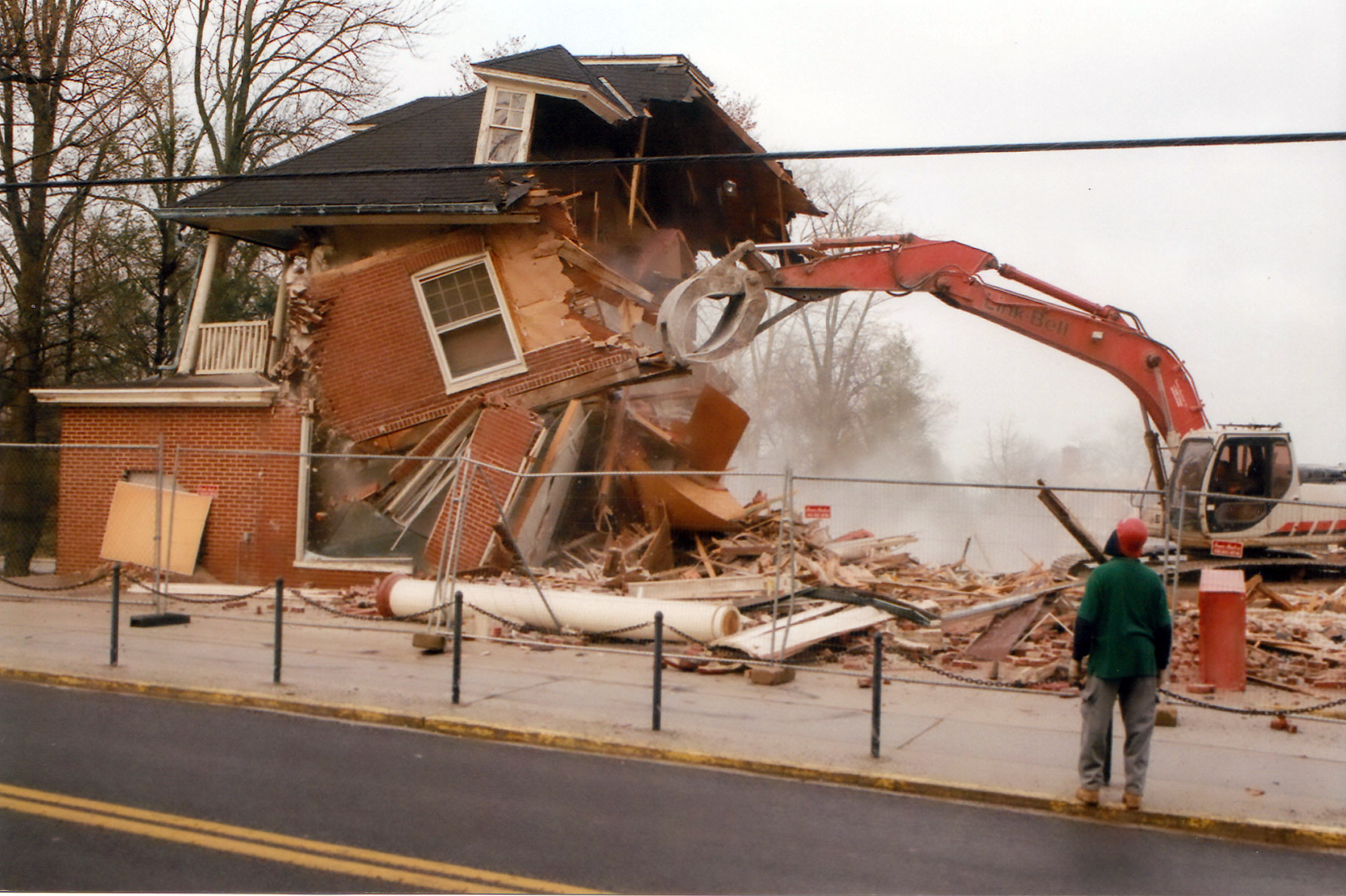
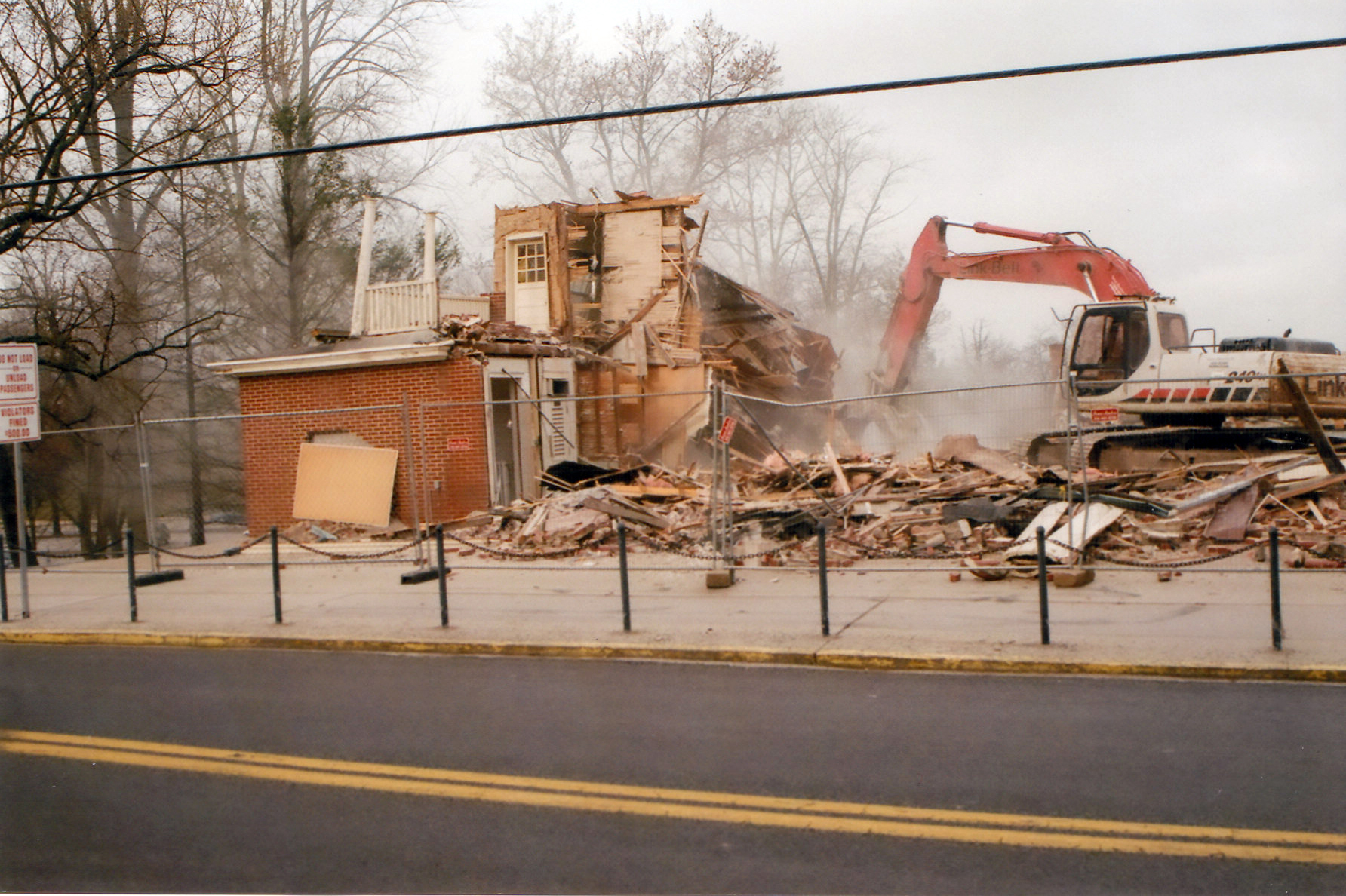
One of the last views of the front of the building. Notice how the columns are already unsteady because of the work occurring at the rear (west) of the structure. This photograph is courtesy of Barbara Adams. This view was taken facing northwest on Thursday, April 2, 2009.
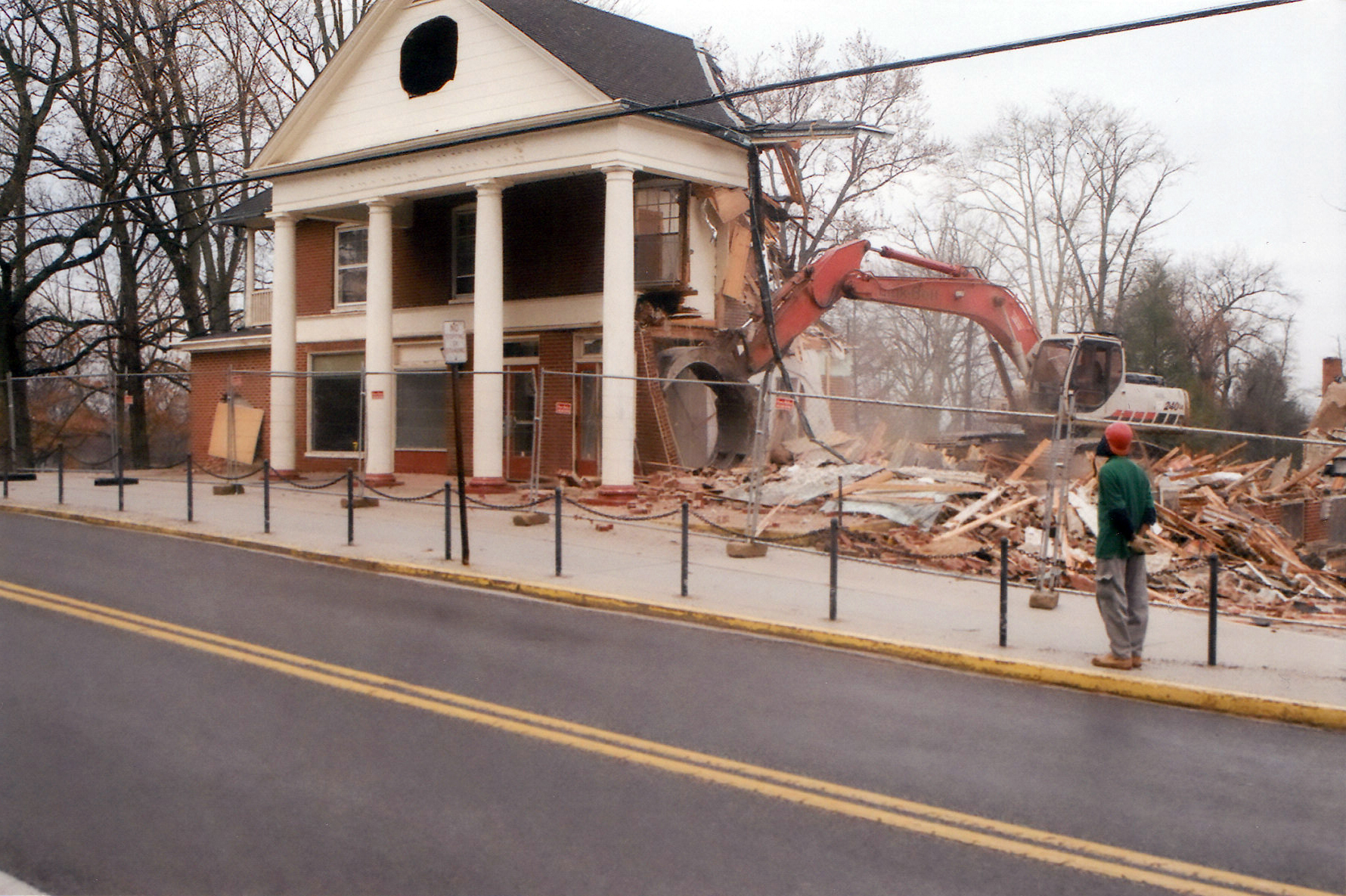
A last look into the lobby. This photograph is courtesy of Barbara Adams. This view was taken facing west on Thursday, April 2, 2009.
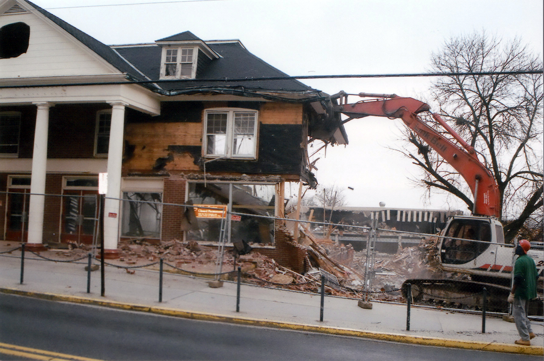
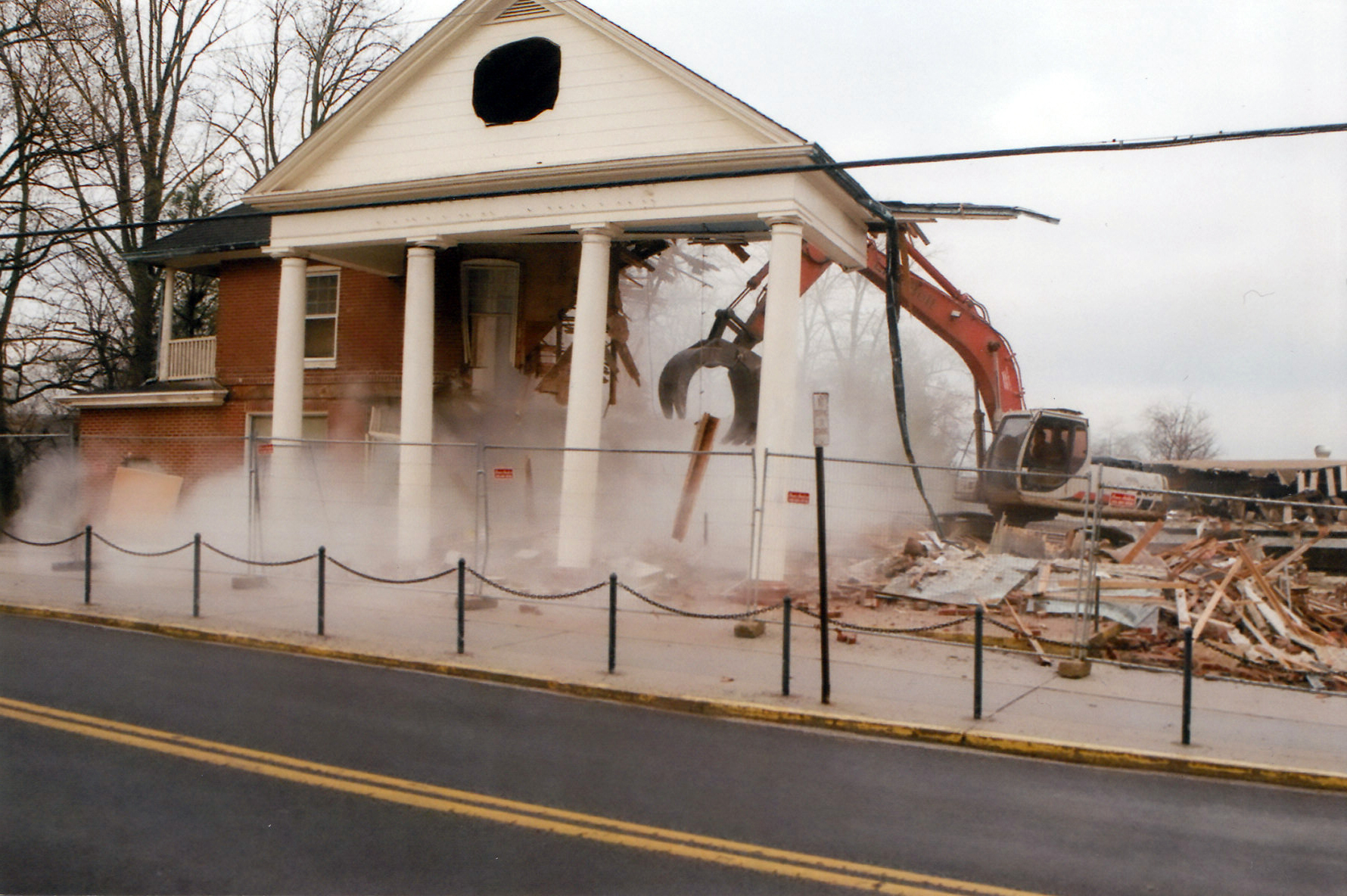
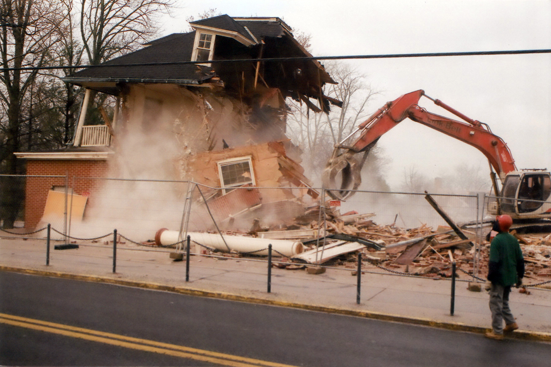
This photograph is courtesy of Barbara Adams. This view was taken facing southwest on Thursday, April 2, 2009.
This photograph is courtesy of Barbara Adams. This view was taken facing southwest on Thursday, April 2, 2009.
This photograph is courtesy of Barbara Adams. This view was taken facing southwest on Thursday, April 2, 2009.
<
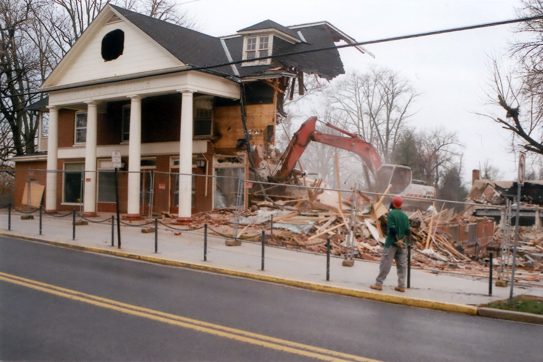
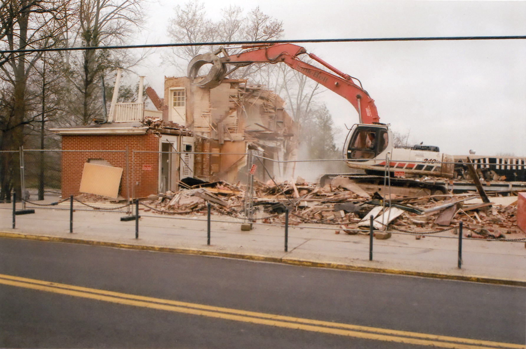
This photograph is courtesy of Barbara Adams. This view was taken facing southwest on Thursday, April 2, 2009.
This photograph is courtesy of Barbara Adams. This view was taken facing southwest on Thursday, April 2, 2009.
This photograph is courtesy of Barbara Adams. This view was taken facing southwest on Thursday, April 2, 2009.
This photograph is courtesy of Barbara Adams. This view was taken facing southwest on Thursday, April 2, 2009.
This photograph is courtesy of Barbara Adams. This view was taken facing southwest on Thursday, April 2, 2009.
This photograph is courtesy of Barbara Adams. This view was taken facing southwest on Thursday, April 2, 2009.
This photograph is courtesy of Barbara Adams. This view was taken facing southwest on Thursday, April 2, 2009.
This photograph is courtesy of Barbara Adams. This view was taken facing southwest on Thursday, April 2, 2009.
This photograph is courtesy of Barbara Adams. This view was taken facing southwest on Thursday, April 2, 2009.
This photograph is courtesy of Barbara Adams. This view was taken facing southwest on Thursday, April 2, 2009.
This photograph is courtesy of Barbara Adams. This view was taken facing southwest on Thursday, April 2, 2009.
This photograph is courtesy of Barbara Adams. This view was taken facing southwest on Thursday, April 2, 2009.
This photograph is courtesy of Barbara Adams. This view was taken facing southwest on Thursday, April 2, 2009.
This photograph is courtesy of Barbara Adams. This view was taken facing southwest on Thursday, April 2, 2009.
This photograph is courtesy of Barbara Adams. This view was taken facing southwest on Thursday, April 2, 2009.
This photograph is courtesy of Barbara Adams. This view was taken facing southwest on Thursday, April 2, 2009.
This photograph is courtesy of Barbara Adams. This view was taken facing southwest on Thursday, April 2, 2009.
This photograph is courtesy of Barbara Adams. This view was taken facing southwest on Thursday, April 2, 2009.
This photograph is courtesy of Barbara Adams. This view was taken facing southwest on Thursday, April 2, 2009.
This photograph is courtesy of Barbara Adams. This view was taken facing southwest on Thursday, April 2, 2009.
This photograph is courtesy of Barbara Adams. This view was taken facing southwest on Thursday, April 2, 2009.
This photograph is courtesy of Barbara Adams. This view was taken facing southwest on Thursday, April 2, 2009.
This photograph is courtesy of Barbara Adams. This view was taken facing southwest on Thursday, April 2, 2009.
This photograph is courtesy of Barbara Adams. This view was taken facing southwest on Thursday, April 2, 2009.
This photograph is courtesy of Barbara Adams. This view was taken facing southwest on Thursday, April 2, 2009.
This photograph is courtesy of Barbara Adams. This view was taken facing southwest on Thursday, April 2, 2009.
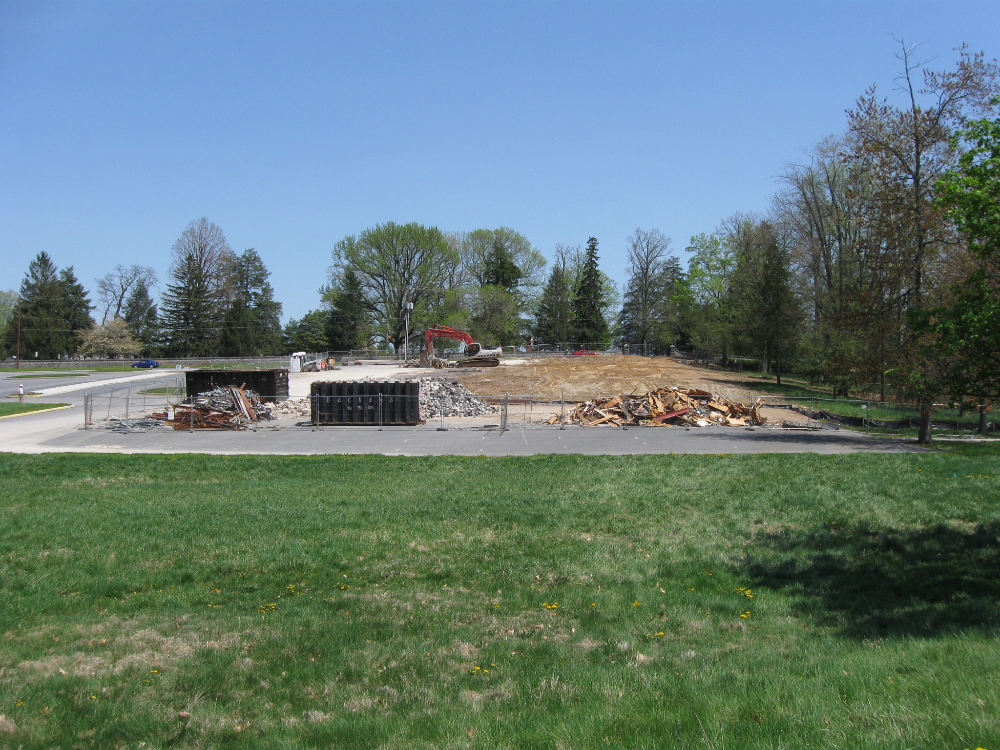
Most of the debris has been removed from the location of the old National Park Service Visitor Center. This view was taken facing east at approximately 2:30 PM on Sunday, April 26, 2009.
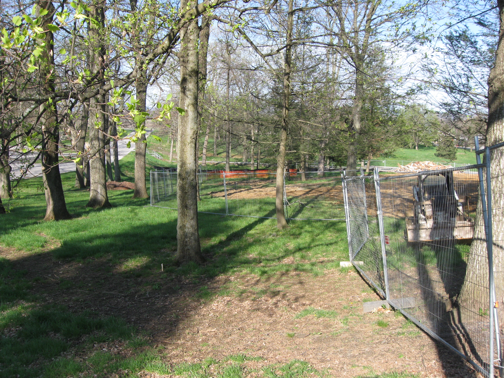
The terrain is now appearing closer to the time that it looked in 1893 when the trolley bed for the Gettysburg Electric Railway was constructed. The trolley bed is the slightly higher ground on the right upon which the trees is growing. We featured this area in our January 26, 2009 post on the trolley. If the battlefield is really going to be put back closer to its 1863 appearance, will the 1893-1918 trolley bed (trolley ceased operating in 1916, tracks taken up in 1918) be removed? This view was taken facing east at approximately 2:30 PM on Sunday, April 26, 2009.
This is the Gettysburg Electric Railroad or “trolley” bed as it was being constructed in 1893. This photograph appeared in a July 1, 1893 Harpers Weekly in an article, “Desecration of the Battlefield,” whose purpose was to show how the trolley destroyed the terrain at some battlefield locations. The trolley tracks were removed in 1918. No article appeared in Harpers Weekly in 1921 condemning the Rosensteel Museum when it was built on this site. This view was taken facing east in 1893.
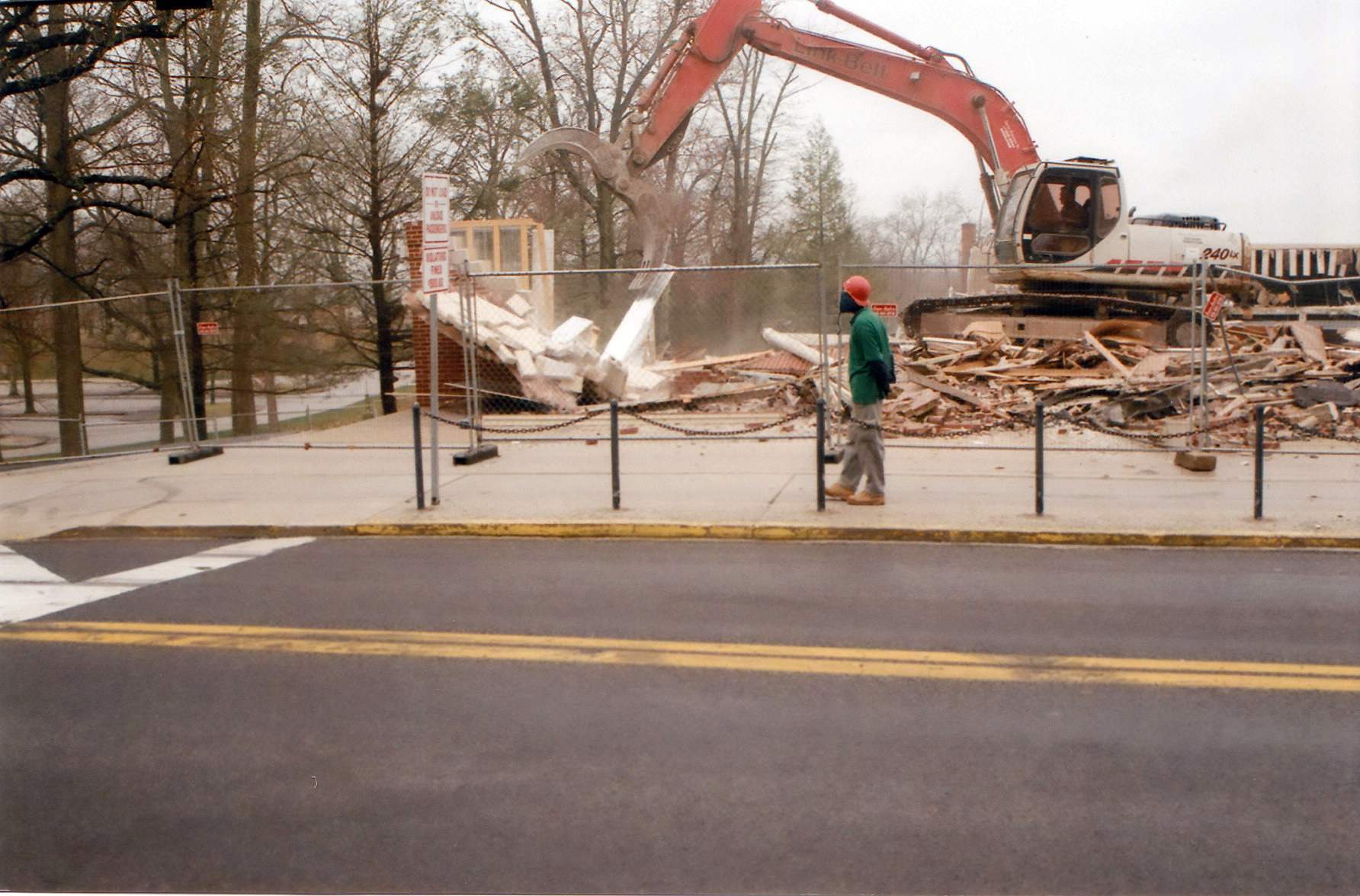
We’re standing near the Taneytown Road, straddling the dividing line between the Old Visitor Center on the left and the cement walkway/sidewalk on the right. This view was taken facing west at approximately 0840 AM on Friday, April 24, 2009.
The gentlemen are clearning up glass, metal, and other debris caused by the toppling of the front entrance of the 1921 building. This view was taken facing west at approximately 0840 AM on Friday, April 24, 2009.
The fences on the south side of the demolition area now extend farther to the left or south in order to cover the area where the underground gas tanks had been removed. This view was taken facing west at approximately 0840 AM on Friday, April 24, 2009.
See the following related posts:
Old NPS Visitor Center and William Patterson House Updates on April 21, 2009.
William Patterson House and Old National Park Service Visitor Center Updates on April 15, 2009.
Culp’s Hill Part 2 with LBG Charlie Fennel, and Visitor Center Demolition #13 on April 10, 2009.
Demolition of the Old Gettysburg National Military Park Visitor Center Update #12 on April 8, 2009.
Demolition of the Old Gettysburg National Military Park Visitor Center Update #11 on April 7, 2009.
Demolition of the Old Gettysburg National Military Park Visitor Center Update #10 on April 6, 2009.
Demolition of the Old Gettysburg National Military Park Visitor Center Update #9 on April 4, 2009.
Demolition of the Old Gettysburg National Military Park Visitor Center Update #8 on April 3, 2009.
Demolition of the Old Gettysburg National Military Park Visitor Center Update #7 on April 2, 2009.
Demolition of the Old Gettysburg National Military Park Visitor Center Update #6 on April 1, 2009.
Demolition of the Old Gettysburg National Military Park Visitor Center Update #5 on March 31, 2009.
Demolition of the Old Gettysburg National Military Park Visitor Center Update #4 on March 27, 2009.
Demolition of the Old Gettysburg National Military Park Visitor Center Update #3 on March 26, 2009.
Demolition of the Old Gettysburg National Military Park Visitor Center Update #2 on March 25, 2009.
Demolition of the Old Gettysburg National Military Park Visitor Center Begins on March 24, 2009.
Cyclorama Construction Fencing: Completed on North Side, Redone on West Side on March 13, 2009.
A Fence Too Far: Cyclorama Construction Fencing Completed on West Side on March 1, 2009.
Construction Fences Arrive at Old Visitor Centers on February 27, 2009.
Old Visitor Center Lawn in Limbo on May 28, 2008.
Lights Out at the Electric Map on April 13, 2008.
Moving Day at the Gettysburg Visitor Center on April 12, 2008.
An Emptiness at the Visitor Center on March 31, 2008.
Gettysburg Guide Room: The Final Days on March 8, 2008.
A Sunday Afternoon Walk Around the Old Gettysburg Visitor Center on February 24, 2008.


