Struggle for the Bliss Farm Part 4 With Licensed Battlefield Guide Woody Christ
July 24, 2009
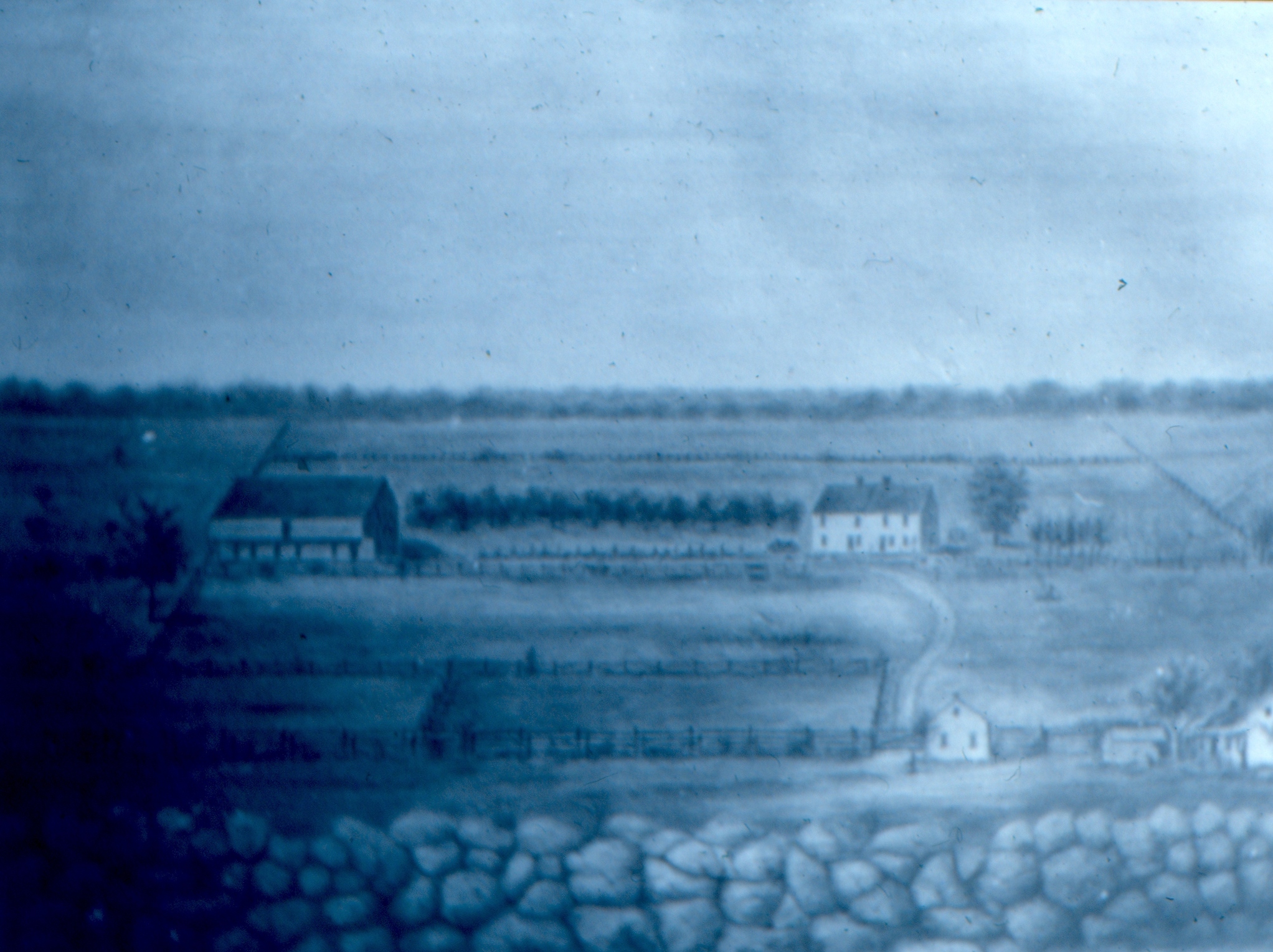
The Bliss Farm as shown in a watercolor by an unknown artist. The painting is not to scale. The Bliss House is in the right background. The Bliss Barn (bank barn) is in the left background. The small white house in the foreground is the Brian Tenant House along the Emmitsburg Road. The Emmitsburg Road is not clearly shown in this painting. The the lane that leads to the Bliss Farm from the Emmitsburg Road. The stone wall in the foreground is on Cemetery Ridge. This view was painted facing west at an unknown time.
Although many individuals know the fields of Pickett’s Charge, fewer know the action which took place in those fields around the Bliss Farm. Gettysburg Licensed Battlefield Guide Elwood “Woody” Christ begins a series on the struggle for the Bliss Farm. His book, Over a Wide, Hot,…Crimson Plain: The Struggle for the Bliss Farm at Gettysburg, July 2nd and 3rd, 1863 was published by Butternut and Blue in 1993. Woody is a Gettysburg College graduate, and has been a Licensed Battlefield Guide since 1982.
In our first post Woody Christ concentrated on some terrain in the area of the Bliss Farm, specifically in what is now the subdivision, Colt Park. In our second post he continued his emphasis on the “broad flat knoll” which is Colt Park. In our third post he showed us the first positions of the United States troops that would be involved at the Bliss Farm. He also showed the route that many of them used to access the Bliss Farm from Cemetery Ridge. In today’s post he takes us to the sites of the Bliss House and Barn.
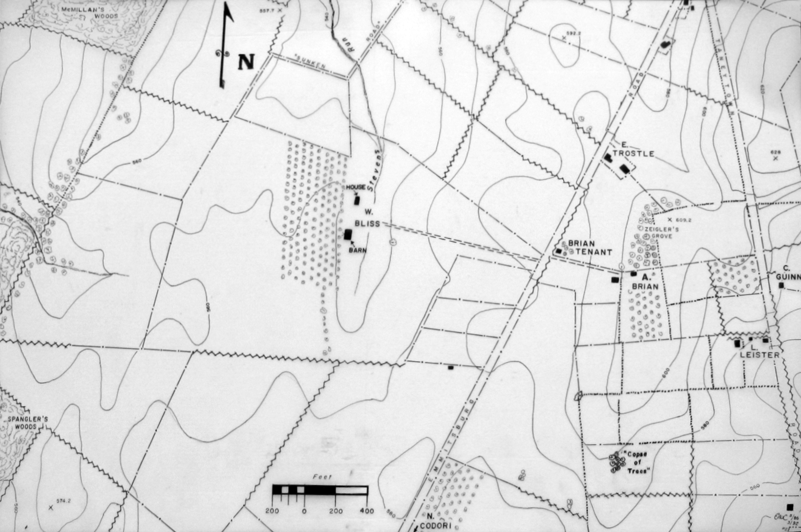
We will use this map provided to us by Woody Christ for the Bliss Farm posts.
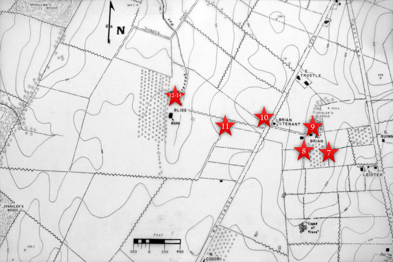
This map shows the location of where our Bliss Farm videos were produced. Videos #1-#6 were shown in our previous Bliss Farm posts. Video #7 was taken at the crest of Cemetery Ridge near the stone wall south of the old Cyclorama building. Video #8 was taken at the monument to the 1st Delaware Infantry Regiment. Video #9 was taken north of the Brian/Brian House. Video #10 was taken along the Emmittsburg Road near the Brian/Bryan farm lane. Video #11 was taken at the fence marking the skirmish line of the 14th Connecticut. Videos #12-#14 were taken at the site of the Bliss House. This map was created facing north at approximately 2:00 PM on Monday, June 29, 2009.
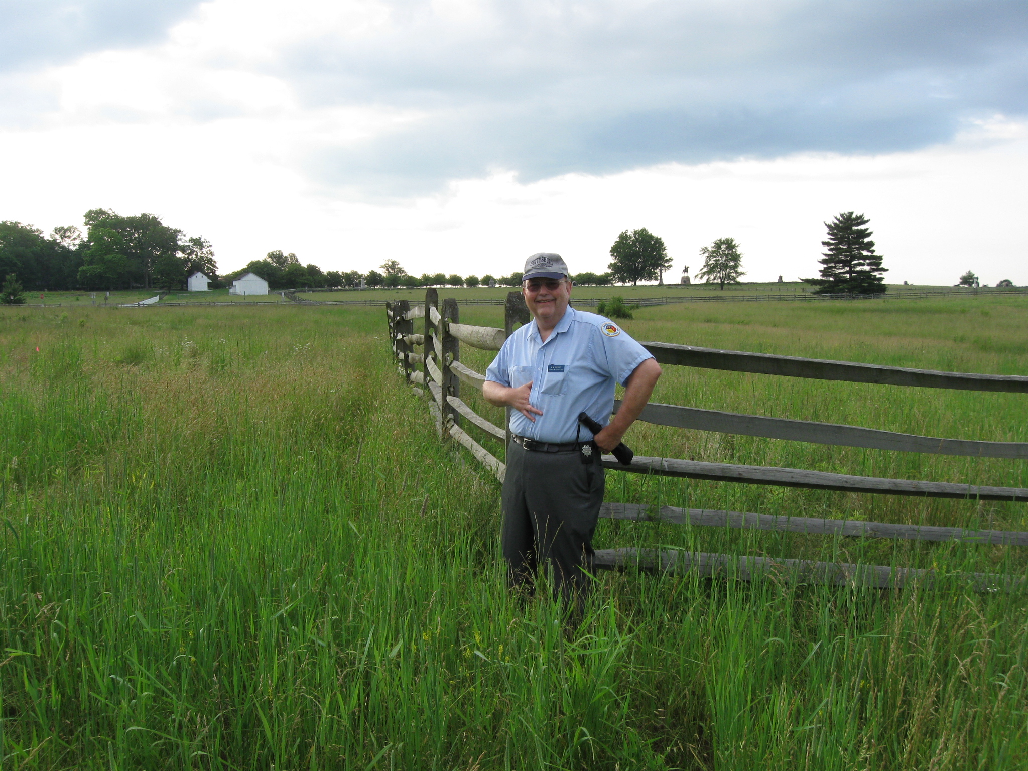
The Napoleonic Gettysburg Licensed Battlefield Guide Elwood “Woody” Christ is the author of the book, Over a Wide, Hot,…Crimson Plain: The Struggle for the Bliss Farm at Gettysburg, July 2nd and 3rd, 1863. He is the host for our series on the fighting for the Bliss Farm. The Brian/Bryan Farm is the white buildings in the left background. Woody is standing at the angle of two wooden post and rail fences. The fence leading to the right (south) marks the approximately position of the skirmish line of the 14th Connecticut Infantry Regiment. This view was taken facing east at approximately 8:00 AM on Saturday, June 13, 2009.
In Video #11 (Videos #s 1-10 were seen in our previous Bliss Farm posts) Gettysburg Licensed Battlefield Guide Woody Christ is standing near the skirmish line of the 14th Connecticut Infantry Regiment. This view was taken facing east to southeast at approximately 8:00 AM on Saturday, June 13, 2009.
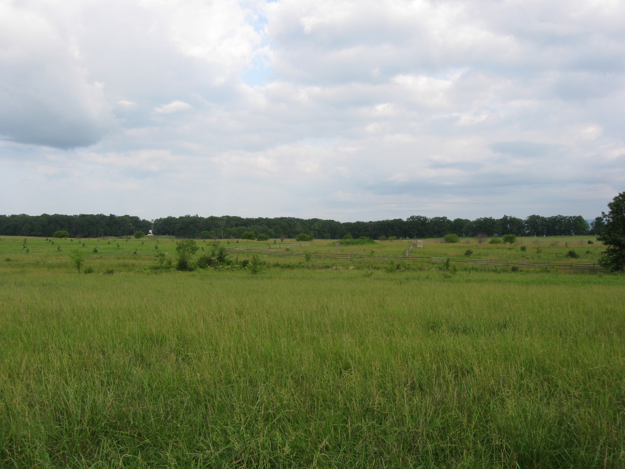
We are standing at the skirmish line of the 14th Connecticut looking at the Bliss Farm. Seminary Ridge is the woodline in the background. The Bliss Orchard is on the left. The monument to the 12th New Jersey Infantry Regiment is visible to the right (north) of what would have been the Bliss Barn. The Virginia State Monument is the light colored object against the trees on Seminary Ridge in the left background. This view was taken facing west at approximately 8:00 AM on Saturday, June 13, 2009.
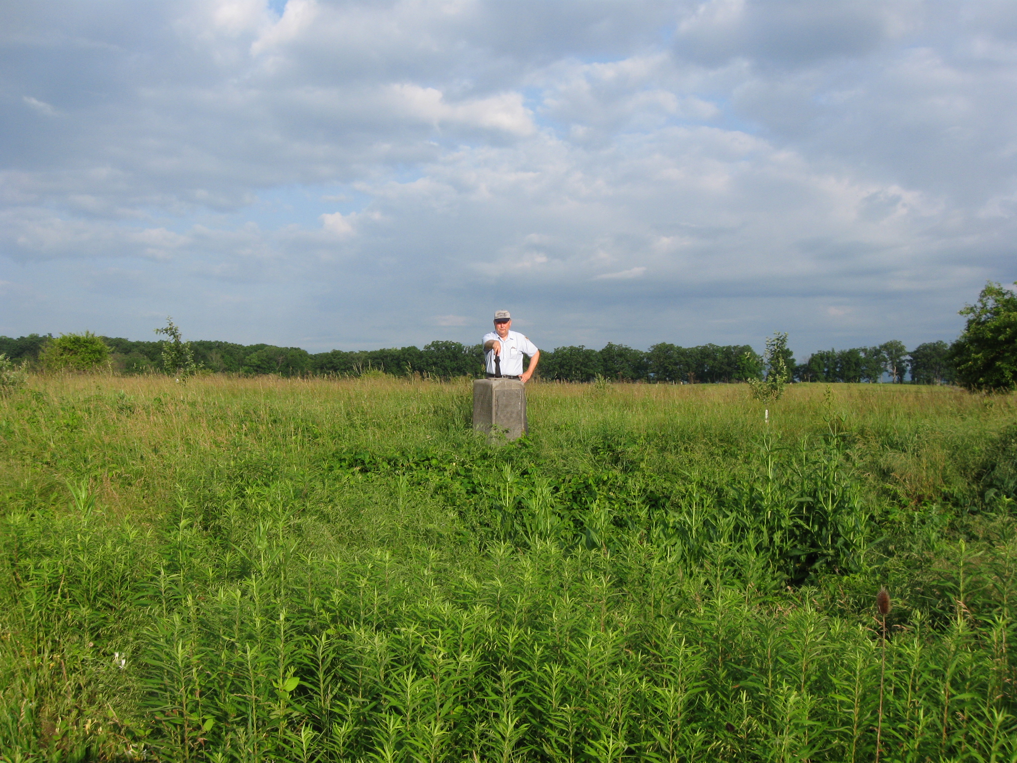
Licensed Battlefield Guide Woody Christ is standing by the marker which claims to be the center of the Bliss House. But… This view was taken facing northwest at approximately 8:00 AM on Saturday, June 13, 2009.
… the center of the Bliss House might have been this large hole (cellar) in front of Woody. This view was taken facing northwest at approximately 8:00 AM on Saturday, June 13, 2009.
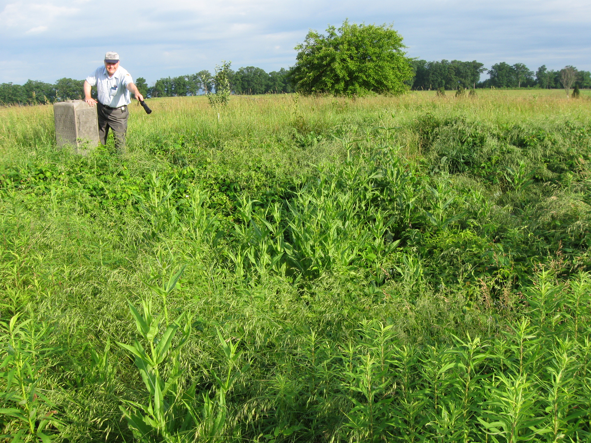
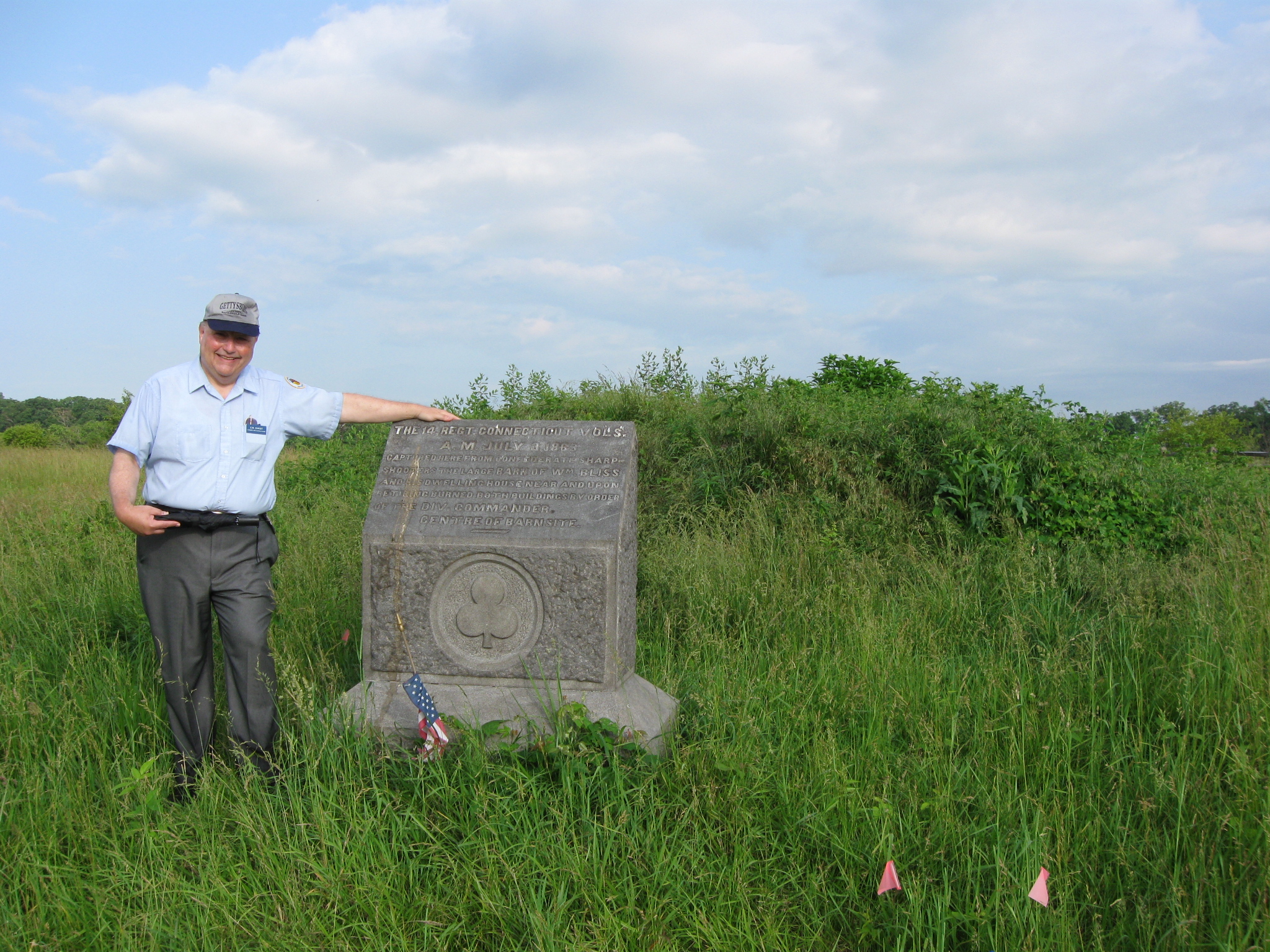
In Video #12 Gettysburg Licensed Battlefield Guide Woody Christ is standing near the marker for the Bliss House. He explains where the house and the barn were located. This view was taken facing northwest to southwest at approximately 8:00 AM on Saturday, June 13, 2009.
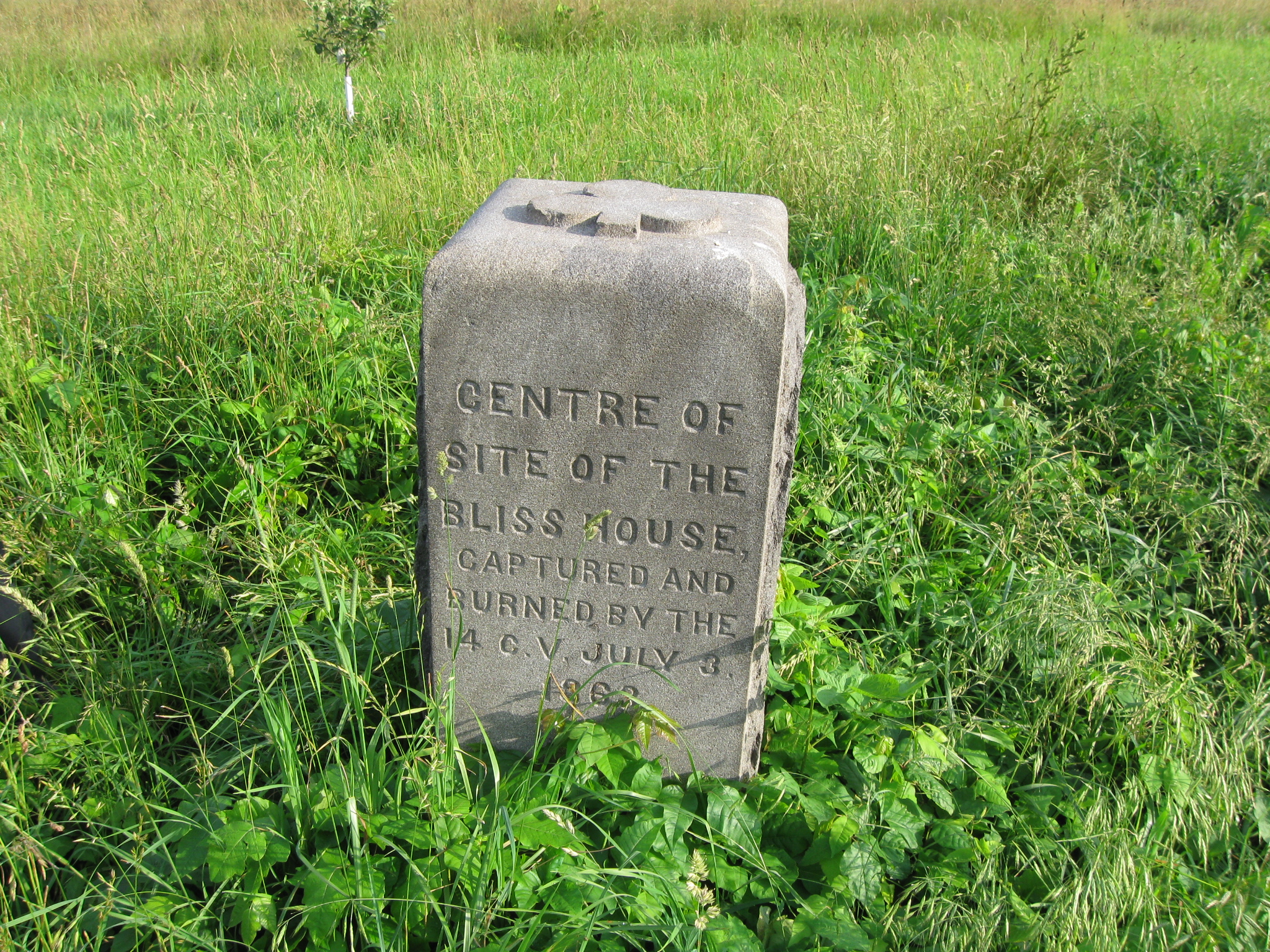
The marker for the center of the Bliss House, which also is a marker for the 14th Connecticut Infantry Regiment, was dedicated on July 3, 1884. This view was taken facing northeast at approximately 8:00 AM on Saturday, June 13, 2009.
The marker for the 12th New Jersey Infantry Regiment. The marker for the 14th Connecticut Infantry is on the left. This view was taken facing southwest at approximately 8:00 AM on Saturday, June 13, 2009.
The marker for the 12th New Jersey Infantry Regiment was dedicated on July 1, 1888. This view was taken facing west at approximately 8:00 AM on Saturday, June 13, 2009.
The east side of the marker for the 12th New Jersey Infantry Regiment describes the action taken by the unit on July 2, 1863. This view was taken facing west at approximately 8:00 AM on Saturday, June 13, 2009.
The west side of the marker for the 12th New Jersey Infantry Regiment describes the action taken by the unit on July 3, 1863. This view was taken facing east at approximately 8:00 AM on Saturday, June 13, 2009.
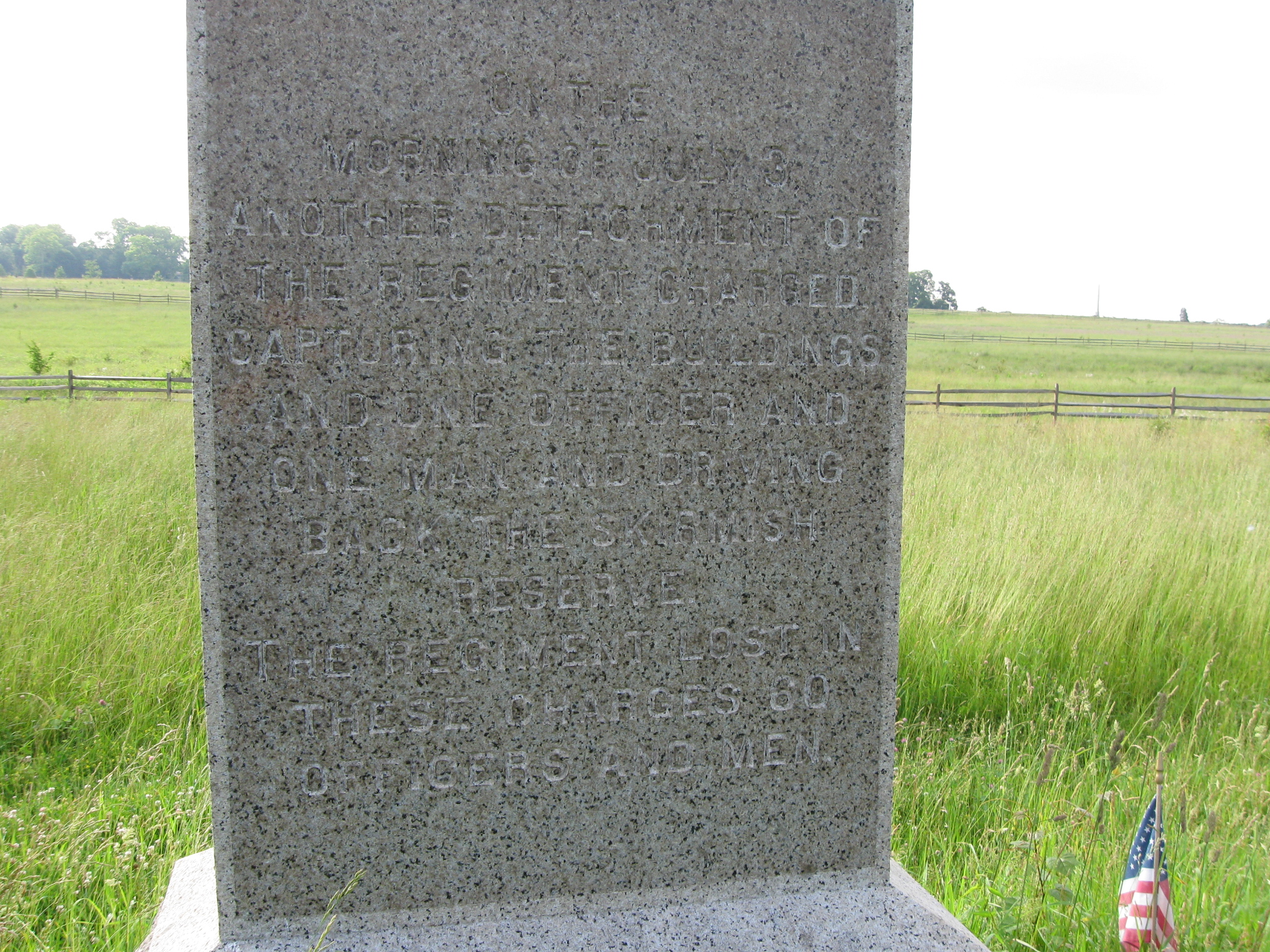
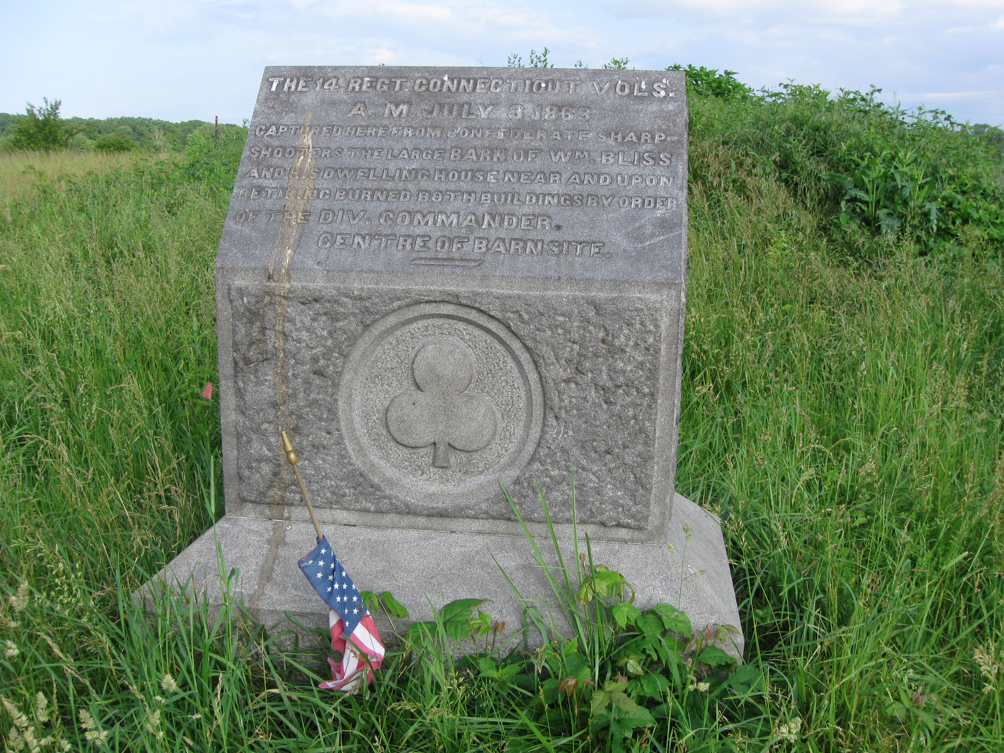
Woody is standing by the marker for the 14th Connecticut Infantry Regiment. The bank part of the Bliss Barn is behind (west of) Woody and the 14th Connecticut marker. This view was taken facing west at approximately 8:00 AM on Saturday, June 13, 2009.
The marker to the 14th Connecticut Infantry Regiment also marks the site of the Bliss Barn. It was dedicated on July 3, 1884. This view was taken facing west at approximately 8:00 AM on Saturday, June 13, 2009.
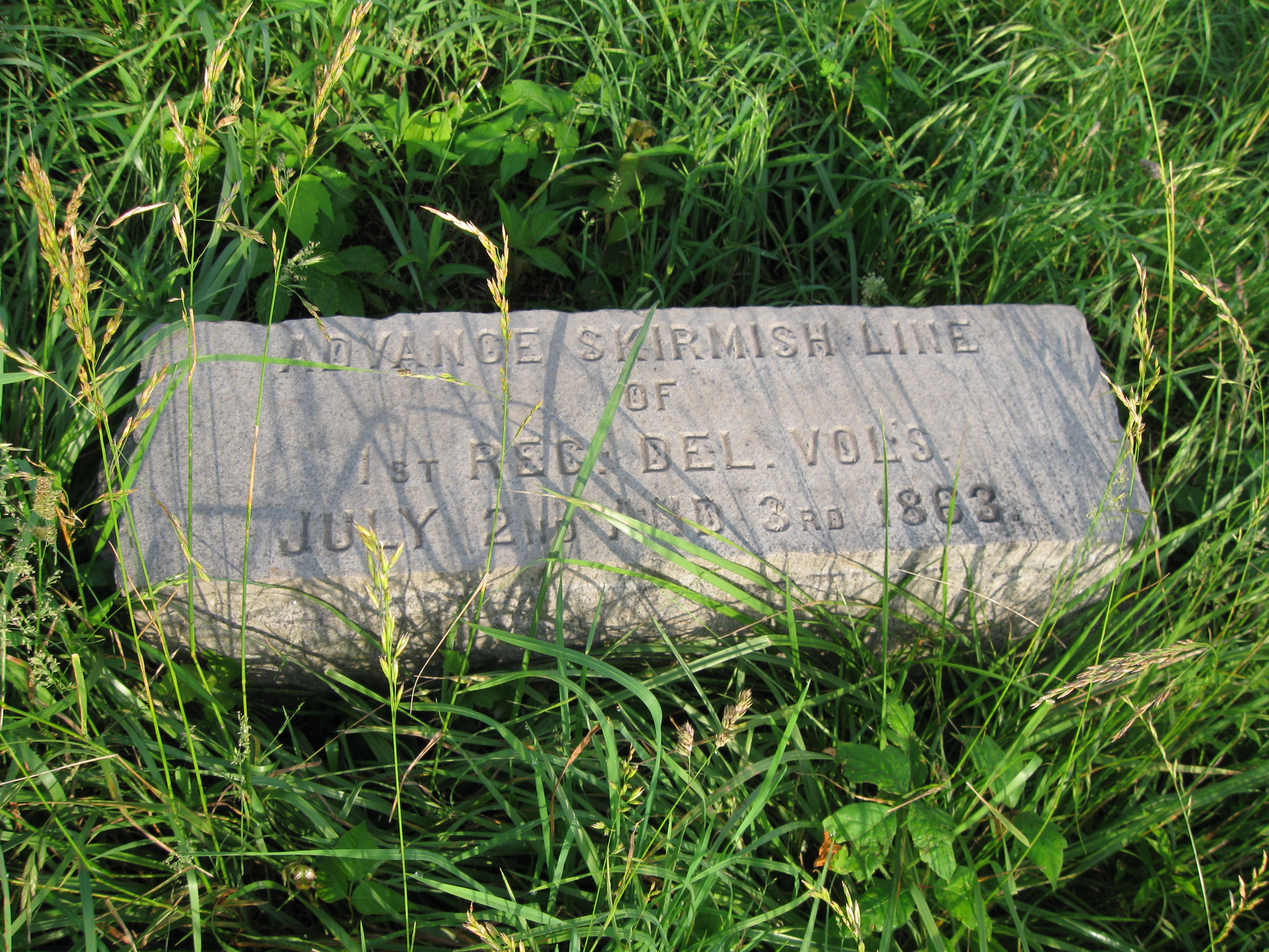
In Video #13 Licensed Battlefield Guide Woody Christ shows us the marker for the skirmish line of the 1st Delaware Infantry Regiment. This view was taken facing southwest at approximately 8:00 AM on Saturday, June 13, 2009.
The skirmish line marker for the 1st Delaware Infantry Regiment was dedicated “after July, 1886.” This view was taken facing west at approximately 8:00 AM on Saturday, June 13, 2009.
Woody Christ is back by the marker for the Bliss House. The National Guard Armory buildings and McMillan Woods are in the left background. William Bliss purchased 53 acres here on April 7, 1857 from Alexander Cobean for $1961. The next year he purchased an additional seven acres from John Cunningham for $139. Total amount of property was 60 acres at $2100. This view was taken facing north at approximately 8:00 AM on Saturday, June 13, 2009.
In Video #14 Woody Christ gives a short history of William Bliss and his family. This view was taken facing north to northwest at approximately 8:00 AM on Saturday, June 13, 2009.
William Bliss met and married Adeline Carpenter in Massachusetts on March 13, 1823, which was Adeline’s 23rd birthday. Their daughter, Amanda Malvina, was born on January 8, 1824, and just nine months later, on September 8, 1824, their daughter, Sarah Gooding was born. The family moved to the Bradford County, Pennsylvania, to what was known as the Rhode Island tract (shown here) circa 1826. On the Rhode Island tract (Bradford County, Pennsylvania), Adeline Elizabeth was born on March 30, 1828, and a son, James William, was born on May 12, 1830. William Bliss sold the Rhode Island tract on April 20, 1831.
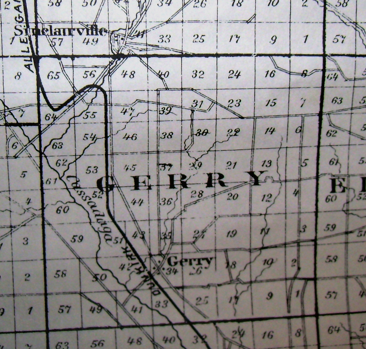
By 1833 William Bliss and his family had moved to Gerry Township (Gerry Town), Chautauqua County, New York. Frances Amelia Bliss was born on June 8, 1833. William Bliss’ father, Dr. James Bliss, died on September 28, 1834. William received what at the time was a large inheritance, $25,369. On October 1, 1835, he used approximately $3000 to purchas lot #32 shown on this map.
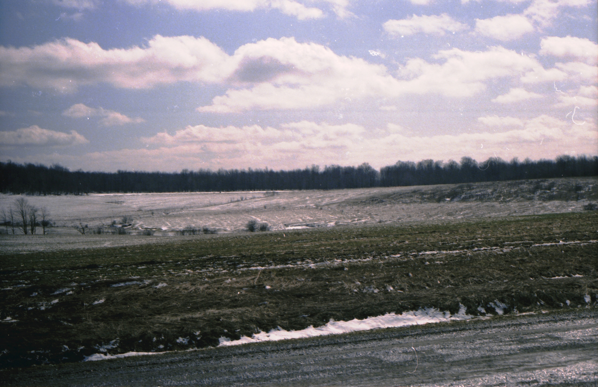
Now we’re sure all farms look alike, but doesn’t this land that Bliss owned in Chautauqua County, New York look eerily similar to the Bliss property he owned at Gettysburg? Cold winters and the lake effect snows coming off Lake Erie did not help the health of the Bliss family. James William Bliss died at the age five on June 18, 1835. An unnamed son died at the age of 17 days on March 12, 1837. Amanda Malvina Bliss died on June 14, 1846 at the age of 22 yrs. The Bliss family decided they wanted move somewhere that had warmer weather, and on July 2, 1856 (yes July 2nd) they sold their New York farm. The next year they purchased the farm in Gettysburg.
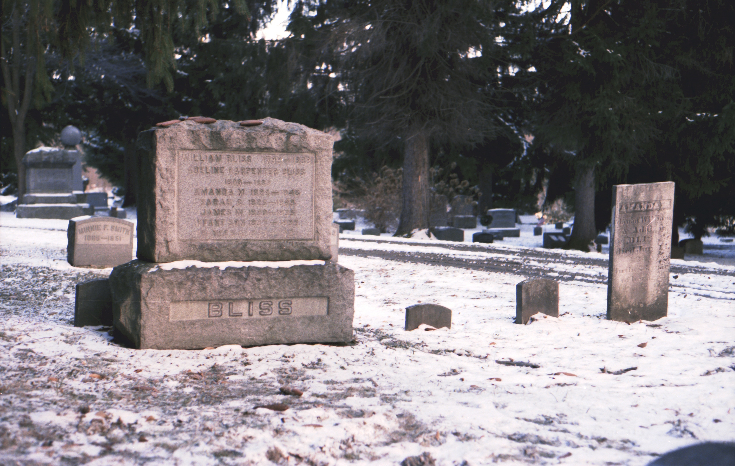
The Bliss property was destroyed during the Battle of Gettysburg. Besides the building and land that were destroyed, Bliss filed a damage claim to recoup $1256 in inventory. The Commonwealth of Pennsylvania granted his damage claim in 1871 and the United States government in 1902, but by that time the Bliss family was long gone. William Bliss sold his farm to Nicholas Codori on October 9, 1865 for $1000. Eventually the family ended up near Jamestown, New York where William died on August 18, 1888. His wife, Adeline, died on July 4, 1889. This is their gravesite in Evergreen Cemetery (yes), Sinclairsville, New York.
To see other posts by Gettysburg Licensed Battlefield Guides,click here.