Sickles at Gettysburg Part 5 With Licensed Battlefield Guide Jim Hessler
June 10, 2009
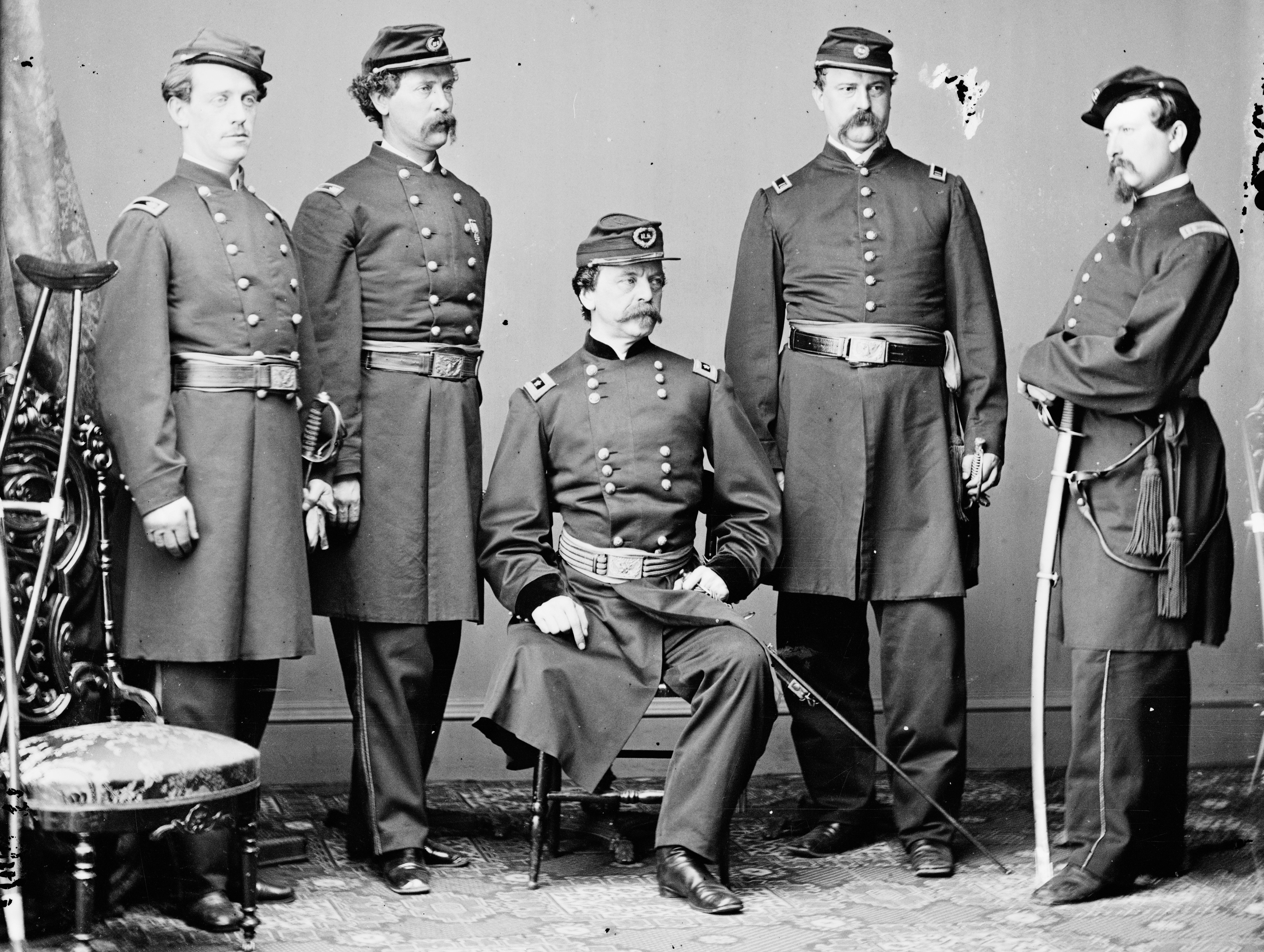
Major General Daniel Sickles and his staff following the Battle of Gettysburg. From left to right: Major Henry Tremain, Lieutenant Colonel Orson Hart, Major General Daniel Edgar Sickles, Captain Thomas Fry, Captain Alexander Moore.
One of the most interesting individuals at the Battle of Gettysburg was United States Major-General Daniel Sickles. His movement to a position forward of the Army of the Potomac’s battle line on July 2, 1863, depending on your point of view, either saved the Union Army, or almost led to its destruction. Gettysburg Licensed Battlefield Guide Jim Hessler has been guiding at Gettysburg since 2003. He is employed full-time with Bill Me Later/ PayPal and has been a Licensed Battlefield Guide since 2003. His book, Sickles at Gettysburg: The Controversial Civil War General Who Committed Murder, Abandoned Little Round Top, and Declared Himself the Hero of Gettysburg, will be published in June. He is a long-time Gettysburg and Little Bighorn enthusiast and also a speaker at Civil War Round Tables. He lives in Gettysburg with his wife and two children.
In our first post on Sickles at Gettysburg we saw Sickles’ Corps’ position at Bridgeport, Maryland, Emmitsburg Maryland, and his arrival at the Gettysburg Battlefield. In our second post, we looked at Sickles’ Gettysburg position near Cemetery Ridge before he made his move west to the Emmitsburg Road. In our third post, we showed Sickles’ movement of his line to the high ground near the Peach Orchard and the Emmitsburg Road. In our fourth post, we showed General Meade’s reaction to Sickles’ move. In today’s post, Jim describes Sickles’ wounding.
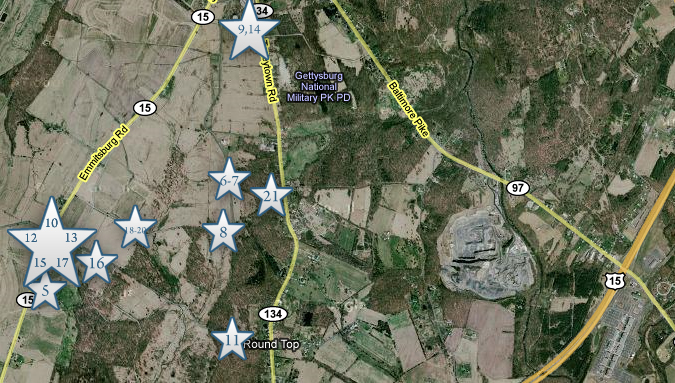
This map shows the location of where our Sickles videos were produced. Videos #1-#5 were shown in our first Sickles video post. Videos #6-7# were taken on Cemetery Ridge near the New York Auxiliary Monument. Video #8 was taken in the low ground near the George Weikert House. Videos #9 and #14 was taken at Meade’s Headquarters (Leister House). Videos #s 10, 12, 13, 15, and 17 were taken in the Sherfy Peach Orchard. Video #11 was taken on the north side of Little Round Top. Video #16 was taken near the Stony Hill/Loop area. Videos #s 18-20 were taken in the area of the Trostle Farm. Video #21 was taken near the Taneytown Road in the vicinity of the Michael Frey Farm. This map was created facing north at approximately 1:45 PM on Sunday, June 7, 2009.
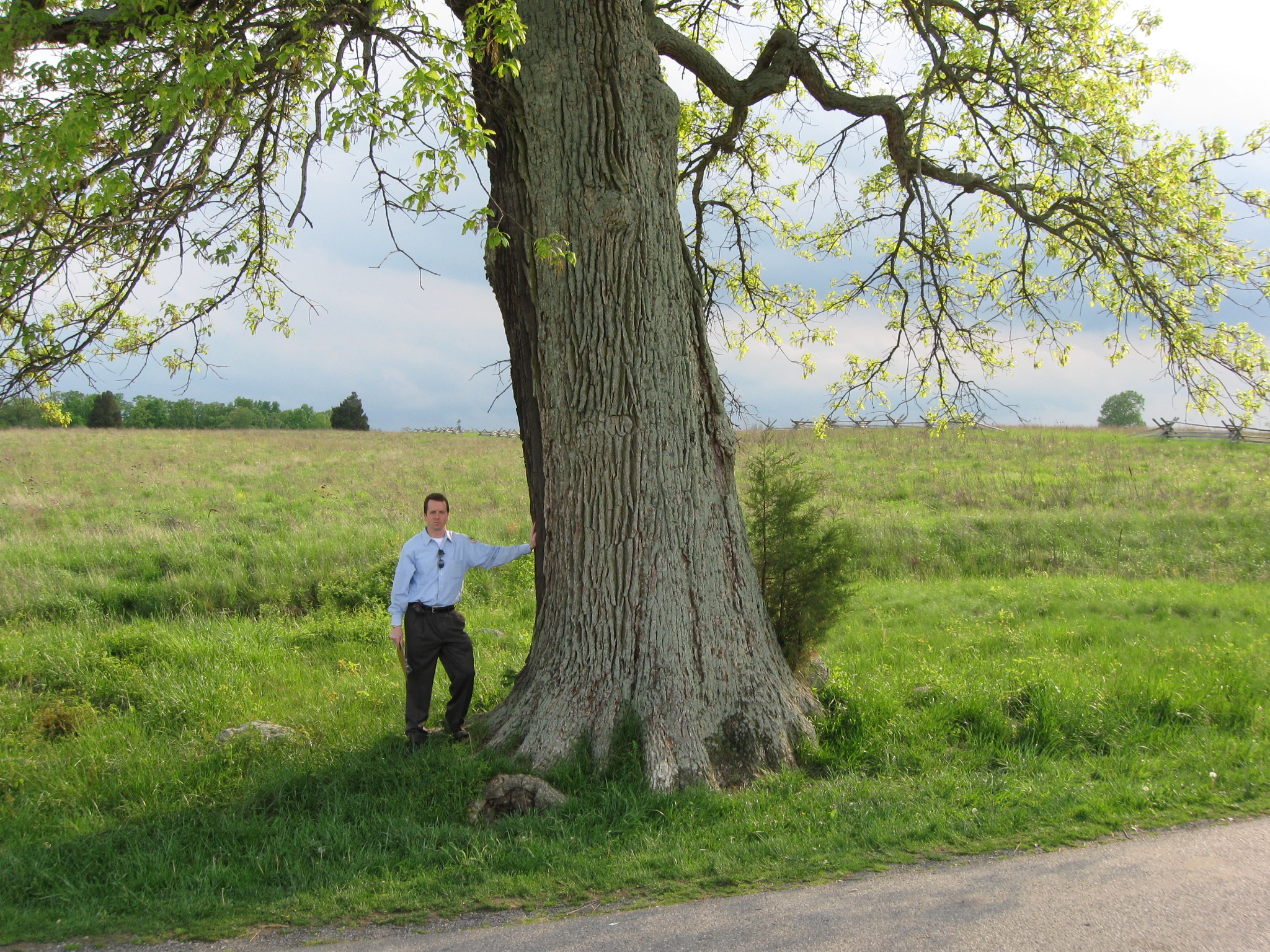
Our host for the Sickles series, Gettysburg Licensed Battlefield Guide Jim Hessler, is standing by the Sickles Witness Tree near the Trostle Barn. The woods of the Stony Hill/Loop area are in the left background. The high ground along the Emmitsburg Road is in the right background. This view was taken facing southwest at approximately 5:00 PM on Monday, May 11, 2009.
A few yards east of the Sickles Witness Tree is the Sickles Headquarters Marker. The branches from the Sickles Witness Tree are on the right. This view was taken facing south at approximately 5:00 PM on Monday, May 11, 2009.
In Video #18 (Videos #1-17 were shown in our previous Sickles’ posts), Gettysburg Licensed Battlefield Guide Jim Hessler explains where Sickles had his headquarters on the afternoon of July 2, 1863, and how it was difficult to see his whole battle line from this position. This view was taken facing west to south to north at approximately 5:00 PM on Monday, May 11, 2009.
As Jim explained in Video #18, Sickles moved to the high ground to the left of (west of) the Abraham Trostle Barn.This view was taken facing north at approximately 5:00 PM on Monday, May 11, 2009.
Jim is standing by the 1901 marker showing the location where Daniel Sickles was wounded on July 2, 1863. It is west of the Trostle Barn. This view was taken facing northeast at approximately 5:00 PM on Monday, May 11, 2009.
In Video #19 Gettysburg Licensed Battlefield Guide Jim Hessler describes the wounding of Major General Daniel Sickles on the afternoon of July 2, 1863. This view was taken facing south to west to southwest to south to southeast at approximately 5:00 PM on Monday, May 11, 2009.
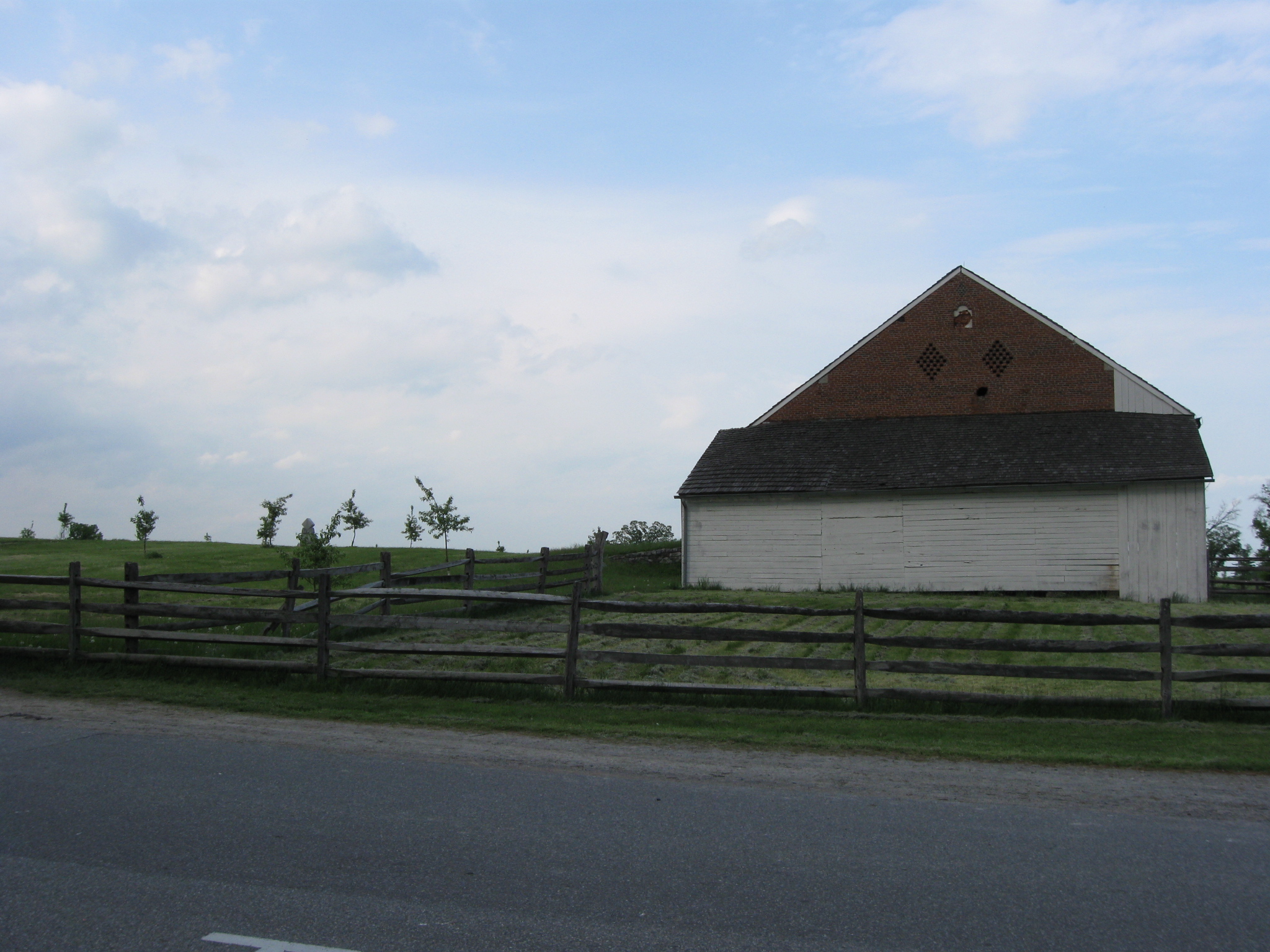
Jim is standing on the west side of the Trostle Barn. This view was taken facing southeast at approximately 5:00 PM on Monday, May 11, 2009.
In Video #20 Jim Hessler shows us that Daniel Sickles was taken from the spot where he was wounded to an area behind the Trostle Barn, and possibly behind some boulders. He also goes over the story of Sickles smoking a cigar as he was carried off the field. This view was taken facing west to south to southeast to south at approximately 5:00 PM on Monday, May 11, 2009.
Gettysburg Licensed Battlefield Guide Jim Hessler is standing on the William Patterson Farm field near the Taneytown Road. In the clearing between the trees is the back (east side) of the New York Auxiliary Monument. Sickles’ Woods are on the right. This view was taken facing west at approximately 5:00 PM on Monday, May 11, 2009.
In Video #21 Jim Hessler explains the area near the Taneytown Road where Sickles may have been brought to have his leg amputated. This view was taken facing west to northwest to east to northeast to east at approximately 5:00 PM on Monday, May 11, 2009.
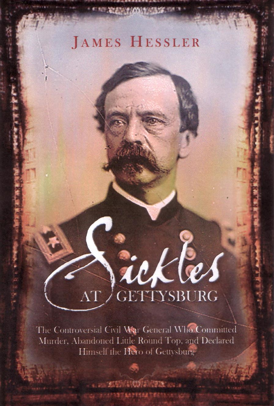
Here is the cover of Jim’s new book on Daniel Sickles. It is published by Savas Beattie LLC, and will be available in June, 2009. Click here for a link to an interview with Jim on their site. This cover was uploaded at approximately 5:00 PM on Tuesday, April 21, 2009.
To see other posts by Gettysburg Licensed Battlefield Guides,click here.