

The streams and creeks were swollen across Adams County from steady rainfall on Friday, but Rock Creek did not rise beyond its banks near this bridge across the Old Harrisburg Road.Photograph taken from the North Gettysburg Trail. This view was taken facing southeast at approximately 6:00 PM on Friday, March 31, 2017.

Two ducks swim in Rock Creek. You can spot a white NPS boundary marker on a tree in the center background. The 54th New York Infantry Marker is located in the woods beyond the boundary marker.This view was taken facing west at approximately 6:00 PM on Friday, March 31, 2017.
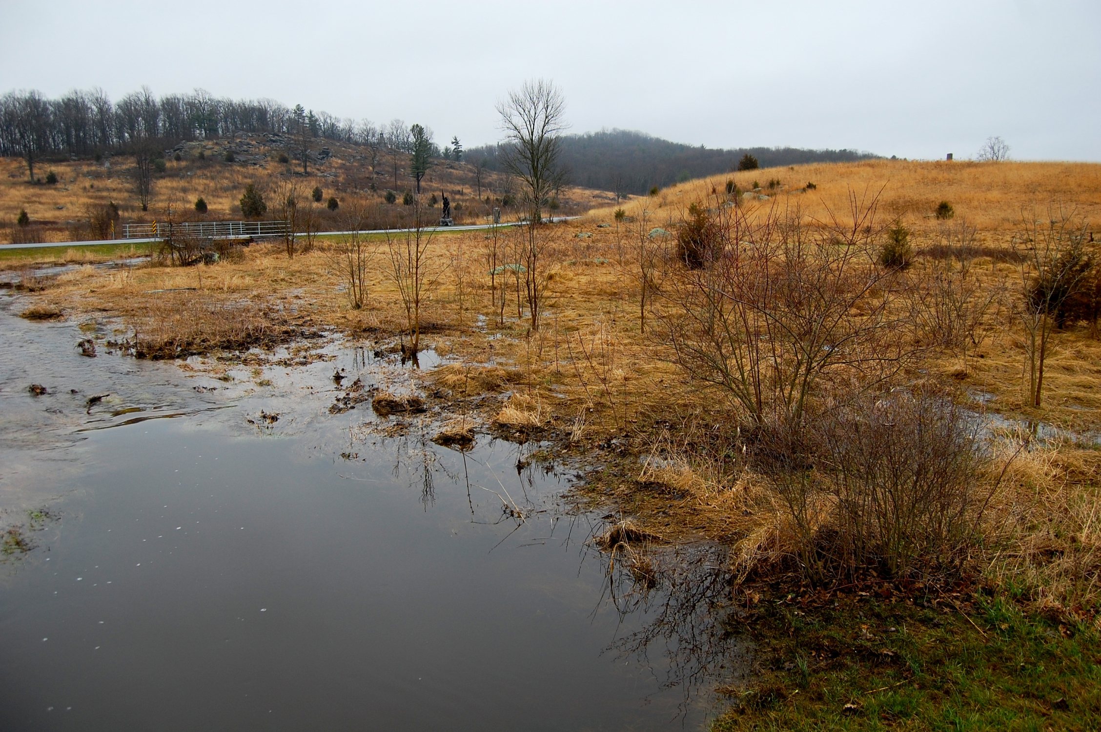
Gettysburg National Military Park’s Plum Run Valley (Valley of Death). Plum Rum (Bloody) Run was swollen but had not risen above any roadways.Houck’s Ridge is the prominence of ground in the right of frame. This view was taken facing southeast at approximately 6:00 PM on Friday, March 31, 2017.

Looking north from the Wheatfield Road at Plum Run. The monument to the 6th Pennsylvania Reserves (35th Pennsylvania Infantry) is along the stone wall. This view was taken facing north at approximately 6:00 PM on Friday, March 31, 2017.

Plum Run with the Wheatfield Road in the background. The Crawford Avenue bridge across Plum Run is visible in the right of frame.This view was taken facing north at approximately 6:00 PM on Friday, March 31, 2017.
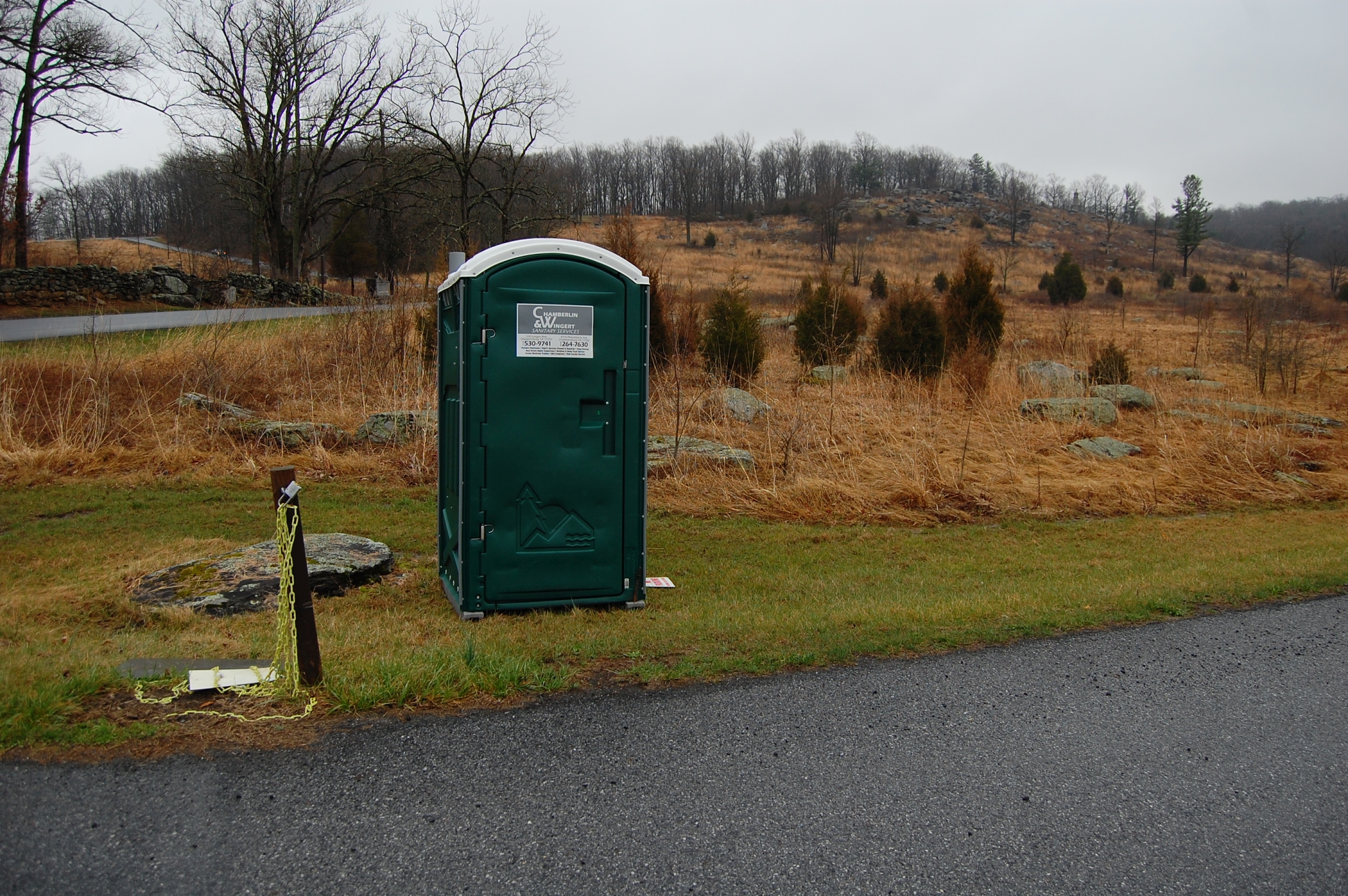
We noticed a portable toilet placed here. This is either for volunteers on Park Day (Saturday, April 1st), or it’s for personnel involved in the prescribed fire (controlled burn) that will take place at Little Round Top sometime this month.This view was taken facing southeast at approximately 6:00 PM on Friday, March 31, 2017.
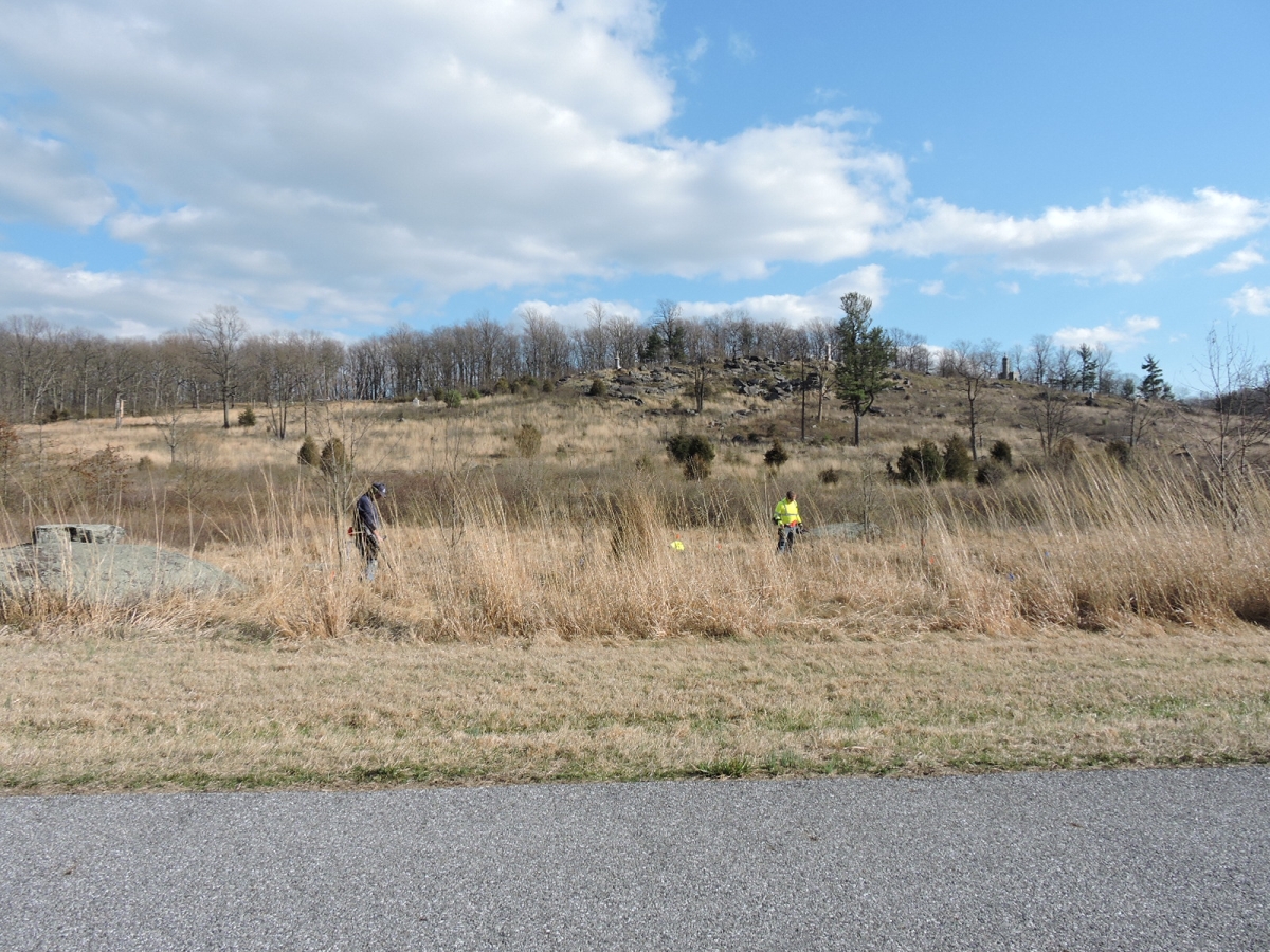
The National Park Service assembled a group of metal detectors to sweep portions of the Plum Run Valley as part of archaeological research ahead of the controlled burn.This view was taken facing east at approximately 5:00 PM on Sunday, February 26, 2017 by Sean Barron, a reader.

A reader of Gettysburg Daily, Skip J., spoke with the team of NPS-led metal detectors. They told him that they had collected “a couple of buckets” of metal and shrapnel from the area.This view was taken facing east at approximately 5:00 PM on Sunday, February 26, 2017 by Sean Barron, a reader.

Plum Run was high at Devil’s Den, but it had not reached the roadway here either.This view was taken facing southeast at approximately 6:00 PM on Friday, March 31, 2017.
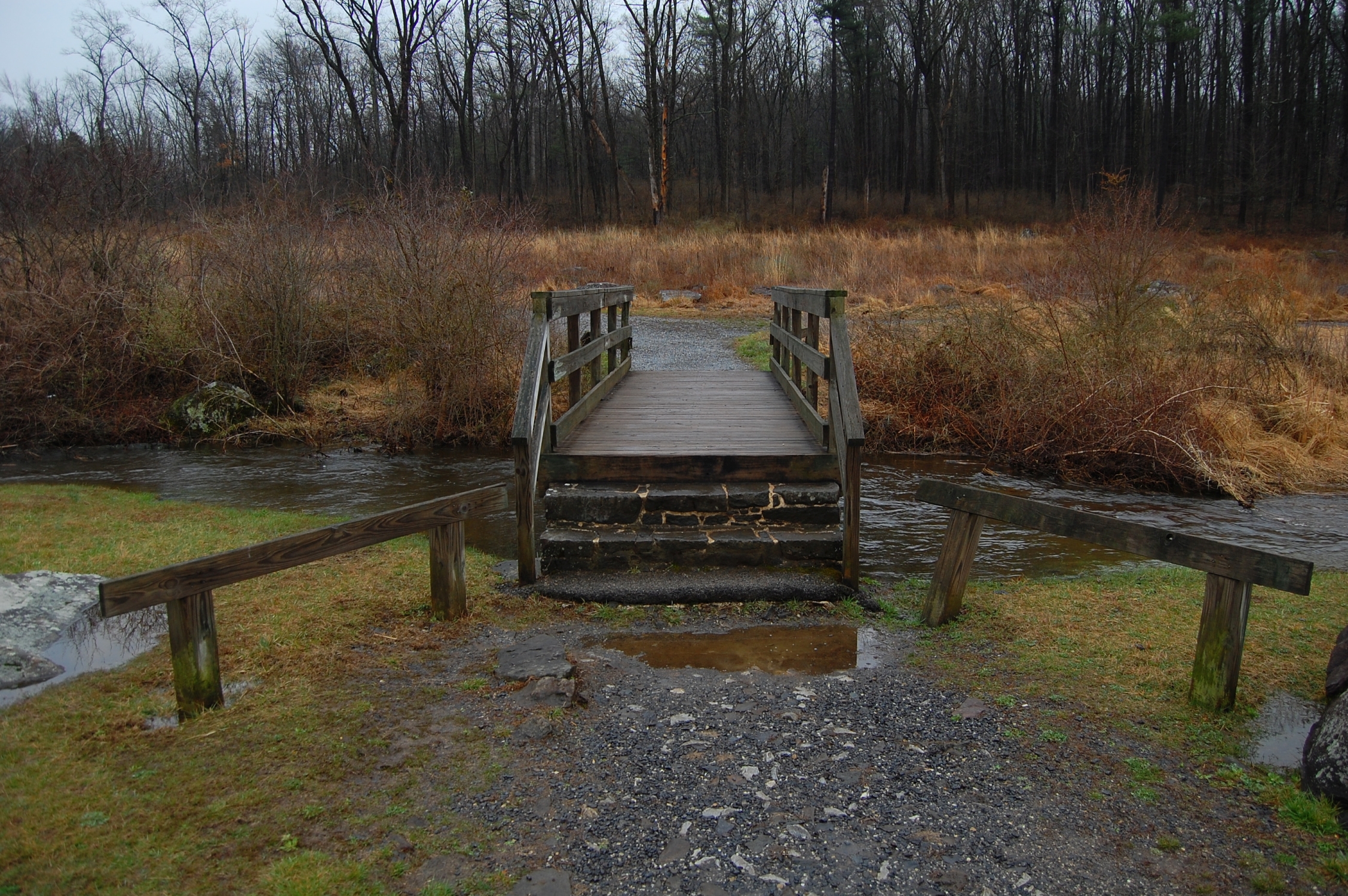
The bridge leading from Devil’s Den to the Slaughter Pen.This view was taken facing southeast at approximately 6:00 PM on Friday, March 31, 2017.
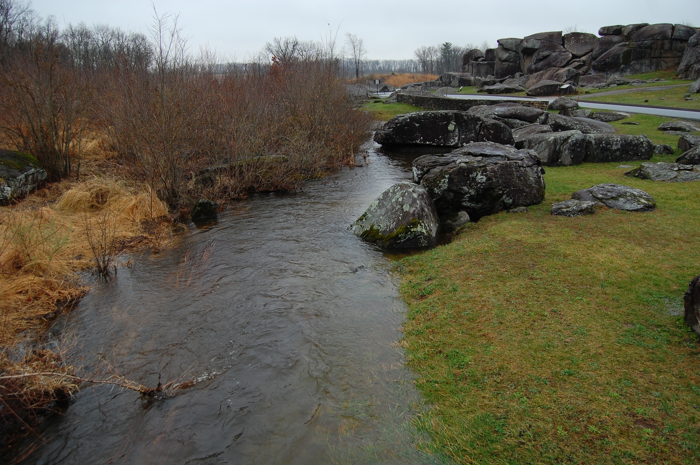
Looking from the bridge over Plum Run towards Devil’s Den.This view was taken facing southwest at approximately 6:00 PM on Friday, March 31, 2017.

Water was also moving switftly in Stevens Run at the intersection of Water St. and Stratton St. in Gettysburg.This view was taken facing west at approximately 6:00 PM on Friday, March 31, 2017.