Licensed Battlefield Guide Rich Kohr: Gettysburg Electric Trolley Part 2
January 26, 2009
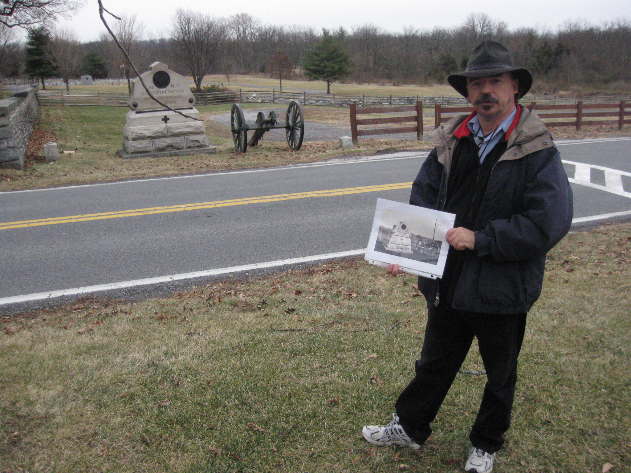
The Gettysburg Battlefield Trolley, or Electric Trolley exited the area of what is now Evergreen Cemetery in the background, and came towards our camera position, to intersect with the Taneytown Road just to the right of the white crosswalk behind Licensed Battlefield Guide Rich Kohr. The area behind the monument to the 3rd New York Independent Battery had been until April, 2008 the parking lot for employees at the “old” National Park Service Electric Map Visitor Center. This view was taken facing east at approximately 11:15 AM on Friday, January 2, 2009
We are continuing our series on the Gettysburg Electric Trolley, which existed from 1893 to 1916. In our first trolley post, Gettysburg Licensed Battlefield Guide Rich Kohr took us from the Electric Power Station in the town of Gettysburg, over Cemetery Hill to Evergreen Cemetery. Today we will take the trolley out of Evergreen Cemetery, around the area of the “old” National Park Service Visitor Center, and show its proposed route at the Angle on Cemetery Ridge.
This map shows the route of the trolley. The red line is the trolley route. The green line is the route of the Gettysburg/Harrisburg/Reading Railroad. For some time, the trolley used the Gettysburg/Harrisburg/Reading Railroad line from the Emmitsburg Road to Little Round Top to help establish a circular route on the battlefield. The blue sections are where the trolley had double or passing tracks. The white stars are the locations where we filmed videos, which we have numbered. Today’s post features videos #s 6-11. This map was created at approximately 9:00 PM on Wednesday, January 21, 2009.
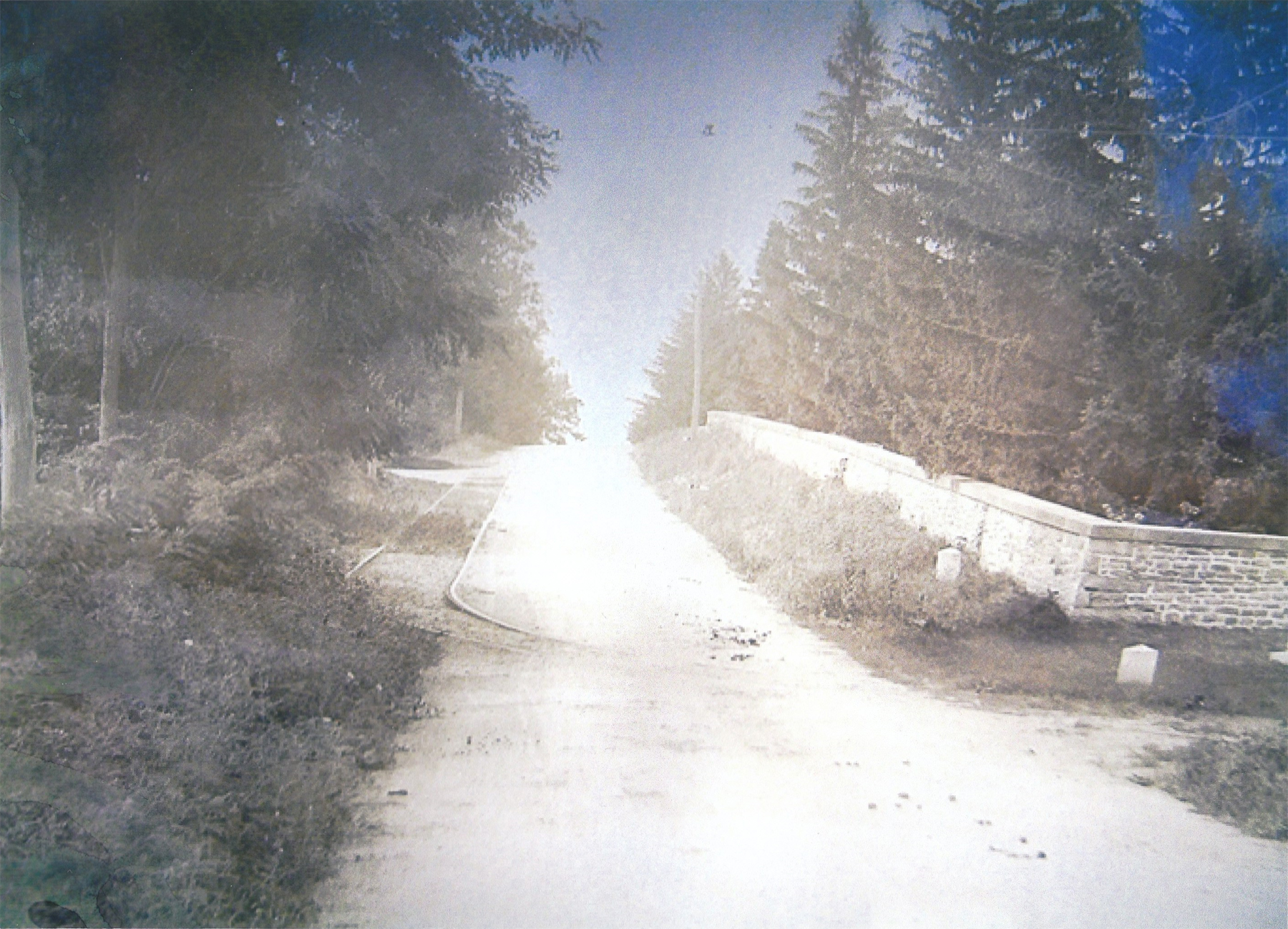
Here is the photo of the 3rd New York Independent Battery, which was dedicated on July 2, 1888. As with most photographs of the trolley tracks, they are incidental to the subject on which the photographer was focusing. You can see the poles and tracks behind the monument. This photograph is courtesy of the National Park Service. This view was taken facing southeast between 1893 and 1916.
In Video #6 (Videos 1-5 were featured on our first trolley post), Rich is standing in the old National Park Service Employee Parking Lot behind (southeast of) the monument to the 3rd New York Independent Battery. This view starts by facing east until we turn to a couple of directions at approximately 11:15 AM on Friday, January 2, 2009.
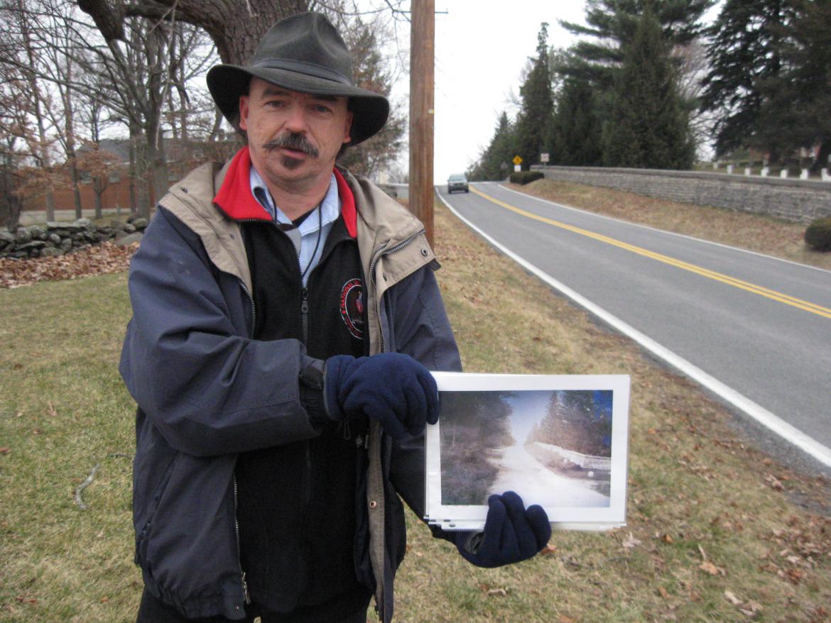
We have now crossed to the west side of the Taneytown Road. The Soldiers’ National Cemetery is on the right. The “old” National Park Service Electric Map Visitor Center is in the left background. Rich is showing us a photograph of the trolley tracks on the Taneytown Road taken near this location. This view was taken facing north at approximately 11:15 AM on Friday, January 2, 2009.
In Video #7, Rich explains how the trolley went north to the Taneytown Road entrance of the National Cemetery. A guide and his group that had left a trolley at the Baltimore Street entrance and walked through the National Cemetery would then get back on the trolley near the Taneytown Road entrance gates. This view was taken facing north at approximately 11:15 AM on Friday, January 2, 2009.
Here is the photograph that Rich was showing us in Video #7. The tracks go up (north) Cemetery Hill on the Taneytown Road. The monument to the 3rd New York Independent Battery is out of sight on the right, but its flank marker is visible. This photograph is courtesy of Sue Boardman. This view was taken facing north between 1893 and 1916.
The old red brick Rosensteel Museum Building, later the National Park Service Electric Map Visitor Center, is shown in the background of this photograph. It did not exist until 1921, and the trolley tracks were taken up beginning in 1917. The trolley groups leaving the Taneytown Road entrance to the National Cemetery would go down Cemetery Hill towards the camera position, just to the right of the Rosensteel/National Park Service building. There is still an embankment, taller than Rich’s waist just to his right (south). This view was taken facing east at approximately 11:15 AM on Friday, January 2, 2009.
In Video #8, Rich explains where the tracks were located in this area, and how the controversy began with the negative impact that the trolley right of way (sometimes listed as ROW) had on the terrain. This view was taken first facing east and then multiple directions at approximately 11:15 AM on Friday, January 2, 2009.
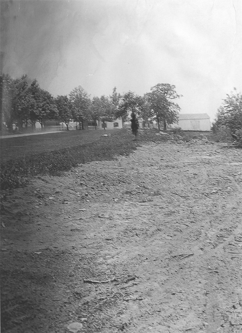
This is the image Rich was showing in Video #8. This is the trolley bed as it was being constructed. This photograph appeared in a July 1, 1893 Harpers Weekly in an article whose purpose was to show how the trolley destroyed the terrain at some battlefield locations. This view was taken facing east in 1893.
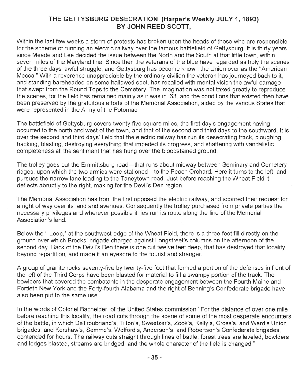
Page one of the text to the July 1, 1893 Harpers Weekly article about the trolley construction titled, “The Gettysburg Desecration.”
Page two of the text to the July 1, 1893 Harpers Weekly article about the trolley construction titled, “The Gettysburg Desecration.”
We are near a familiar intersection of Hancock Avenue and the driveway that runs from right to left (west to east) that connects the Emmitsburg Road, out of sight on the right (west) with the Taneytown Road, out of sight on the left (east). The Brian House is the white building in the background. The Cyclorama building is out of sight to the left (southeast). This view was taken facing south at approximately 1:00 PM on Friday, January 2, 2009.
In video #9 Rich explains how the trolley crossed what is now the driveway linking the Taneytown and Emmitsburg roads. He also explained how on the north side of the road the trolley right of way is visible, on the on the south side of the road it is not. The War Department filled in the right of way after the tracks were removed. This video begins facing north and then turns south to look toward the Brian Farm. This view was taken at approximately 1:00 PM on Friday, January 2, 2009.
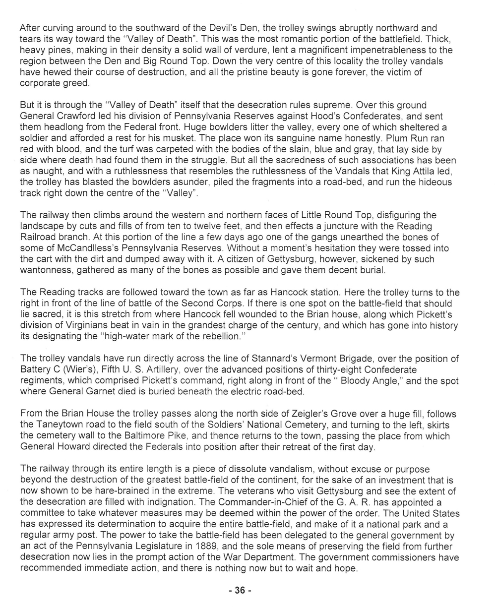
The photograph that Rich showed us in Video #9. The light-colored dirt is where the War Department filled in the trolley right of way. This photograph is courtesy of the National Park Service. This view was taken facing south in 1918.
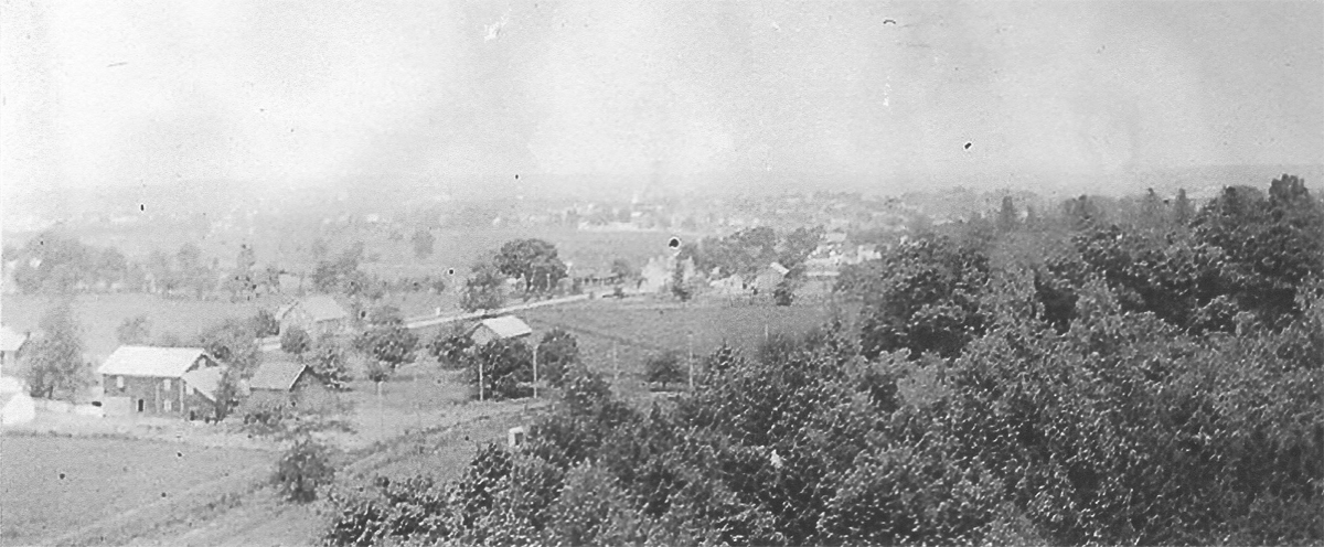
This view was taken from the old tower located on Cemetery Ridge at Ziegler’s Grove. The area of the trolley we featured in Video #9 is visible near the bottom of the photograph above the leaves on the Ziegler’s Grove trees. The right of way and poles are clearly visible. The driveway had not yet been constructed. Rich would have been standing left of the War Department marker. The trolley moved outbound, or from right to left. This photograph is courtesy of the National Park Service. This view was taken facing northwest between 1893 and 1916.
In Video #10 We are at the famous “Angle” of the stone wall which was prominent in Pickett’s Charge. Rich explains how the trolley was originally supposed to run in this area, and they had the area in front of the stone wall excavated. We start the video facing east and then we will turn to the south at approximately 1:00 PM on Friday, January 2, 2009.
Rich is standing in the excavated, but never used trolley right of way near the Angle. The monument to the 72nd Pennsylvania Infantry Regiment is emerging from behind his hat. The Copse of Trees or Clump of Trees is to the left of the 72nd Pennsylvania Monument. The Round Tops are in the background. This view was taken facing south at approximately 1:00 PM on Friday, January 2, 2009.
In Video #11, Rich explains that because the veterans to the 72nd Pennsylvania Regiment owned land on the west side of the stone wall in the Angle and High Water Mark area, the trolley could not run along the stone wall towards the Round Tops. The trolley backers would have to change their route.
The photograph that Rich showed in Video #11. It shows the destructive nature of the excavation for the right of way west of the stone wall. This picture appeared in the July 1, 1893 Harpers Weekly article “The Gettysburg Desecration.” This view was taken facing south in 1893.
See our previous posts on Gettysburg Licensed Battlefield Guides:
Gettysburg Guide Room: The Final Days on March 8, 2008.
Lights Out at the Electric Map on April 13, 2008.
New Guide Room at the New Visitor Center on April 19, 2008.
New Association of Licensed Battlefield Guide Office and Library Opens on August 25, 2008.
Evergreen Cemetery Headstone Damage with LBG Deb Novotny on October 20, 2008.
Camp Letterman Part 1 with LBG Phil Lechak on November 15, 2008.
Camp Letterman Part 2 with LBG Phil Lechak on November 17, 2008.
Gettysburg Artillery Part 1 with LBG George Newton on November 21, 2008.
“Mammy’s Little Baby Loves Guided Tours” with LBG Charlie Fennell on November 23, 2008.
Bucktails on McPherson’s Ridge Part 1 with LBG Rich Kohr on November 26, 2008.
Gettysburg Licensed Battlefield Guide Exam 2008 on December 6, 2008.
Gettysburg Hawk Hunting with Licensed Battlefield Guide Dave Weaver on December 14, 2008.
Licensed Battlefield Guide Rich Bellamy: Colonel Edward Ephraim Cross Part 1 on January 3, 2008.
Licensed Battlefield Guide Rich Bellamy: Colonel Edward Ephraim Cross Part 2 on January 5, 2009.
Licensed Battlefield Guide Rich Kohr: William Wible’s Gettysburg Quarry on January 21, 2009.
Licensed Battlefield Guide Rich Kohr: The Gettysburg Electric Trolley Part 1 on January 23, 2009.