John Gibbon at Gettysburg Part 2 With Licensed Battlefield Guide Anthony Kellon
August 31, 2009
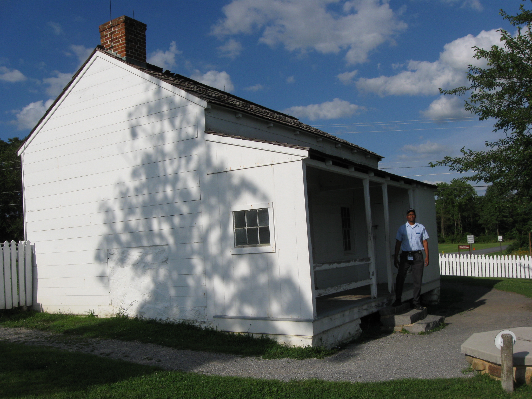
Gettysburg Licensed Battlefield Guide Anthony Kellon is an attorney in the Cuyahoga County, Ohio Public Defender’s Office. Tony has been a Licensed Battlefield Guide since 2006. Today he continues his series on United States Major General John Gibbon. Tony is standing near the Leister House, which was Major-General George Gordon Meade’s primary headquarters during the Battle of Gettysburg. This view was taken facing northeast at approximately 5:30 PM on Thursday, August 6, 2009.
John Gibbon was born in the Holmesburg section of Philadelphia, Pennsylvania, the fourth of ten children born to Dr. John Heysham Gibbon and Catharine Lardner Gibbon. When Gibbon was 11 years old the family moved near Charlotte, North Carolina, because Dr. Gibbon took a position as chief assayer at the U.S. Mint. John Gibbon graduated from the United States Military Academy in 1847 and was commissioned a brevet second lieutenant in the 3rd U.S. Artillery. He served in the Mexican-American War without seeing combat, attempted to keep the peace between Seminoles and settlers in south Florida. In 1855, Gibbon married Francis “Fannie” North Moale. They had four children: Frances Moale Gibbon, Catharine “Katy” Lardner Gibbon, John Gibbon, Jr. (who died as a toddler) and John S. Gibbon. Lieutenant John Gibbon taught artillery tactics at West Point where he wrote The Artillerist’s Manual in 1859. The manual was used by both sides in the Civil War.
In our first Gibbon post, Gettysburg Licensed Battlefield Guide Anthony Kellon showed us where Gibbon directed the Second Army Corps through Taneytown Maryland, and where they bivouacked near Gettysburg on the night of July 1, 1863.
In today’s post, Licensed Battlefield Guide Tony Kellon describes to us the three positions occupied by the Second Army Corps on July 2, 1863.
This map shows the location of the videos taken during our series on John Gibbon. Videos #1-3 were shown in our first Gibbon post. Video #4 was taken at Meade’s Headquarters at the Leister Farm. Video #5 was taken on the south side of Powers Hill near Granite Schoolhouse Road. Video #6 was taken on the east side of the Pennsylvania State Monument. This map was created facing north at approximately 11:30 AM on Monday, August 10, 2009.
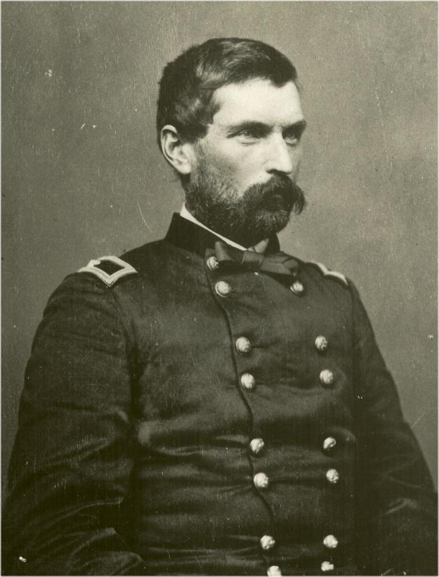
Gibbon stayed in the United States Army after the American Civil War. He reverted to his regular army rank of colonel and was in command of the infantry at Fort Ellis in the Montana Territory, during the campaign against the Sioux in 1876. Gibbon, General George Crook, and General Alfred Terry were to make a coordinated campaign against the Sioux and Cheyenne, but Crook was driven back at the Battle of the Rosebud, and Gibbon was not close by when Lt. Col. George A. Custer attacked a very large village on the banks of the Little Bighorn River. The Battle of the Little Bighorn resulted in the deaths of Custer and some 261 of his men. Gibbon’s approach on June 26 probably saved the lives of several hundred men under the command of Major Marcus Reno who were still under siege. Gibbon arrived the day after the battle and helped to bury the dead and evacuate the wounded. This photograph was taken circa 1862.
Gettysburg Licensed Battlefield Guide Tony Kellon is standing on the pathway leading from the Leister House, shown on the left, to the crest of Cemetery Ridge, which is out of sight on the right. This view was taken facing southeast at approximately 5:30 PM on Thursday, August 6, 2009.
In Video #4 (Videos #1- #3 were shown in our previous Gibbon posts) Gettysburg Licensed Battlefield Guide Tony Kellon is standing near the Leister House, the headquarters of Major General George Gordon Meade on the second and third days of the Battle of Gettysburg. He explains how Gibbon met with Meade here on the morning of July 2, 1863. Meade wants the Second Corps to be in a position to help repel a possible attack on the Union right. This view was taken facing south to southeast to northeast to southeast at approximately 5:30 PM on Thursday, August 6, 2009.
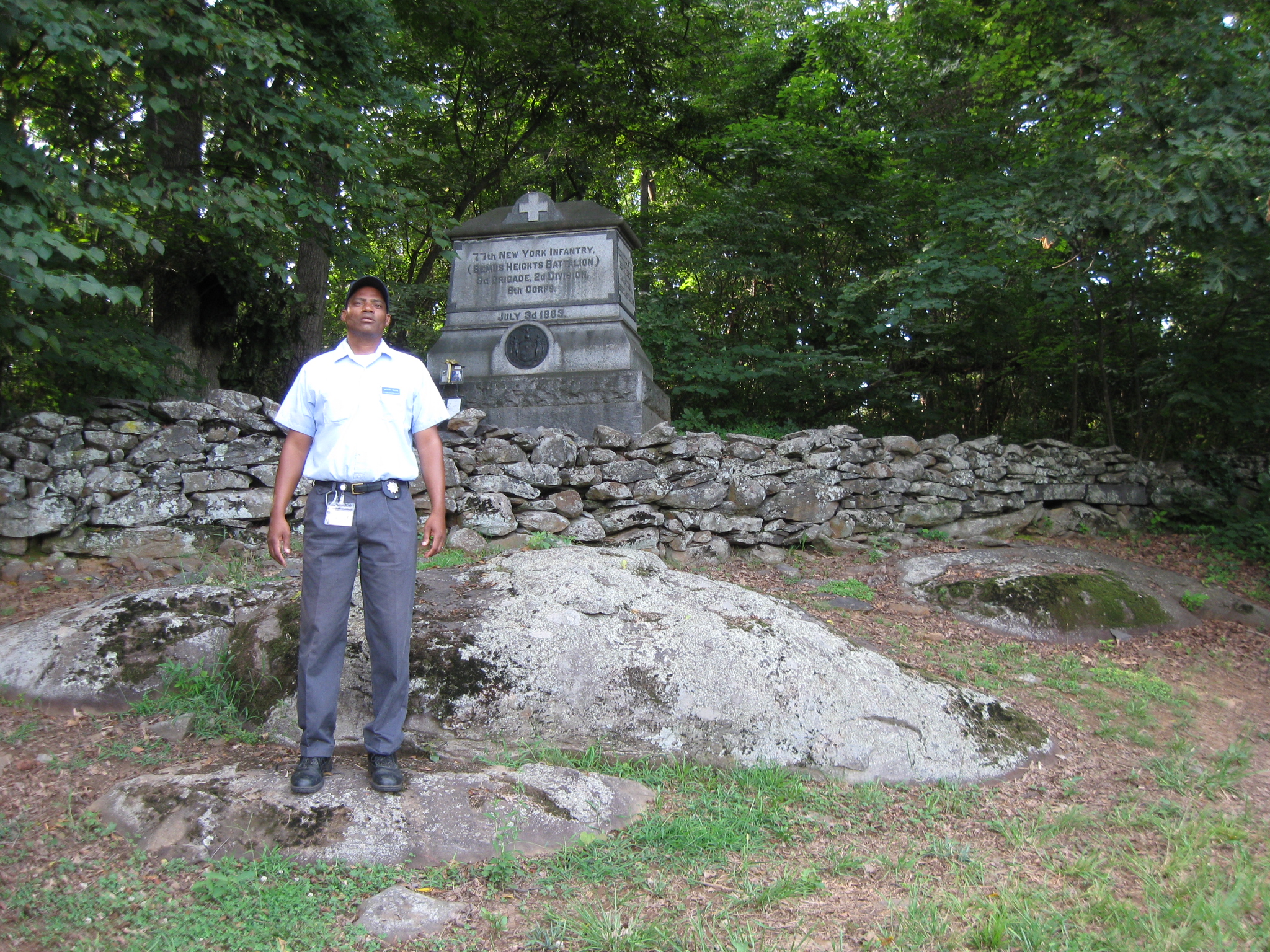
Licensed Battlefield Guide Anthony Kellon is standing on the south slope of Powers Hill. The monument to the 77th New York Infantry Regiment is in the background. This view was taken facing north at approximately 5:45 PM on Thursday, August 6, 2009.
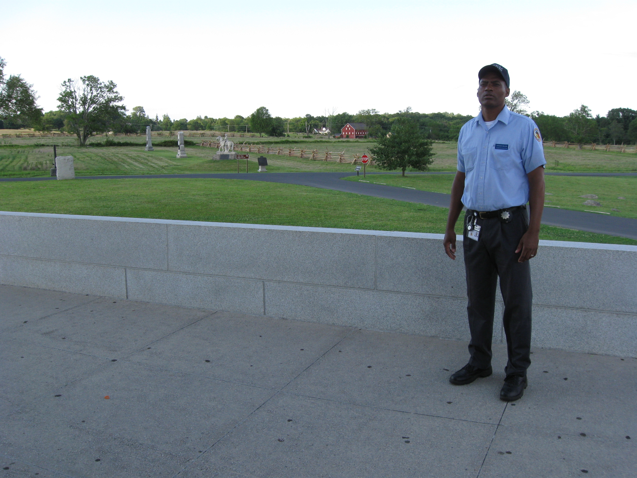
Licensed Battlefield Guide Tony Kellon is still standing on the south slope of Powers Hill. The Granite Schoolhouse Road is in the background. This view was taken facing south at approximately 5:45 PM on Thursday, August 6, 2009.
In Video #5 Licensed Battlefield Guide Tony Kellon is standing in the cleared field south of Powers Hill. He shows us why it was important for the Second Corps to occupy this position, and how they were first positioned facing northwest. This view was taken facing south to southeast to south at approximately 5:45 PM on Thursday, August 6, 2009.
Tony Kellon is standing on the east side of the Pennsylvania State Monument. The Peter Frey Barn on the Taneytown Road is the red structure in the background. Culp’s Hill is the group of trees above the barn. At the stop sign, Pleasanton Avenue runs right to left (east to west). This view was taken facing northeast at approximately 6:00 PM on Thursday, August 6, 2009.
In Video #6 Tony Kellon is standing on the east side of the Pennsylvania monument. He describes how the Second Corps was moved from the area around Granite Schoolhouse Lane to Cemetery Ridge. Hancock also takes over the command of the Second Corps again, and Gibbon returns to the command of his division. This view was taken facing east to southeast to northeast to south at approximately 6:00 PM on Thursday, August 6, 2009.
To see other posts by Gettysburg Licensed Battlefield Guides,click here.