
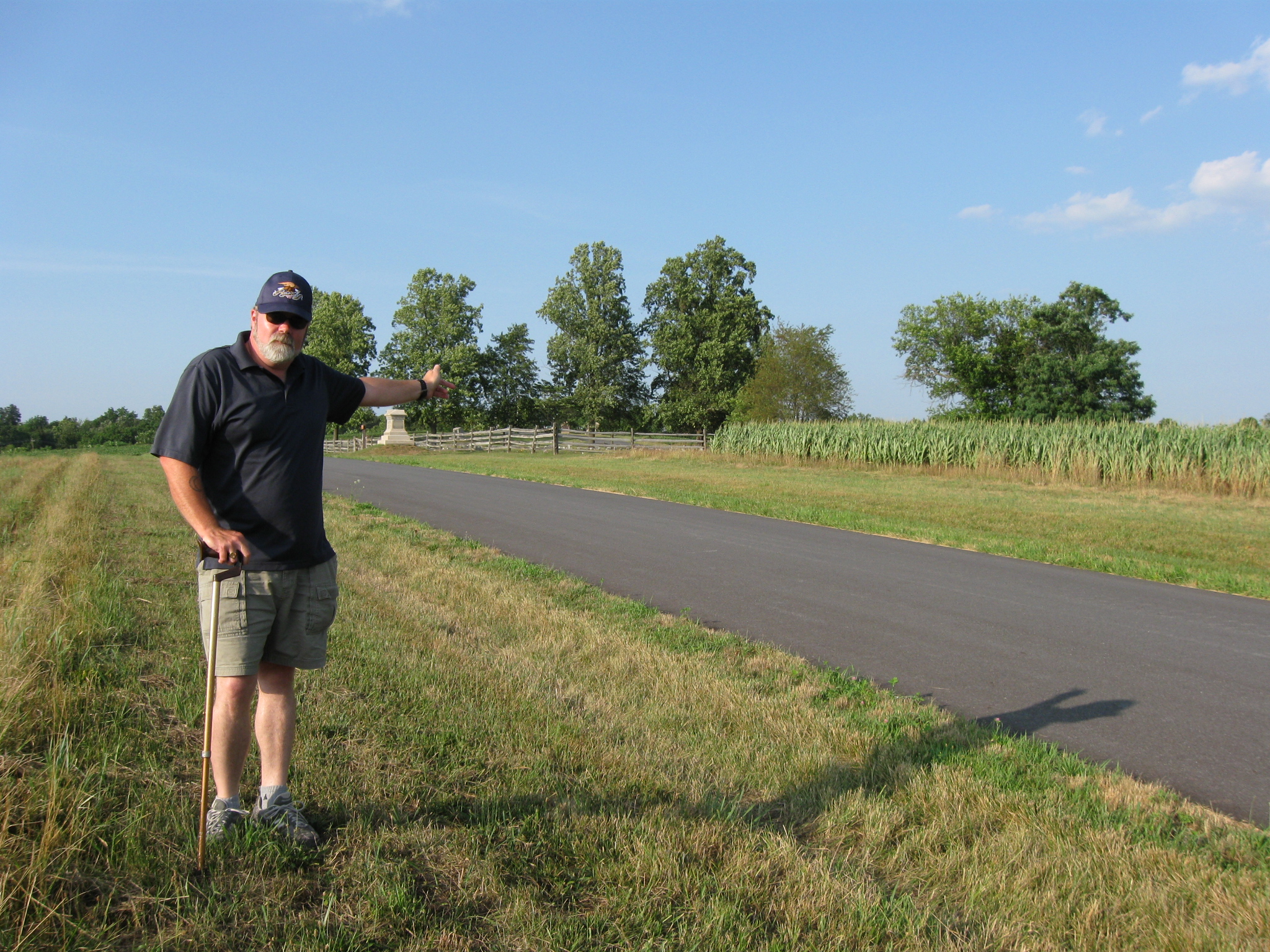
Gettysburg Licensed Battlefield Guide Stuart Dempsey is standing on the southwestern slope of Barlow Knoll, and is pointing to the summit of the hill. On the afternoon of July 1, 1863, Georgians from John Brown Gordon’s Brigade would break the Union line on Barlow’s Knoll and advance to the right, and towards the camera position. This view was taken facing northeast at approximately 6:30 PM on Saturday, July 18, 2010.
Gettysburg Licensed Battlefield Guide Stuart Dempsey is our host for a series on the Eleventh Army Corps during the Battle of Gettysburg. Stuart had two relatives in the Eleventh Corps (73rd Ohio Infantry Regiment) and both were killed/mortally wounded at Gettysburg. They are both buried in the National Cemetery. Stuart has been a Licensed Battlefield Guide since 2004.
Previous entries in the Eleventh Corps series can be found here.
In today’s Eleventh Corps post, Gettysburg Licensed Battlefield Guide Stuart Dempsey describes the collapse of Krzyzanowski’s Brigade on the afternoon of July 1, 1863.
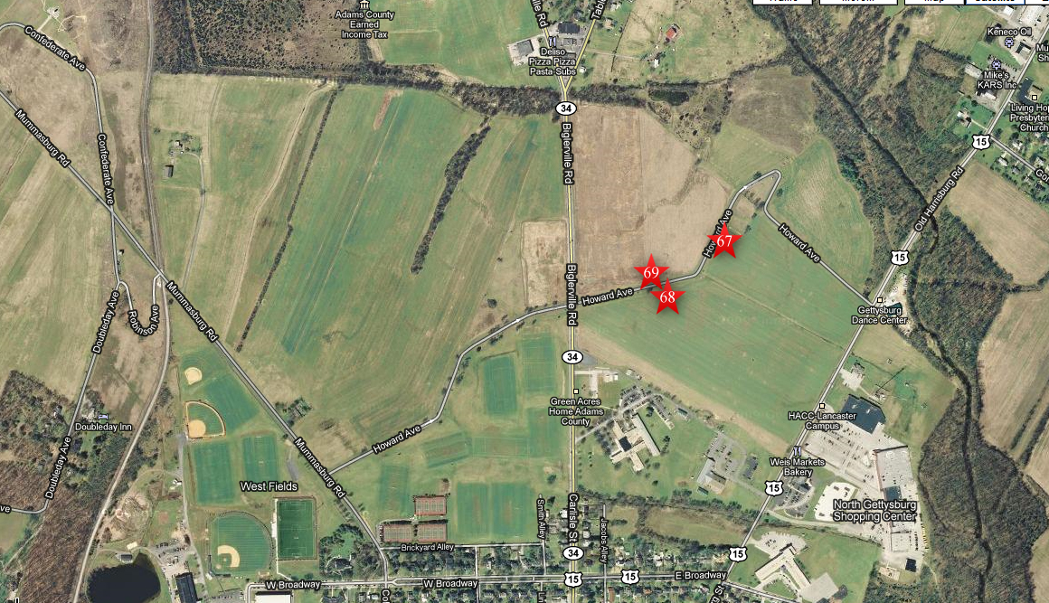
This map shows the location of where our Eleventh Corps at Gettysburg videos were produced. Videos #1-#64 were shown on other maps on our previous posts. Video #65 was taken on the southwestern slope of Barlow Knoll by the first shade tree that we could find on a hot July day. Video #66 was taken on the south side of East Howard Avenue, near the monument to the 26th Wisconsin Infantry Regiment. Video #67 was taken north side of East Howard Avenue between the monuments to the 26th Wisconsin and the 75th Pennsylvania Infantry regiments. This map was created facing north at approximately 8:15 PM on Wednesday, July 28, 2010.
In Video #67 (Videos #1-#66 were shown in our previous Eleventh Corps posts) Gettysburg Licensed Battlefield Guide Stuart Dempsey is standing on the southwestern slope of Barlow Knoll. He describes the circumstances leading to the advancement of Krzyzanowski’s Brigade to these fields north of Gettysburg. This view was taken facing northeast to south to northeast to southwest at approximately 6:30 PM on Saturday, July 18, 2010.
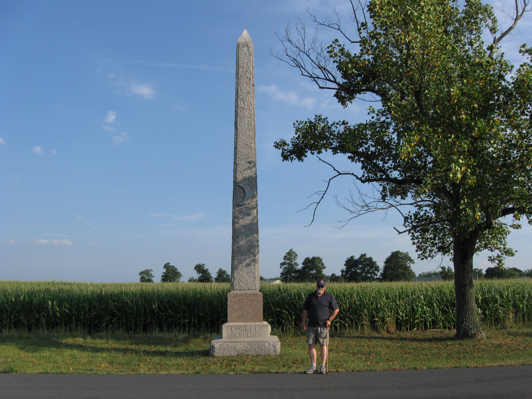
Licensed Battlefield Guide Stuart Dempsey is standing on East Howard Avenue near the monument to the 26th Wisconsin Infantry Regiment. The 26th Wisconsin was the right (east) of Krzyzanowski’s Brigade’s battle line in this area. The monument is located near the position of where the unit fought. The roofs seen above the corn are atop buildings of the Adams County Agricultural Society. At the time of the battle that area was the location of the Adams County Alms House. This view was taken facing south at approximately 6:30 PM on Saturday, July 18, 2010.
In Video #68 Licensed Battlefield Guide Stuart Dempsey is standing on east Howard Avenue near the monument to the 26th Wisconsin Infantry Regiment. He shows how the monuments of Krzyzanowski’s Brigade do not match their actual positions when they fought in this area. This view was taken facing south to southwest to south at approximately 6:30 PM on Saturday, July 18, 2010.

The monuments to Krzyzanowski’s Brigade do not match the positions where their units fought during the battle. The monument in the left background, at the curve is to the 58th New York Infantry Regiment. They only had two companies in the battle line north of town on the first day. Stuart says they were not on the right of the brigade line during the fighting, but he has not found evidence of exactly where they were placed in the battle line. The next tall monument, the top of which is hidden by the tree, is to the 26th Wisconsin. They would have been on the right (east) of Krzyzanowski’s line, somewhere in the area of the monument. The monument closest to the camera is to the 75th Pennsylvania. This position was occupied during the battle by the 119th New York Infantry. This view was taken facing east at approximately 6:30 PM on Saturday, July 18, 2010.

Again, the monuments to Krzyzanowski’s Brigade do not match the positions where their units fought during the battle. The 75th Pennsylvania monument, which is the first one of the left, is at the position where the 119th New York fought on July 1, 1863. The next monument is to the 82nd Ohio. That position was occupied during the battle by the 75th Pennsylvania. Near the Carlisle Road is the monument to the 119th New York. That position was occupied by the 82nd Ohio. The first monument on the other (west) side of the Carlisle Road is to the 157th New York. This view was taken facing southwest at approximately 6:30 PM on Saturday, July 18, 2010.
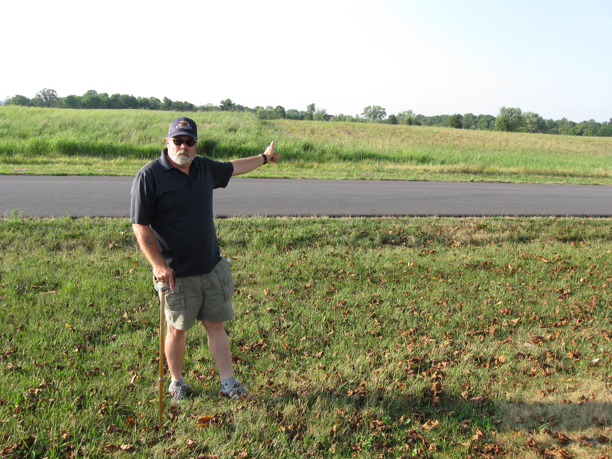
Stuart Dempsey is standing on East Howard Avenue. The monuments to the 26th Wisconsin and the 75th Pennsylvania are now behind the camera. Approaching this position from the fields in the background, were first, the 21st Georgia Infantry Regiment, and later, a significant part of Doles’ Georgia Brigade. Stuart is pointing to the dark colored roof of the Blocher Farm which is visible through the trees. This view was taken facing north at approximately 6:30 PM on Saturday, July 18, 2010.
In Video #69 Licensed Battlefield Guide Stuart Dempsey is standing on East Howard Avenue. He describes the fight between Krzyzanowski’s Brigade and Doles’ Brigade. He points out that Krzyzanowski’s Brigade began to collapse when regiments from Gordon’s Brigade outflanked their right. This view was taken facing north to northeast to north to northwest to southwest at approximately 6:30 PM on Saturday, July 18, 2010.
To see other posts by Gettysburg Licensed Battlefield Guides, click here.