

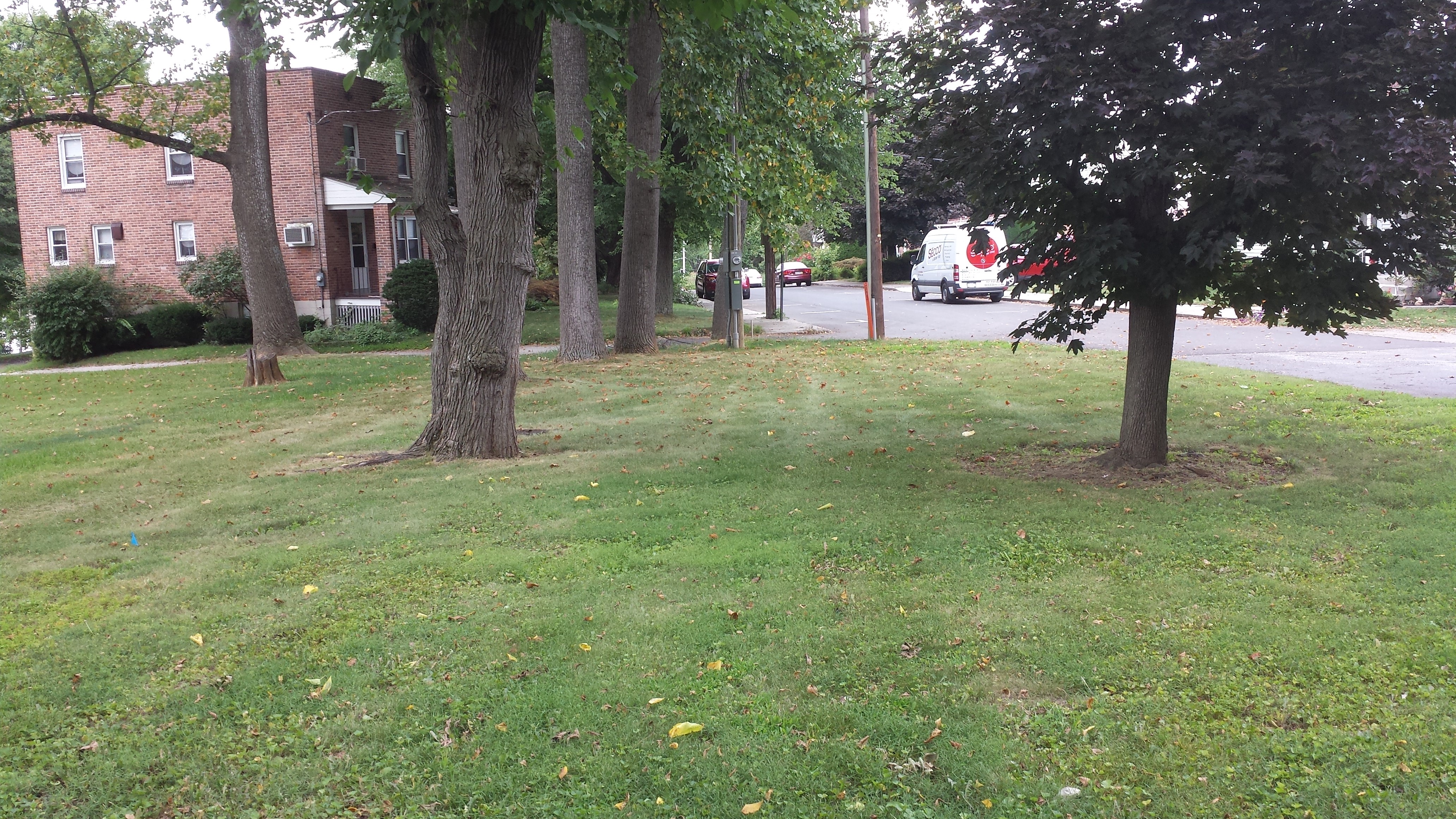
The Civil War Trust is tearing down a structure that they purchased on East Cemetery Hill. They are doing their part to restore the ground to the way that it looked in 1863 when this line was lightly defended by Ohio soldiers who were overrun by Louisiana soldiers on the evening of July 2, 1863. We are thankful that someone is following through on the goal to restore the battlefield back to its 1863 appearance. Like, you know, as is stated in the NATIONAL PARK SERVICE’S GENERAL MANAGEMENT PLAN. This work occurred Saturday morning and afternoon on the Hillcrest Place property that the Civil War Trust had acquired near the water tanks. The flank markers to the 107th Ohio and to the 25th Ohio are shown on the far right. This view was taken facing east to slightly northeast at approximately 2:00 PM on Saturday, July 16, 2016.
This aerial view shows the East Cemetery Hill area. The red star is on the structure that is being removed at 570 Hillcrest Place.. This image is courtesy of Google Maps.

This aerial view shows the East Cemetery Hill area in 1941. The reservoir (south of the current water tanks) is on the far left. The Gettysburg Tour Center parks some of their extra vehicles in this area now. The location of the building being torn down (and that we are featuring today) is not visible in this view. That location is left of (northeast of) the reservoir. The old Cyclorama Center is visible at the bottom left of the photograph near the Baltimore Pike. The Gettysburg Tour Center is currently located to the right of, or south of, this old Cyclorama location. This image was taken facing southeast on an afternoon in 1941. This image is courtesy of the National Park Service.

Here is a view from National Park Service land on East Cemetery Hill looking towards the Borough of Gettysburg. Wiedrich’s 1st New York Battery is on the left. The monument to the 134th New York is to the left of Wiedrich’s guns near the stone wall. The old Cyclorama building is just past (north of) where the tour center is located today. On the right is the reservoir and one of the early water tanks. The building that is being torn down is out of site to the right of this view, but we had some pictures that we like and wanted to show you them anyway. This view was taken facing northwest circa the 1950s.

Here is a panorama of the area that is being restored. On the left we are looking down the hill and the road is Hillcrest Place. On the far right is the left flank marker of the 107th Ohio Infantry Regiment. The current water tanks are behind this flank marker. This view was taken facing north to south at approximately 2:00 PM on Saturday, July 16, 2016.

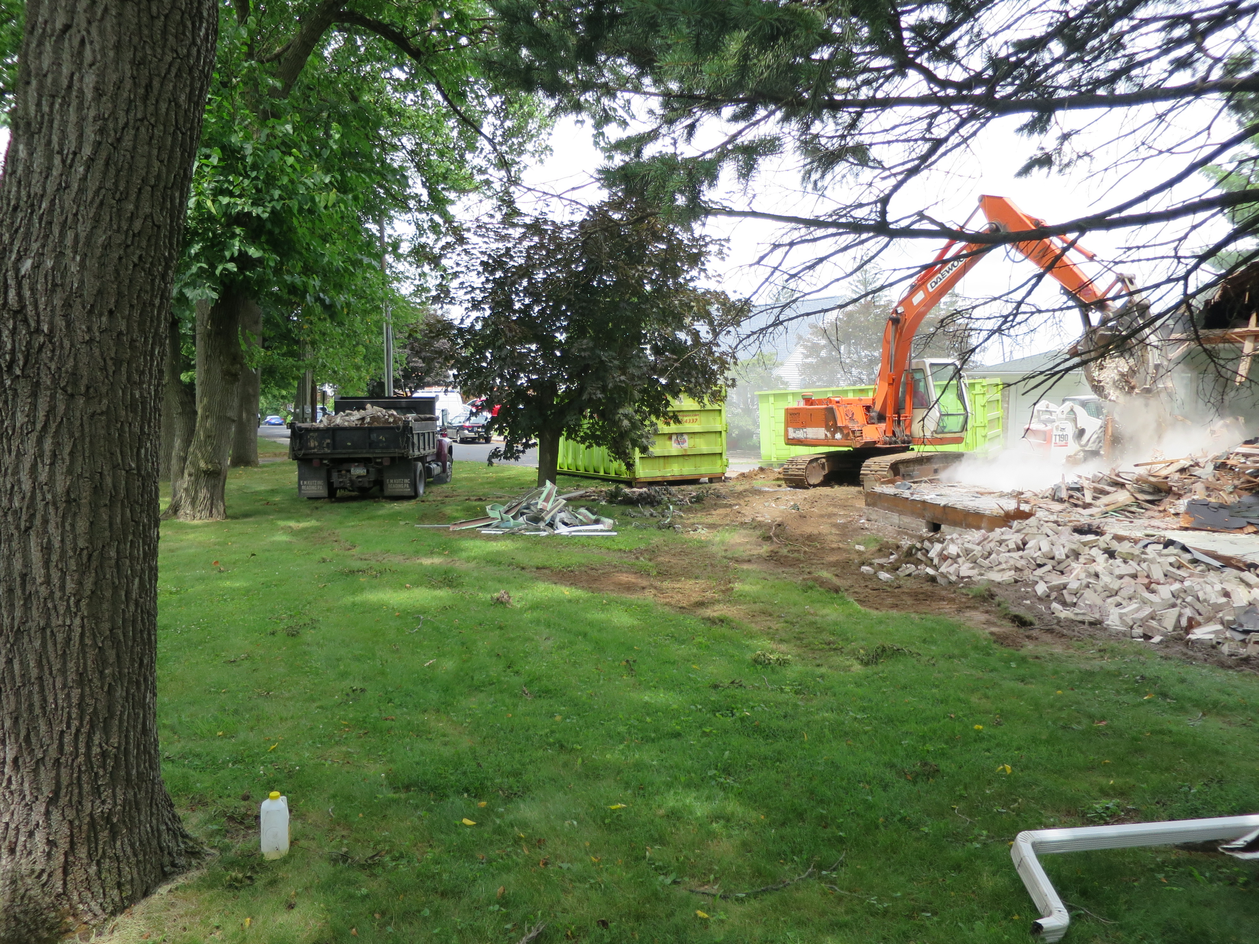
The refuse is placed in the vehicle behind the tree and the green dumpster that is labeled “Hoppers.” This view was facing northeast at approximately 2:00 PM on Saturday, July 16, 2016.
Let’s walk over to the right of this view, out of the way of the demolition work, to where the flank markers are located. This view was taken facing east at approximately 2:00 PM on Saturday, July 16, 2016.
The house sits on the battleline of the 107th Ohio Infantry Regiment and the 25th Ohio Infantry Regiment. By the evening of July 2nd, their skirmish line had been placed near this location at the battleline. These regiments did not have a good “early warning system” to inform them when and if the Confederates were going to attack. This view was taken facing northeast at approximately 2:00 PM on Saturday, July 16, 2016.
Here is a panorama of what the area looks like standing behind (south of) the house. This view was taken facing west to east at approximately 2:00 PM on Saturday, July 16, 2016.

So if one was able to acquire more property, what is the view that might be restored? Look at the marker on the left, which is the right flank marker of the 107th Ohio. This view was taken facing north at approximately 2:00 PM on Saturday, July 16, 2016.
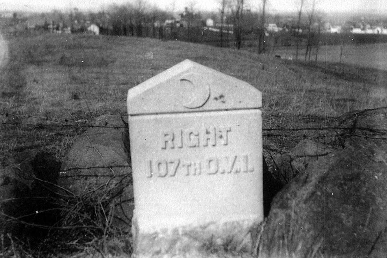
Wouldn’t it be nice to get this view back? The buildings in the distance are on High Street and along Middle Street in Gettysburg. This view was taken facing north circa 1887.
Let’s move to the front of this structure. Notice there are two green dumpsters. This view was taken facing northeast at approximately 2:00 PM on Saturday, July 16, 2016.
Here’s the view of this area that the Ohio soldiers had. The Confederates from Louisiana charged toward them and towards the camera position. This view was taken facing north at on August 9, 2015.

Here’s the front of the structure. One of the neighbors told us while we were out taking these pictures, that approximately 60 years ago a barn was located here. It did have livestock which grazed on the slopes of East Cemetery Hill. This view was taken facing southeast at approximately 2:00 PM on Saturday, July 16, 2016.

Here’s another view of the front. The water tanks are in the right background. The left flank marker for the 107th Ohio is in the right background. Thank you Civil War Trust for removing a building that was not here in 1863. This view was taken facing south at approximately 2:00 PM on Saturday, July 16, 2016.

If only more organizations that acquire structures not here in 1863 would follow through and remove them to restore the historic views. For instance, why is this building still standing? This view was taken facing southeast at approximately 3:45 PM on Saturday, March 19, 2011.