
“‘Little’ Little Round Top,” in Brewer, Maine. The statue of Joshua Chamberlain (center) and this reproduction of the 20th Maine Infantry monument sit on top of the hill. This view was taken at approximately 6:30 AM on Wednesday, June 29, 2011.
Gettysburg Licensed Battlefield Guide Christina Moon took a trip to Maine in the summer of last year and visited a very curious location related to Gettysburg — the Chamberlain Freedom Park. In today’s post, Christina will give us a tour of this site, which serves as both a memorial to Joshua Chamberlain and a monument to the Underground Railroad.
To email Licensed Battlefield Guide Christina Moon, please click here to reveal her address.

The sign for “Chamberlain Freedom Park,” placed on split-rail fences at the base of the hill. To see this location on Google Maps, click here. This view was taken at approximately 6:30 AM on Wednesday, June 29, 2011.
In this video, LBG Christina Moon introduces us to Brewer Maine and the wayside to Chamberlain Freedom Park.
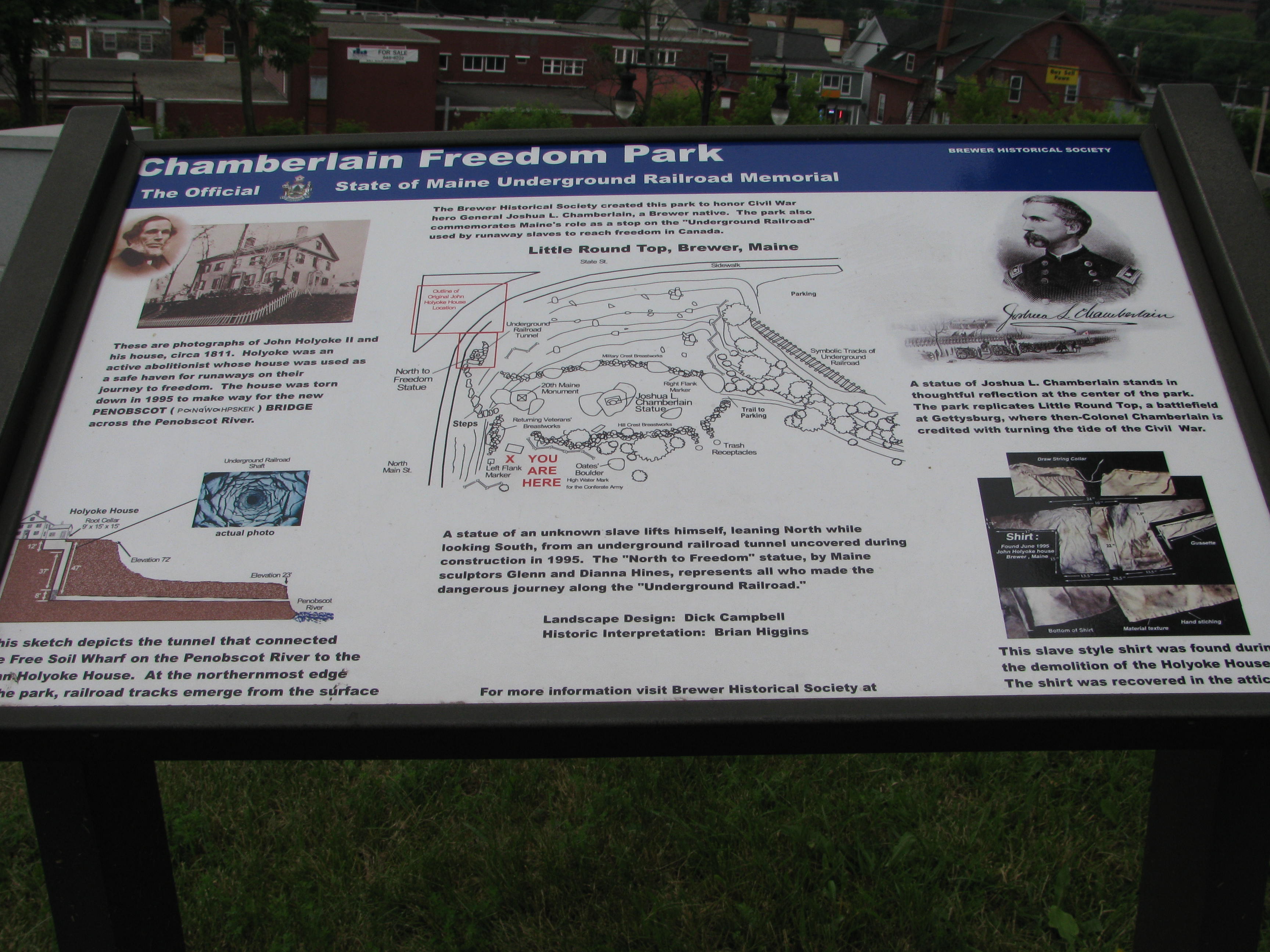
We’ll take a closer look at the Brewer Historical Society’s wayside that introduces us to the site in the next five images. This view was taken at approximately 6:30 AM on Wednesday, June 29, 2011.
This view was taken at approximately 6:30 AM on Wednesday, June 29, 2011.

This view was taken at approximately 6:30 AM on Wednesday, June 29, 2011.

This view was taken at approximately 6:30 AM on Wednesday, June 29, 2011.

This view was taken at approximately 6:30 AM on Wednesday, June 29, 2011.

This view was taken at approximately 6:30 AM on Wednesday, June 29, 2011.

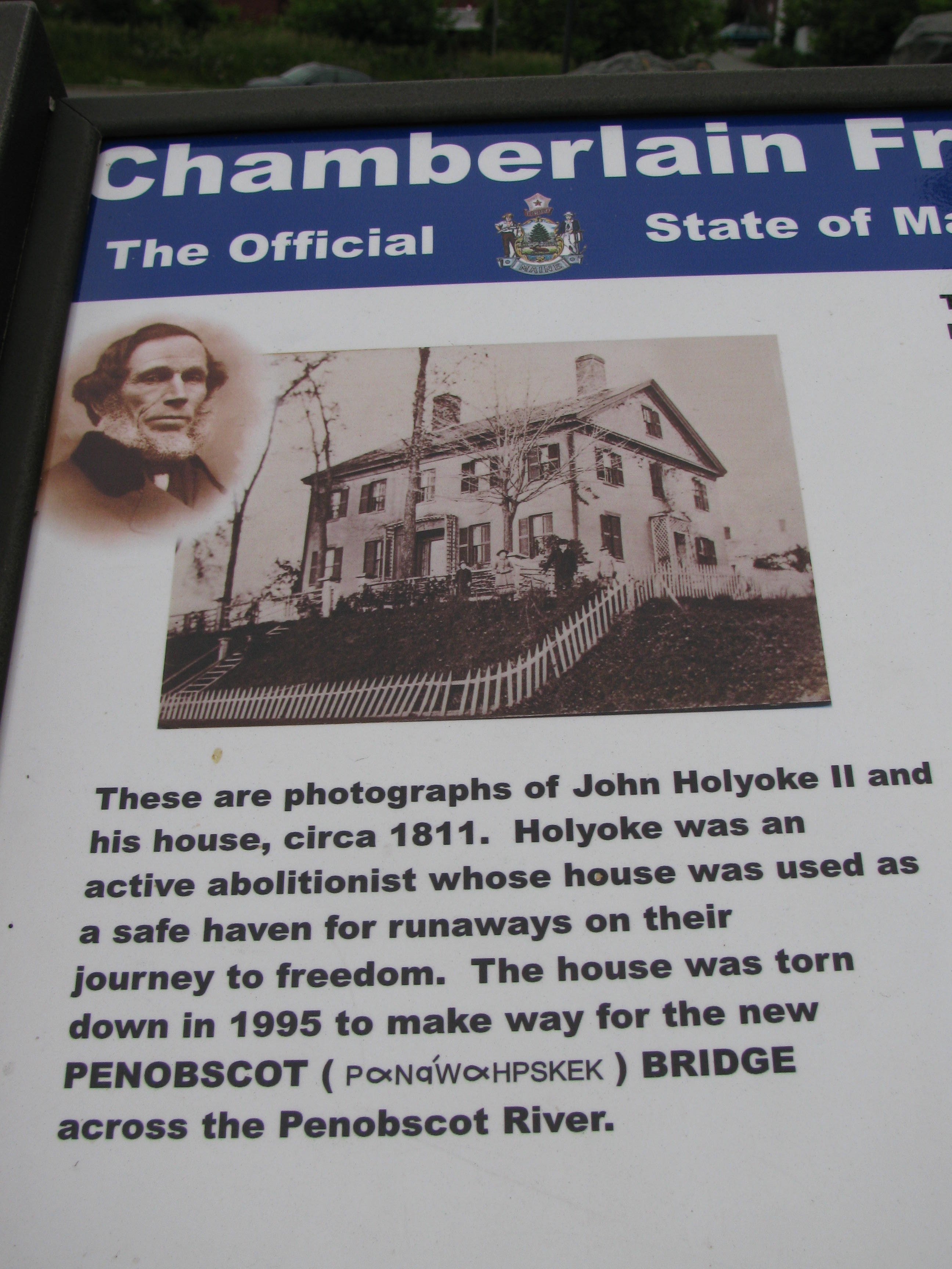
The park is partially built on the foundation of the John Holyoke House, the outline of which can be seen in the upper-left of this image. This view was taken at approximately 6:30 AM on Wednesday, June 29, 2011.
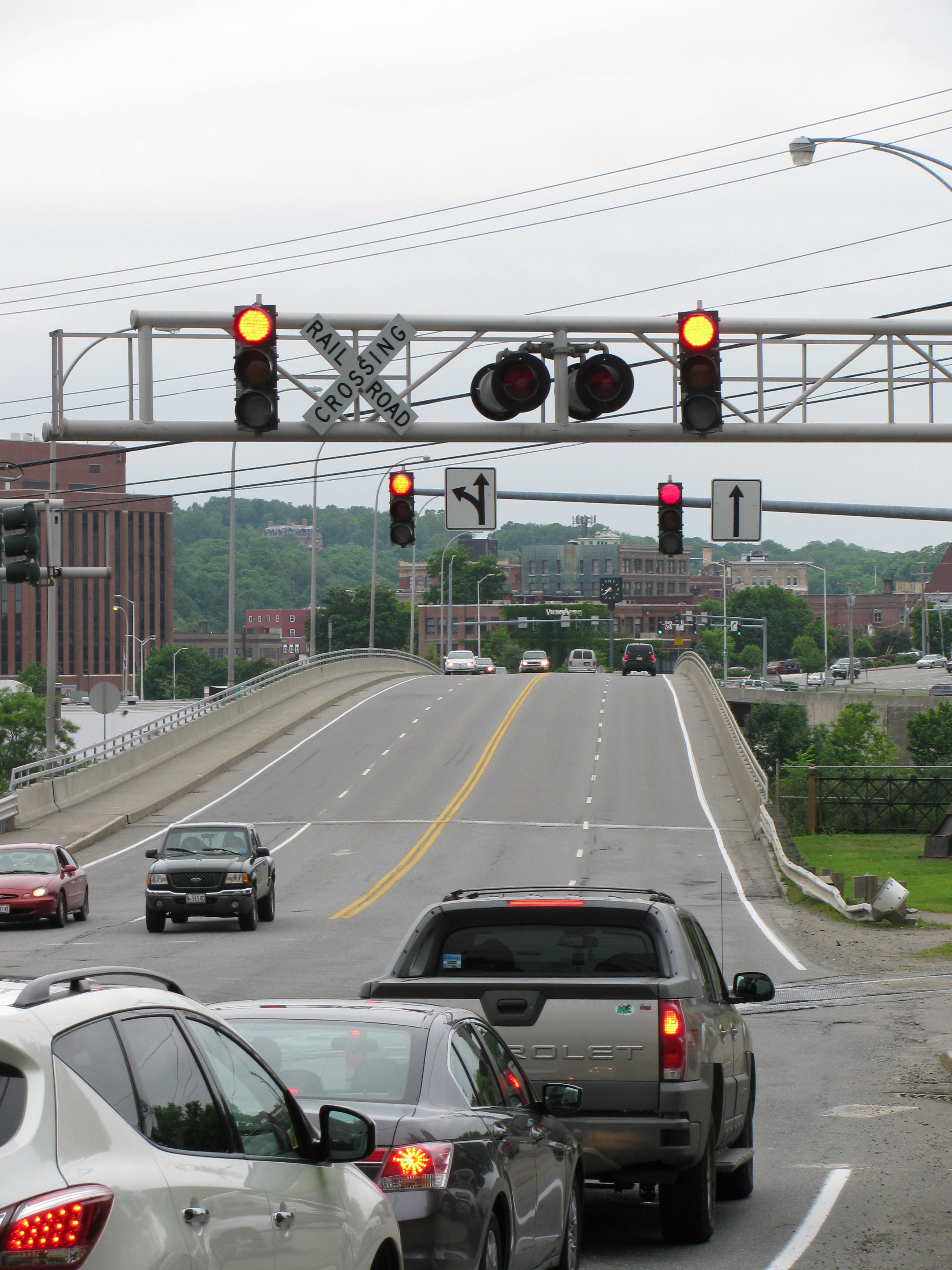
The park is out of sight to the rear and right of this view, which shows the Chamberlain Bridge, also known as the New Penobscot Bridge, which crosses the Penobscot River, connecting Brewer to Bangor, Maine. The construction of the initial Penobscot River Bridge was completed in 1911 and was a through-truss bridge. The bridge in this photo replaced it in 1997. This view was taken at approximately 6:30 AM on Wednesday, June 29, 2011.
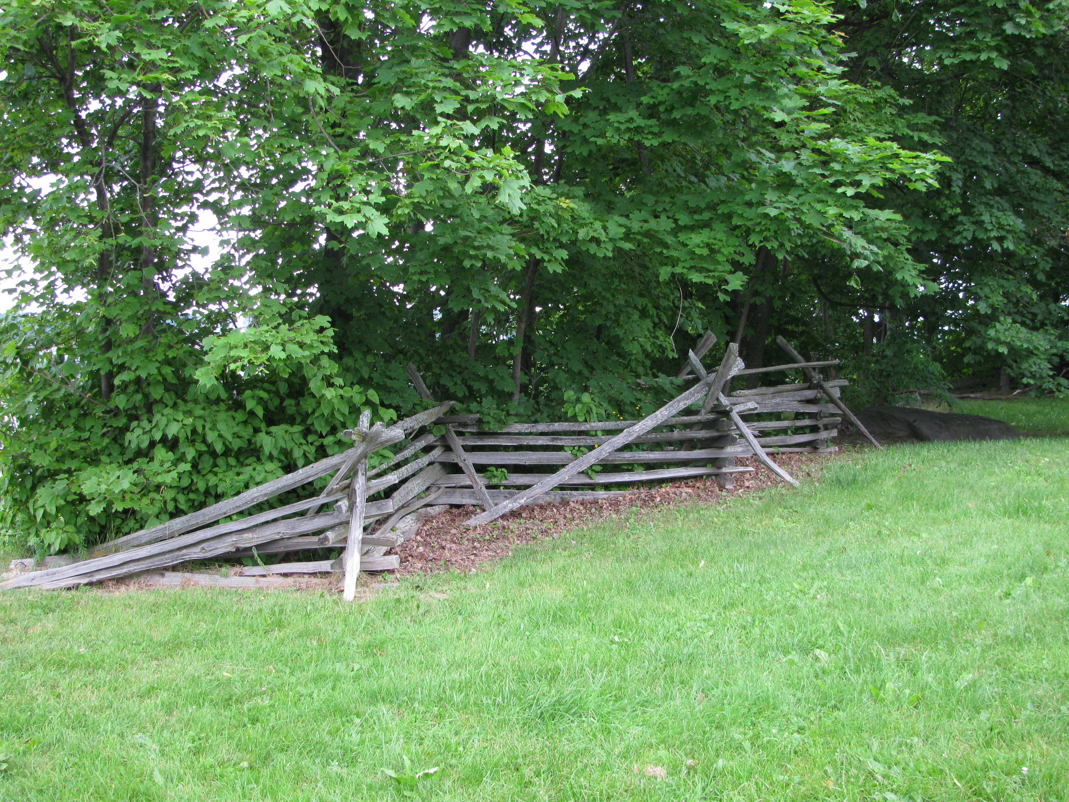
The split-rail fences have been placed in sections around the park to represent the type of split-rail fences present in Pennsylvania farmland. This view was taken at approximately 6:30 AM on Wednesday, June 29, 2011.
LBG Christina Moon shows us the statue to Joshua Chamberlain, who was born and raised in Brewer, Maine, and the monument to the 20th Maine Infantry.

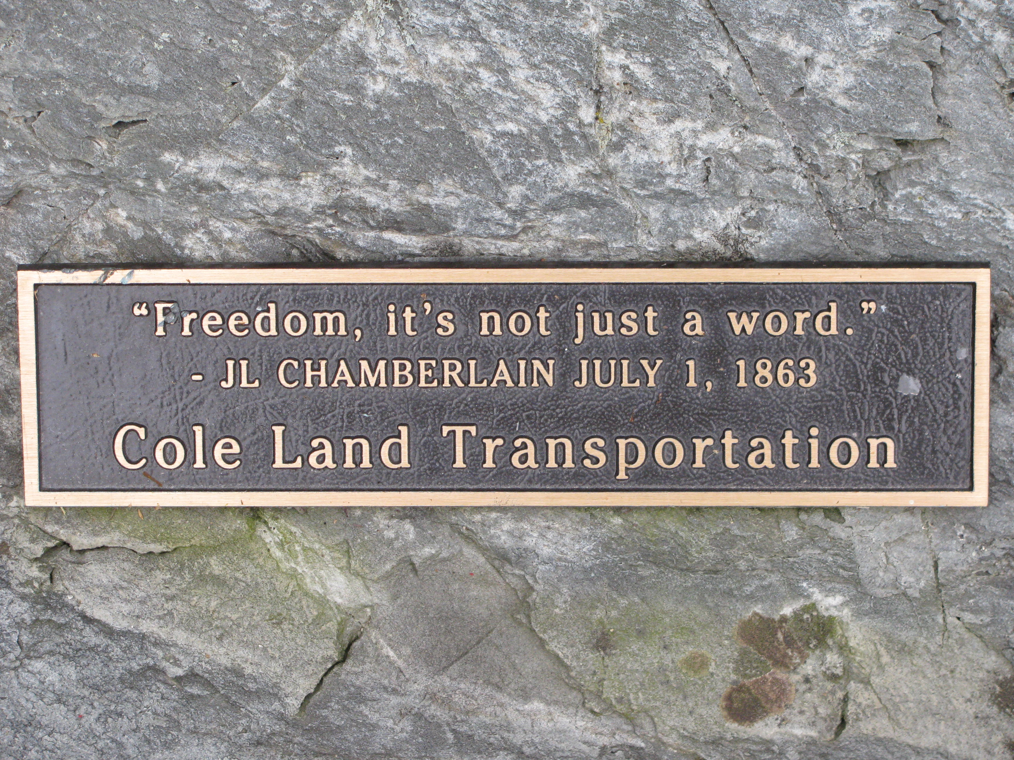
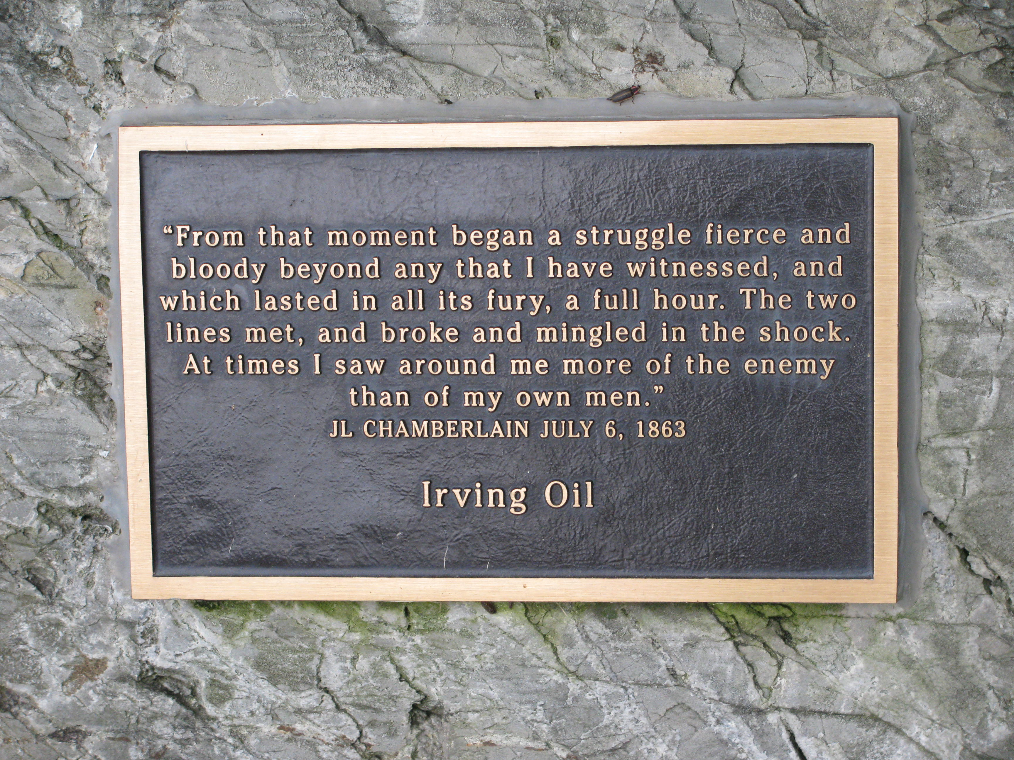
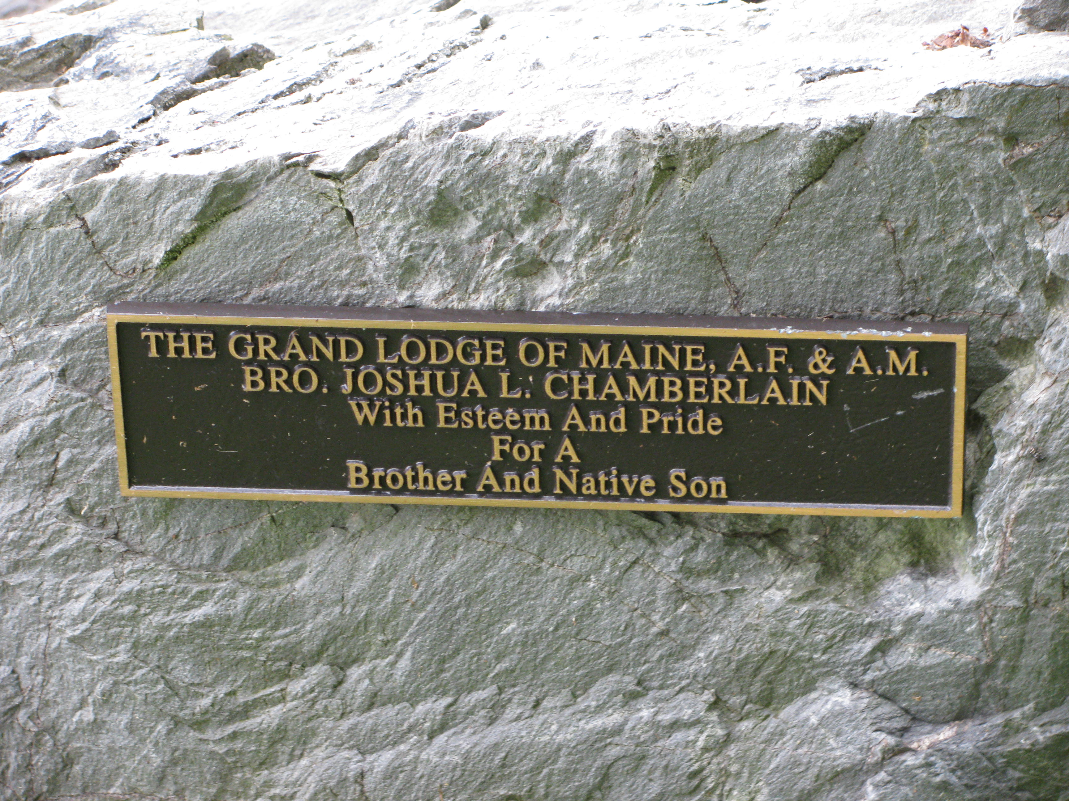
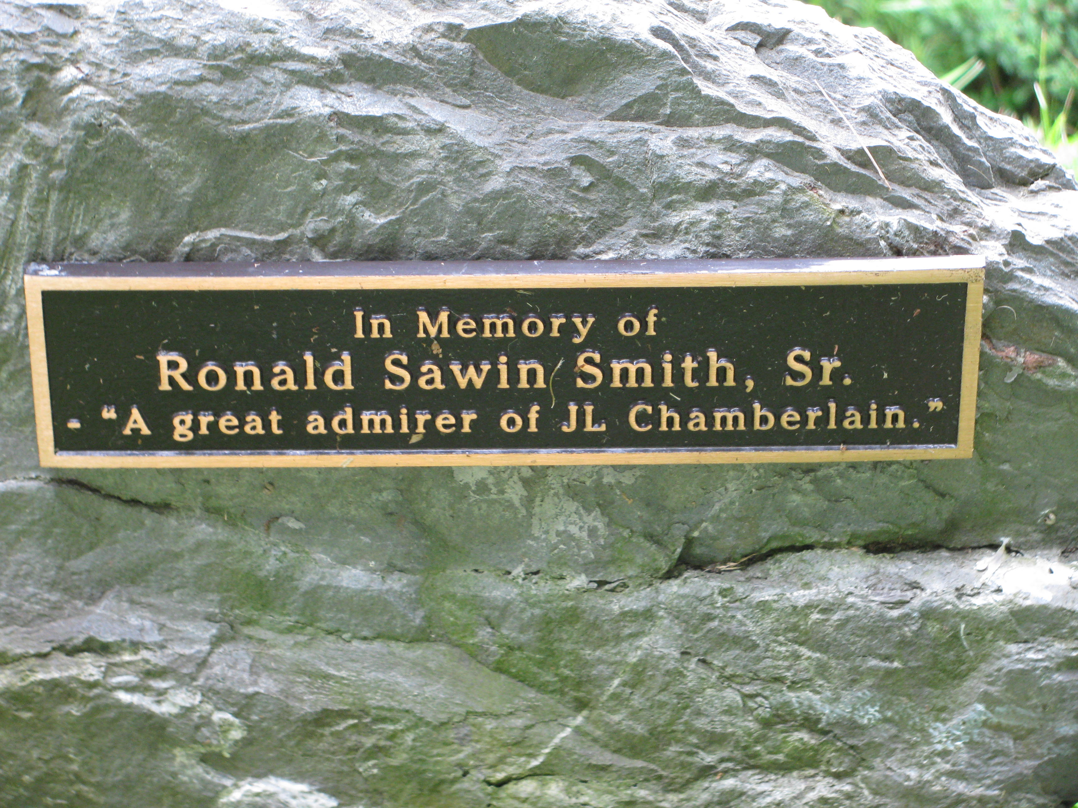
The Chamberlain Freedom Park has a lot of plaques … This view was taken at approximately 6:30 AM on Wednesday, June 29, 2011.

… and most of them are located on the rock which Chamberlain’s statue sits upon at the top of the hill. We’ll give you a chance to read these plaques in the next few images. This view was taken at approximately 6:30 AM on Wednesday, June 29, 2011.
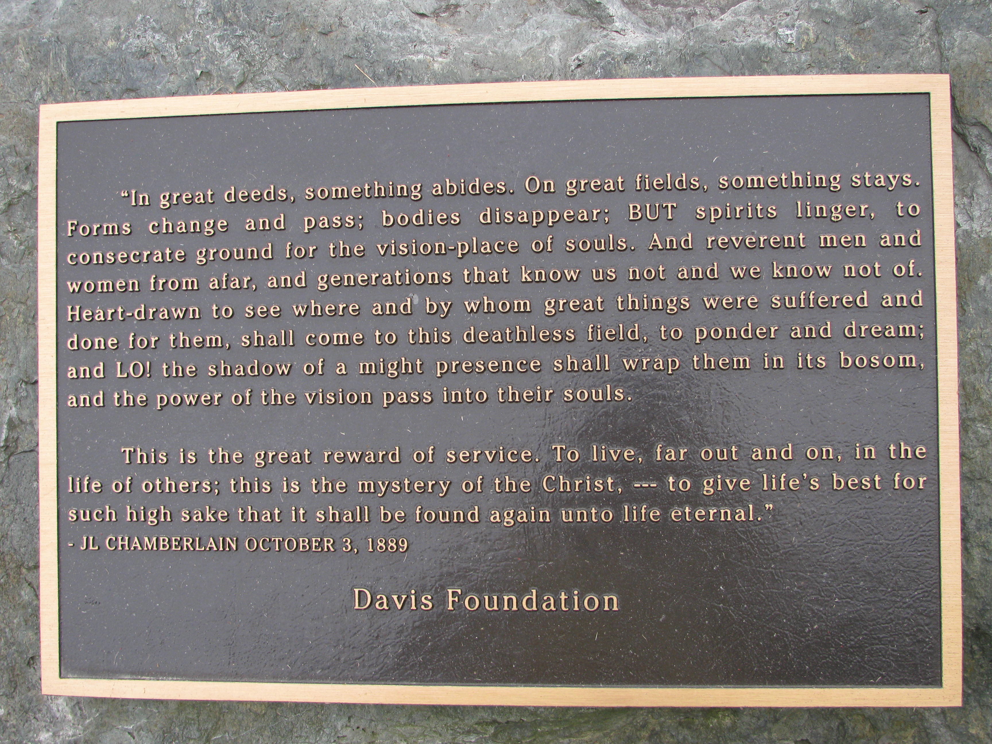
This large plaque is not located on the statue rock, but is on another smaller rock behind the copy of the 20th Maine Monument. This view was taken at approximately 6:30 AM on Wednesday, June 29, 2011.
This view was taken at approximately 6:30 AM on Wednesday, June 29, 2011.
This view was taken at approximately 6:30 AM on Wednesday, June 29, 2011.
This view was taken at approximately 6:30 AM on Wednesday, June 29, 2011.

This view was taken at approximately 6:30 AM on Wednesday, June 29, 2011.
This view was taken at approximately 6:30 AM on Wednesday, June 29, 2011.

This view was taken at approximately 6:30 AM on Wednesday, June 29, 2011.
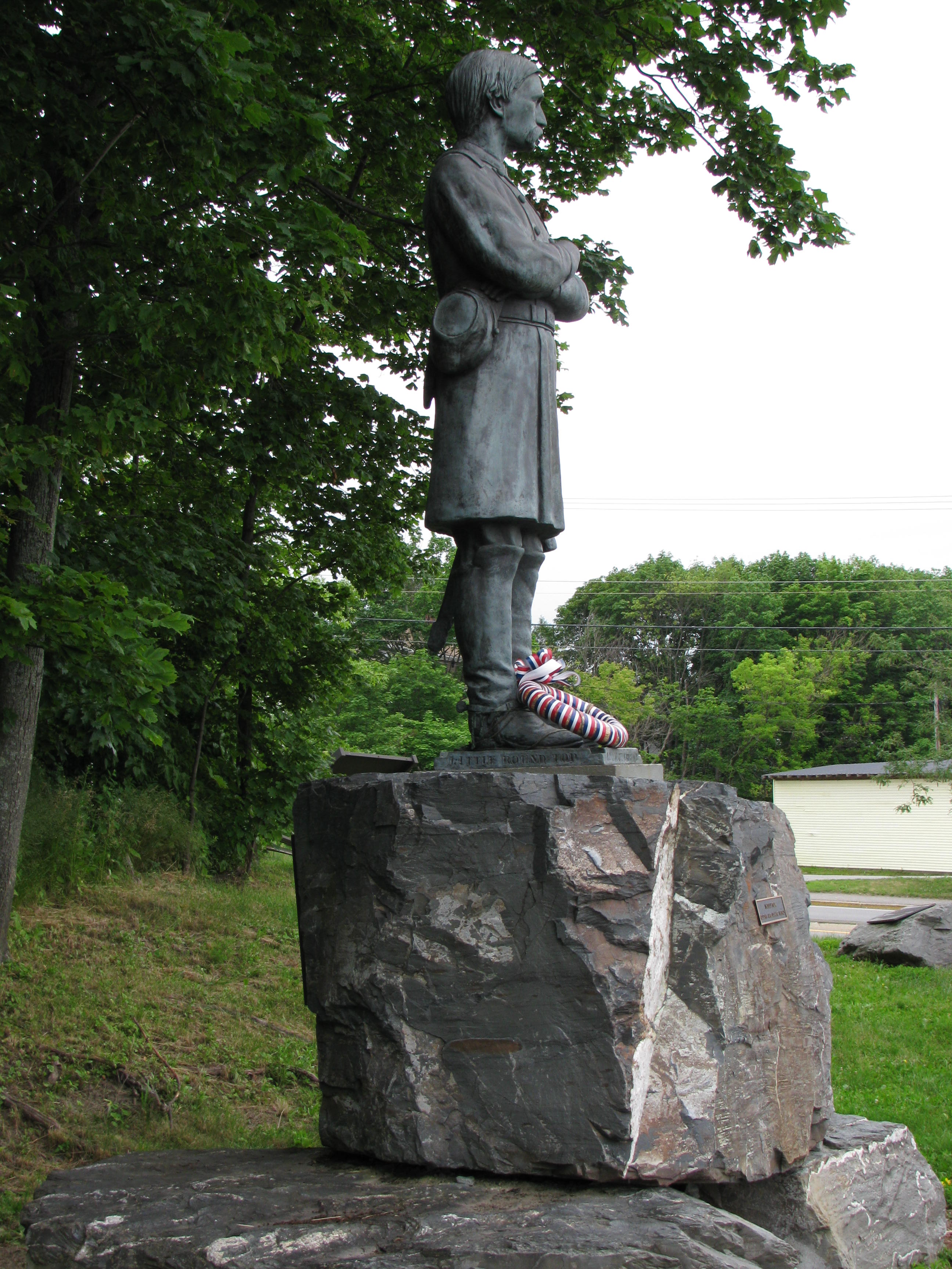
Here’s a side view of the Chamberlain statue. Down to the statue’s right … This view was taken at approximately 6:30 AM on Wednesday, June 29, 2011.
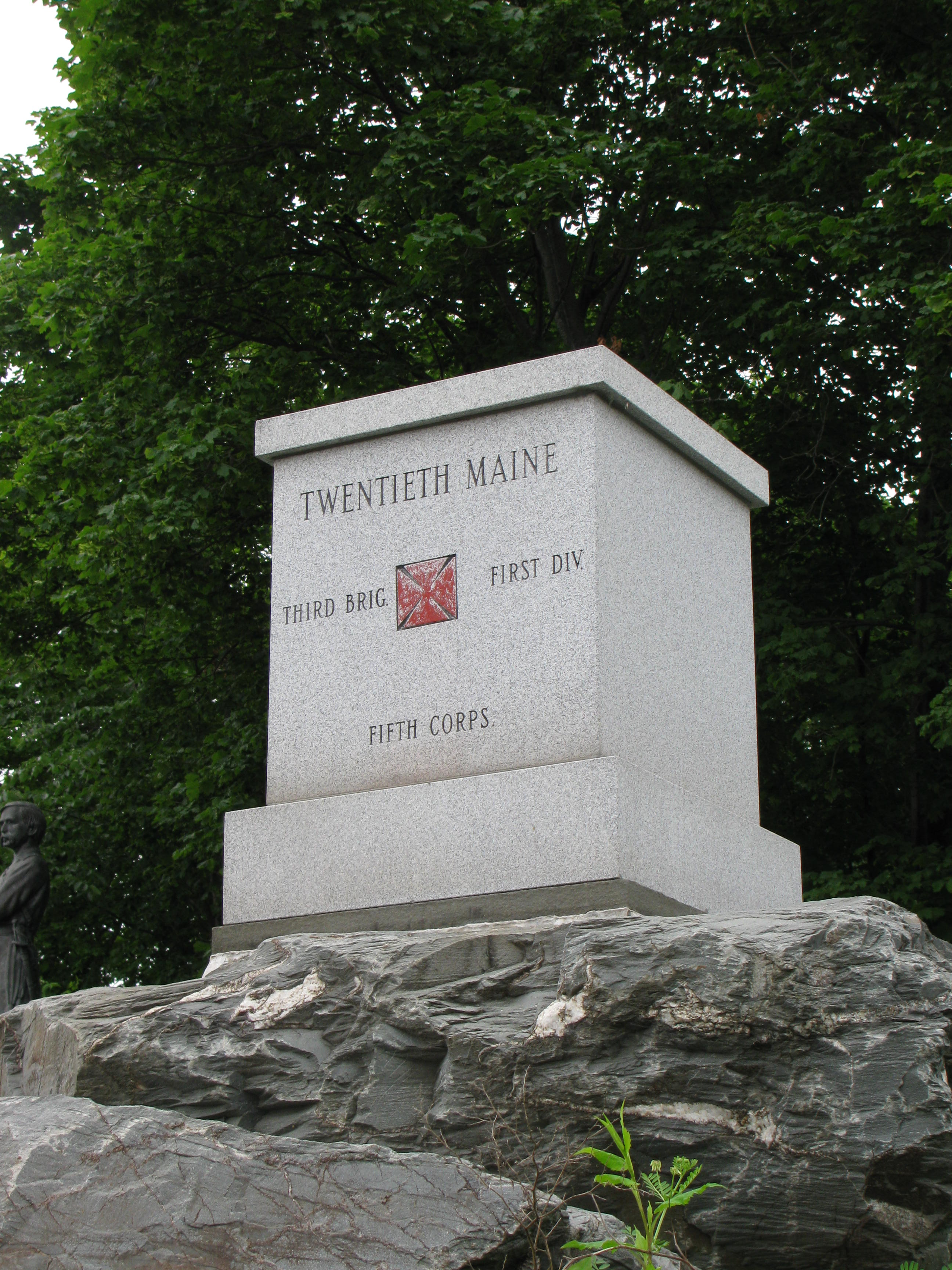
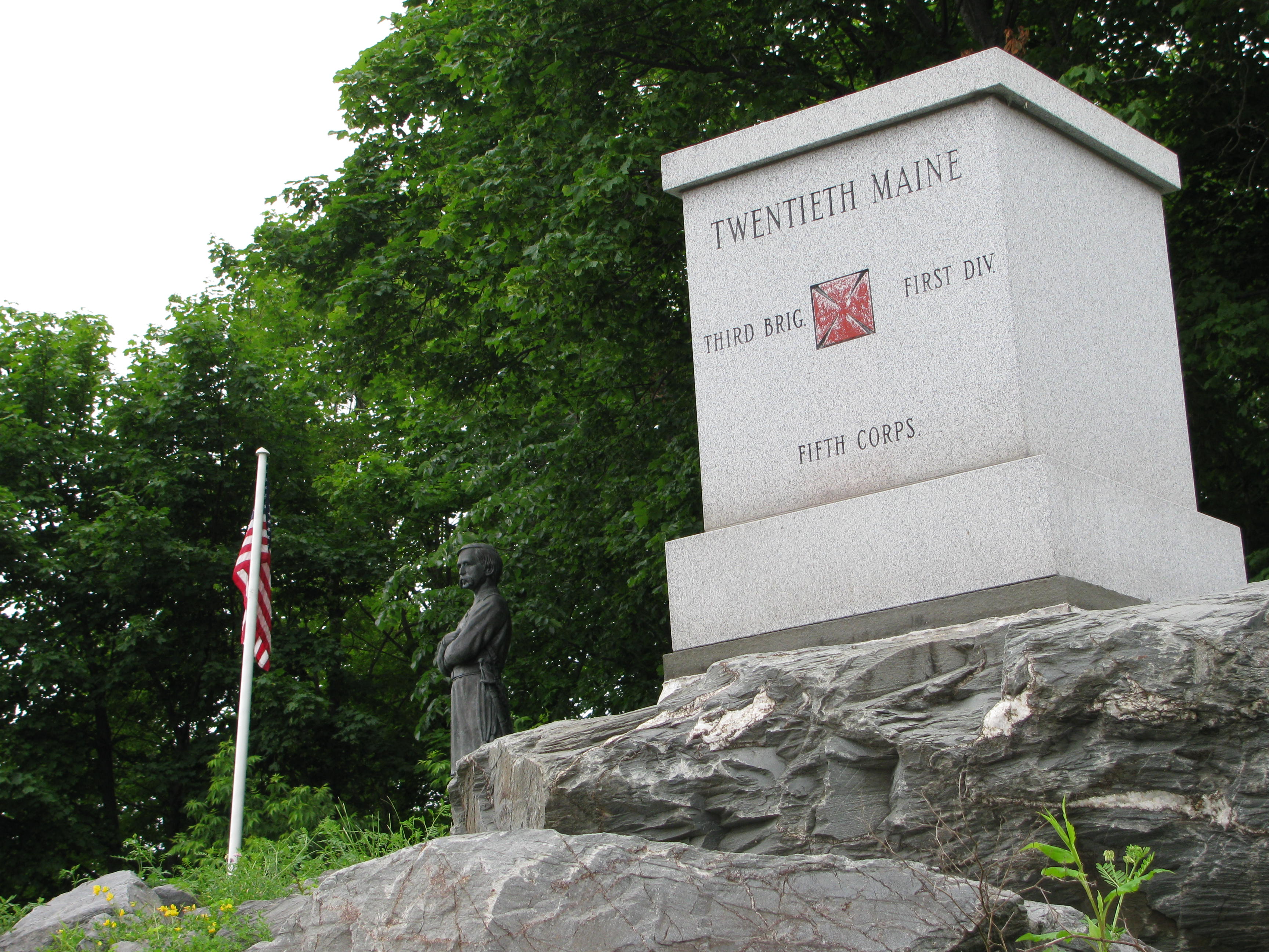
… is the copy of the 20th Maine monument that sits on Little Round Top in Gettysburg … This view was taken at approximately 6:30 AM on Wednesday, June 29, 2011.
LBG Christina Moon walks down to the bottom of the hill at Chamberlain Freedom Park and explains how the park got its name.
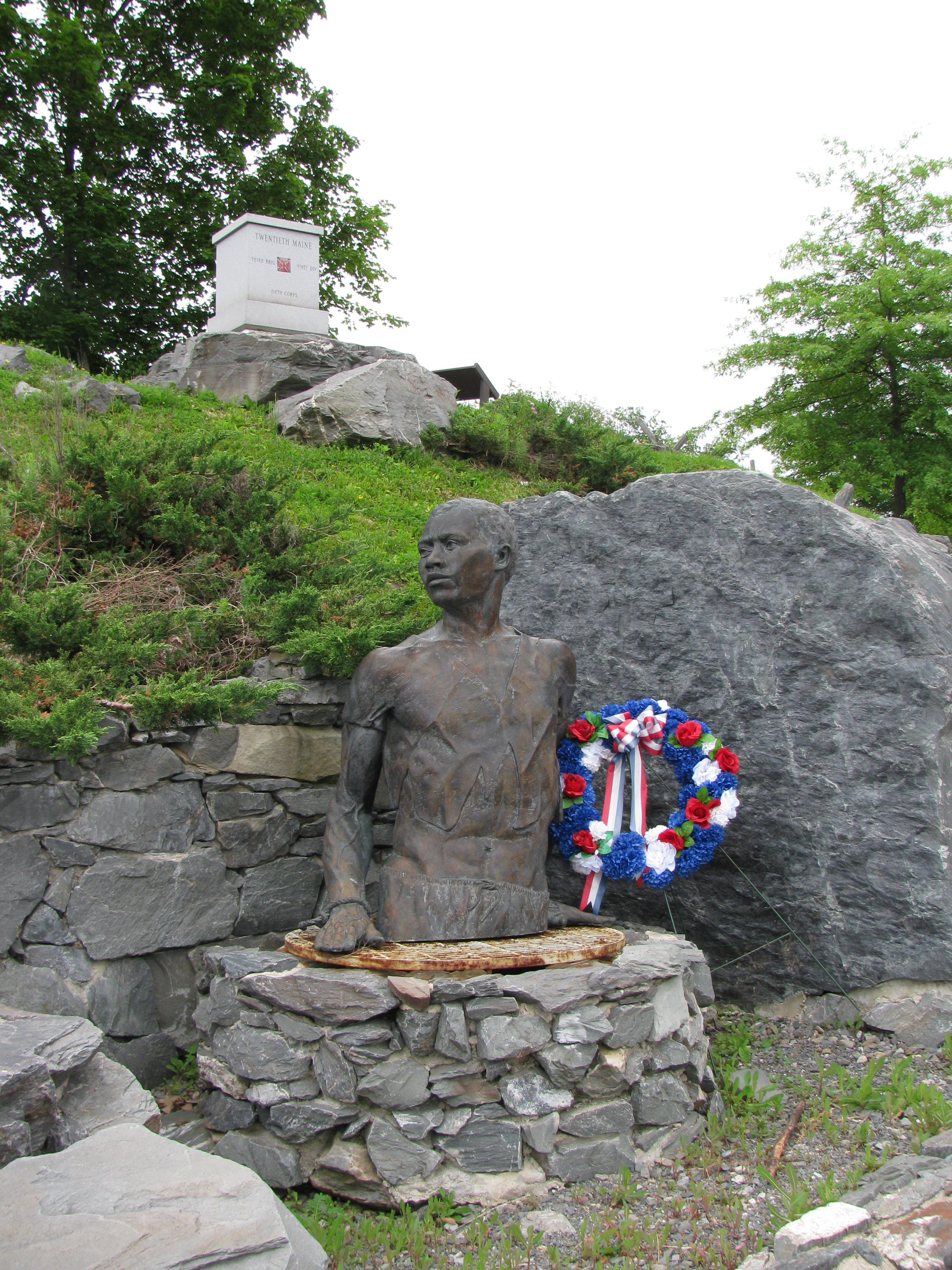
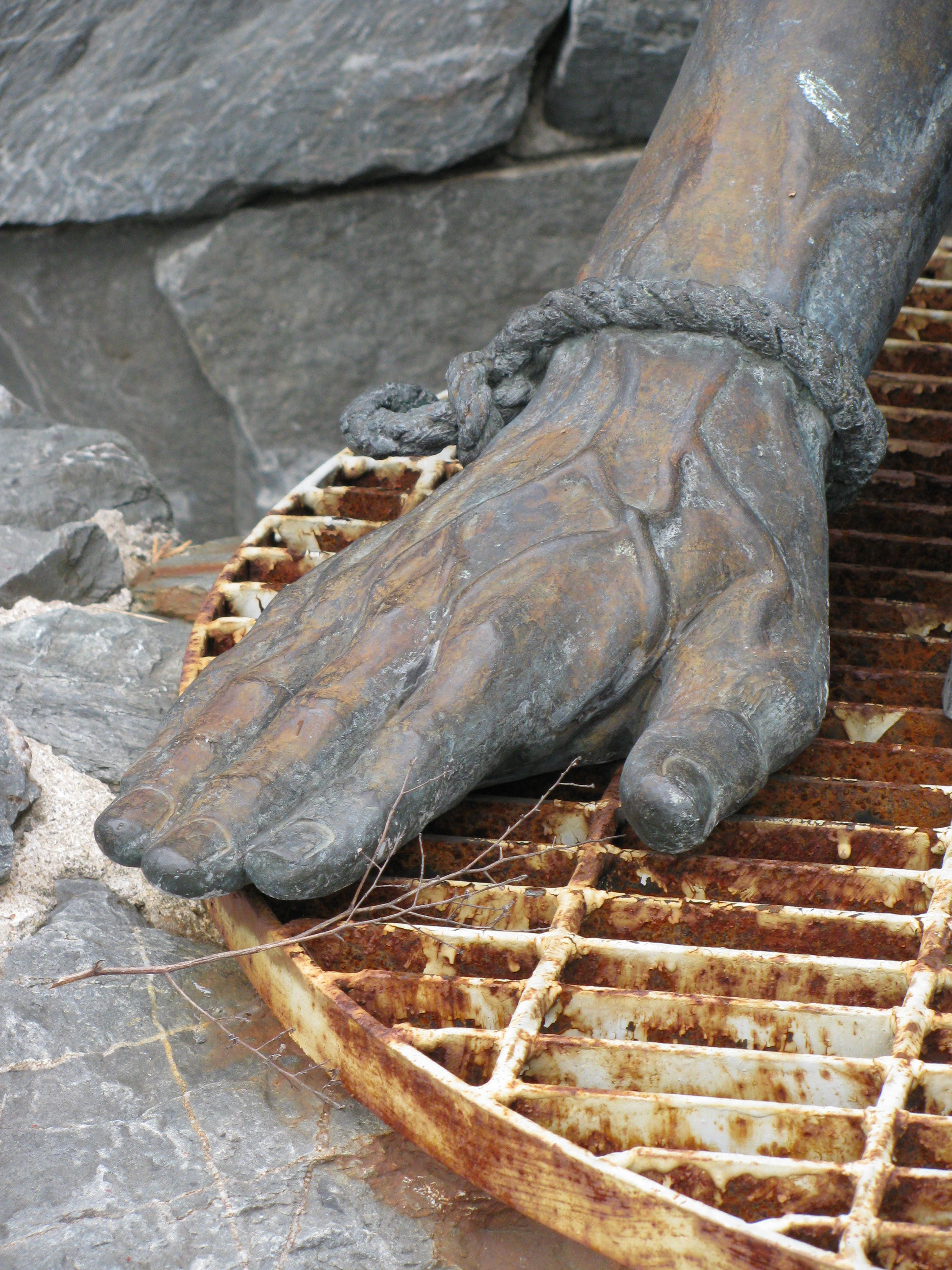
… and below that is a statue representing an escaped slave who might have passed through the Holyoke House and the tunnel that comprised part of the “Underground Railroad.” This view was taken at approximately 6:30 AM on Wednesday, June 29, 2011.

This view was taken at approximately 6:30 AM on Wednesday, June 29, 2011.
This view was taken at approximately 6:30 AM on Wednesday, June 29, 2011.
LBG Christina Moon shows us the railroad tracks that symbolize the Underground Railroad.

These railroad tracks which Christina mentioned in the previous video also border Chamberlain Freedom Park … This view was taken at approximately 6:30 AM on Wednesday, June 29, 2011.
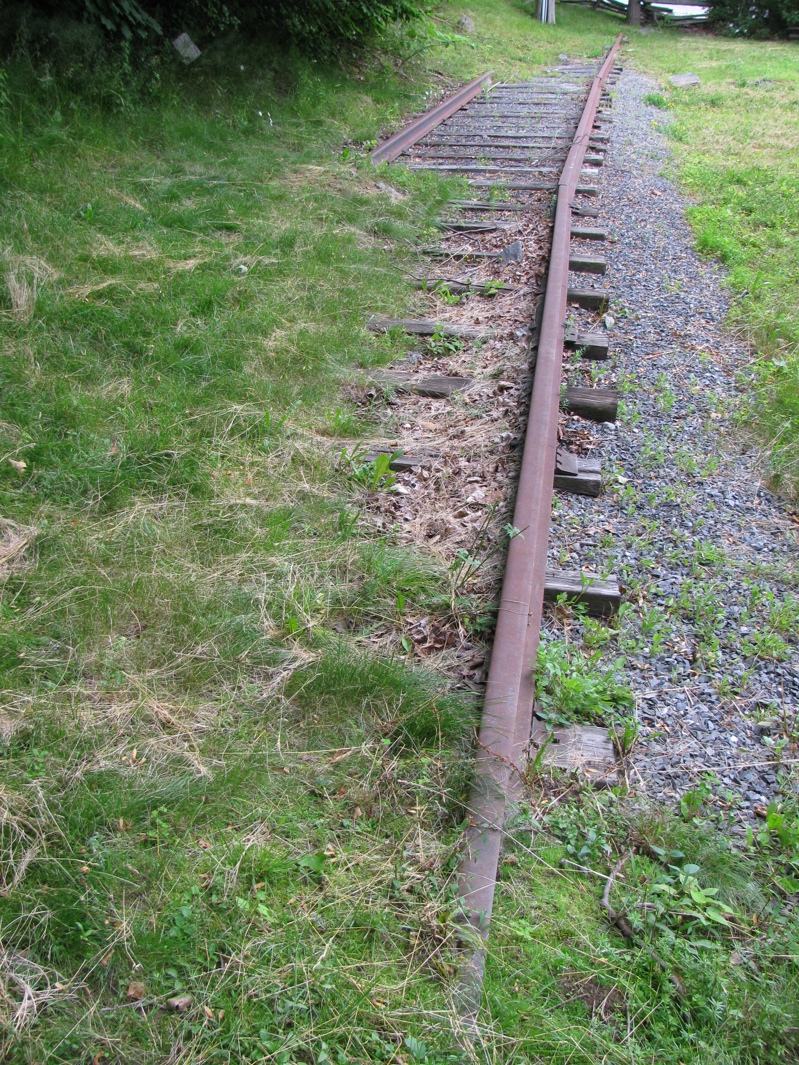
… and serve as another reminder of the site’s historical significance in relation to the abolitionist movement in the northern states. This view was taken at approximately 6:30 AM on Wednesday, June 29, 2011.
Parks that commemorate sites of historical significance which aren’t managed by the government apparently need sponsors. This view was taken at approximately 6:30 AM on Wednesday, June 29, 2011.

We hope you’ve enjoyed this look at Chamberlain Freedom Park in Brewer, Maine, and our thanks to LBG Christina Moon for presenting this content. This view was taken at approximately 6:30 AM on Wednesday, June 29, 2011.

In our next posting on Chamberlain in Maine, LBG Christina Moon will take us on a tour of the Joshua Chamberlain House in Brunswick, Maine. This view was taken at approximately 6:30 AM on Wednesday, June 29, 2011.