

Licensed Battlefield Guide Phil Lechak begins today’s tour from behind the Giant Store at its southeast corner. This was the area of the Operating Tents. This view was taken facing northwest at approximately 2:30 PM on Sunday, November 9, 2008.
This is the second installment of Licensed Battlefield Guide Phil Lechak’s tour of Camp Letterman. In our previous post, we covered the general history of the site. Today we will cover the Operating Tent Area, and the view from what Phil calls “Hospital Hill.”
To contact Phil Lechak, click here to reveal his email address.
See our posts on:
Camp Letterman Part 1 on November 15, 2008.
National Park Service seasonal ranger program on Civil War Medicine on August 5, 2008.
National Park Service seasonal ranger program on nurse Salome “Sallie” Myers on August 1, 2008.
National Park Service seasonal ranger program on nurse Cornelia Hancock on July 24, 2008.
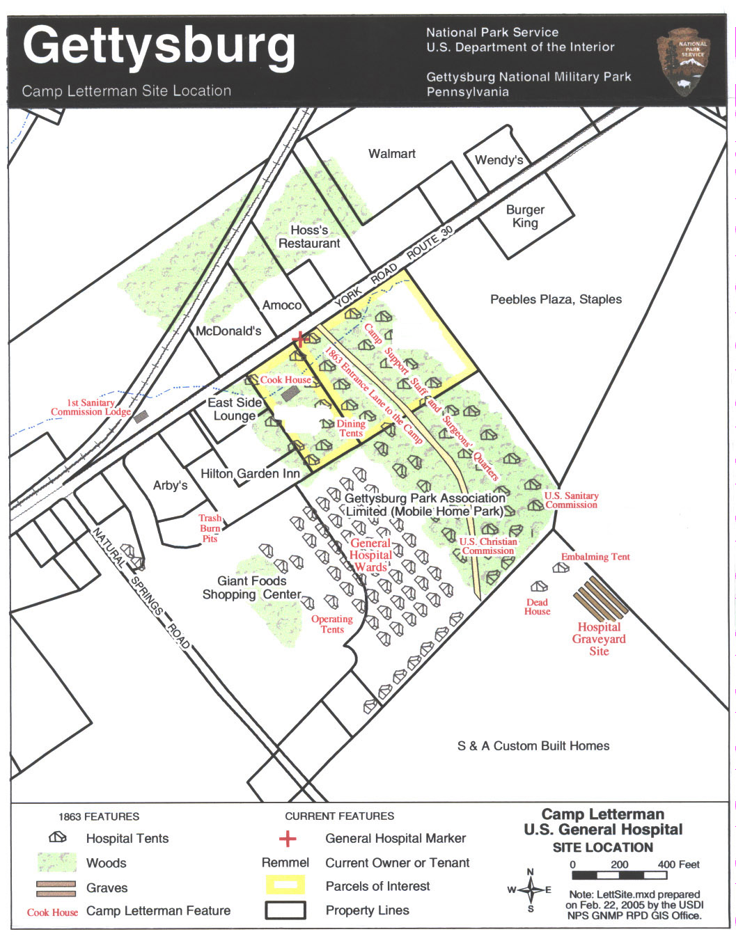
This map created by the National Park Service in 2005 shows the Camp Letterman area with modern locations labeled. The Gettysburg Park Association Limited (Mobile Home Park) no longer exists. The mobile homes are now gone. This map was created on February 22, 2005 by the United States Department of the Interior, and the National Park Service.

This map shows Camp Letterman in 1863 with different locations within the camp labeled in red. This map was created on February 22, 2005 by the Department of the Interior and the National Park Service.
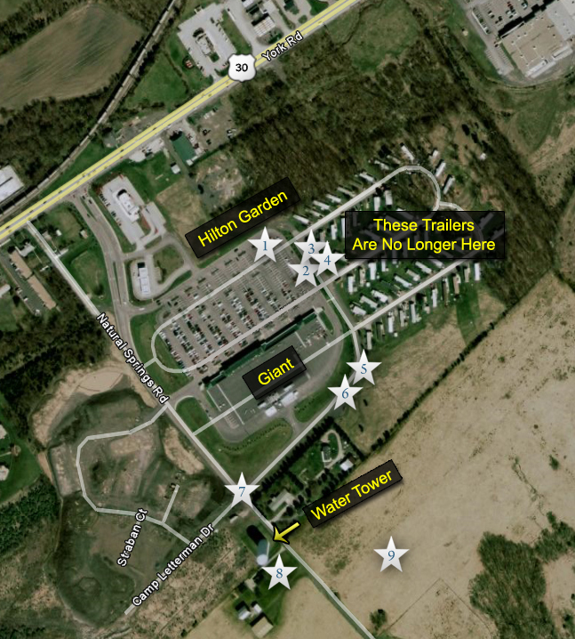
This is a view of the site with locations where we took the videos numbered inside a white star. The mobile homes are no longer in this location. Videos 1-4 may be seen in our previous post on Camp Letterman. This map was created on November 16, 2008.
In Video #5 (Videos 1-4 were on our first post of Camp Letterman), Phil points out where the operating tents were located.
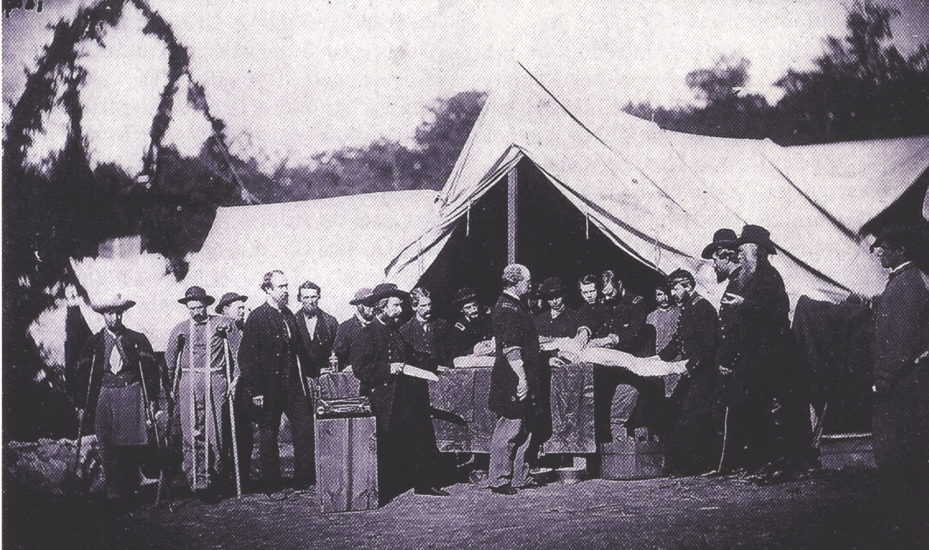
This photograph by Peter S. Weaver in October, 1863 shows one of the operating tents. It is very likely that the amputation of the person’s leg is not being staged, because in the next photograph, there is ample evidence that the scene was real. This view was looking northeast in October, 1863.

A companion view to the previous scene, this is an actual operation of someone’s left arm. There is a severed stump near the shoulder, and bloodstains on the table covering. This view was looking northeast in October, 1863.

A view from the operating room site. Remember, the ground where the photographer is was not this low in 1863. The trees of the woods near the Camp Letterman “Dining Tents” are in the left background. This view was taken facing north at approximately 4:30 PM on Monday, November 17, 2008.
In Video #6, Phil Lechak takes us from looking northwest at the operating tent area, back to the northeast where the convalescent tents, or “General Hospital Wards,” were located. He explains how they were able to move so many men through the camp. View facing northwest to northeast at approximately 2:30 PM on Sunday, November 9, 2008.

We are looking down Natural Springs road and its intersection with Camp Letterman Road on the right. View is facing northwest at approximately 2:30 PM on Sunday, November 9, 2008.
In Video #7, Phil explains how recovering soldiers could have seen large parts of the battlefield from this spot. View facing northwest to southwest at approximately 2:30 PM on Sunday, November 9, 2008.

Camp Letterman’s view of the cupola at the Lutheran Theological Seminary on Seminary Ridge with a telephoto lense. View facing west courtesy of Phil Lechak.

Camp Letterman’s view of the Evergreen Cemetery Gatehouse on Cemetery Hill, the New York Monument in the Soldiers’ National Cemetery, and Cemetery Hill’s light green or light blue water tank. View facing west courtesy of Phil Lechak.
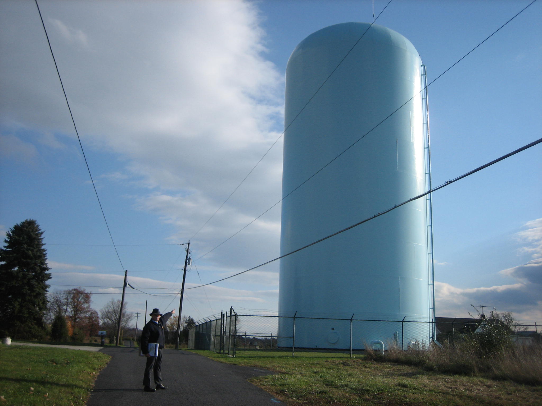
Phil with his favorite light green/light blue water tank on “Hospital Hill.” View facing southwest at approximately 2:30 PM on November 9, 2008.
In Video #8, we have continued walking southwest on Natural Springs Road to the other (southwest) side of the water tank. Phil points out how one can see Big Round Top from this location. View facing southwest at approximately 2:30 PM on Sunday, November 9, 2008.
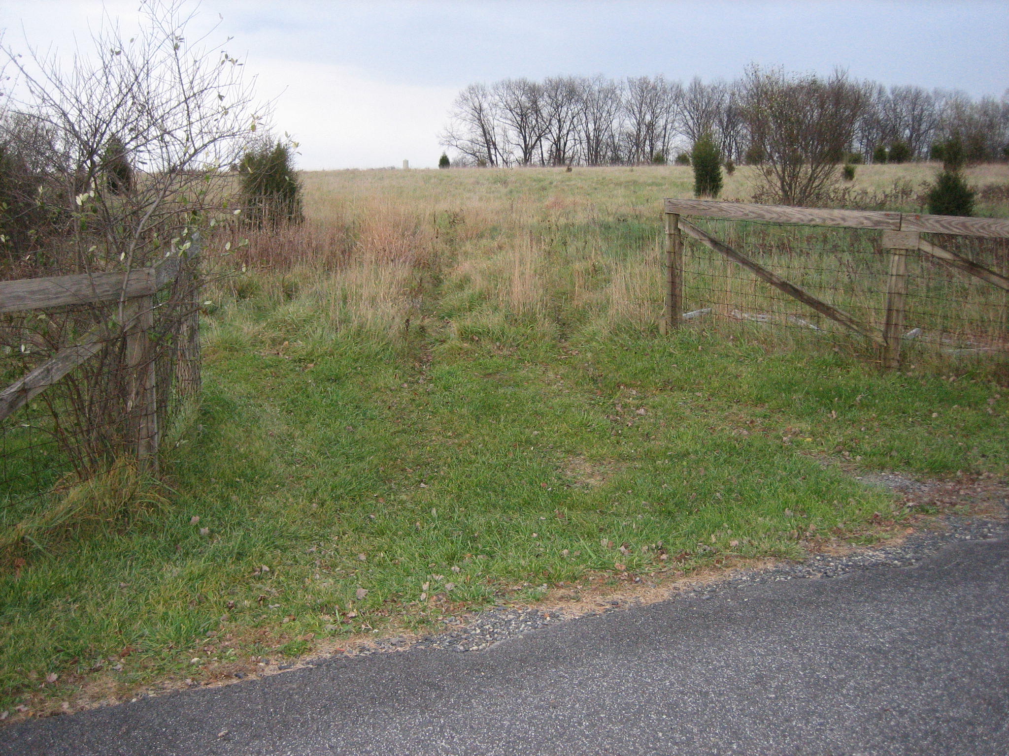
We are now turning left off of Natural Springs Road and moving to the northeast. View facing east at approximately 4:30 PM on Monday, November 17, 2008.

As we have moved northeast, Phil is pointing out that we are behind a row of seven tents shown on his map. View facing northeast at approximately 2:30 PM on Sunday, November 9, 2008.
In Video #9, Phil explains our location behind a row of cedar trees. We will continue in this direction toward the graveyard and the embalming tents on our next visit to Camp Letterman. View facing north at approximately 2:30 PM on Sunday, November 9, 2008.