
Gettysburg National Military Park seasonal ranger Raffi Andonian led Monday afternoon’s Battle Walk. The subject was the advance of Benning’s Georgia Brigade. The terrain was rough, but one received an appreciation of the ground covered by these men 145 years ago. This view is of the group going down Benning’s Knoll toward’s the Houck’s Ridge/Devil’s Den area. Devil’s Den is the first ridge marked by the large tree. Little Round Top is in the background. This view was taken from the west facing east at approximately 4:30 PM on Monday, July 28, 2008.
Raffi Andonian, a seasonal park ranger at Gettysburg National Military Park led Monday afternoon’s Battle Walk. The subject was the advance of Henry Benning’s Georgia Brigade on the afternoon of July 2, 1863. The group went through some interesting terrain. They began at Warfield Ridge near West Confederate Avenue around 3:30 PM, and finished at Plum Run Gorge, or the Slaughter Pen around 5:15 PM.
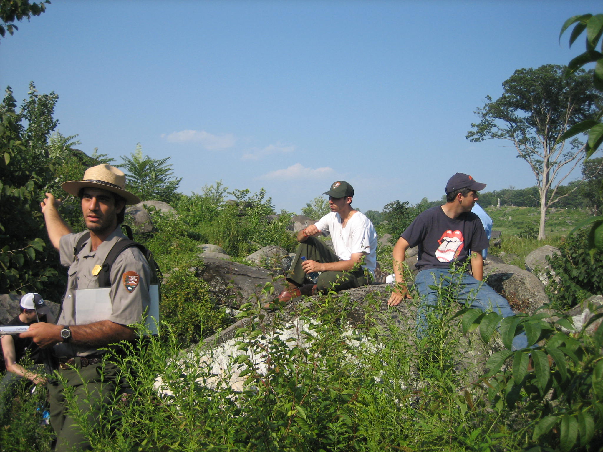
Raffi Andonian explains to the group the object of today’s walk in an area overlooking the Emmitsburg Road area, and the Eisenhower Farm, where Benning’s Brigade was in reserve before they made their advance. This view was taken from the east facing west at approximately 3:30 PM on Monday, July 28, 2008.
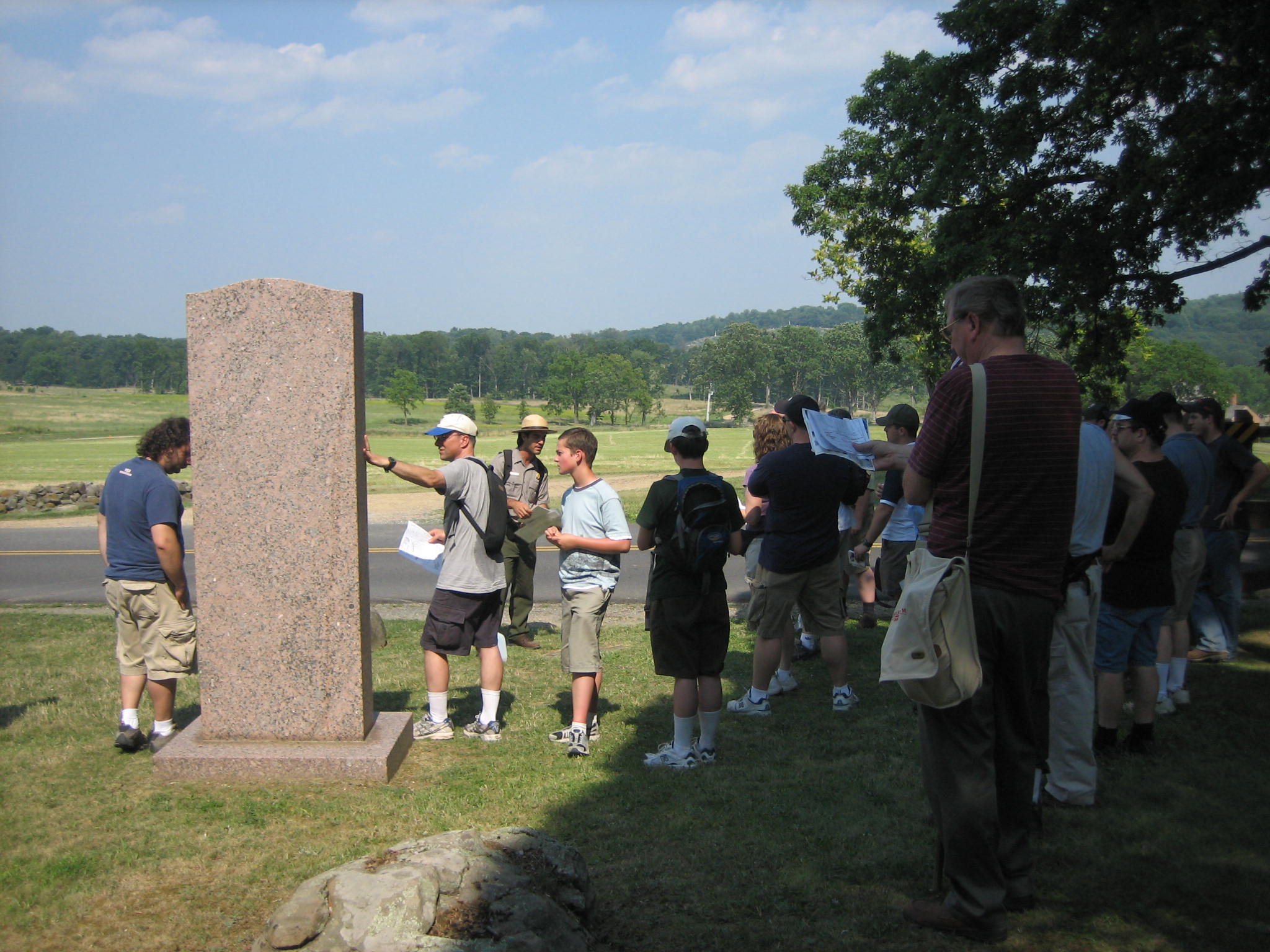
Raffi then spoke to the group near the Texas State monument near West Confederate Avenue. Benning’s Georgians were in support of Robertson’s Texas Brigade and Law’s Alabama Brigade to the right or south. Raffi had provided some handouts, including maps, which were very helpful. This view was taken from the west facing east at approximately 3:45 PM on Monday, July 28, 2008.
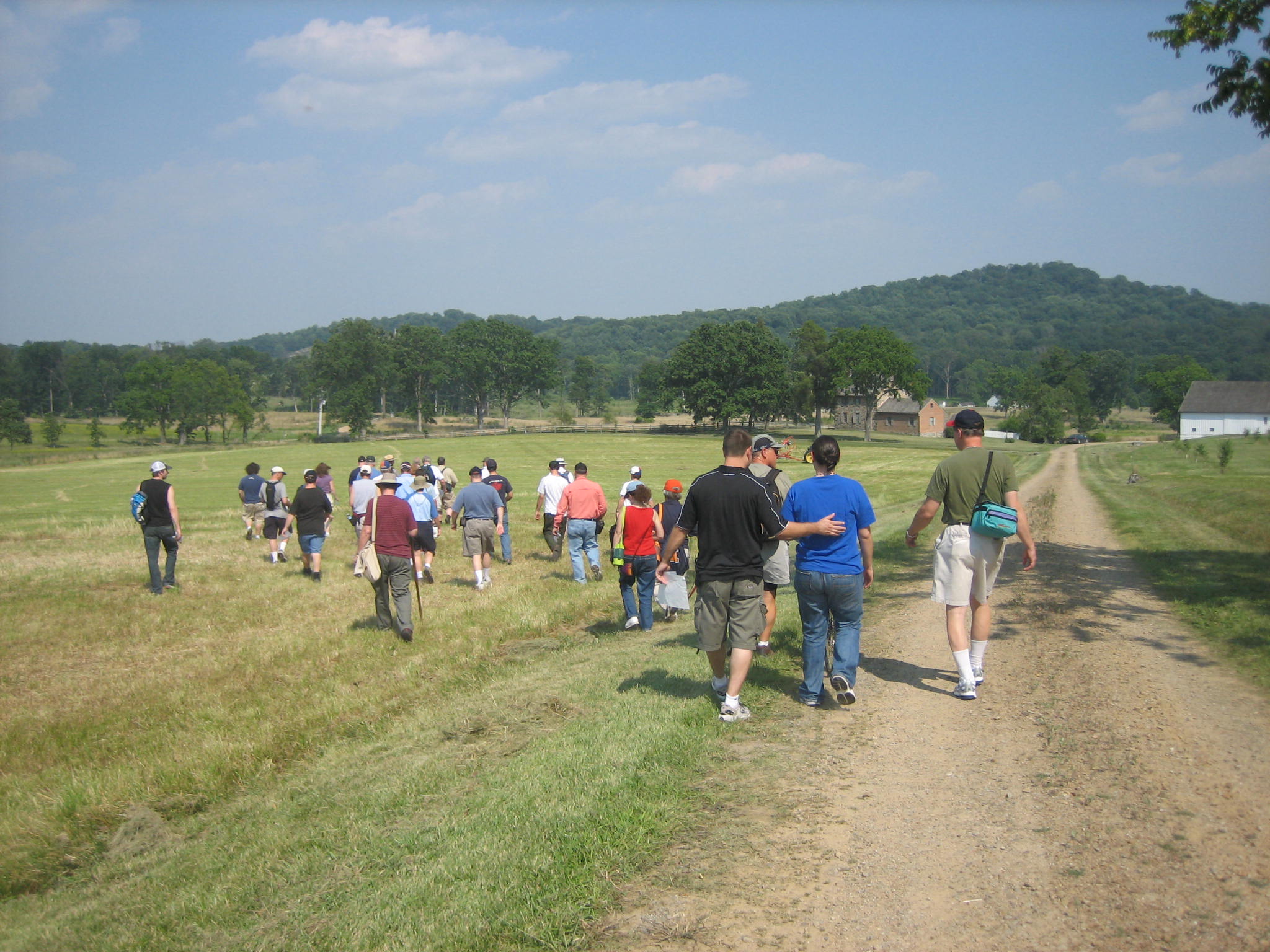
The group then began to walk across the fields to the Bushman Farm, which are the buildings to the right. Big Round Top is in the right background. Little Round Top is in the center and left background. This view was taken from the west facing east at approximately 4:00 PM on Monday, July 28, 2008.
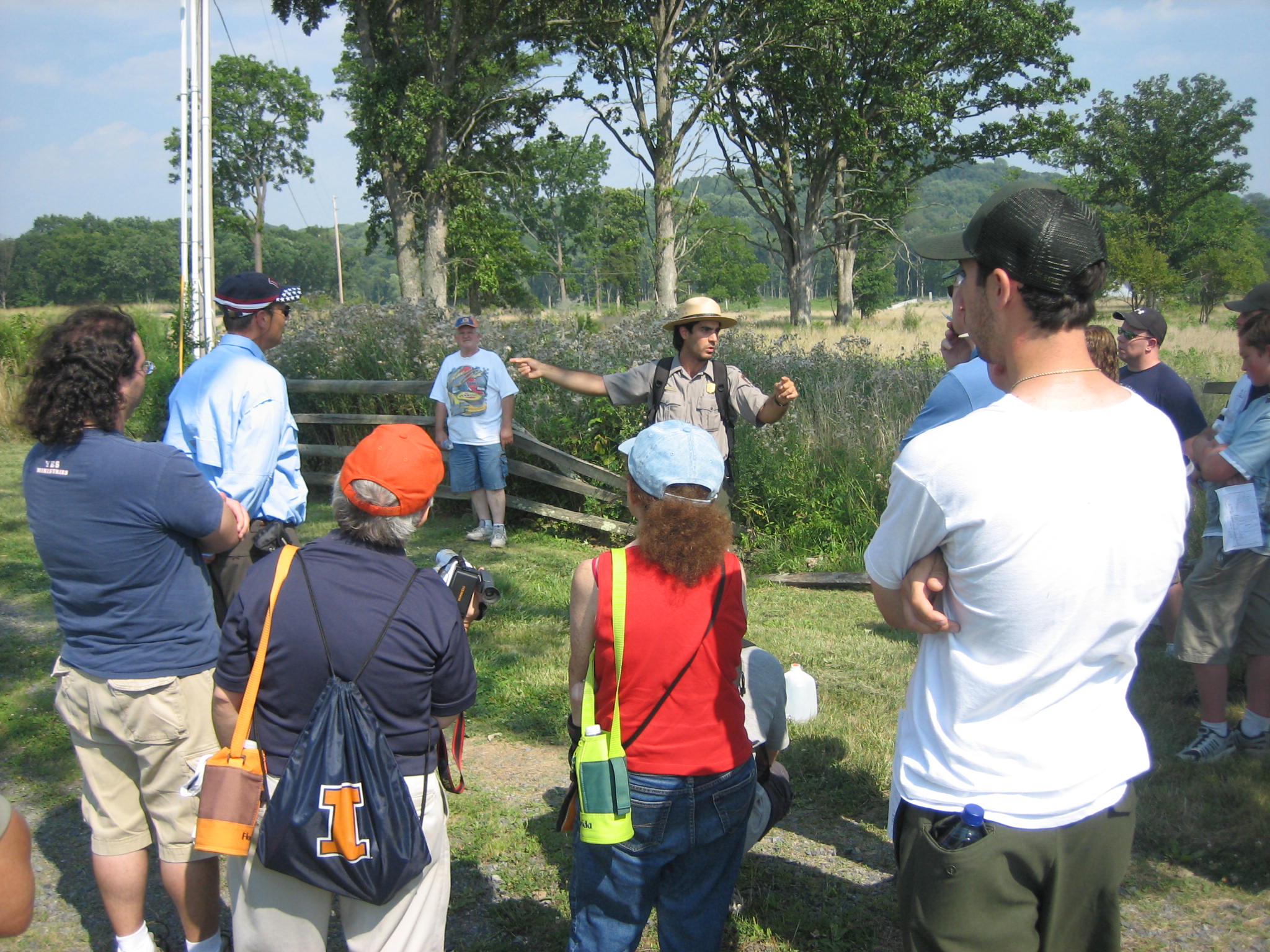
Just past the Bushman Farm, Ranger Andonian explains how Berdan’s Sharpshooters were hitting the Texans and Alabamians in front of the Georgians in this area. This view was taken from the northwest facing southeast at approximately 4:00 PM on Monday, July 28, 2008.
In this same area, Raffi read an account of a member of the 17th Georgia near the right side of Benning’s Brigade. This account discusses the artillery hitting this area from the Peach Orchard and Houck’s Ridge. This view was taken from the northwest facing southeast at approximately 4:00 PM on Monday, July 28, 2008.

The Bushman farm is on the left. Benning’s Brigade advanced out of the trees on Warfield Ridge in the background, and down the slope to this position. This view was taken from the northeast facing southwest at approximately 4:00 PM on Monday, July 28, 2008.
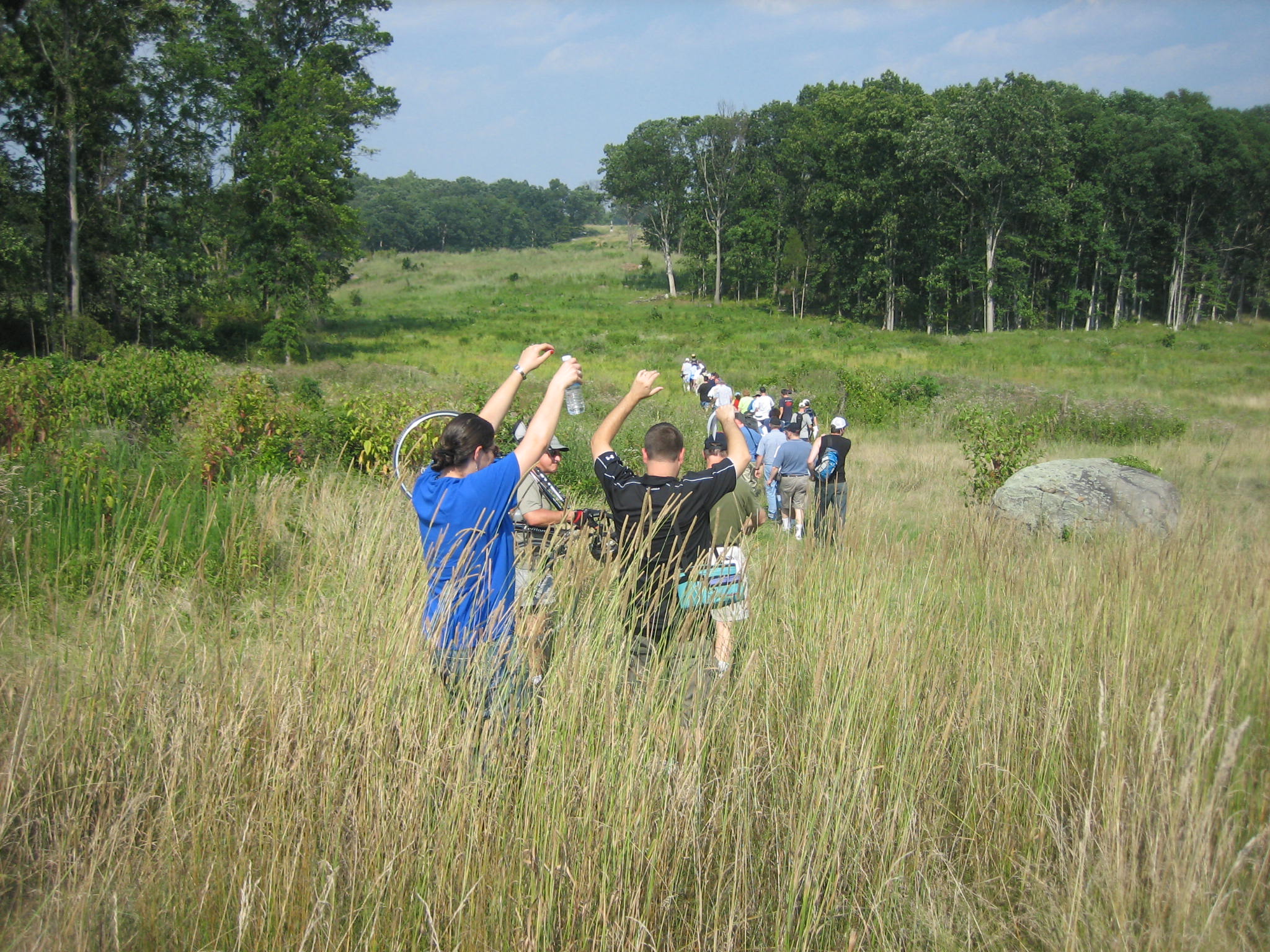
The group then moved toward Benning’s Knoll, which is east of Houck’s Ridge, and in the gap between the group of trees. The people in the back raising their arms are trying to avoid ticks latching on to their clothes as they advance through the tall grass, and bushes. This view was taken from the southwest facing northeast at approximately 4:00 PM on Monday, July 28, 2008.
This stop is near the Weikert farm, as it was known during the battle, and which later was known as the Timbers Farm. Benning Knoll is the next ridge to the east. Houck’s Ridge/Devil’s Den is the ridge marked by the large single tree. Little Round Top is in the distant background with the monuments. This view was taken from the west facing east at approximately 4:15 PM on Monday, July 28, 2008.

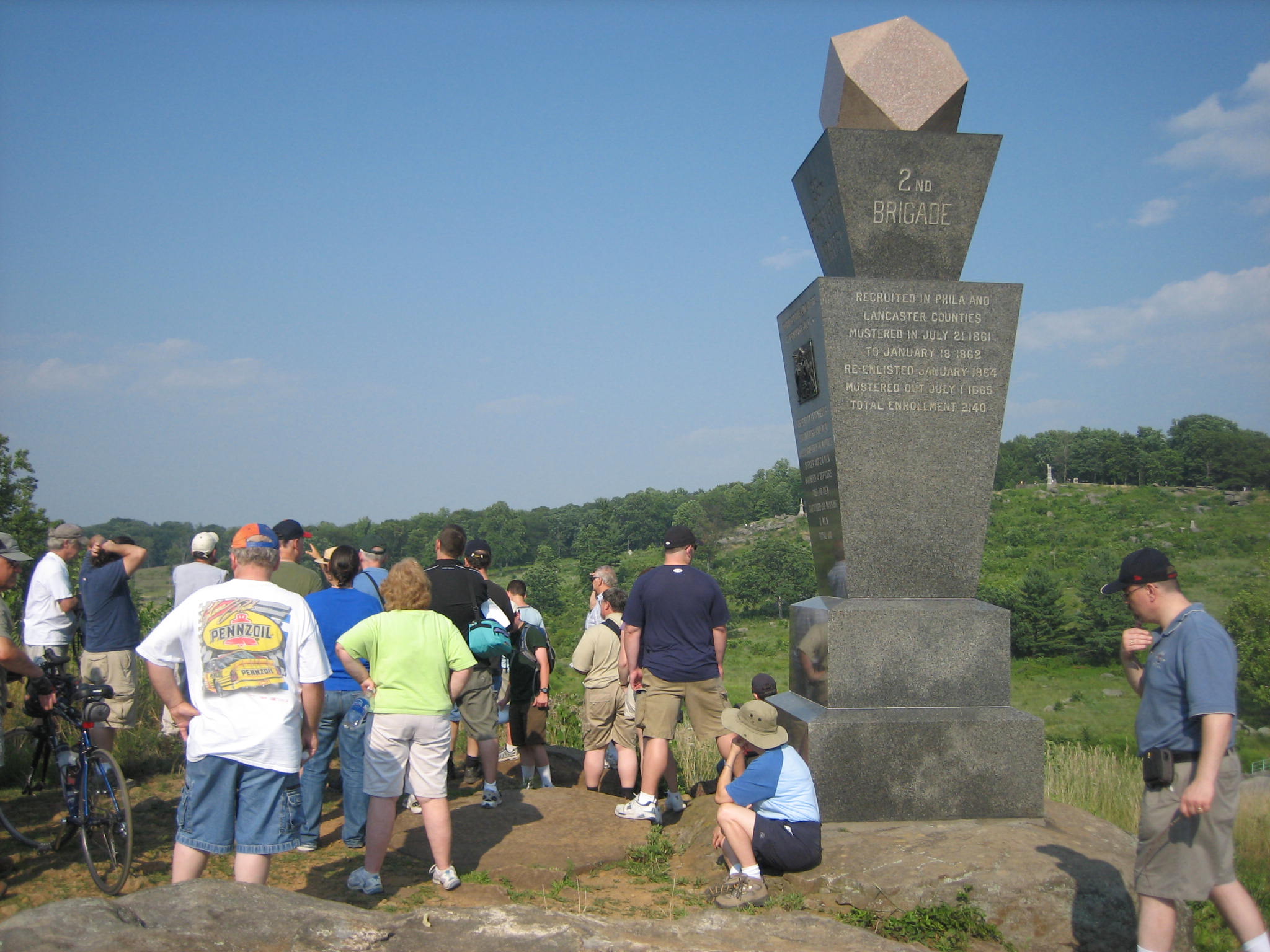
On Benning’s Knoll, Raffi explains that Benning Brigade goes on either side of the knoll, and becomes split into two halves. The right half consists of the 2nd and 17th Georgia. The left half is the 15th and 20th Georgia. The monument to the 124th New York Infantry Regiment on Houck’s Ridge/Devil’s Den is seen in the background to the left of Raffi. This view was taken from the southwest facing northeast at approximately 4:15 PM on Monday, July 28, 2008.
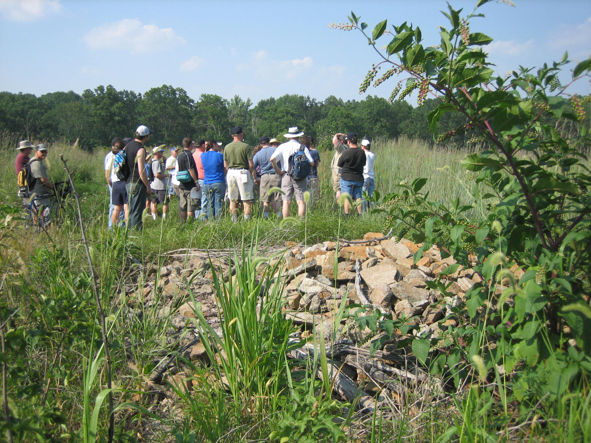
On Benning’s Knoll, Raffi explained that these piles of rock may have been put up by the 15th Georgia of Benning’s Brigade when they began to retreat from this area on July 3rd. This view was taken from the southwest facing northeast at approximately 4:15 PM on Monday, July 28, 2008.
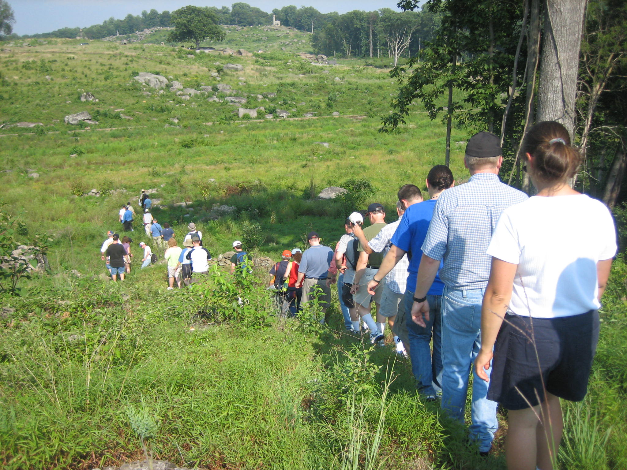
The group advanced off Benning’s Knoll, as shown in the first photograph, and had to cross Rose’s Run single file in this location. This view was taken from the northwest facing southeast at approximately 4:30 PM on Monday, July 28, 2008.
At the foot of Houck’s Ridge/Devil’s Den (marked by the single tree in the background) Raffi reads an account of what happened to Lieutenant Colonial William Harris of the 2nd Georgia as his horse was shot attempting to advance in this area. This view was taken from the west facing east at approximately 4:30 PM on Monday, July 28, 2008.

The group then advanced up the slope of Houck’s Ridge, following in the footsteps of the 15th and 20th Georgia. This view was taken from the northwest facing southeast at approximately 4:30 PM on Monday, July 28, 2008.
Near the top of Houck’s Ridge, the group crossed the stone wall at the top of the triangular field one at a time. This view was taken from the northeast facing southwest at approximately 4:30 PM on Monday, July 28, 2008.
After crossing the stone wall, Raffi reads an account of a member of the 20th Georgia Infantry regiment who attacked up the hill in this area. This view was taken from the southeast facing northwest at approximately 4:30 PM on Monday, July 28, 2008.
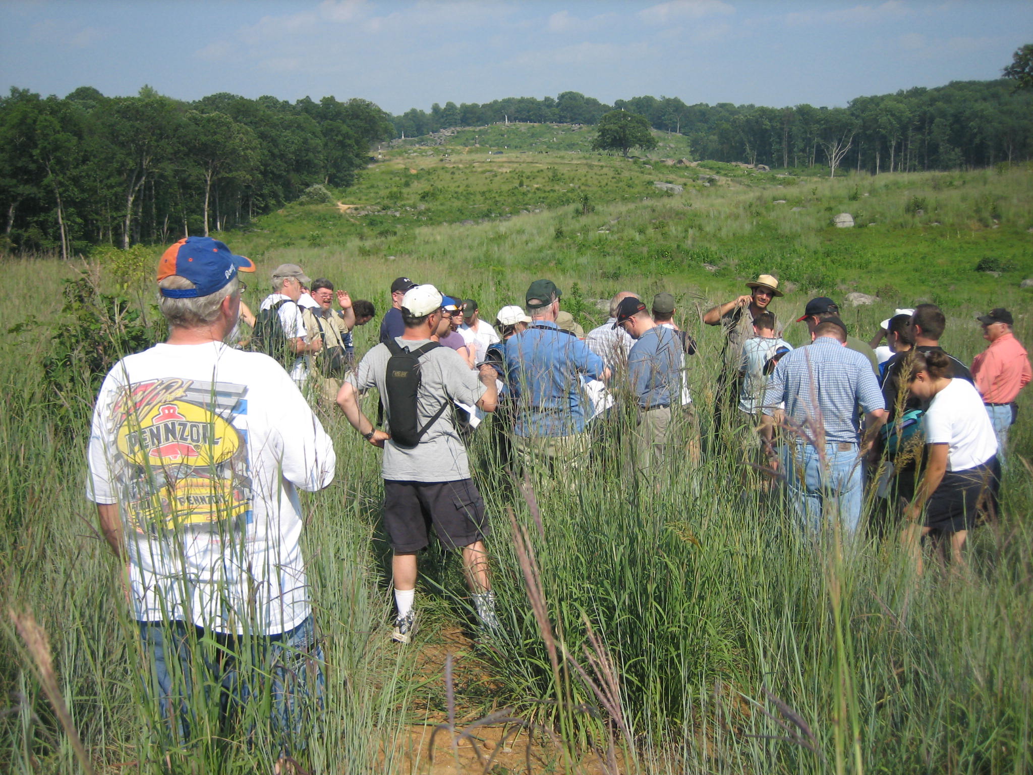
At the top of Houck’s Ridge, near the monument to the 99th Pennsylvania Infantry Regiment, Raffi explains how the cannon from Smith’s 4th New York Battery were captured here. He then explained that Benning repulsed a counterattack from Burbank’s and Day’s Brigades of U.S. Regulars in this area. Little Round Top is in the background. This view was taken from the southwest facing northeast at approximately 4:30 PM on Monday, July 28, 2008.
The group has now moved to the southeast side of Devil’s Den to the area of the Slaughter Pen or Plum Run Gorge. Raffi describes the fighting here. This view was taken from the southwest facing northeast at approximately 5:00 PM on Monday, July 28, 2008.
The Georgians are finally stopped in this Plum Run Gorge or Slaughter Pen area where the 2nd Georgia and 17th Georgia fought. Lieutenant Colonel Harris of the 2nd Georgia was killed in this area attempting to lead his men through the gorge. Little Round Top is in the right background. This view was taken from the southwest facing northeast at approximately 5:00 PM on Monday, July 28, 2008.