

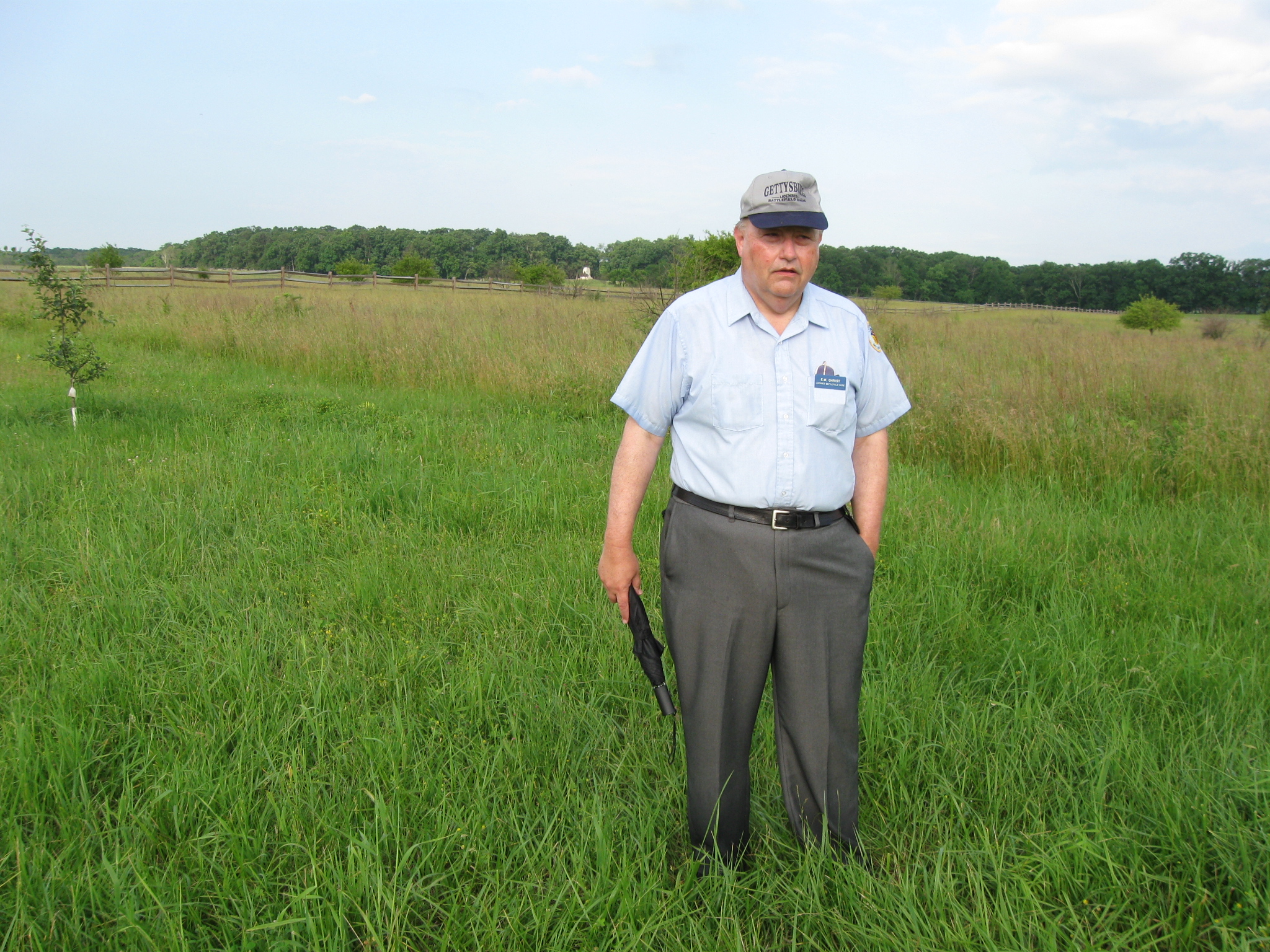
Gettysburg Licensed Battlefield Guide Elwood “Woody” Christ is the author of the book, Over a Wide, Hot,…Crimson Plain: The Struggle for the Bliss Farm at Gettysburg, July 2nd and 3rd, 1863. He is the host for our series on the fighting for the Bliss Farm. Woody is standing at the location of the Bliss Farm. The treeline on Seminary Ridge, is approximately 600 yards behind (west of) Woody. The light colored Virginia State Monument is in the left background. This view was taken facing southwest at approximately 8:15 AM on Saturday, June 13, 2009.
In today’s post, the Confederate and United States soldiers arrive at the Bliss Farm area.
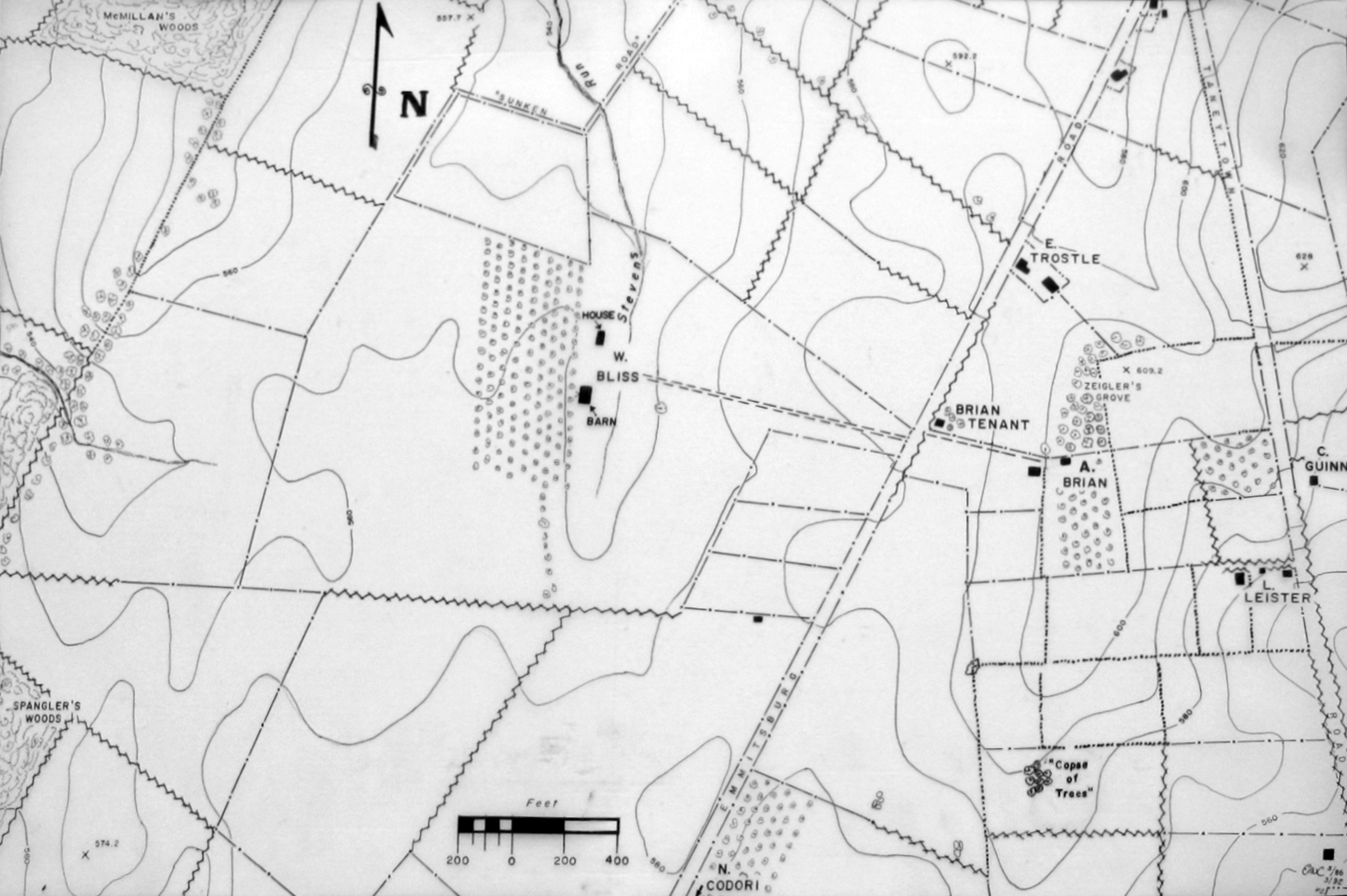
This map was provided to us by Woody Christ for the Bliss Farm posts.

This map shows the location of where our Bliss Farm videos were produced. Videos #1-#6 were shown in our previous Bliss Farm posts. Video #7 was taken at the crest of Cemetery Ridge near the stone wall south of the old Cyclorama building. Video #8 was taken at the monument to the 1st Delaware Infantry Regiment. Video #9 was taken north of the Brian/Brian House. Video #10 was taken along the Emmittsburg Road near the Brian/Bryan farm lane. Video #11 was taken at the fence marking the skirmish line of the 14th Connecticut. Videos #12-#16 were taken at the site of the Bliss House. Video #17 was taken south of the Bliss Barn. This map was created facing north at approximately 1:00 PM on Saturday, July 4, 2009.
In Video #15 (Videos #s 1-14 were seen in our previous Bliss Farm posts) Gettysburg Licensed Battlefield Guide Woody Christ reorients us to the location of the Bliss Farm in relation to Seminary and Cemetery Ridges. This view was taken facing east to west at approximately 8:15 AM on Saturday, June 13, 2009.
In Video #16 Licensed Battlefield Guide Woody Christ is standing in the same location as Video #15. He reorients us to north and south boundaries of the Bliss Farm from this location. He also describes the arrival of Scales’ North Carolina Brigade and the 1st Delaware Infantry to the Bliss Farm on July 2, 1863. This view was taken facing west to northwest to southwest at approximately 8:15 AM on Saturday, June 13, 2009.

Licensed Battlefield Guide Woody Christ is standing south of the Bliss Barn site. The subdivision, Colt Park, is in the right background. This view was taken facing north at approximately 8:15 AM on Saturday, June 13, 2009.
In Video #17 Woody Christ describes the arrival of Richard Anderson’s Confederate division, and how Confederates would use an oblique movement to isolate Union soldiers at the Bliss Farm from the Union battleline on Cemetery Ridge. This view was taken facing north to northwest to northeast at approximately 8:15 AM on Saturday, June 13, 2009.