
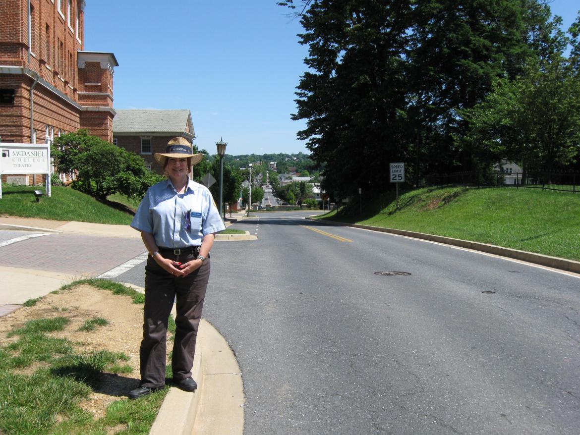

Gettysburg Licensed Battlefield Guide Hope Coates is a native of Westminster, Maryland. She is standing on College Hill (known as “the Commons” in 1863). The town of Westminster is behind her. In the background, we are looking down Main Street. This view was taken facing southeast at approximately 3:30 PM on Sunday, June 14, 2009.
Gettysburg Licensed Battlefield Guide Hope Coates begins a series on the Battle of Westminster, Maryland. This short fight (fought 146 years ago today on June 29, 1863) was one of those important events that contributed to the delay of Major-General J.E.B. Stuart’s Confederate cavalry from reaching Robert E. Lee’s Army of Northern Virginia before the Battle of Gettysburg. Hope is a native of Westminster, and has been a Licensed Battlefield Guide since 2006.
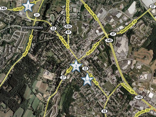
This map shows the location of where our Westminster videos were produced. Video #1 was on the campus of McDaniel College, now known as College Hill. Video #2 was taken on near the railroad. Video #3 and #4 were taken at the wayside markers at the Mary Shellman House. This map was created facing north at approximately 3:30 PM on Wednesday, June 17, 2009.
In Video #1 Gettysburg Licensed Battlefield Guide Hope Coates is standing on College Hill. She introduces us to her hometown, Westminster, Maryland. This view was taken facing southeast at approximately 3:30 PM on Sunday, June 14, 2009.

An 1862 map of Westminster, Maryland. This map, which is oriented to the northwest, was scanned at approximately 3:30 PM on Wednesday, June 17, 2009.

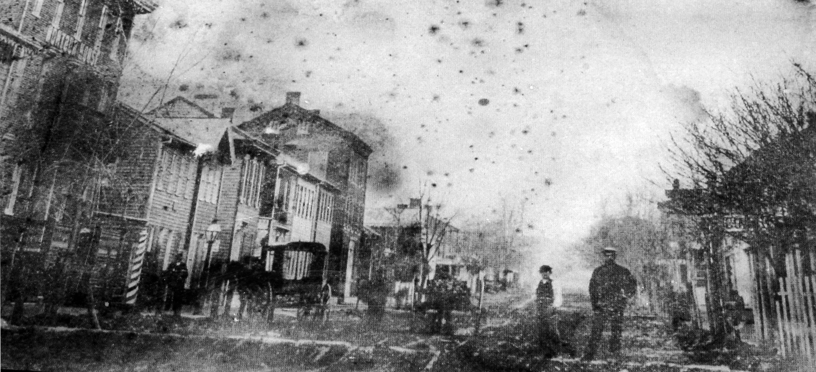
An 1868 view of Westminster’s Main Street. This view was taken facing southeast circa 1868.
Another 1868 view of Westminster’s Main Street. This view was taken facing northwest circa 1868.

Hope has now moved south of Railroad Street/Liberty Street by the railroad tracks. Main Street is running from right to left in the background. The tracks eventually lead to Baltimore. This view was taken facing north at approximately 3:30 PM on Sunday, June 14, 2009.
In Video #2 Hope is standing south of the Western Maryland Railroad tracks. She explains that during and following the Battle of Gettysburg supplies were brought to this location, and Herman Haupt had to build sidings along the track in order to unload the supplies. This view was taken facing north at approximately 3:30 PM on Sunday, June 14, 2009.

There are a couple of waysides north of the tracks at this location. This view was taken facing east at approximately 3:30 PM on Sunday, June 14, 2009.
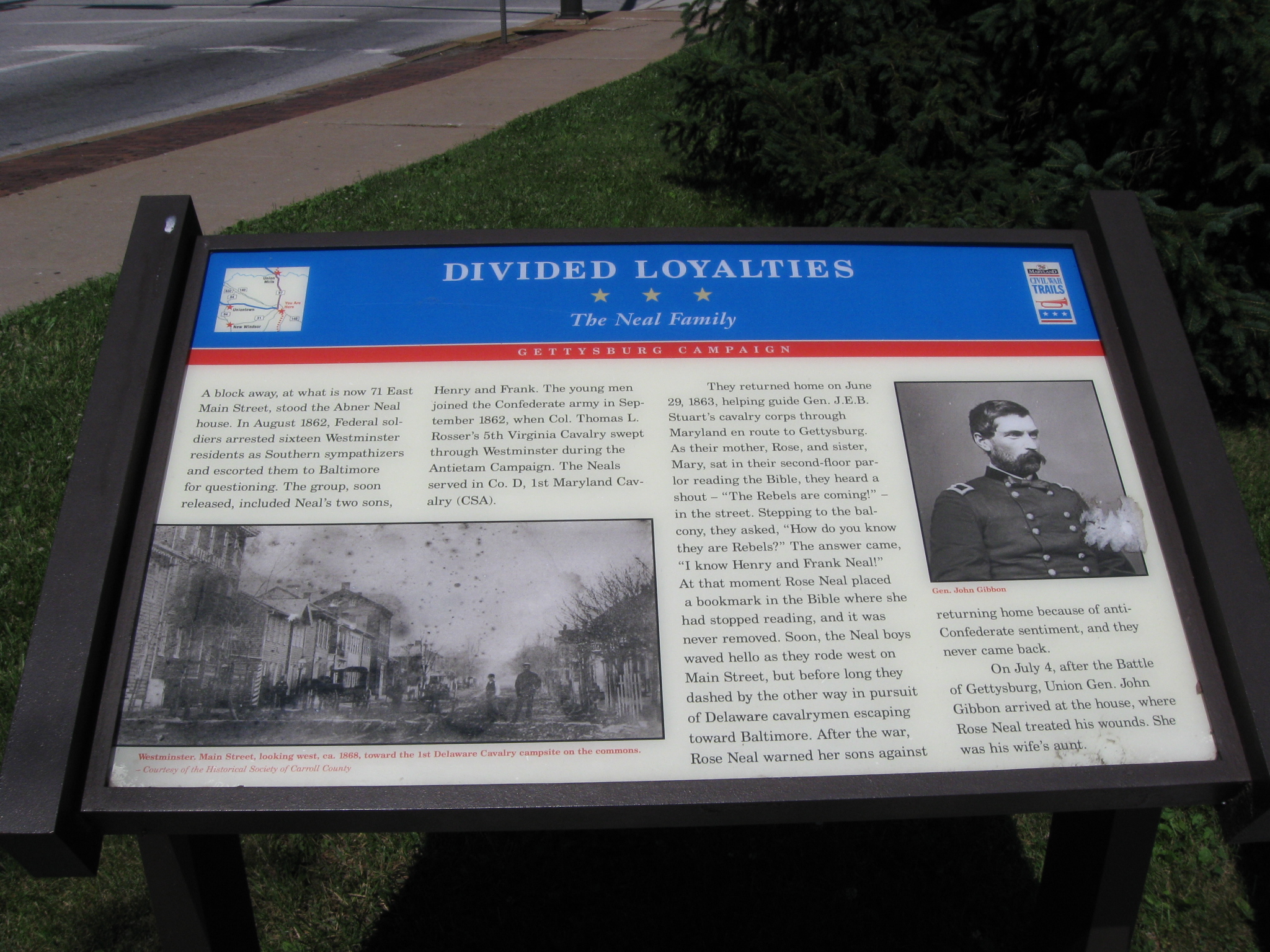
The first one tells the story of the Neal family, whose sons served in Stuart’s Cavalry. This view was taken facing northeast at approximately 3:30 PM on Sunday, June 14, 2009.
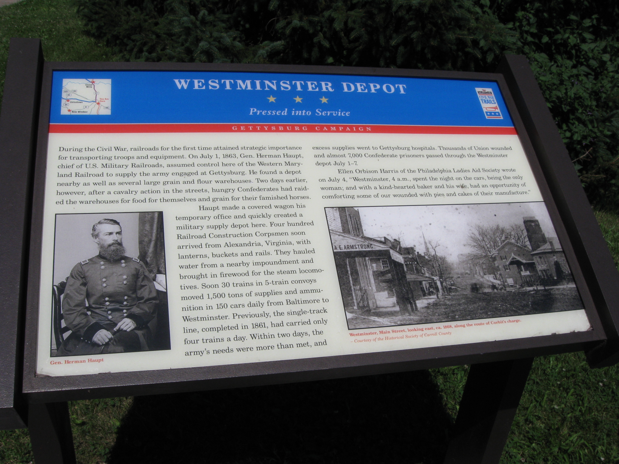
The second wayside details the supplies brought to Westminster and eventually to Gettysburg, and the wounded and prisoners following the Battle of Gettysburg that were brought to the depot and taken to Baltimore. This view was taken facing northeast at approximately 3:30 PM on Sunday, June 14, 2009.
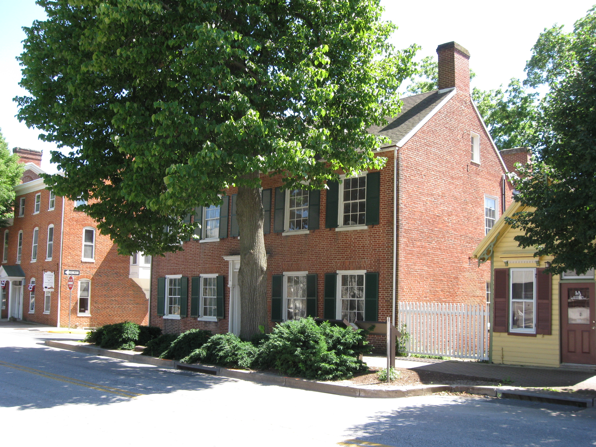
We have moved farther south along Main Street to the Mary Shellman House. This view was taken facing south at approximately 3:30 PM on Sunday, June 14, 2009.
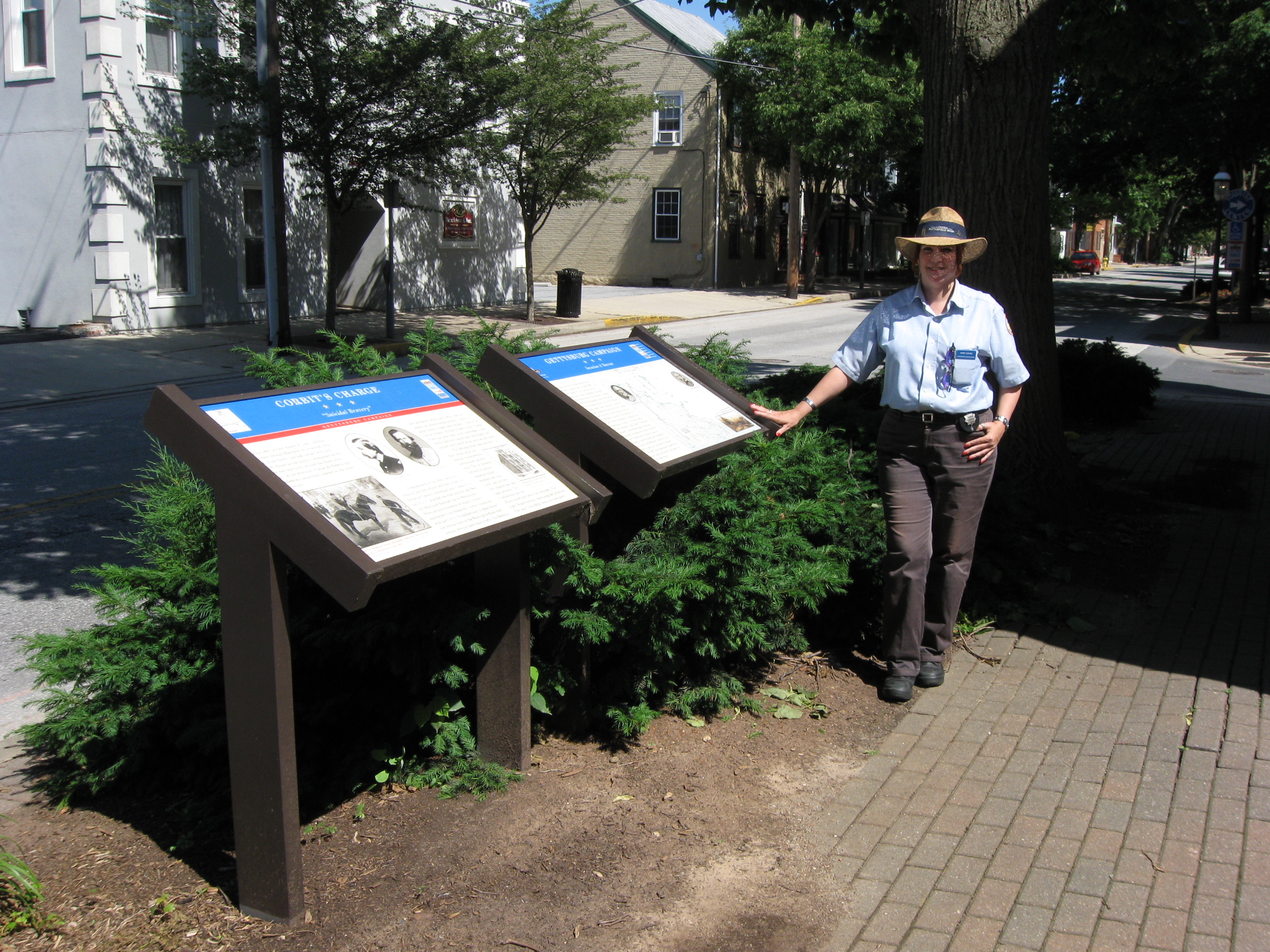
There are two waysides on the north side of the Mary Shellman House. This view was taken facing southeast at approximately 3:30 PM on Sunday, June 14, 2009.

The first one describes the cavalry fighting during the Battle of Westminster. This view was taken facing northeast at approximately 3:30 PM on Sunday, June 14, 2009.

The other wayside describes how Westminster fit into the Gettysburg Campaign. This view was taken facing northeast at approximately 3:30 PM on Sunday, June 14, 2009.
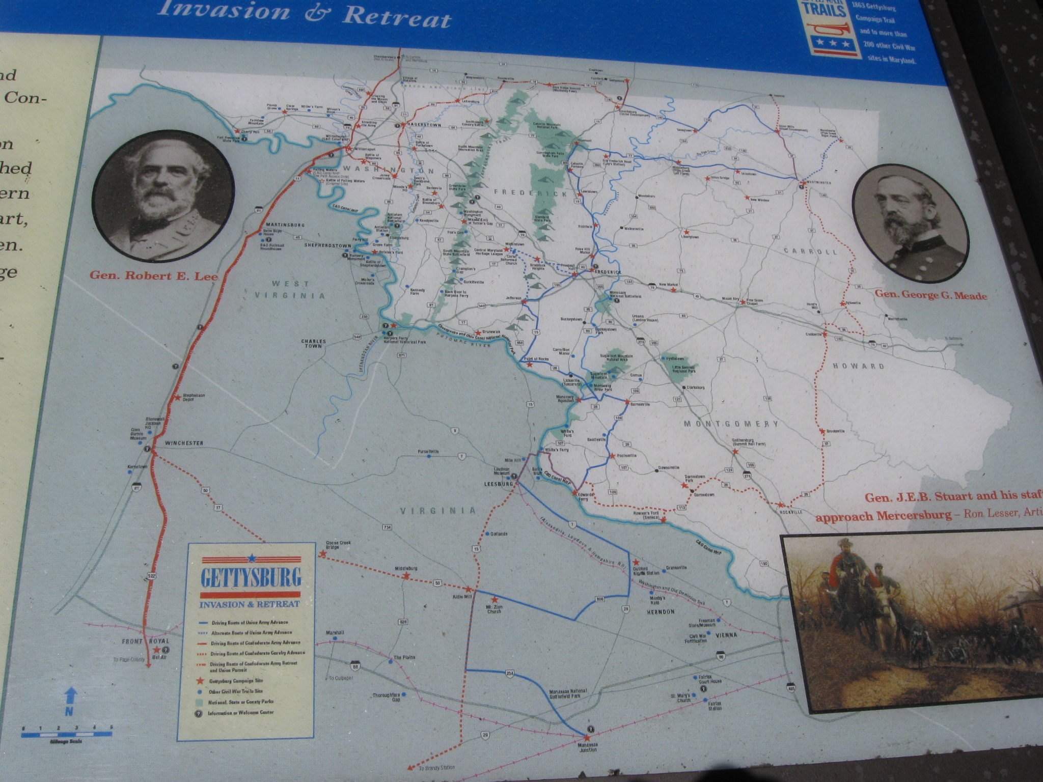
Here is a closer view of the map on the wayside. This view was taken facing northeast at approximately 3:30 PM on Sunday, June 14, 2009.
In Video #3 Licensed Battlefield Guide Hope Coates uses the map on the wayside to explain how Westminster fits into the Gettysburg Campaign. This view was taken facing southeast at approximately 3:30 PM on Sunday, June 14, 2009.
In Video #4 Hope Coates explains how the 1st Delaware Cavalry entered Westminster, and where their commander, Major Napoleon B. Knight stayed the night before the fighting. This view was taken facing southeast to east at approximately 3:30 PM on Sunday, June 14, 2009.

Here is the site of the City Hotel. This view was taken facing east at approximately 3:30 PM on Sunday, June 14, 2009.

The City Hotel is where Major Knight of the 1st Delaware had his headquarters in Westminster, and where Colonel Paul J. Revere of the 20th Massachusetts Infantry Regiment died. Revere was wounded at the Battle of Gettysburg on July 2, 1863, and died here on July 4, 1863. This view was taken facing east circa 1880.
To see other posts by Gettysburg Licensed Battlefield Guides, click here.