
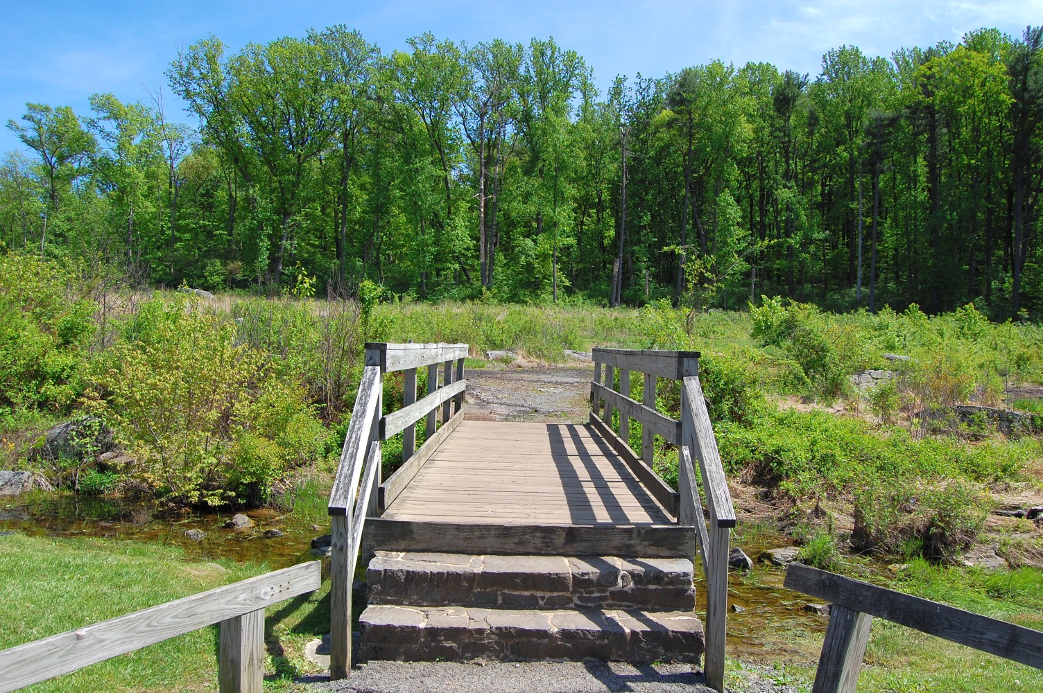
We’ll be taking a look at a path today that begins in the Slaughter Pen/Devil’s Den area, near where the old comfort station was located on the south portion of the battlefield. This view was taken facing east at approximately 3:00 PM on Tuesday, May 10, 2011.
Today we’ll take a look at another path in one of the most heavily visited areas on the battlefield to show you its current condition and to provide some continued speculation on which paths/walkways the National Park Service plans on restoring/repairing for the 150th Anniversary. Part 1 of this posting series can be seen here.
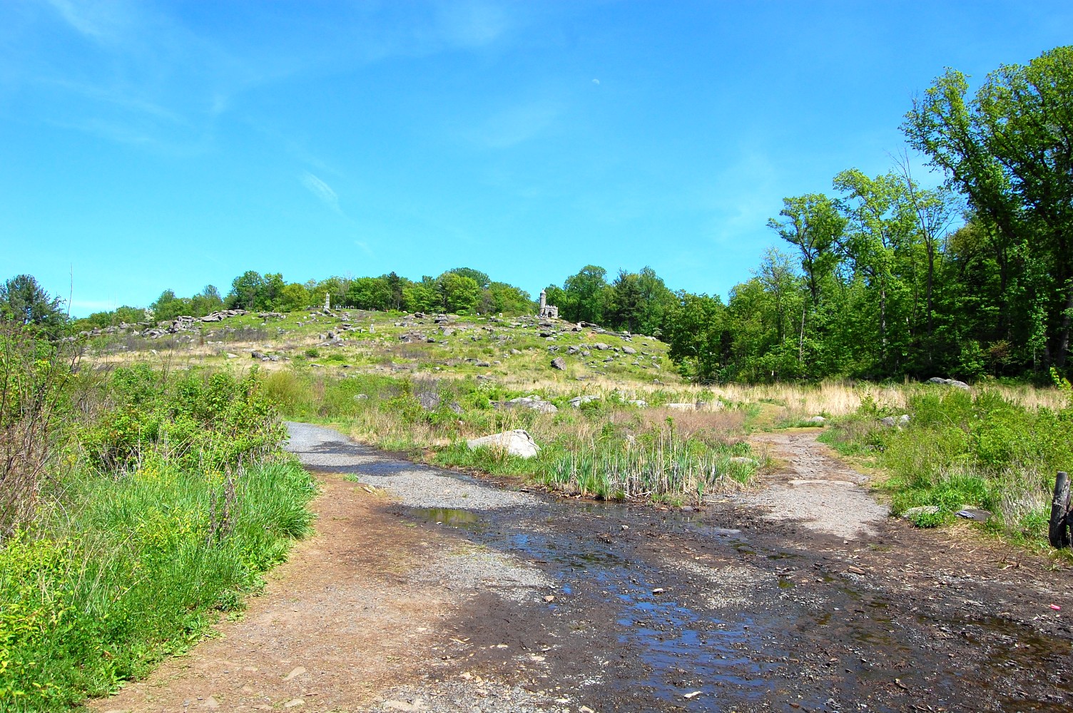
To get to today’s pathway, one can either go left, or right at this intersection of paths. In fact, there is a third path out of view to the right that follows Plum Run south of Devil’s Den. Little Round Top is in the background. This view was taken facing east at approximately 3:00 PM on Tuesday, May 10, 2011.

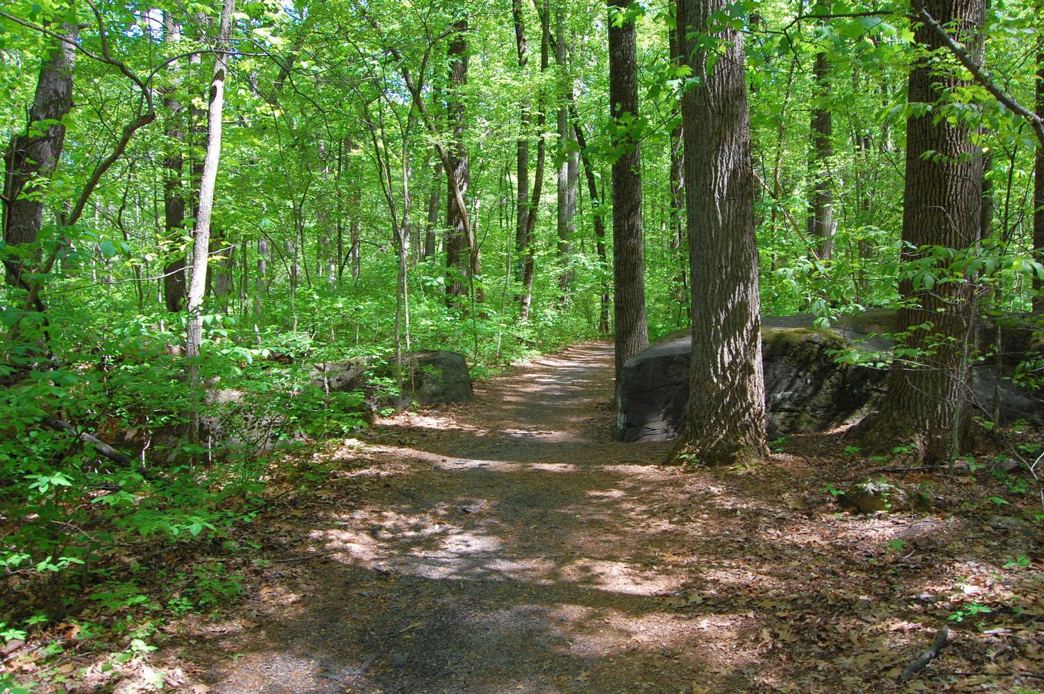
We’ll take the right-hand path in the previous view and head towards the tree-line. This view was taken facing east at approximately 3:00 PM on Tuesday, May 10, 2011.


And of course, we weren’t the only ones heading this way. This view was facing northwest at approximately 3:00 PM on Tuesday, May 10, 2011.

A large tour bus group led by a Licensed Battlefield Guide was taking this path as well. This view was taken facing north at approximately 3:00 PM on Tuesday, May 10, 2011.
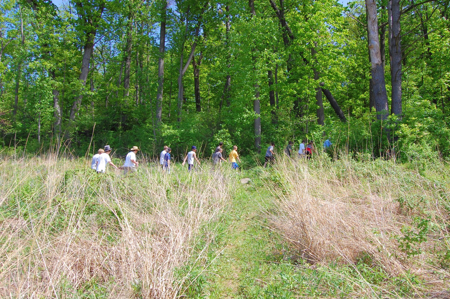
As they enter into the woods (on their way to the Big Round Top parking lot) … This view was taken facing east at approximately 3:00 PM on Tuesday, May 10, 2011.

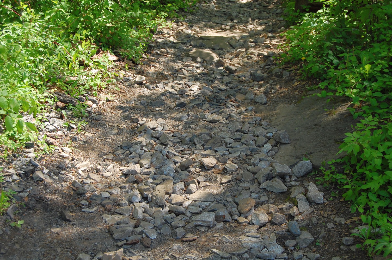
… Here is the state of much of the current pathway. It’s a bit … rocky. This view was taken facing southeast at approximately 3:00 PM on Tuesday, May 10, 2011.
And though it certainly improves as visitors make their way towards Big Round Top, we’ve heard that this network of paths in the Slaughter Pen area will not be repaired anytime soon. The group that most heavily uses the trails/paths in this area? Boy Scouts. This view was taken facing southeast at approximately 3:00 PM on Tuesday, May 10, 2011.

And it’s quite a beautiful part of the battlefield to walk through. This view was taken facing northeast at approximately 3:00 PM on Tuesday, May 10, 2011.

But perhaps restoring these paths doesn’t make sense — after all, they are probably far less used than other trails and walkways in need of restoration, so we can see how it would be reasonable to direct limited funds for restoration elsewhere … This view was taken facing southeast at approximately 3:00 PM on Tuesday, May 10, 2011.
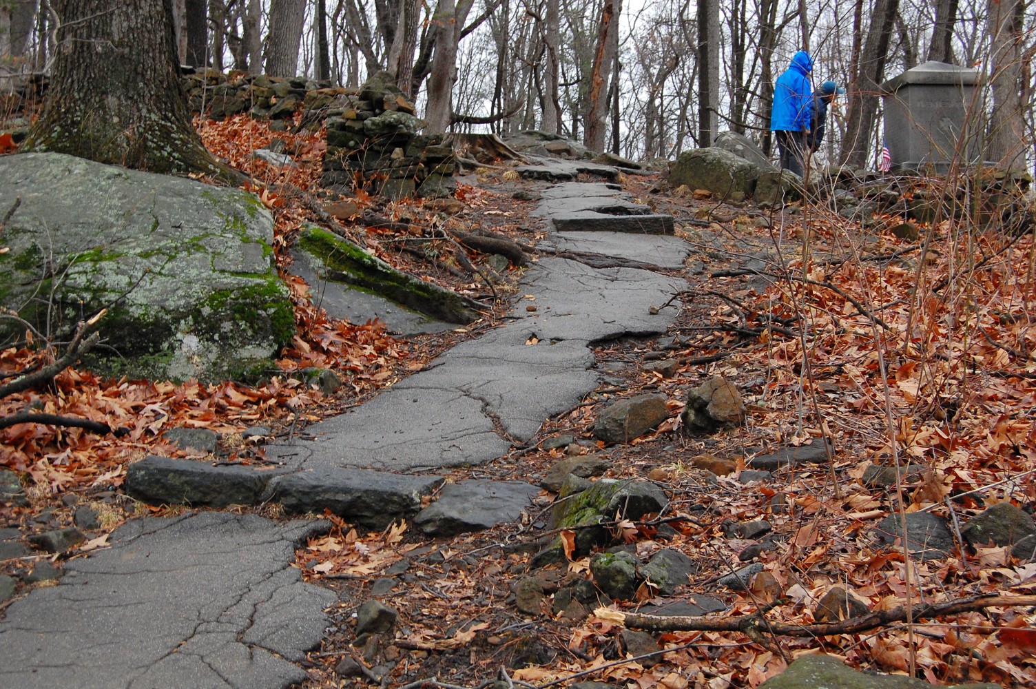
… Like to the access path to the 20th Maine monument on Little Round Top that we covered in Part 1 of this post. This view was taken facing northeast at approximately 4:30 PM on Monday, February 28, 2011.

We’ve heard recently though that this path will not be restored (as we originally hoped and were informed), due to a lack of funding. Perhaps there were horse trails in need of more dire improvements. This view was taken facing northeast at approximately 4:30 PM on Monday, February 28, 2011.