
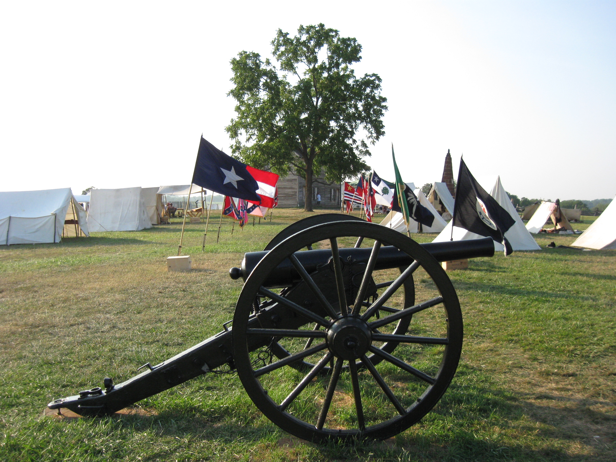
We continue our visit to Manassas National Battlefield to capture scenes in the final hours of daylight on July 21st, the 150th anniversary of the First Battle of Manassas. The location is Henry Hill. We are walking towards the Henry House, which is behind the tree in the center background. This view was taken facing northwest at approximately 7:00 PM on Thursday, July 21, 2011.
The Gettysburg Daily decided on Thursday, July 21, 2011 that after finishing their tours at Gettysburg to drive to Manassas. The goal was to stand on the ground on the 150th anniversary of the Battle of First Manassas, to document the scene, and to avoid the crowds.
In the first Manassas 150th Anniversary post we showed the structures that were put in place for the commemoration ceremonies of the 150th Anniversary of the Battle of First Manassas (First Bull Run).
In today’s First Manassas 150th Anniversary post we concentrate on the material around the Henry House on Henry Hill, including tents, equipment, and artillery pieces.
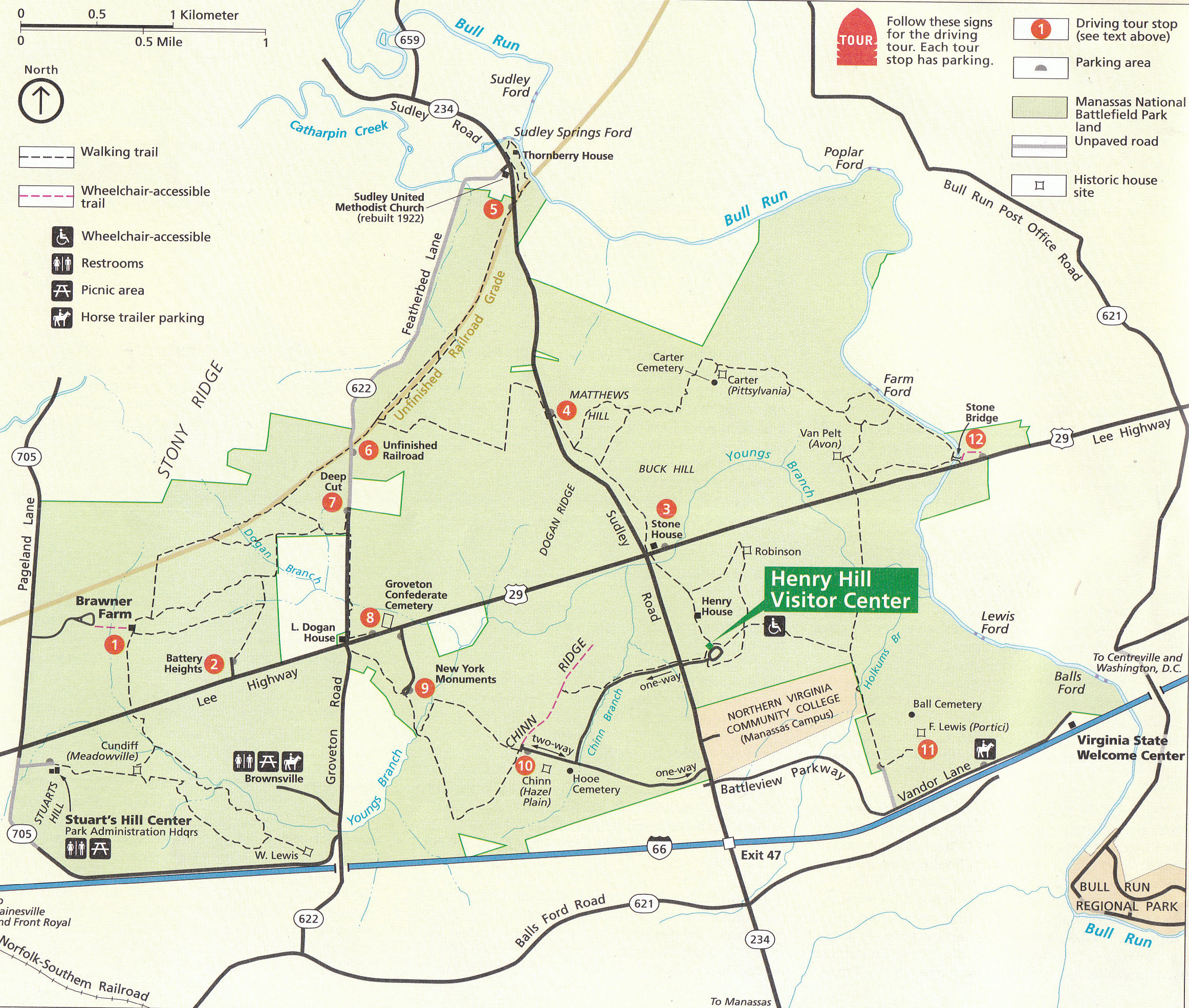
This is the National Park Service Map of Manassas National Battlefield. Most of the map shows areas concerning the Second Battle of Manassas, which was fought from August 28-30, 1862. Today, we are concerned about the First Battle of Manassas, which was fought on July 21, 1861. This final stages of the battle centered around the Henry Hill area, shown in the bottom right of the map. This map was scanned facing north at approximately 11:00 AM on Friday, July 22, 2011.
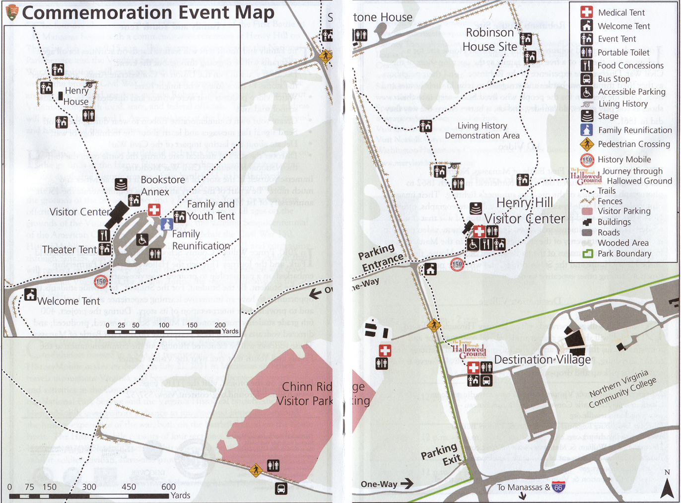
This is the National Park Service Map of the area around Henry Hill for the 150th anniversary period. Large tents, tractor trailers, Coca Cola trucks, Pepsi trucks, food stands, etc… dot the hill of the first major land battle of the American Civil War. So if you had thoughts of going to the battlefield and to be transported back in time 150 years ago, that was difficult. This map was scanned facing north at approximately 11:00 AM on Friday, July 22, 2011.
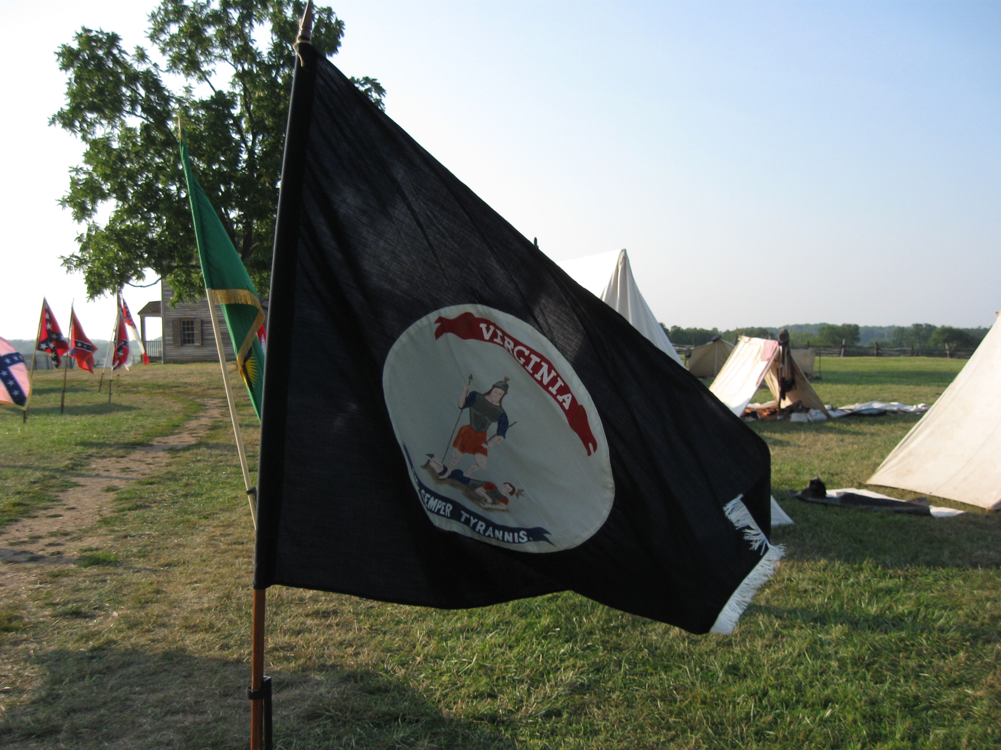
The flags are Confederate flags representing some of the flags used during the fighting at First Manassas. This view was taken facing northwest at approximately 7:00 PM on Thursday, July 21, 2011.
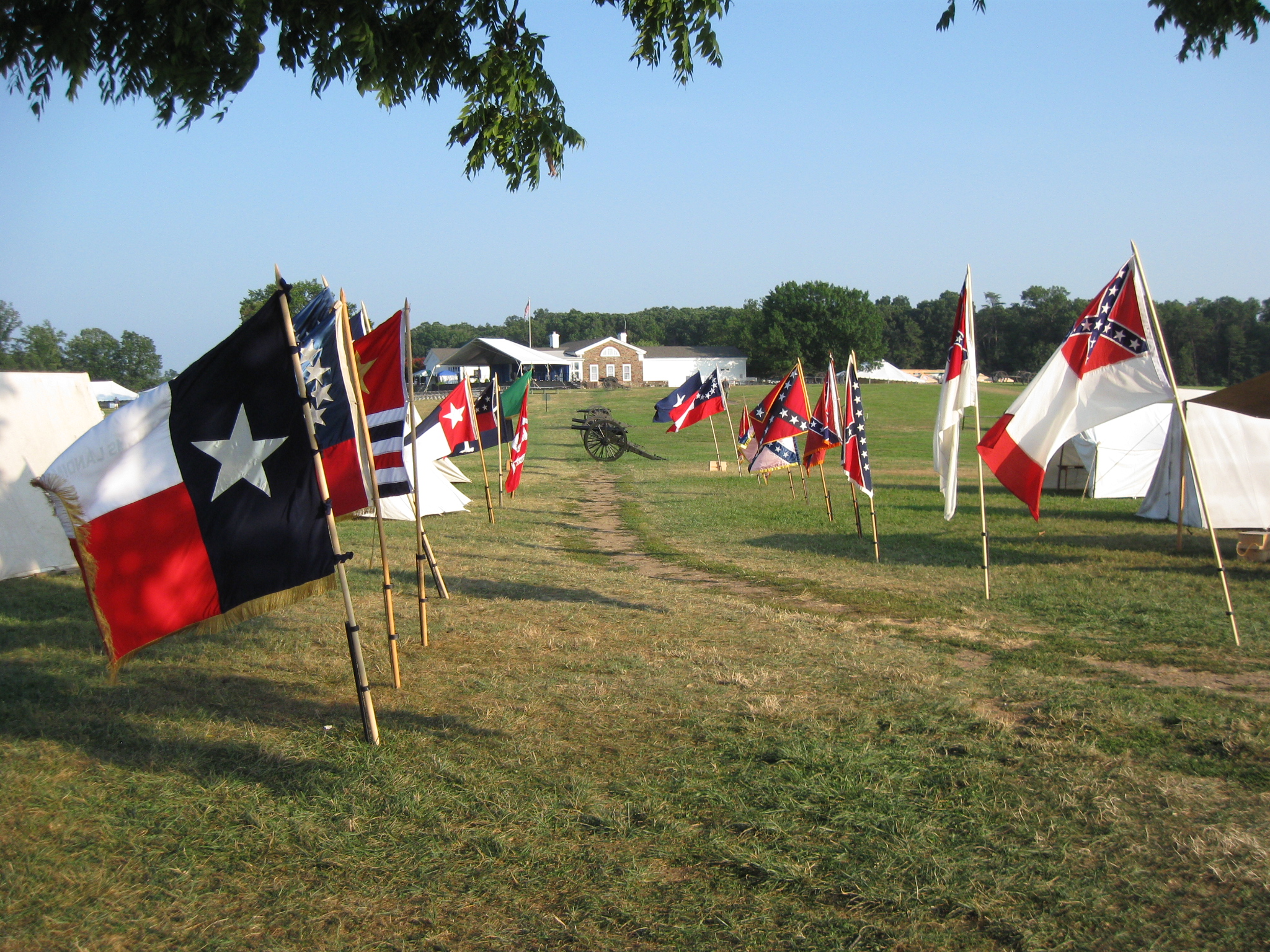
They were all Confederate flags on display when we arrived. This view was taken facing southeast at approximately 7:00 PM on Thursday, July 21, 2011.
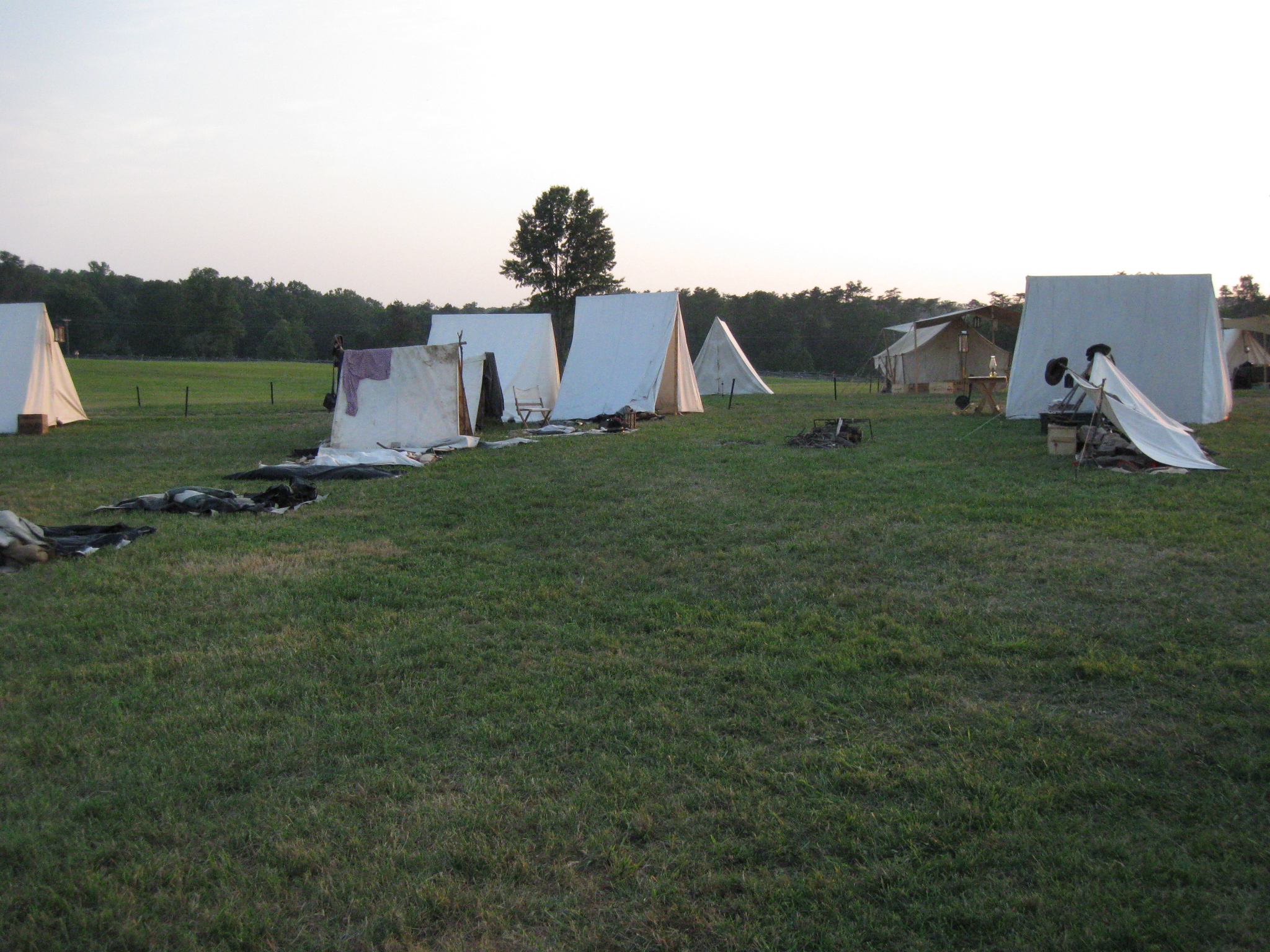
Although this was labeled as the “Living History Demonstration Area,” it appeared to be a Confederate camp only. This view was taken facing southwest at approximately 7:00 PM on Thursday, July 21, 2011.
No tents for the United States soldiers were visible. This view was taken facing southwest at approximately 7:00 PM on Thursday, July 21, 2011.
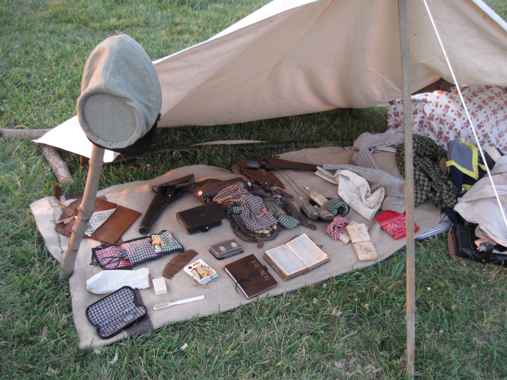
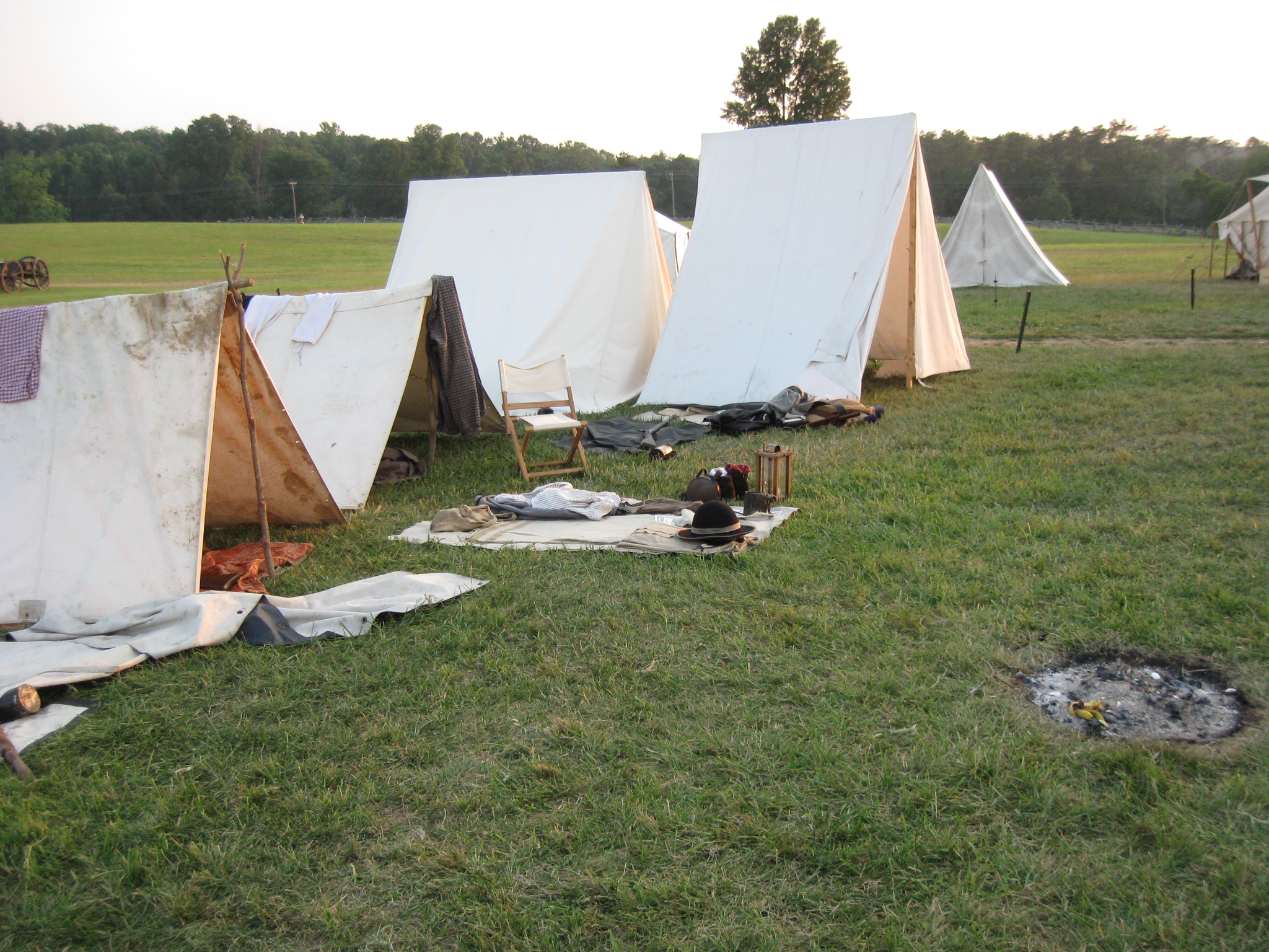
The personal items of the soldiers were on display. This view was taken facing north at approximately 7:00 PM on Thursday, July 21, 2011.

Some of their military issue items were also on display. This view was taken facing northwest at approximately 7:00 PM on Thursday, July 21, 2011.
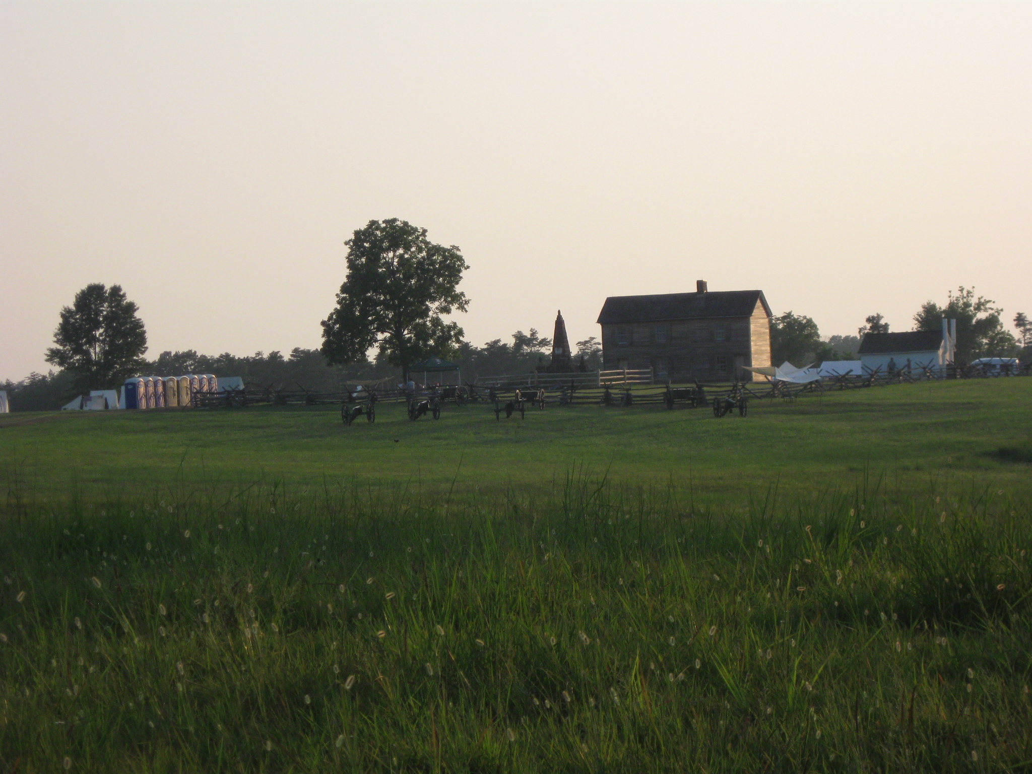
A wider view of the Living History Demonstration area on Henry Hill. The tents for the Confederate soldiers are in the left background to the left of the blue Port O Potties. This view was taken facing northwest at approximately 7:00 PM on Thursday, July 21, 2011.
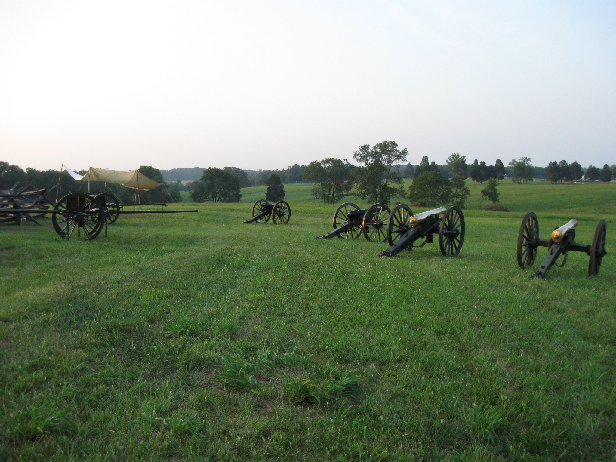
Also present were some artillery pieces, two rifled ones on the left and two bronze guns on the right. This view was taken facing northeast at approximately 7:00 PM on Thursday, July 21, 2011.
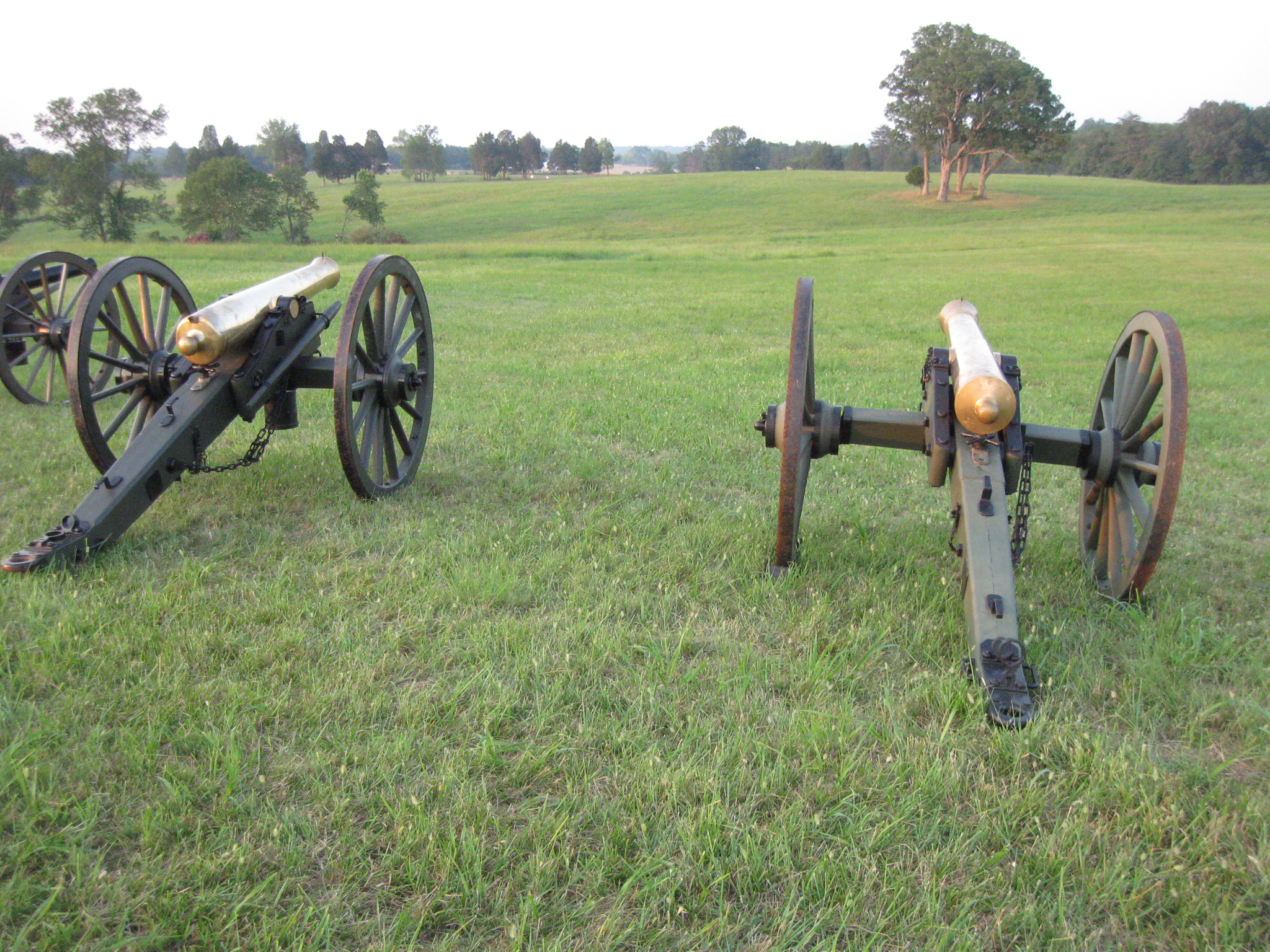
On the right is a six-pounder, on the left is a twelve-pounder. This view was taken facing northeast at approximately 7:00 PM on Thursday, July 21, 2011.
The six-pounder was from the “Southern Grays Artillery” unit, the “Fort Washington Garrison.” This view was taken facing northeast at approximately 7:00 PM on Thursday, July 21, 2011.

This is a reproduction piece. This view was taken facing southwest at approximately 7:00 PM on Thursday, July 21, 2011.

A Model 1857 Gun Howitzer or Napoleon. This view was taken facing west at approximately 7:00 PM on Thursday, July 21, 2011.
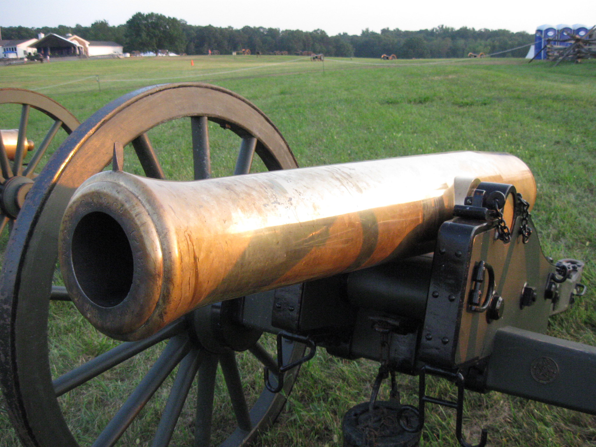
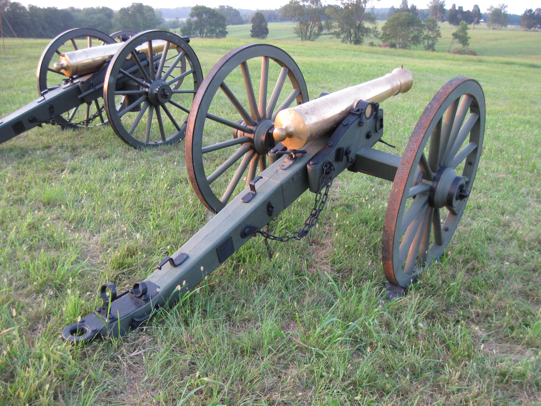
The 12-pounder Napoleon was operated by a unit known as the “Antietam Artillery.” This view was taken facing south at approximately 7:00 PM on Thursday, July 21, 2011.
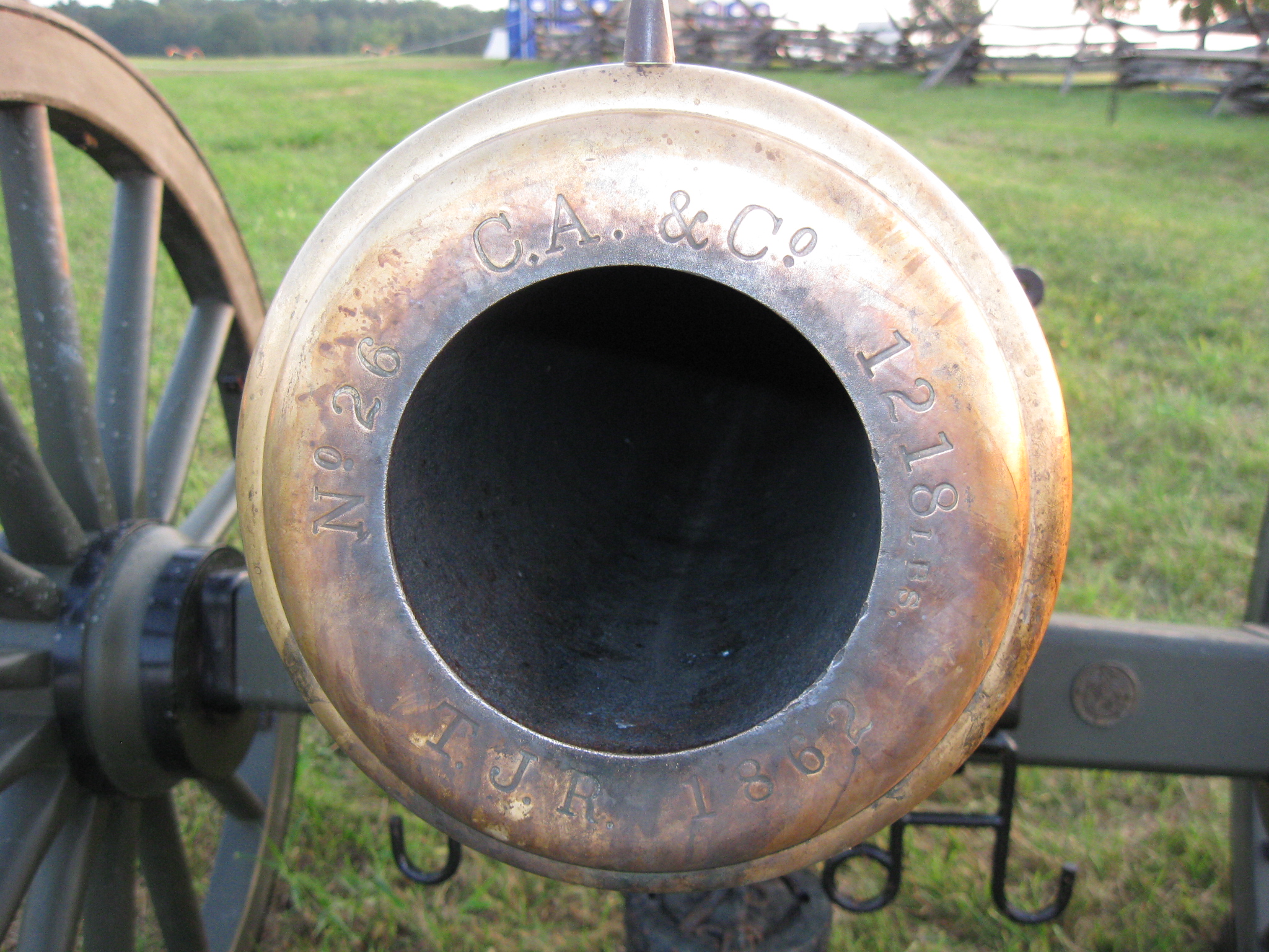
The markings on the muzzle certainly lead one to believe that this is an original tube. This view was taken facing southeast at approximately 7:00 PM on Thursday, July 21, 2011.

The Henry House is not the original structure at the time of the battle. This section of the building closest to the camera was constructed in 1870. This view was taken facing north at approximately 7:00 PM on Thursday, July 21, 2011.
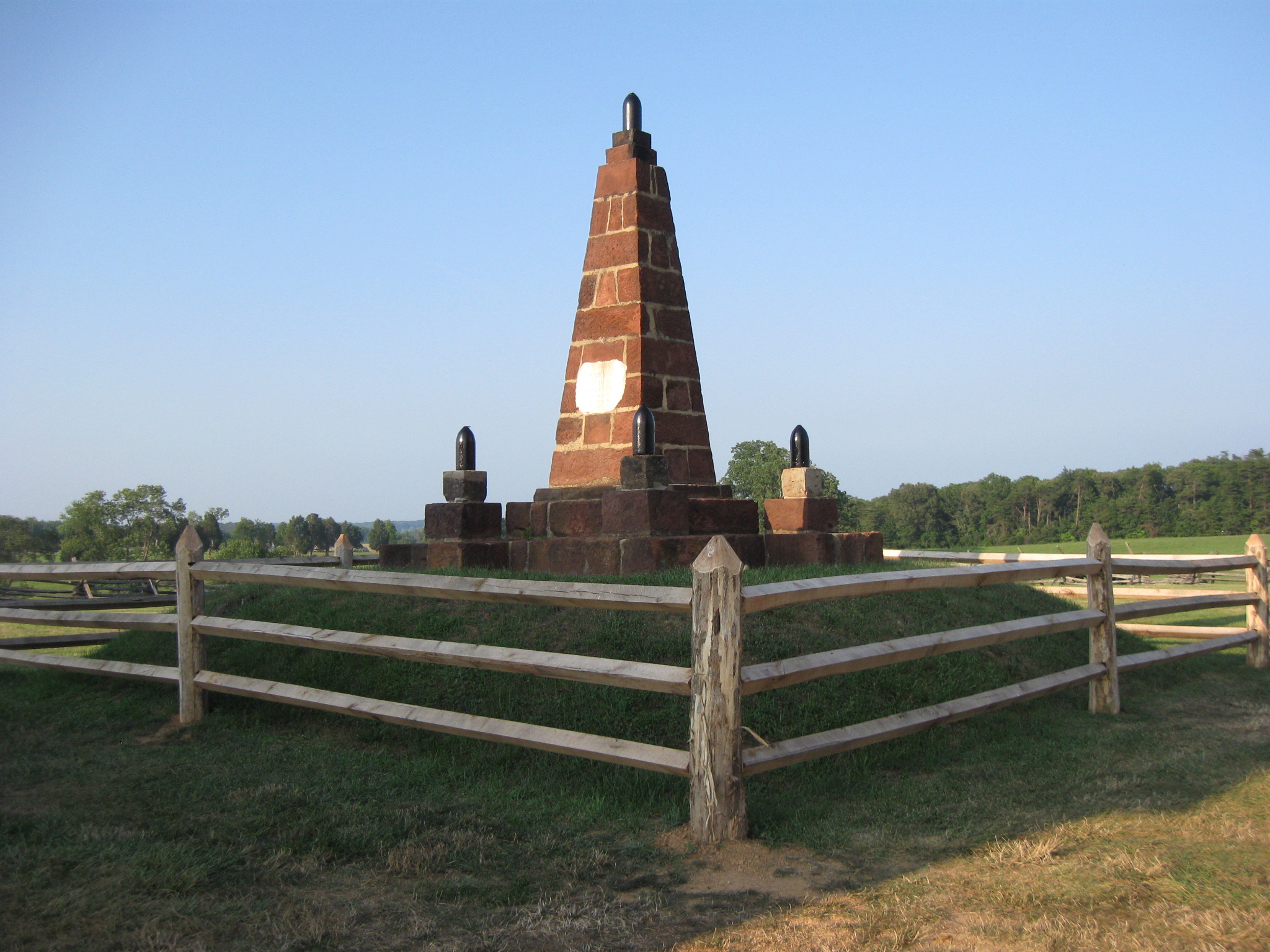
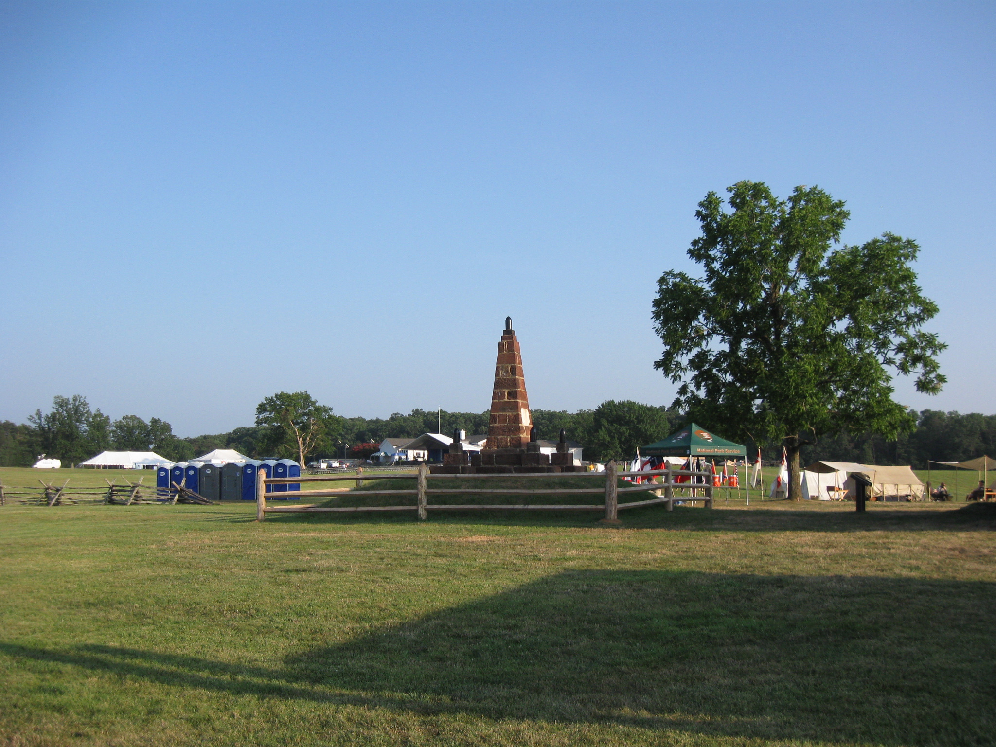
To the east of the Henry House is the Henry Hill Monument. This view was taken facing northeast at approximately 7:00 PM on Thursday, July 21, 2011.
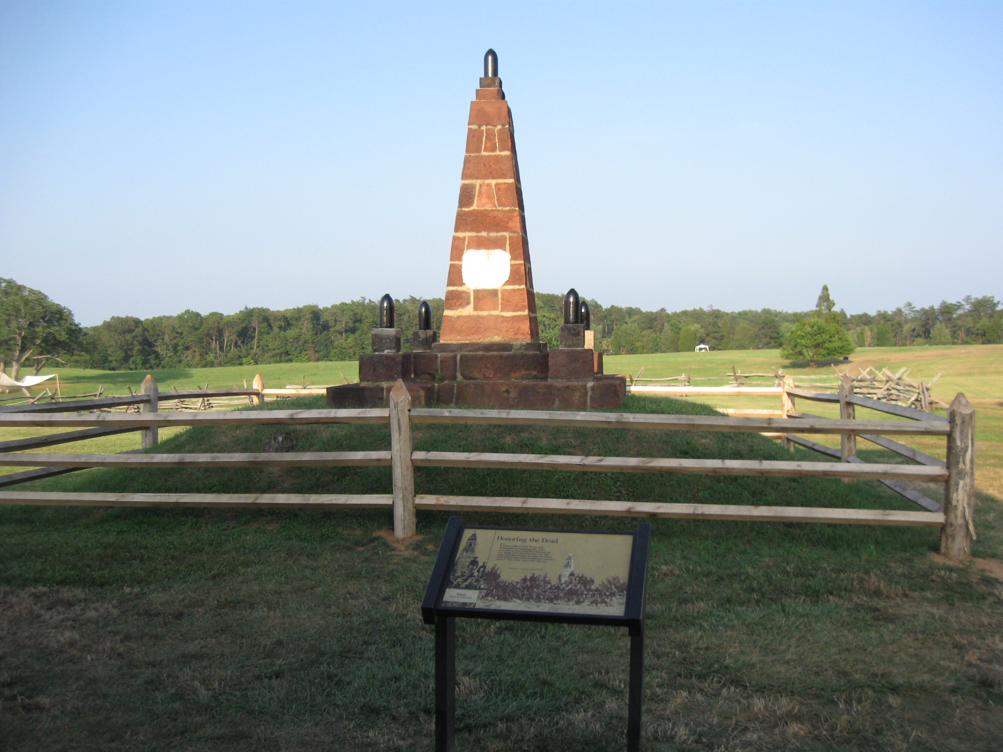
The monument was constructed by United States soldiers in 1865. This view was taken facing east at approximately 7:00 PM on Thursday, July 21, 2011.
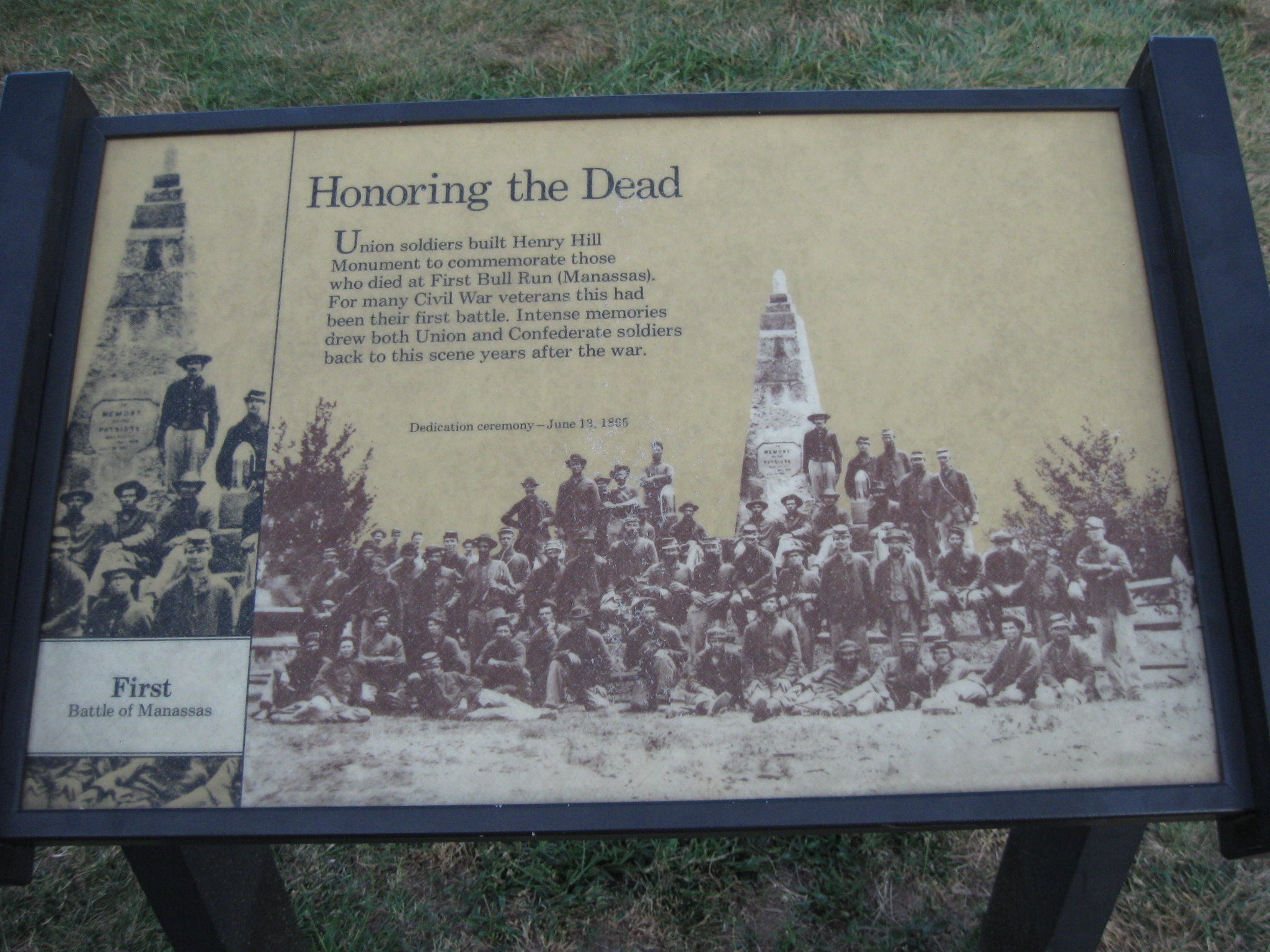
A closeup of the Henry Hill Monument wayside exhibit. This view was taken facing east at approximately 7:00 PM on Thursday, July 21, 2011.
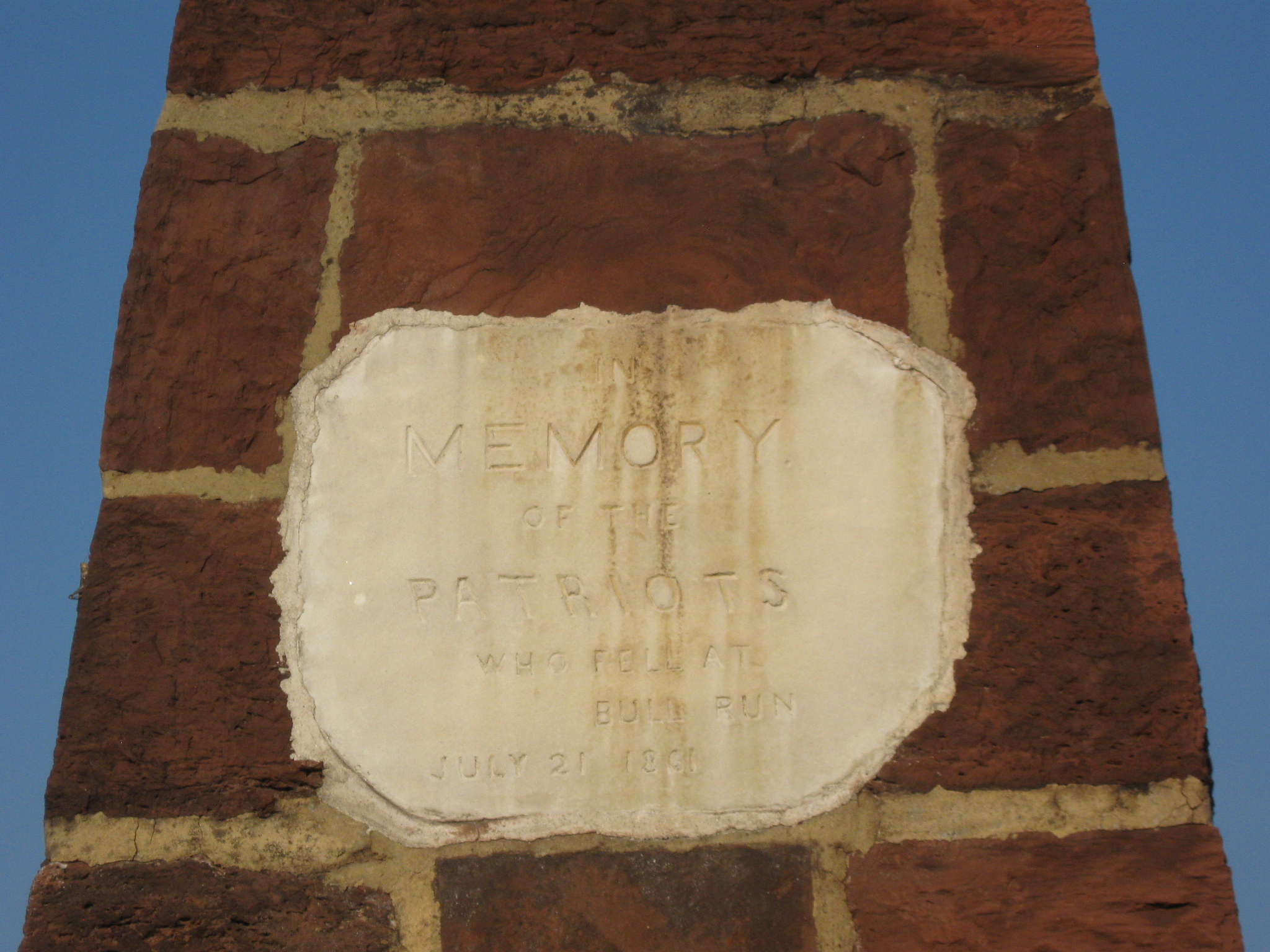
A closeup of the writing on the side of the monument. This view was taken facing east at approximately 7:00 PM on Thursday, July 21, 2011.
The Henry Hill Monument was erected by members of the 5th Pennsylvania Heavy Artillery in four days. This view was taken facing southeast at approximately 7:00 PM on Thursday, July 21, 2011.
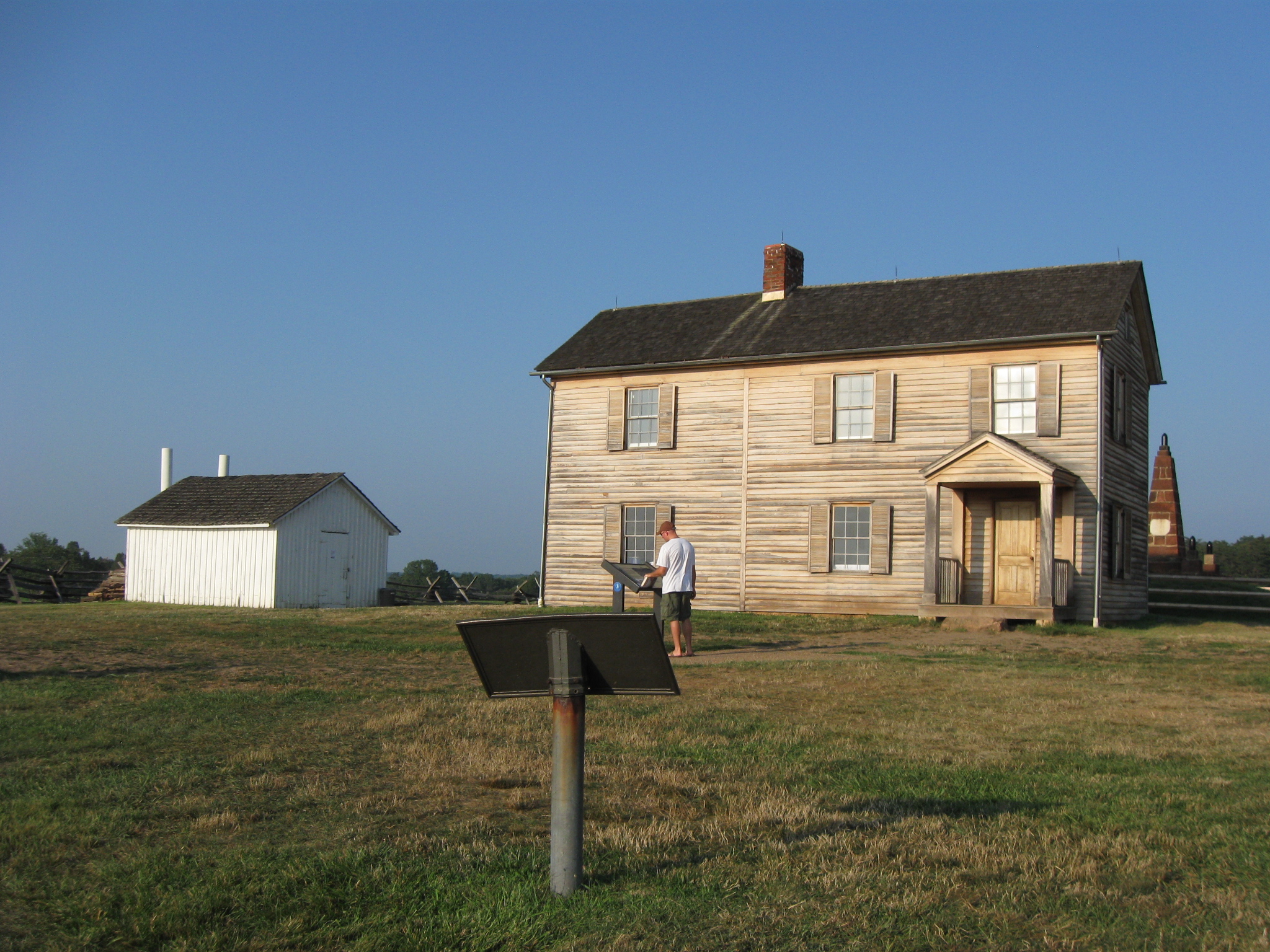
The west side of the Henry House contains a small marker and a wayside exhibit which the gentleman is reading. This view was taken facing northeast at approximately 7:00 PM on Thursday, July 21, 2011.
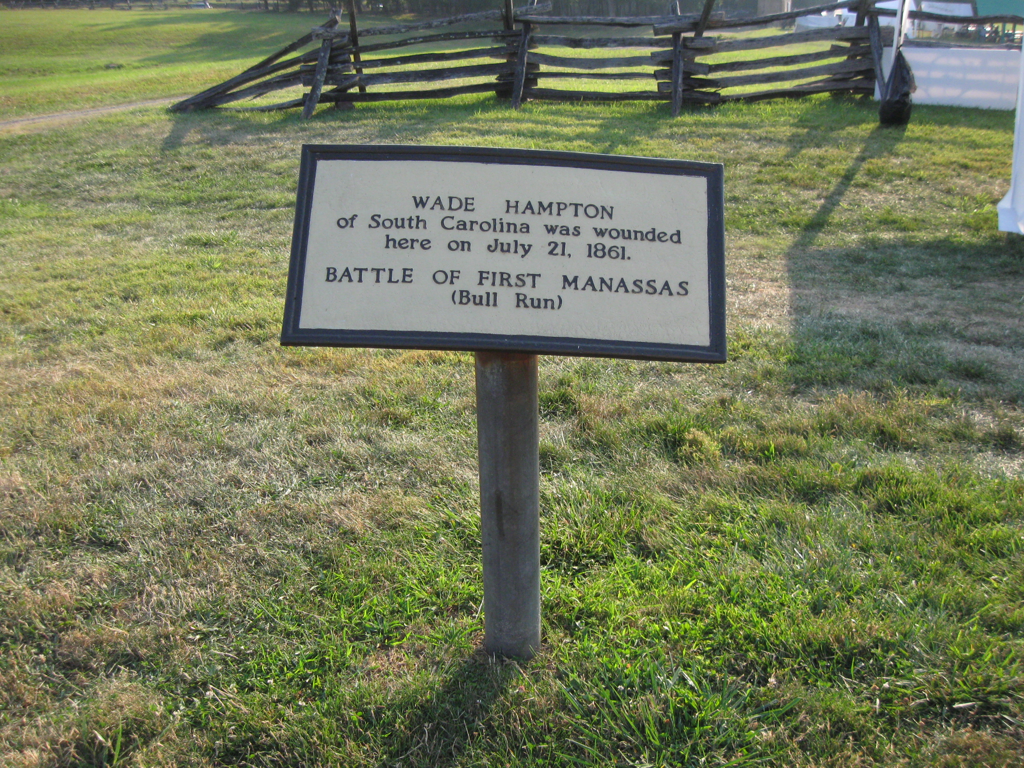
The marker shows where Wade Hampton was wounded during the battle. This was the first of five wounds that Hampton would receive during the Civil War. His second wound was at the Battle of Seven Pines. His third, fourth and fifth wounds occurred during the Gettysburg Campaign. This view was taken facing west at approximately 7:00 PM on Thursday, July 21, 2011.
Here’s the wayside on the west side of the Henry House that the gentleman was reading in an earlier photograph. This view was taken facing north at approximately 7:00 PM on Thursday, July 21, 2011.
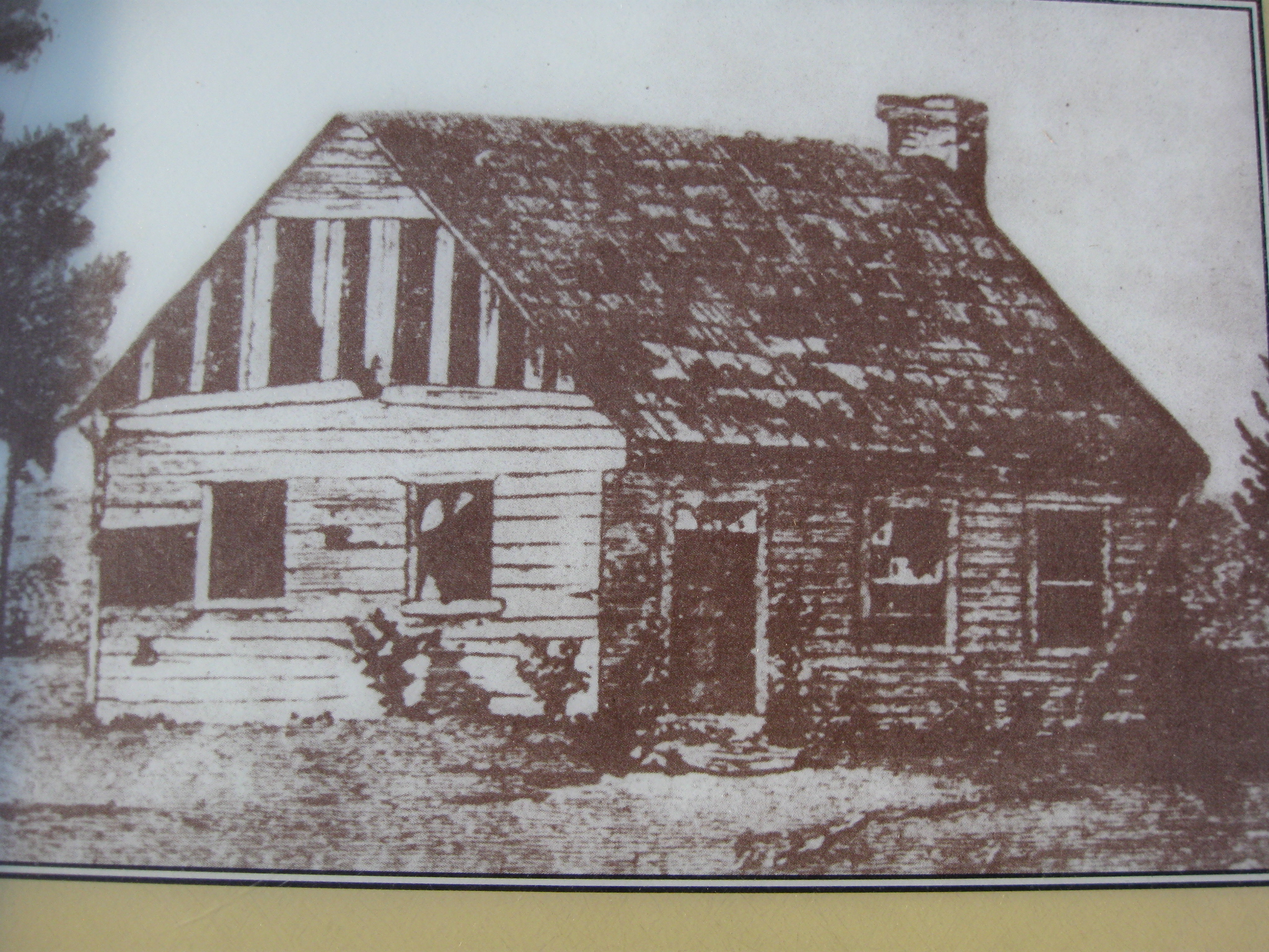
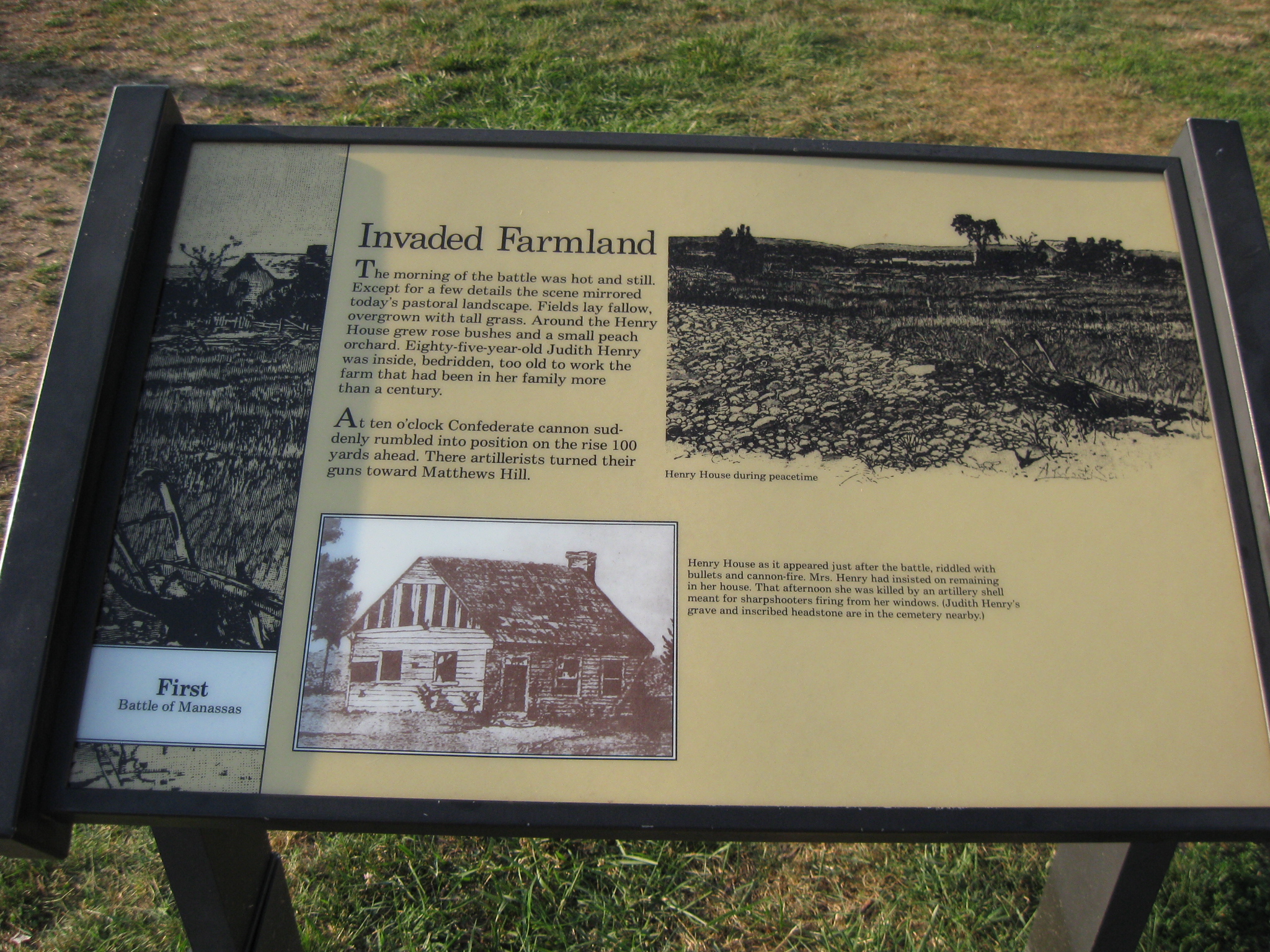
The original Henry House was constructed circa 1812 and appeared like this at the time of the Battle of First Manassas. Souvenir hunters and soldiers seeking building materials for their winter quarters destroyed the Henry House before the Second Battle of Manassas occurred in August, 1862. This view was taken facing north at approximately 7:00 PM on Thursday, July 21, 2011.

The current Henry House was constructed in two phases. The section on the right was constructed in 1870. The addition on the left was constructed circa 1882. In the right foreground is a small cemetery. This view was taken facing southeast at approximately 7:00 PM on Thursday, July 21, 2011.

The tallest marker belongs to the widow Judith Henry who was killed during the Battle of First Manassas. Depending on your source, some type of artillery projectile entered the house and mortally wounded her. This view was taken facing west at approximately 7:00 PM on Thursday, July 21, 2011.
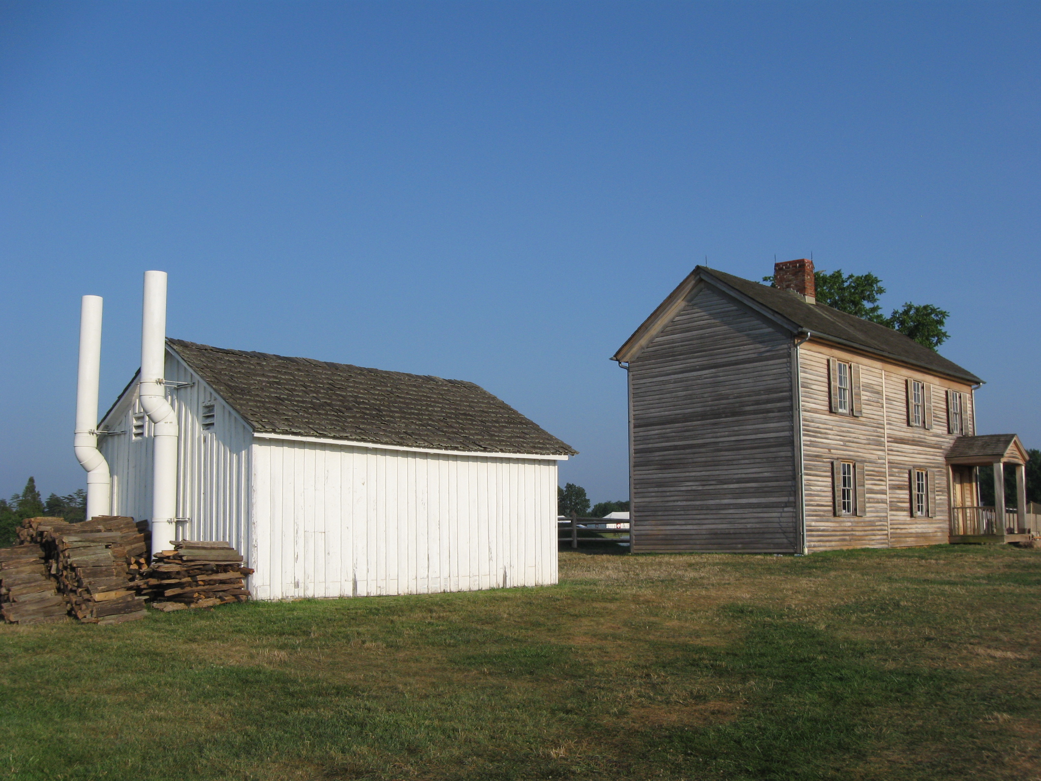
In the 1880s and 1890s, Hugh Fauntleroy Henry Sr., the son of Judith Henry, operated a souvenir shop and museum out of the Henry House. The Henry House “Shed” is the white structure on the left. This view was taken facing southeast at approximately 7:00 PM on Thursday, July 21, 2011.

Hugh Fauntleroy Henry Sr. charged visitors fifty cents admission onto his property and erected signs on Henry Hill to show where some important events occurred during the Battle of First Manassas. This view was taken facing southwest at approximately 7:00 PM on Thursday, July 21, 2011.

The United States Marine Corps erected a tent with exhibits on the history of the Corps. This view was taken facing northwest at approximately 7:00 PM on Thursday, July 21, 2011.

Down the slope from the Henry House and the Marine Corps tent is a new wayside exhibit. This view was taken facing north at approximately 7:00 PM on Thursday, July 21, 2011.

This member of the Corps is showing some visitors the wayside. This view was taken facing southeast at approximately 7:00 PM on Thursday, July 21, 2011.

A closer view of the wayside that explains the Marines’ participation in the fight on Henry Hill on July 21, 1861. This view was taken facing southeast at approximately 7:00 PM on Thursday, July 21, 2011.

We’ll start heading down the hill towards Matthew’s Hill. This view was taken facing north at approximately 7:00 PM on Thursday, July 21, 2011.
Off to our west, along the Sudley Road, is a tent for support personnel, including law enforcement from other National Parks in the Mid-Atlantic Region. This view was taken facing southwest at approximately 7:00 PM on Thursday, July 21, 2011.

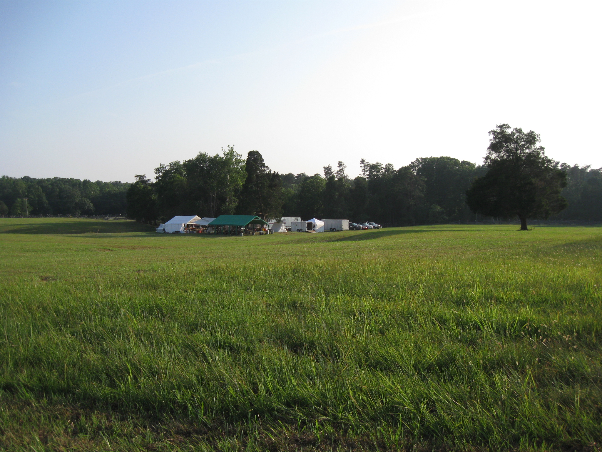
One final look at the Henry Hill complex. This view was taken facing southeast at approximately 7:00 PM on Thursday, July 21, 2011.
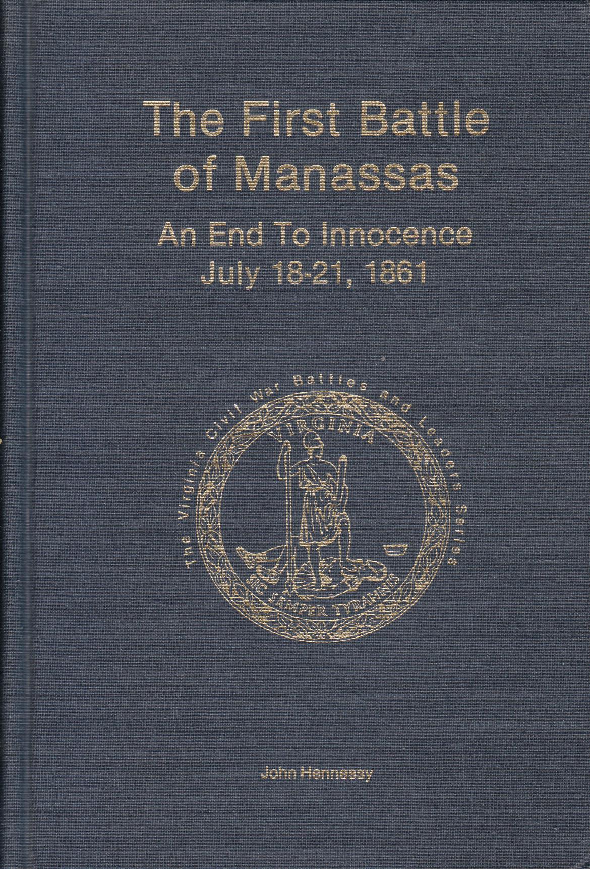
We feel the best book on the Battle of First Manassas is John Hennessy’s book, First Battle of Manassas: An End to Innocence. It is part of the Virginia Civil War Battles and Leaders Series by H.E. Howard. This image was scanned facing north at approximately 7:40 PM on Sunday, August 7, 2011.